Thanks to the brilliance of the last government and some of its predecessors, and to the construction, banking and other captains of industry, the Irish economy is in some little difficulty, and there are inspiring calls for us all to put our shoulders to the wheel, our noses to the grindstone and our children on the plane to the Lands Beyond the Sea where there are long-horned cows, money-order offices and jobs.
So here’s a contribution to the promotion of tourism. Naturally, I assume that the tourist — at least the better sort of tourist — is primarily interested in waterways, with secondary interests in railways, industrial history and brewing. So here is a suggestion for a one-day walk around Dublin, taking in parts of the Royal Canal, the Grand Canal, the Liffey and several alehouses, with passing reference to railways and other sights. The tour does not take in every interesting section of the Dublin waterways, and might be thought to concentrate unduly on waterways that no longer exist, but I think it makes for a good day out.
The itinerary includes two stretches of non-existent waterway that are covered in some detail elsewhere on this site; this page doesn’t duplicate that information but links to it.
If you are down wid da kidz in da technological hood, and know what QR Codes and NFC Tags are, and have one of those newfangled telephone devices, be aware that you get get more information as you visit some places along the Royal Canal; and if you’re still, like me, trying to get to grips with the non-existence of telephones with dials, you can print information in advance from Canals of Dublin, which explains all about the scheme.
I have no commercial interest in, or link to, any of the fee-charging establishments mentioned, except as an infrequent customer.
Overview
This is a very rough sketch map. It doesn’t show all the streets; those it does show are in a brownish orange. The canals, the Liffey, the Dodder and various bodies of water are shown in blue; broken blue lines show canal lines that no longer exist. Green is the LUAS (tram: pronounced like “Lewis”) green line and red is the LUAS red line, which follows part of the abandoned Main Line of the Grand Canal. Black is for railways; I haven’t shown all the lines on the north side of the Liffey. Nor have I shown the lines running in to Heuston (formerly Kingsbridge) station. I couldn’t fit the legend “Connolly Railway Station” (formerly Amiens Street) at its correct location so I put in a black dot with the letter C beside it and explained it at the right-hand side.
I’ve put in larger-scale Google maps in appropriate places.
The general idea of the walk is that you:
- start at Connolly Railway Station
- walk along Amiens Street and North Strand Road to the Royal Canal
- walk up the canal to the Broadstone Branch
- walk south along the Branch
- continue south along Constitution Hill, then turn right up North King Street to Stoneybatter
- return south, cross the Liffey and walk along Victoria Quay
- walk up Stevens Lane, James’s Street and Echlin Street to the Grand Canal Harbour
- finish at the Guinness Storehouse.
I’m afraid I have no idea how long that will take, but it’s easily doable within a day, even with many pauses. If you do the walk, and time it, do please report back.
Connolly Station to Newcomen Bridge
This is a case where the Google satellite view may be better than the map view.
At the bottom of the map, within a semicircle of road north of the River Liffey, you’ll find the Custom House, designed by James Gandon.
North-east of that is Busáras [pronounced roughly “busawrus”], the central station for long-distance buses; the modernist building was designed by Michael Scott.
There is a stop on the LUAS Red Line on the far side of Busáras, with a junction whence one branch goes to Connolly railway station and the other downriver. Head towards Connolly.
The station is on the right-hand side of Amiens Street; walk north up the street, passing the Five Lamps on your left.
The street becomes North Strand, which was bombed by Germany in WW2. In the next photo, the rise in the distance is Newcomen Bridge over the Royal Canal, so you’re nearly there.
Newcomen Bridge to Lock 3
The next stretch takes you along the banks of the Royal Canal (as Brendan Behan put it) from Newcomen Bridge to Cross Guns Bridge, which means Locks 1 to 5.
Lock 1 is just above Newcomen Bridge, but let’s start on the downhill side of the bridge. Just below it is a railway bridge: a very low-level railway bridge. The current bridge lifts straight up, with a jack at each corner; L T C Rolt described its predecessor, near which he slept on his Royal Canal trip:
Just ahead of our mooring was yet another drawbridge, this time a curious steel skew bridge with one long balancing girder which carried a single line of railway across the canal. This was a heavily graded and curved goods loop line connecting the CIE goods lines down to North Wall depot with the Great Northern Railway of Ireland at Amiens Street Station. Where we lay we were within a yard of the metals but nothing passed during the evening. That night, however, I was awakened with a start by a volume of sound which at first suggested to my sleep-fuddled mind that an earthquake or a tidal wave was about to overwhelm us. It was a goods train beating up the incline with a banking engine assisting in the rear. The train engine which had wakened me had passed before I sat up and looked through the port-hole, but I could dimly see the whorling spokes of the waggon wheels as they clanked rhythmically over the rail joints. Then came a renewed crescendo of labouring sounds as the banking engine went by and a glimpse of thrashing coupling rods through a drift of steam. A few cinders from the ash pan remained to glow for a moment between the metals as the sound of the train faded. I have been an inveterate train-watcher since my earliest childhood, but I never thought that I should one day lie in bed and watch the driving wheels of a locomotive pass almost within my reach.
L T C Rolt Green and Silver George Allen and Unwin 1949
The bridge is very low, with not enough room even for a canoe to pass beneath, so it has to be lifted for every boat. Here is is being lifted for boats on an IWAI Dublin rally some years ago.
According to the IWAI Dublin Branch, the bridge will be lifted on one day each month from April to September 2011. Which is nice.
On the uphill side of Newcomen Bridge is Lock 1, which acted as the sea lock for many years when Royal Canal Dock lacked its sea lock. A new lock, with radial gates as a flood-prevention measure, has now been installed. The water level between the sea lock and Lock 1 has to be lowered to enable boats to get under certain obstructions ….
Anyway, back to Lock 1. Here is that boat descending before it went under the lifting bridge.
The lock gear seems to be the same as that used on the Grand Canal. I don’t know what the gear was like when the Royal Canal was operated by its own company or, after 1845, by the Midland Great Western Railway Company, which bought the canal to use its wayleaves; the railway is very close to the canal all the way to Mullingar. From old photos, I couldn’t see much difference in the lock gear, but it is possible that the gate racks may, on some locks, have been mounted facing each other rather than (as in the photo above) facing the same way.
Those two photos, by the way, are taken at Charleville Mall, scene of the most exciting incident in James Joyce’s long book Ulysses, when Father Conmee sees a turf barge, presumably tied up, with the “bargeman” sitting amidships smoking. (The ~1900 OSI map shows mooring posts at Charleville Mall.) Some other stuff happens in the book after that, but there is little of waterways interest.
The next bridge is between Russell Street and Jones’s Road, and we get a closer view of Croke Park, the headquarters and stadium of the Gaelic Athletic Association, which runs the (amateur) sports of Gaelic football and hurling.
After Lock 1, there are five deep locks fairly close together, starting at the next bridge up from Jones’s Road. They are double locks (“staircase pairs” in British canalese); a double lock counts as one in Ireland. The rises (Guide to the Royal Canal of Ireland 3rd ed Office of Public Works 1994) are:
- Lock 2 21.6 feet
- Lock 3 17.7 feet
- Lock 4 17.6 feet
- Lock 5 18.8 feet
- Lock 6 17.4 feet.
Then come three singles (8.5, 8.8, 6.9 feet) and three more doubles (18.0, 18.2, 18.4 feet), the last of them, Lock 12, on the far side of the aqueduct over the M50 at Blanchardstown. After that boaters can relax for a bit.
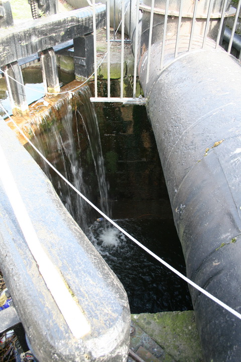
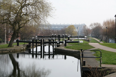
Of all the locks, I think Lock 2, at Binn’s Bridge, is the worst. In fact “at” is not really the right word: “under” would be better.
As far as I can see, once you’ve opened the right-hand gate, you’re stuck on the island between canal and railway. So you need a minimum of three people for this lock: one on the boat and one on each gate. (Most Irish canal locks don’t have ladders.)
Here are some pics of the upper end and the middle gates.
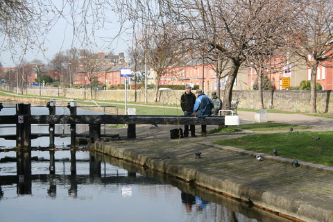
Still, it’s scenic. That’s a seated statue of Brendan Behan (see above) behind the chaps talking beside the top gate.
Lock 4 to Cross Guns Bridge
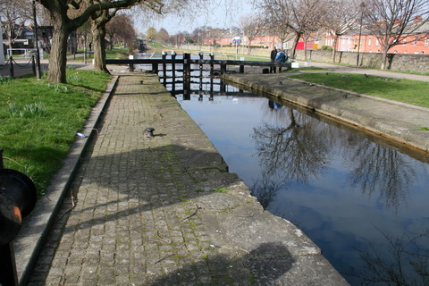
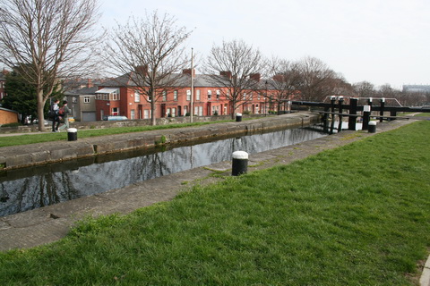
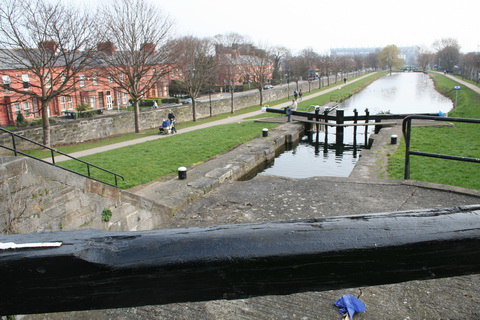
Let’s have a closer look at Lock 4.
The 1994 Guide to the Royal says that the depth on the cill of the Royal locks is 1.4m. However, Waterways Ireland’s Navigating Ireland’s Inland Waterways says that the maximum draft for the Royal is 1m.
Another traditional Irish sport can be mentioned at this point: that of road bowling (“bowl” rhyming with “cowl”, I think, at least in Cork), in which the ne plus ultra is to loft a bowl over the Chetwynd Viaduct. There seems to be some uncertainty over whether Mick Barry did it with a 28-ounce or a 16-ounce bowl, but Hans Bohllen seems to have done it with a 28-ounce bowl in 1985.
You may be wondering what this has to do with the Royal Canal. The point is that road bowling is rarely played in Dublin and the wall of Mountjoy Prison is not the local equivalent of the Chetwynd Viaduct. So if you see folk trying to throw stuff over the wall, it’s not a quaint Irish sport and I wouldn’t stop to take photos: it might be people attempting to supply their friends on the inside with illicit substances. A net has been put over the yard recently, so this activity may have ceased but, if you do see it, “Watch the wall, my darling, while the gentlemen go by.” That said, I should add that I have never experienced anything even faintly threatening anywhere along the route described here, although I’ve never been there by night.
But Mountjoy has another association with the canal (apart from being beside it, that is). Dominic Behan, brother of Brendan Behan whose statue is by Lock 2 (see above), wrote a song called The Auld Triangle, about life in the Joy, to be included in Brendan’s play The Quare Fellow. Its refrain is:
And that auld triangle went jingle-jangle
All along the banks of the Royal Canal.
The song has become an anthem, not just for the Royal Canal but also for the triangular route formed by the Royal Canal, the Shannon from Richmond Harbour to Shannon Harbour and the Grand Canal back to Dublin.
There are many recordings, but here is one of Brendan Behan himself singing it. The song starts about 5:55.
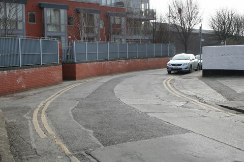
On we go. The block of flats on the left is Dakota Court, built on the site of the Dakota printing works, itself built on a filled-in dry dock.
Time for another map.
The Broadstone Line of the Royal Canal, now filled in, leads down to the left, and we’ll go down there in a moment.
The photo above shows the side of the Dakota Court flats, from the main line of the canal, but we might as well go up to Cross Guns Bridge to have a look at Lock 5. The next photo shows the bridge from the junction with the Broadstone Line.
See the white building on the left, behind the tree? That’s Porterhouse North.
You can see one former mill to the left of the lock and another just visible further up, beside Lock 6. There is a discussion in the Comments on the Broadstone Line page about which of these mills was which. On the OSI ~1840 map the Lock 6 mill is marked as a “Logwood & Wire Mill” and the Lock 5 is not; on the ~1900 map Lock 6 is a “Pin Mill (Disused)” and Lock 5 is “North City Flour Mills”, which later became a Ranks mill.
Refreshment
At this stage you may be feeling in need of rest and refreshment and, by an amazing coincidence, you are across the road from Porterhouse North, one of the outposts of the Porterhouse microbrewery.
You’ll have to check for yourself whether they’re serving food. Ignore their Google map, which is wrong; use this one instead.
The Porterhouse is marked correctly there. Cross Guns Bridge is not named, but it’s the bridge carrying the N2 road.
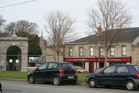
If you would prefer a more traditional Dublin pub, there is an excellent one only a small walk away. On the Google map above, the grey area is Glasnevin Cemetery, and you’ll see “John Kavanagh” off its right-hand edge.
This is probably one of the best traditional pubs in Dublin: Kavanaghs, the Gravediggers. No music, no television; I believe soup and sandwiches are available. The bar, on the left, is my favourite; on sunny days folk take their pints outside.
When you’re sufficiently refreshed, go back over Cross Guns Bridge, turn right and walk down Royal Canal Bank (shown on the Google map above). We take up the story on this page.
There is another Royal Canal walk, with an algebraic angle (comme on dit), on this site.














Pingback: The Auld Triangle or Royal Canal | NJN Network
Nice commentary & lovely pics
Thank you. bjg
Pingback: Visit Dublin. Walk canals. Drink beer. - Portobello