In Volume II of The History, Topography, and Antiquities, of the County and City of Limerick; with a preliminary view of the history and antiquities of Ireland [George M’Kern, Limerick; Baldwin, Cradock and Joy, London 1827; available on tinterweb], the Rev Patrick Fitzgerald, Vicar of Cahircorney, in the diocese of Emly, and John James M’Gregor, author of The History of the French Revolution &c, wrote:
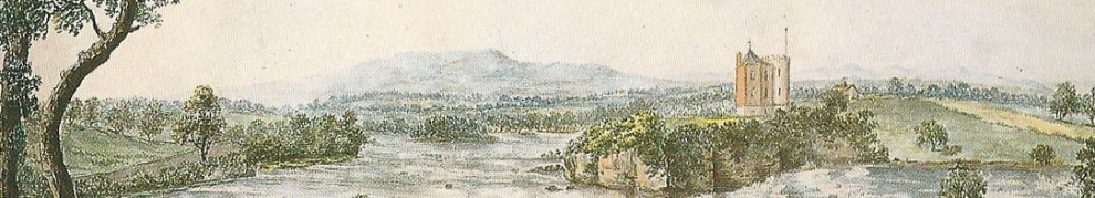
The falls of Doonass and Hermitage, are some of the finest in the United Kingdom — here the whole Shannon is impelled with tremendous force and deafening noise over a succession of craggy limestone-rocks, down a descent of 551/3 feet, in about half a mile, and this spot is perhaps unequalled in its situation, and water-power for mill-sites, and almost unrivalled in its picturesque beauties — here the sublime and beautiful are united, and the lovers of nature may revel in scenery congenial to their various tastes — here are assembled the foaming cascade, the rushing torrent, the boiling flood, the craggy rock, the gently swelling lawn, the frowning cliff, the retiring vale, the wooded hill, the noble mansion, and the peaceful cottage embosomed in woods — here is the spot for those who love to study or enjoy nature, where the poet, the philosopher, the sentimentalist, the engineer, and the sportsman, may alike find food for the mind and body.
The Falls of Doonass (W H Bartlett)
Although it may be difficult accurately to calculate the strength of these fine falls for the purpose of driving machinery, yet we have been informed, that in middling water the upper fall alone is equal to one thousand horse power (in winter perhaps double this), and would be adequate to driving six or seven cotton factories of one hundred and fifty to two hundred horse power each, or two hundred pairs of mill-stones for grinding corn. Is it not marvellous that this vast body of water has been allowed to spend its great powers on the rugged rocks and run uselessly here for ages, when we consider the immense sums spent annually in England and Scotland for the moving power in factories, which could be had here for one-twentieth part of what it costs in England for a steam engine and coal to work it?
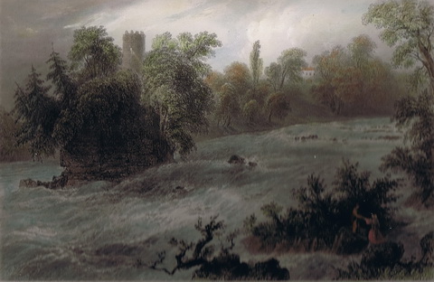
I have a page here about the Doonass bleach mill, one of the few enterprises that made use of the horsepower to which Messrs Fitzgerald and M’Gregor drew attention; that page includes other decriptions of the falls.
The economic historian Joel Mokyr, commenting on the “relationship between the physical environment and technological change” in The Lever of Riches: technological creativity and economic progress [Oxford University Press, New York and Oxford 1990], wrote:
Rainy England soon counted thousands of water mills, whereas rainy Ireland did not.
Mokyr was writing about the early Middle Ages, rather than about what he called “The Years of Miracles”, the early industrial revolution of 1750–1830. It did make me wonder whether he should have taken more account of the positioning of mountains and their rain-generating capacity: England’s Pennines are usefully located down the middle, with space on either side for processable produce to be grown or reared, whereas many of Ireland’s mountains (or hills) are located around the edge, with little useful productive land and few people living nearby.
Where England has mountains down the middle, Ireland has a river running through a plain. The River Shannon drops only about 30 feet over 113 miles from Leitrim to Killaloe, which meant that the scope for the application of water power was limited (though there were some mills along the way). From Killaloe to the sea at Limerick, however, a distance of fifteen miles, the Shannon fell about 100 feet; the falls discussed by Fitzgerald and M’Gregor are in that section of the Shannon. The power of the 100 foot fall is nowadays captured by the hydroelectric power station at Ardnacrusha.
The River Lawn bleach mill
The bleach mill at Doonass was not the only one on the Shannon between Killaloe and Limerick. The Ordnance Survey 6″ map (of around 1840) shows a second bleach mill downstream of Castleconnell.

Doonass bleach mill at top right. River bleach mill near bottom left (OSI ~1840)
Here is a closer look. The mill is called River Bleach Mill.

River Bleach Mill (OSI ~1840)
Zooming in again shows the millrace and a sluice.

River Bleach Mill in close-up (OSI ~1840)
This link should take you to the modern OSI map of the location (which I do not have permission to reproduce) and you can also look at the Ortho (aerial) views.
I know little about the history of this mill. Fitzgerald and M’Gregor mention a bleaching establishment (one of three near Limerick) “near Castle Connell, erected within a few years by Mr Fisher”. Saunders’s News-Letter of 29 August 1820 reported a fire in the dwelling-house at Clareville bleach-yard, belonging to J Fisher jun: the chimney caught fire and ignited the roof, but the inhabitants and the furniture were saved and the premises were “insured with the Atlas Company”. [Further exploration of the British Newspaper Archive would no doubt produce more information.]
Samuel Lewis’s Topographical Dictionary says (in describing Castleconnell):
River Lawn, a mile below the town, is an extensive bleach-green and mill[.]
The National Inventory of Architectural Heritage shows a nearby building, whose location you can see by clicking on NIAH’s “View location on map”. It says
However, the main mill building, which faced the River Shannon, is not [sic] longer extant.
I find it difficult to reconcile that with the evidence of these photographs. The trees made it difficult to take good photographs, but the building is in the location shown on the OSI map (and, for that matter, on NIAH’s own map).
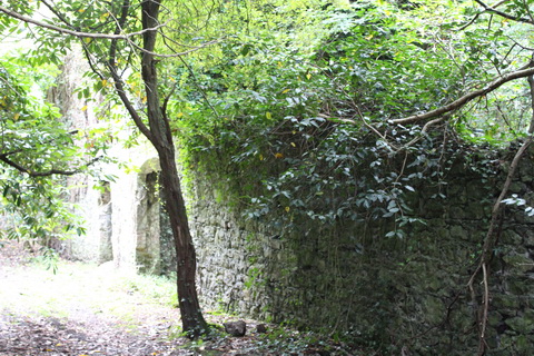
T’mill 1

T’mill 2

T’mill 3
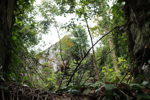
T’mill 4

T’mill 5

T’mill 6
I am utterly unable to connect with the Limerick local authority’s website so I can’t say what information it might have.
There are two ways of getting to the site: you can walk down the bank from Castleconnell or drive on the road (shown on the OSI maps) running towards the river south of the mill. There is room to park a car or two; you then walk upriver, leaping gracefully across the stream (outflow). There may be a plank, but not everybody likes walking the plank.

The stream or outflow

Perhaps a dry former outflow channel?

The Shannon
This link should take you to the Google satellite photo of the area. You can drag the little man to the road and look at the scenery — and at the building shown on the NIAH site.
I would welcome more information about the construction, ownership and operation of the bleach mill.
The C19 water works
The bleach mill is not, however, the only delight to be seen in the area. The OSI map of ~1910 has, alas, a section missing, but you can just see that Clareville Water Works has been built close to the bleach mill.

Clareville waterworks (OSI ~1910)
For a better view, I suggest you have a look at the modern OSI map. You can see that a new, and much longer, channel has been cut on inside (on the landward side of) the old mill race, with a sluice at its upper end.

Waterworks sluice (OSI ~1910)
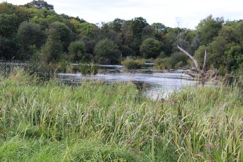
The Shannon upstream of the sluices
The sluices just visible in the trees

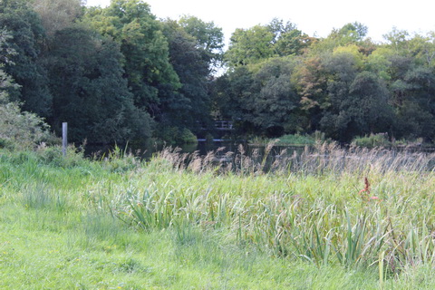
The upstream end with boom and guards

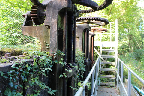
Serious kit
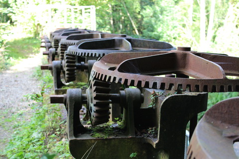
Along the line

Close-up

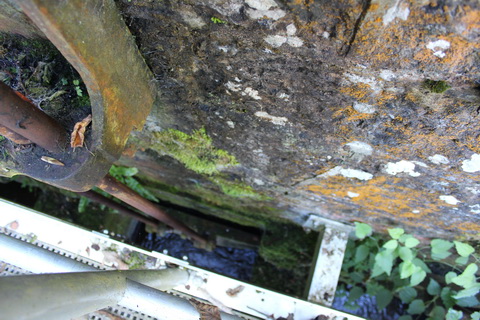
Lower walkway and ladder
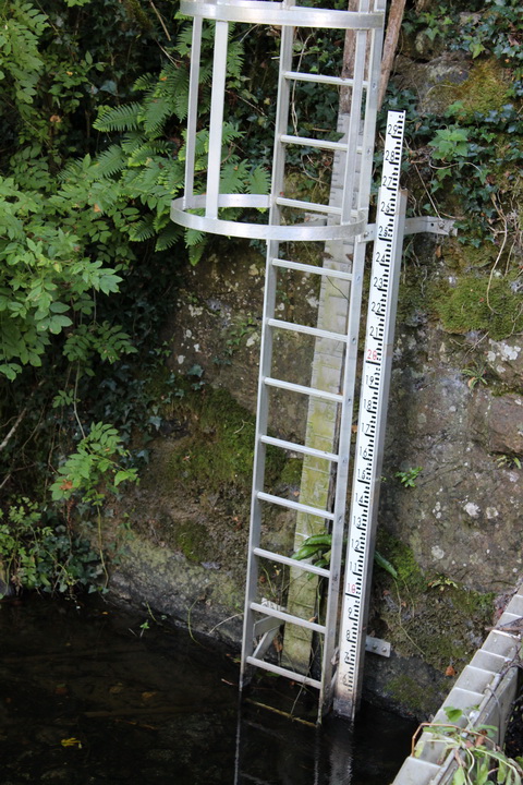
Depth gauge

Mechanism
Giant hogweed

Another view
Paddle lift mechanism 1
Paddle lift mechanism 2

Anchors
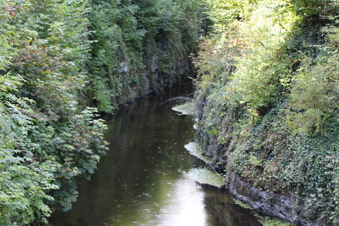
The channel downstream of the sluices

Another view of the channel
Although most of the channel is on the missing section of the next map, it does show all the places of interest: the waterworks sluices, the waterworks building across the channel, the bleach mill and the building shown on the NIAH web page.

Areas of interest (OSI ~1910)
Here are some photos of the waterworks building spanning the channel.

The building
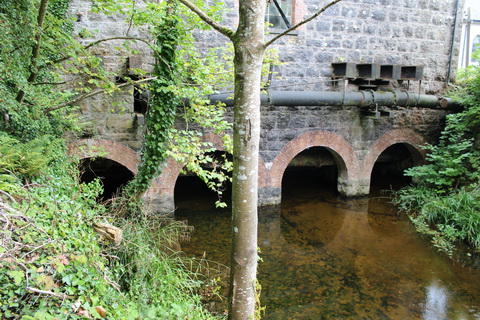
Spanning the channel

The side of the building
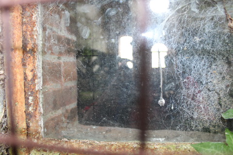
Looking (in vain) through the window

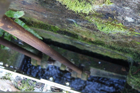
Sluices under the building 1

Sluices under the building 2

Sluices under the building 3
There is a description here of how the system worked up to the 1920s, how it was affected by the diversion of most of the Shannon’s water through Ardnacrusha and how the plant has developed since then. I would like more information (with diagrams and photos) about the original methods of operation.
The modern waterworks
Finally, here is a view of the (firmly locked) gate into the modern waterworks.

The modern waterworks
You can download a PDF about it from this page.
![]()
LkNav05


Pingback: Cots and canoes at Castleconnell | Irish waterways history
Pingback: Why the Shannon floods | Irish waterways history