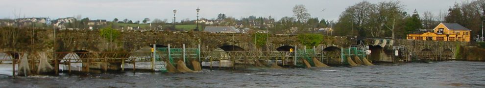
This page presents a slideshow of photos of the journey by water from Killaloe to Limerick, on the lower Shannon, including a passage through the lock at Ardnacrusha.
The journey was that of the converted former Grand Canal Company motor-barge 68M, which was carrying barrels of Guinness to Limerick to mark the fiftieth anniversary of the last commercial cargo carried by the Grand Canal Company, which was a cargo of Guinness to Limerick; the trip was timed to get the Guinness to Dolan’s Pub in time for Arthur’s Day 2010. I am grateful to the skipper of 68M for allowing me to join the trip.
The trip from Killaloe to Limerick by water is one of the best experiences it is possible to have in the Limerick area. The highlight is the passage through Ardnacrusha Lock: its two chambers have a combined drop of about 100 feet, whereas the deepest British lock is about 19 feet. But even after that, and even in the rain, there is much to enjoy, especially the sense of entering Limerick by the back door. Then there is the view of the city from the water, the trip to the docks, the docks themselves ….
Unfortunately, unless they have boats (or boat-owning friends), most people won’t ever experience this trip; this slide show may give an impression, but can’t replace the experience. However, at time of writing I believe that two firms with RIBs (fast inflatable boats) are licensed to carry passengers between Limerick and Killaloe: they are the Spirit of Lough Derg and Shannon Estuary RIB tours. They both cater for groups rather than individuals.
There are 300 photos (about one fifth of the number I took), so the slideshow takes a little time. The trip itself was in two parts. The Limerick Docks can be entered only when the tide has risen such that the water level is the same on both sides of the gates. So the first part of the trip was about four hours from Killaloe to the sea lock (Sarsfield Lock) in Limerick, where we waited for the tide. We spent about an hour and a quarter on the second part, from the sea lock to the Docks, but most of that was killing time, including a diversion downriver to Coonagh.
Some of the photo captions mention Counties Clare and Tipperary. For most of the journey, Clare is on the west bank, the boat’s right-hand side, and Tipperary on the east, the boat’s left-hand side. Don’t take “west” and “east” too literally, though: for at least part of the time the banks are north and south.
The Ordnance Survey map shows the headrace and the river but can’t be embedded here; the Google map can, but unfortunately it doesn’t show the headrace.
For more on Ardnacrusha, see this page.


Many thanks for the slideshow. It was a truely interesting trip!
Thanks, Richard. bjg
The small “castle” below the Limerick Docks, was known locally as “The Snuffbox” ?I have no details of its origion or background
it must have been a great trip. Pity to see the old Barge on the Bank……
Pingback: Please don’t look at these photos | Irish waterways history
Pingback: Ardnacrusha tours | Irish waterways history
Pingback: Crowded House for Goggin Lecture on Steam – Killaloe-Ballina