Tag Archives: bridge

Shinners to the right of them …

… Shinners to the left of them. The local resident Shinners, having done well in a recent election, may end up forming part of a government while, across the water, the British Shinners (formerly known as the Conservative Party) are well ensconced and about to start dispensing benefits to their supporters.

No, no, not those ex-Labour idiots who voted for them: how much did any of those voters contribute to party funds? Very little, I imagine, so they can’t expect to be rewarded with anything other than the drippings from the pan.

One of the things uniting Irish and British Shinners is a devotion to useless vanity projects, usually costing the public purse a fortune in return for little or no benefit. The Irish Shinners have been pushing the Clones Sheugh for years and they also support the Narrow Water Bridge, which would be built in the middle of nowhere and be far less useful than the Newry Bypass. The British Shinners, however, have an even more idiotic bridge in mind, to be built across a munitions dump.

Her Majesty’s Chief Nitwit, the appalling Johnson, has a string of idiotic proposals behind him, some of which even got built. And now he’s at it again, proposing both a railway line and a bridge to distract attention from his cluelessness, ignorance and stupidity. But there is probably more to it than that, as the admirable Richard Murphy points out today. The bridge (and, I suggest, the railway) will benefit the modern courtiers who finance such projects.


Header photo 20191202

Looking towards Clondra Lock.

The new header photo 20191102

Lanesborough bridge

Fuel for Athlone

The Messrs Robinson of Athlone, having supported Captain Mathew, the Conservative Member for the town, last election, threats have been offered and violence used to the boatmen conveying turf to their distillery, and in consequence the establishment will henceforth burn coal in the concern, a great loss to the country people.

Clare Journal, and Ennis Advertiser 23 February 1835

Staffing the Shannon

According to the eleventh and final report of the Shannon Commissioners, published in 1850 but covering the year 1849, each of the quays built by the commissioners on the Shannon Estuary had an officer stationed at it to collect tolls and other charges. Five of the six — Querrin, Saleen, Kilteery, Kildysart [aka Cahircon] and Clare [now Clarecastle] — had Second Class Collectors; Kilrush, being busier, had a First Class Collector.

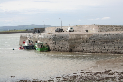
Cappa [Kilrush] pier

Moving upriver, Limerick was one of only two places on the Shannon to have an Inspector; it also had a First Class Collector and a Lock-keeper. Park, the next lock up on the Limerick Navigation, also had a keeper, as did five of the six locks on the Plassey–Errina Canal — Plassey [aka Annaghbeg], Gillogue, Newtown, Cloonlara [so spelt] and Errina. Presumably the Cloonlara keeper also locked after the nearby Monaskeha Lock. Preusmably, too, the keepers collected any tolls or charges due at the locks: there were no separate collectors, yet from other evidence we know that tolls and wharfage were collected at Plassey [Annaghbeg] and Errina.

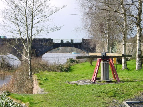
O’Briensbridge modern [ie 1830s] navigation arch

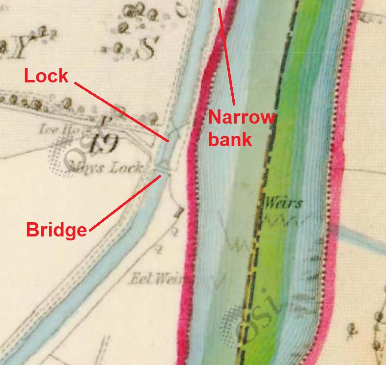
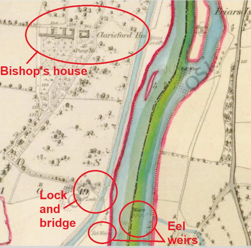
Back on the river, O’Briensbridge had a Second Class Collector. On the Killaloe Canal, each of the three locks — Cussane, Moyse [sic] and Killaloe — had a keeper; the Cussane keeper must have collected tolls and wharfage. Killaloe had a First Class Collector.

On Lough Derg, Scarriff and Portumna each had a Second Class Collector. Portumna, like several places upstream, had an opening bridge, but the Shannon Commissioners did not employ a bridge-keeper: the bridge was not built, owned or operated by the Shannon Commissioners.

Back on the river, on what used to be called the Middle Shannon, the commissioners employed both a Second Class Collector and a lock-keeper at Victoria Lock (Meelick). There was another Second Class Collector, and a bridge-keeper, at Banagher. At Wooden Bridge, the crossing of the Shannon from the Grand Canal’s main line to its Ballinasloe line, the commissioners employed two ferry boatmen: by that stage the bridge no longer existed and the commissioners had installed a ferry to carry horses and tow boats between the canals.

Shannon Bridge had a Second Class Collector and a bridge-keeper; Athlone had a bridge-keeper but earned itself a First Class Collector. On Lough Ree, Lecarrow and Lanesborough each had a Second Class Collector but Tarmonbarry had nobody: a First Class Collector was assigned to Cloondragh [so spelt] but presumably had to look after Clondra and Tarmonbarry locks, the weir, Tarmonbarry bridge and the collection of tolls. Mighty men they had back then.

The second Inspector was based at Rooskey, along with a lock-keeper who presumably also operated the bridge and did anything that needed doing on the weir. Albert Lock on the Jamestown Canal had a lock-keeper but Kilbride, the quay at the upper end of the canal, had a wharfinger, the only one on the Shannon.

Fermate at Kilbride Quay

The collection of tolls (presumably by the wharfinger) did not begin at Kilbride until March 1849 but in that year it took in £6 in tolls and £1 in wharfage, compared with £1 + £2 at Drumsna and £0 + £0 at Jamestown. Perhaps the road beside the quay made it a suitable place for cargoes from Roscommon to transfer from road to water transport.

Carrick-on-Shannon, not an important station on the Shannon, had just a Second Class Collector; there was a lock-keeper at Knockvicar for the Boyle Water and another at Battle Bridge who presumably looked after all the locks on the Lough Allen Canal.

Cranes were provided at several places but there is no mention of designated crane-operators.

Source: Eleventh and Final Report of the Commissioners under the Act 2 & 3 Vict c61 for the improvement of the Navigation of the River Shannon, Ireland; with an appendix Ordered, by The House of Commons, to be Printed, 3 June 1850 [407]


The Bishop of Killaloe and the bridge at Moys

That would be the Bishop of the United Church of England and Ireland, as established by the fifth article of the Acts of Union of 1800, of course.

Cussane lock (OSI 25″ ~1900)

Cussane (or Coosaun, as above) Lock was the furthest downstream of the three locks on the Killaloe Canal. It was submerged by the “Flooded Area” created by Parteen Villa Weir as part of the Ardnacrusha hydroelectric scheme.

The middle lock on the Killaloe Canal is at Moys and its remains are visible, just above the water, in normal non-flood conditions. It is (or was until recently) still possible to go through it by (small) boat, though of course without needing to use the lock mechanisms.

Approaching Moys Lock from upstream

However, although the lock itself survives, the bridge that crossed it is no longer there. It was shown on the 6″ (~1840) and 25″ (~1900) Ordnance Survey maps; I would guess that it was removed as part of the Ardnacrusha works, but I don’t know and would welcome information.

The lock and bridge at Moys (OSI 6″ ~1840)

The other thing I don’t know about the bridge is why it was built in the first place. Hely Dutton [Statistical Survey of the County of Clare, with observations on the means of improvement; drawn up for the consideration, and by direction of the Dublin Society The Dublin Society, Dublin 1808] wrote that

It seems to be the general opinion in Killaloe, that the canal has been cut in the most improper direction; they think it should have been brought in a valley between Killaloe and Dr. Parker’s, and to the north of the Bishop’s house, and not parallel to the Shannon as at present. Bishop Bernard offered several thousand pounds, if this line had been pursued; for, instead of cutting his demesne off from the Shannon, as at present it does, it would have gone at the back of his house; if this was the only objection, I think the engineer acted very impartially, as all public officers should, but very seldom do.

That suggests that the bishop was not best pleased to have a canal in front of his house; if he was willing to pay “several thousand pounds” to have the canal put somewhere else, the Limerick Navigation’s promoters must have been able to deploy considerable firepower (political and financial) to overcome his opposition. I wonder whether promotion to Limerick might have helped: according to a later estimate [Dublin Weekly Register 21 September 1822], promotion from Killaloe to Limerick would have increased a bishop’s income from £7000 to £8000 a year.

Charlotte Murphy [“The Limerick Navigation Company 1697–1836” in North Munster Archaeological Society Journal Vol 22 1980], describing John Brownrigg’s report on the navigation in 1801, said

This latter [Moys] lock had a bridge over the tail to accommodate the Bishop of Killaloe, whose demesne was served by the canal.

But what accommodation did the bishop need? A small strip of land downstream of the lock was insulated by the canal; perhaps the bridge provided access for cattle.

Another possibility is that the bridge provided access to the episcopal eel weirs. According to Mr Blackburne QC, addressing the Shannon Commissioners in 1837 on behalf of the Bishop of Killaloe and Sir Gilbert King Bart of Jamestown [Saunders’s News-Letter 29 December 1837],

The bishop, his tenants, and his predecessors had from time immemorial been in the habit of using twenty-five eel weirs, extending from the tail of Lough Dearg down the whole line of the rapids of Killaloe, which place, from natural impediments, could never be made navigable.

I think I have read somewhere that the eel weirs were worth £75 a year to the bishop, but I can’t remember where I saw that so I haven’t been able to check it.

The bishop’s house, the lock and the bridge (OSI 6″ ~1840)


There is one other aspect. The bridge was used by the horses towing boats on the canal and, of course, by the men leading them. We know that because the towing-path changed sides at Moys Lock. It was on the west side of the canal from Cussaun to Moys but on the east from Moys to Killaloe: it is marked on the 6″ OSI map and named on the 25″.

That forced horses and men to walk on a narrow embankment rather than on the shore. But it kept them out of the bishop’s garden and a little further from his house. Might that have been the intention?

I would be glad to hear from anyone who knows more about Moys.


The Newry bypass

I hesitate to criticise the Newry & Portadown Branch of the Inland Waterways Association of Ireland, admirable folk who conduct regular work parties improving the Newry Canal. So perhaps I should say that I disagree with them instead — at least on the proposal for a Southern Relief Road, aka bypass, around Newry, linking “the Warrenpoint Dual Carriageway to the A1 Dublin/ Belfast Road“.

Such a bypass is a very good idea and, of course, far better than the insane Narrow Water handsacrosstheborder project. But the new road must cross  the Newry River and the Newry Ship Canal, and I would be vastly surprised if there were any economic justification for the cost of an opening section or for the disruption that each opening would cause to traffic. Certainly six or twelve sailing vessels would no longer be able to reach the Albert Basin in Newry, but the greatest good of the greatest number should surely prevail.

I can’t see that the absence of sailing pleasure craft from Newry would in any  way diminish the heritage or historic value of the ship canal or the basin, and they are of course entirely irrelevant to the stillwater canal.

A spokesman from the Inland Waterways Association of Ireland” says that

The IWAI was formed in 1954 to stop the building of low bridges on the River Shannon. Fortunately this campaign was successful otherwise there would be no hire boats on the Shannon today. Think of the loss of revenue. This should be a lesson to the bridge builders in Newry.

This is rubbish, for two reasons. First, sailing vessels on Carlingford Lough are never going to be available for hire on the Newry Canal, so their inability to reach Albert Basin would have little effect.

Second, the IWAI campaign on the Shannon was notably unsuccessful. Instead of swivelling bridges that would allow masted vessels through, the Shannon now has fixed bridges (Banagher, Shannonbridge, Athlone) and lifting bridges (Roosky, Tarmonbarry) that lift enough to allow motor cruisers through, but not enough for sailing vessels.

Ruth Delany [in Ireland’s Inland Waterways: celebrating 300 years Appletree Press, Belfast 2004] says that the IWAI Shannon campaign resulted in there being a minimum clearance of 4.3m on the Shannon, which is a long way from the 35m that the Newry & Portadown folk are seeking. The only Shannon bridge providing that clearance is Portumna, a swivel bridge, which (unlike the others mentioned above) was not — or its ancestor was not — built by the Shannon Commissioners.

By using the Shannon as a model, the N&P folk have actually weakened their case: the 9m clearance suggested for the Newry bypass is more than twice what the Shannon provides.


Killaloe Bridge

A new bridge for Killaloe:

We may here state that in the projected improvements of the Shannon, the rapids will be lowered, a new bridge erected, and the navigation of the river between Killaloe and Limerick materially altered.

James Fraser, Landscape Gardener and Designer of Rural Improvements A Hand Book for Travellers in Ireland, descriptive of its scenery, towns, seats, antiquities, etc with various statistical tables. Also an outline of its mineral structure, a brief view of its botany, and information for anglers William Curry, Jun and Company, Dublin; Longman and Company, London; Fraser and Co, Edinburgh 1844

It took a while, but the new bridge seems to be on its way. The old bridge — which has been altered in many ways over the years — has done enough and deserves to be relieved of the volume of traffic crossing it daily.

Anyone intending to create any further delays to the bypass should be invited to go and boil his or her head.


Grand Canal announcements

The Grand Canal Company do hereby give Notice, that they are ready to receive Proposals for supplying Ashler Stones for repairing the Locks upon the Grand Canal; the Stretching Stones to be twelve Inches Bond, and the Heading Stones two Feet Bond. All Persons willing to furnish the same, are desired to apply to Captain Charles Tarrant, No 45, Cuffe street, who will inform them where the same are to be layed down. —

Proposals will be received for Building, by Contract, two Boats on the Canal (the Size and Dimentions to be known upon Application as above), the Contractor finding Timber and every Article requisite.

Also for furnishing Lime per Hogshead, in the Neighbourhood of Ballyfermott Bridge.

June 18, 1777. Signed by Order, R BAGGS, Sec

WHEREAS the Sluice erected upon the Canal in the Barrenrath Level, has been wantonly and feloniously broken down, a Reward of Twenty Guineas shall be paid for discovering and prosecuting to Conviction the Person or Persons who have committed the said Offence.

By Order of the Grand Canal Company, June 7, 1777, R BAGGS, Sec

Saunders’s News-Letter 23 June 1777

Handsacrosstheborderism

I see from the blatts that there are

Fears over future of Narrow Water bridge project

and that

Planning permission for development at Carlingford Lough due to expire in October.

This is encouraging: I hope that the planning permission will be allowed to expire, unmourned by anyone, and that the project will be buried at the crossroads with a stake through its heart.

Like the Clones Sheugh, this scheme put symbolism over practicality and usefulness. It would require motorists from the south to drive to the middle of nowhere to cross the Newry River, when what is needed is an eastern bypass of Newry. Those living towards the eastern end of Carlingford Lough would be better served by a ferry, and I see that such a service is now proposed, to run between Greenore and Greencastle.

The only possible justification for the proposed bridge would be to build it without access roads, name it Garvaghy Road and allow — nay, sentence — Orange Order members to march up and down it in perpetuity.