Tag Archives: estuary

Kilteery

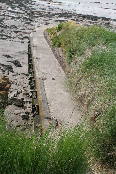
The current header photo shows Kilteery Pier on the Shannon Estuary. Here is a page about the building of the pier.

The Traveller’s Map of the River Shannon (1830)

The Traveller’s Map of the River Shannon. Arranged as a Guide to its Lakes and the Several Towns, Gentlemens’ Seats, Ancient Castles, Ruins, Mines, Quarries, Trading Stations, and General Scenery on Its Banks, Source in Lough Allen to the Sea, Leitrim, Longford, Roscommon, Westmeath, King’s County, Tipperary, Galway, Limerick, Kerry and Clare, Accurately Taken from the Survey made by J. Grantham, by order of the Irish Government, under the direction of the late J. Rennie. Printed and published for the Irish Inland Steam Navigation Company, 1830.

Oblong folio, 15 numbered maps printed in black with river and water features coloured in light blue. Original quarter calf green cloth boards, russet title to centre of upper boards, stamped in gilt with gilt fillet boarder. Repair to rear of plate 15, otherwise all maps in very good to fine condition.

Contents: 1. Map of Ireland, 2. Index Map. Lough Derg to the sea, 3. Index Map. Lough Derg to Lough Allen., 4. Kilrush to Tarbert and Foynes Island, 5. Foynes Island to Grass Island, 6. Grass Island to Limerick and O’Brien’s Bridge. 7. O’Briens Bridge to Killaloe and Dromineer. 8. Dromineer to Portumna and Redwood Castle. 9. Redwood Castle to Banagher, and Seven [Churches (Clonmacnoise)], 10. Seven Churches to Athlone and Lough Ree, 11. Lough Ree to Lough Forbes. 12 Lough Forbes to near Leitrim. 13. Leitrim to Head of Lough Allen. 14. map of Limerick, 15. Map of Killaloe.

Map 1 shows Ireland and its waterways at scale of 1″ equals 20 miles, Maps 2 and 3 show the key for 4-13, with table of falls of water along the route on former and table of distances on latter; Maps 4-14 each have a short descriptive panel; Map 14 shows Limerick from the north of King’s Island to the New Barrack in the south with key Map 15 from the town at left to Beal Boru at right.

Yours for only €1800 at Ulysses Rare Books in Dublin.
The Lady of the Shannon

Folk interested in early steam transport in Ireland may wish to know that the latest issue [Vol 41] of The Other Clare, journal of the Shannon Archaeological & Historical Society, has an article, “Mr Paterson’s steamer”, about the Lady of the Shannon, the steamer built on the Clyde in 1816 for James Paterson of Kilrush.

While the steamer and its operations are well known (see for instance the page by Senan Scanlan on the Clare County Library site), a lack of contextual information has meant that the scale of Paterson’s achievement is not widely appreciated. His steam boat was built only four years after PS Comet, Europe’s first commercially viable steamer, began operations on the Clyde. Paterson, who built baths at Kilrush at the same time as he acquired his steamer, may have intended to imitate Henry Bell’s operations.

At the time, most steamers operated on rivers and estuaries, but some undertook longer delivery voyages to new areas of operation in Britain and Europe. But Paterson’s may have been the first to brave the rigours of the Atlantic: it probably travelled west off Ireland’s north coast, and then down the west coast to the Shannon. Ensuring that coal was available along the way must have required a good deal of planning.

Commercially, Paterson’s steamer was not a long-term success, and the possible reasons for its failure are explored briefly in the article.

The Shannon Archaeological & Historical Society does not itself appear to sell its journal online; Scéal Eile Books in Ennis may be able to supply it by post, as may the Celtic Bookshop in Limerick.

Maps

Many thanks to the learned Eoin C Bairéad for the information that the good people at logainm.ie have scanned many old maps, and other documents, and made them available here, free of charge. They include maps of counties bordering the Shannon, Murdoch Mackenzie’s 1775 chart of the Shannon Estuary (with some soundings) and Mackenzie’s Views of the West Coast of Ireland.

Note: some of the files are very large.


Mr Paterson, General Lake and Napoleon Bonaparte

Dublin

On Tuesday sennight sailed his Majesty’s gun-boat, the General Lake, commanded by Mr James Patterson; and on Wednesday the Bishop, Lieut S Dunn, an experienced officer, who had served in the Royal Navy during the whole of the American war — these, with two others now fitting out, are to join the Kingsmill and Gen Duff gun boats at Carrigahoult bay, where they are to be stationed for the purpose of defending the entrance of the Shannon, the whole under the command of Lieut Augustus Margett, senior officer of division.

The Hon Capt Pakenham, who arrived at Limerick some time back to survey the works on the river, had the boats constructed upon his own plan, and they are found to be in every respect both capable of standing the shock of cannonading, and of annoying an enemy. There is a signal post, with a proper person to conduct it, stationed on Ray Hill, a commanding eminence near Loophead, from whence there is an extensive prospect of the offing. The gun-boats are furnished with private signals, so as to communicate with the person who conducts the signals on shore, by which means friends or enemies at sea are easily ascertained, long before they can come near the shore, and regular and certain intelligence conveyed to the commanding officer of the district.

The following is a list of the gun-boats stationed in the River Shannon, with the names of their commanders, forces, and complement of men:

Vessels                 Guns  Pounders    Men    Commanders

Pakenham              1           24           19      A Markett
Kingsmill                1           18            19     J Alexander
Gen Duff                  1           18            18     — Wing
Bishop                      1           18            18     S Dunn
Gen Lake                 1           18            18     J Patterson
The Shannon         1           18            18     Geo Perry

The whole completely equipped, with every description of small arms, ordnance stores, &c.

Dublin Evening Post 6 May 1797. From the British Newspaper Archive run by Findmypast Newspaper Archive Limited, in partnership with the British Library.


Yesterday dispatches were received at the Admiralty from Vice Admiral Kingsmill at Cork, brought over in the Waterford mail. Intelligence is received by this conveyance that the River Shannon is now rendered perfectly secure from any designs of an enemy, by the judicious stationing of several gun-boats, which wholly command the entrance and port of Limerick in every direction. The Naval Agents in Ireland, it also appears, continue, by order of Government, to purchase stout ships, which are converted into floating batteries for the defence of other harbours of the kingdom in like manner.

Hereford Journal 9 August 1797. From the British Newspaper Archive run by Findmypast Newspaper Archive Limited, in partnership with the British Library.


The Hon Capt T Pakenham, who shortly after went to Limerick, converted some turf-boats into gun-vessels, each of which carried a twenty-four pounder, constructed to traverse on a platform, and to fire in every direction with the same facility. We are gratified to learn that the system is to be generally adopted.

The Monthly Mirror: reflecting men and manners. With strictures on their epitome, the stage May 1798 in Vol V, Thomas Bellamy, London


Shannon Estuary murders

Limerick, May 16. Piracy

About six weeks since, a most daring act of piracy and murder was supposed to have been committed in Mr Parker’s turf-boat, which was lying at anchor near Ahanish, in this river. Tuesday, in consequence of private information, a search was made on one of the islands convenient to where the vessel lay at the time of the piracy, where the three unfortunate men who composed the crew of said boat were discovered in a pit, with their throats cut from ear to ear, their heads and bodies much lacerated, and a large rope bracing them together. The anchor, cables, and parts of the rigging, were found secreted in another part of the island.

Evening Mail 29 May 1818. From the British Newspaper Archive run by Findmypast Newspaper Archive Limited, in partnership with the British Library.

The Purton boat graveyard

If you happen to be driving across southern England and Wales — say from Fishguard or Pembroke to London — and you want a break, you could turn off the M4 or M48 and drive to the Purton ships’ graveyard in Gloucestershire. It’s roughly 25 miles, 35 minutes, each way: a two-hour break will give you an hour on site — and take you a world away from the busy motorways.

Purton gives you two waterways for the price of one: the Severn estuary and the Gloucester and Sharpness Canal, which bypasses part of the estuary.

The estuary

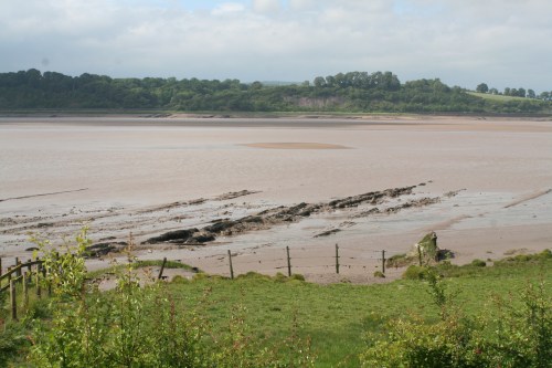
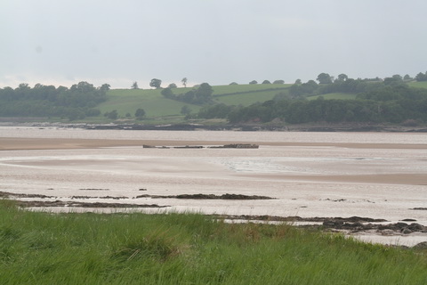
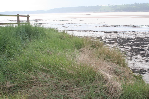
Big estuaries — including the Shannon and the Suir — always give a sense of space, with big open skies, but somehow the Severn looks even bigger when the tide goes so far out.

Severn rotation 3 05_resize

The long and level sands stretch far away

Severn rotation 1 01_resize

Note the train on the far bank, behind the signpost

Incidentally, the west bank too seems to have a place called Purton, if Messrs Google’s map is to be believed.

Severn rotation 3 02_resize

Drawing a line in the sand

The canal

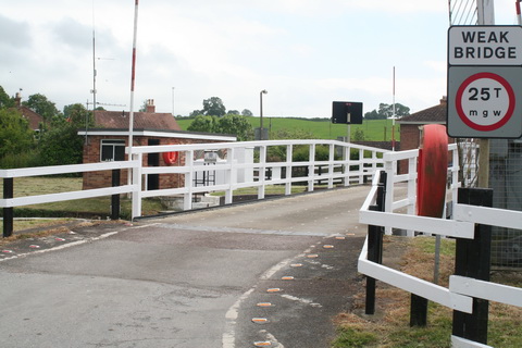
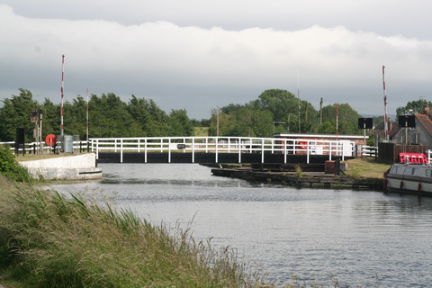
Purton has two of the Gloucester and Sharpness Canal‘s swing bridges, a weir and other interesting features.

Purton lower bridge 01_resize

Purton lower bridge

Purton lower bridge 03_resize

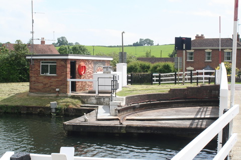
Purton lower bridge control room. The keeper operates both bridges

Purton lower bridge 06_resize

Swinging room

Purton lower bridge 08_resize

Purton lower bridge from downstream

Purton upper bridge

Purton upper bridge

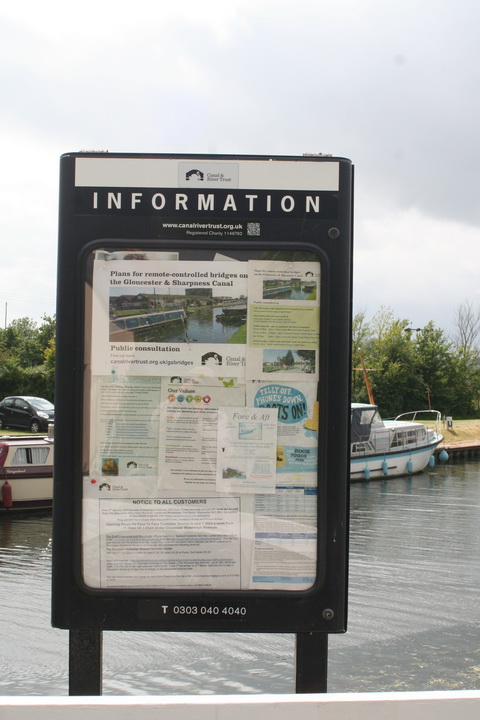
Purton Gloucester and Sharpness Canal 02_resize

Information board beside the lower bridge

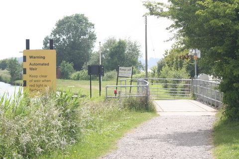
Purton weir 01_resize

Purton weir

Purton weir 03_resize

Weir bridge and sluices

Purton weir 04_resize

Weir inflow

Purton weir 06_resize

Weir sluices

Purton weir 07_resize

Weir outfall

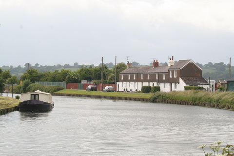
Purton cottages 01_resize

Canalside cottages (all occupied)

Purton canal furniture 04_resize

One of several designs of self-closing gate

Purton canal furniture 05_resize

Pontoon

Purton canal furniture 06_resize

Pumpout

Purton Gloucester and Sharpness Canal 03_resize

Moorings

Boats at Purton 2015 01_resize

Boats 1

Boats at Purton 2015 05_resize

Boats 2

Boats at Purton 2015 06_resize

Boats 3

Purton boats 10_resize

Boats 4

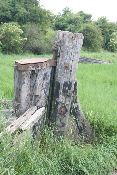
The hulks

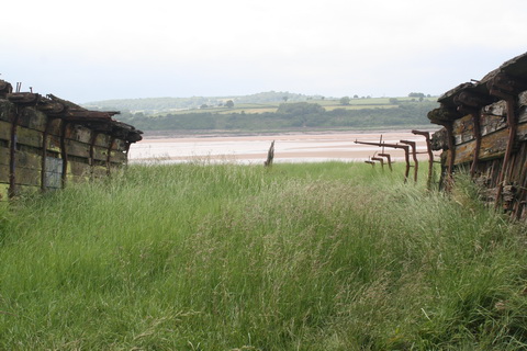
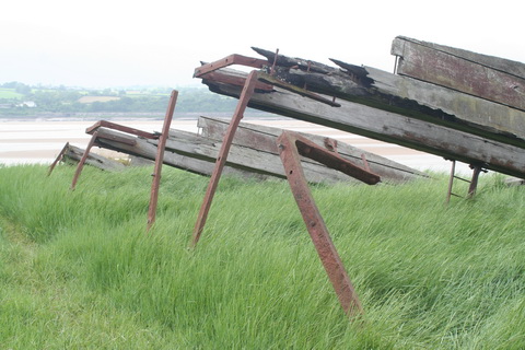
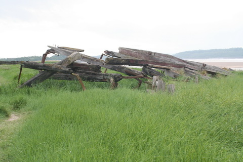
The hulls of old vessels were used to shore up the embankment, between canal and river, at Purton. [This practice was also used in Ireland, on both the Barrow and the Suir, but not on anything like the same scale.] The result was the creation of a boat or ship graveyard that preserved, and makes reasonably accessible, the hulls or frames or at least parts of a large number of inland, estuarial and coastal vessels. And some of them are vessels that traded with Ireland.

The Friends of Purton have an informative website here; please also read their page about access here. I can confirm that parking is restricted on the site; it would be easy to annoy the local people by careless parking.

Good information is provided on site.

Purton hulks general information 01_resize

Information board

Purton hulks general information 02_resize

Memorial

Purton hulks general information 03_resize

Close-up

Purton hulks general information 04_resize

Advice

Purton hulks Severn Collier 04_resize

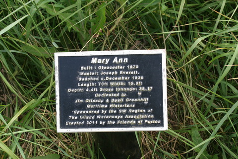
All identified wrecks have plaques like this

I had allowed an hour for my visit, but didn’t see everything; it would have been easy to spend twice as much time there. In the summer, growth hid a few of the artefacts, but there was plenty to see without trampling on the shrubbery.

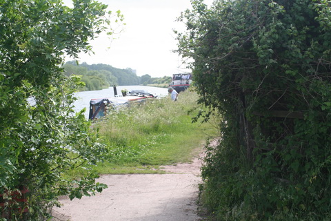
Mary Ann 01 resize

The Mary Ann

Mary Ann 03 resize

… is in there somewhere

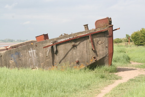
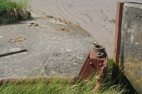
There are quite a few concrete (ferrocement) barges, built during the Second World War.

IMG_5227_resize

Up close

IMG_5229_resize

Bows on

Purton concrete barges 01_resize

Information plaque

Purton concrete barges 02_resize

Stacked up

Purton concrete barges 08_resize

Deck details

Purton concrete barges 17_resize

Merging into the bank

Purton concrete barges 18_resize

One side

Of the other vessels, the Dursley is apparently in reasonable condition but, on my visit, was largely hidden in the grass.

Dursley 06 resize

Dursley plaque

Dursley 02 resize

Dursley sternpost and rudder

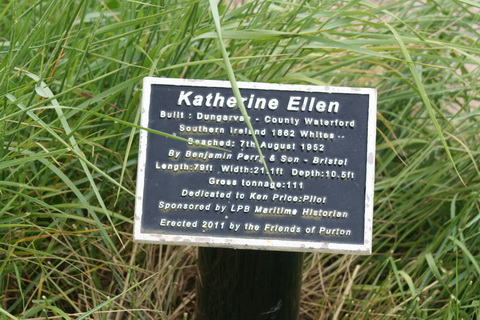
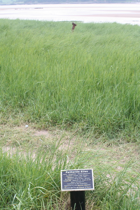
The same was true of the Katherine [or Catherine] Ellen, built in Dungarvan.

IMG_5165_resize

Katherine Ellen plaque

IMG_5166_resize

Katherine Ellen site

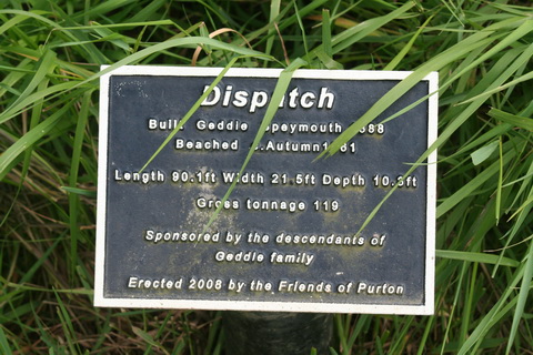
I failed to find the Jonadab, a Severn trow that traded to the (Munster) Blackwater, but I did see the remains of the Scottish-built Dispatch, which is amongst the vessels listed by Niall O’Brien as having visited the Munster Blackwater [Blackwater and Bride: navigation and trade 7000BC to 2007, Niall O’Brien Publishing, Ballyduff Upper, 2008].

IMG_5189_resize

Dispatch plaque

IMG_5190_resize

Dispatch hull

Then there were the dramatic remains of Sally, renamed King, of London.

IMG_5171_resize

Sally plaque

IMG_5172_resize

Sally remains 1

IMG_5169_resize

Sally remains 2

And many more. Even isolated timbers or iron ribs had their interest. But let me finish with a wreck that is not on the embankment but just offshore.

Purton hulks tanker 06_resize

Tanker offshore

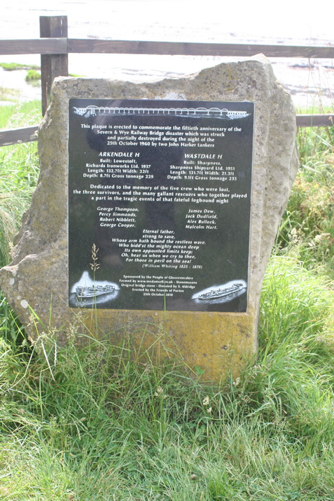
You can read about the loss of the tankers Arkendale H and Wastdale H here and here. They are remembered on a plaque at the site.

Purton hulks tanker 02_resize

Plaque about the tankers

Purton hulks tanker 03_resize

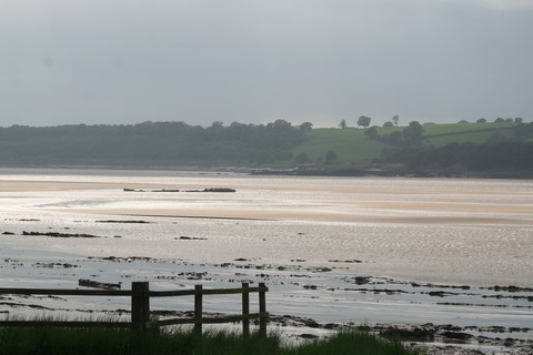
I don’t know which of the tankers is shown in my photos

Purton hulks tanker 05_resize

The wreck is a reminder of the hazards of estuaries

Purton is well worth a visit — but it is only one of the waterways delights close to the Fishguard/Pembroke to London route.

ESB and the Shannon

I wrote here that I had written to the ESB, on 27 May 2015, to ask about navigation on the Shannon from Castleconnell downstream. One month later, I have not yet received a reply.

I did hear this weekend that ESB had contacted certain boat-owners to inform them that they were not to moor to the ESB embankments between Portumna and Meelick. As a riparian landowner, ESB is no doubt within its rights, but it would be interesting to know how much of the bed of the Shannon it claims to own in that area.

I have still not been able to find out, from the ESB, the clearance under its high-voltage lines crossing the Shannon (and other navigations). I gather that the ESB works on the principle that, if it provides no information, it can’t be blamed if owners of masted vessels electrocute themselves, whereas if it did provide information it might be sued. Strange that a public sector body should have such a blasé attitude to the prospect of the electrocution of the citizenry.

Perhaps if I asked questions under the Access to Information on the Environment Regulations 2007/2011 I might get replies.


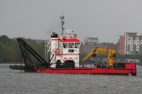
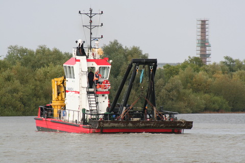
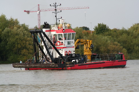
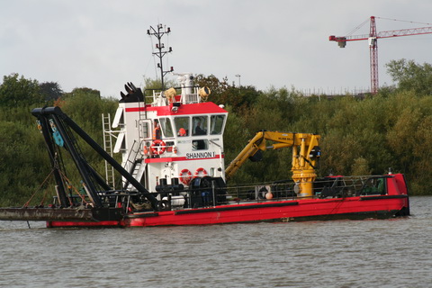
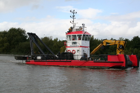
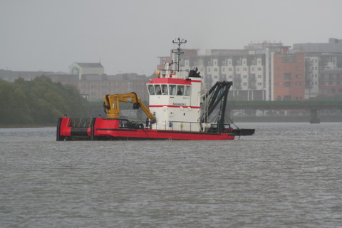
The Shannon One

Copy of IMG_4546_resize

Heading down the estuary past Shannon Airport

Limerick Port dredger Shannon I 3_resize

Working in Limerick

Limerick Port dredger Shannon I 4_resize

Almost as much kit as WI’s Swiss Army Knife

Limerick Port dredger Shannon I 5_resize

The big crane, though, is not part of the kit

Limerick Port dredger Shannon I 7_resize

Great view from the cab … er, wheelhouse

Limerick Port dredger Shannon I 11_resize

Pusher bow?

Limerick Port dredger Shannon I 1_resize

Limerick in the background

Limerick Port old dredger Curraghgour II 3_resize

Shannon 1’s predecessor Curraghgour II


Backtracking the Barrow trackway

Some time ago I put up a page about the Barrow trackway [towing-path]. For some reason, the page disappeared shortly afterwards. I have now recreated it; unless or until it disappears again, it is here.