The Ordnance Survey maps of 1838 to 1840 show a small canal network in a bog near Roscrea. Lewis indexes it under Corbally, the parish, but modern folk could find it more easily by travelling on the N7 to Racket Hall, a hotel on the Dublin side of Roscrea: the canal carried turf from a bog to the east and south of the hotel.
Here is what Lewis had to say about it:
Corbally Co Tipperary A private canal, about four miles in length, has been constructed, from which are several branches, one for conveying turf to the distillery at Birch Grove, and another to the Rathdowney road leading to Roscrea, and partly supplying the latter town; all run into the bog of Corbally, in which is a lake about one Irish mile in circumference. A considerable portion of the bog has been reclaimed by Messrs. Birch, and is now in a high state of cultivation.

Birchgrove from a distance. The Equality Authority now has offices in the premises; the government intended to move the entire organisation to Roscrea (a form of internal exile, like sending opponents to Siberia) but it seems to maintain at least a toehold in Dublin
According to the Roscrea Heritage Society, the turf boats were hauled by donkeys.

In the grounds of Birchgrove
The Griffith’s Valuation maps are available free online; look for Birchgrove in Tipperary. It is difficult to distinguish between paths and watercourses.

The house close up
For a contemporary view, use the Ordnance Survey aerial photographs: select “Buy now” (you don’t actually have to buy anything) and go to Birchgrove, east of Roscrea, just south of the N7. If you can get the “ITM Coords” (see bottom left of the screen) to 615232, 689445 you should be just on Birchgrove itself. On the right-hand side of the screen, select “Land Registry” under “Map Products” and you’ll see all the watercourses in the area.

A building in the grounds
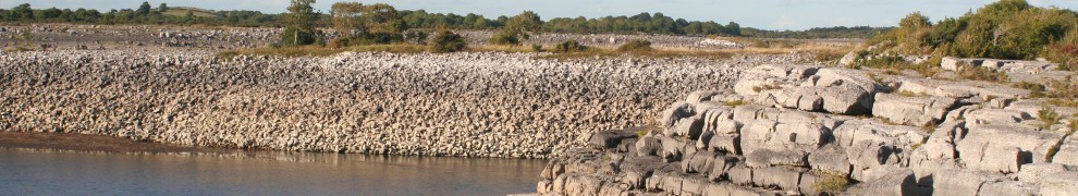
Although some of the land seems to have been drained since the OS map was drawn, the bog is still extensive and there are many watercourses to the east and to the south of Birchgrove. I saw some of them, but only those close to the road; they seem to be amongst the smallest and least significant, perhaps mere drains rather than canals (or combined canals and drains). I can’t say which was the private canal mentioned by Lewis; there seem to be several possible candidates.

Drainage ditch?

Another ditch?
The watercourses shown in my photos seem to be too small ever to have served as canals (although I suspect they might have been larger when draining the bog).
Still, my visit to the area did allow me to see Monaincha Abbey, a small but remarkable ruin with an atmosphere of its own: well worth a visit. You can read Roscrea historian George Cunningham’s article here. There are several Birch gravestones in it.

Monaincha Abbey

A Birch gravestone
Here is what John Carr wrote about it in The Stranger in Ireland: or, a tour in the southern and western parts of that country, in the year 1805:
About two or three miles before we reached Roscrea, the singular ruins of the Abbey of Monanincha were pointed out to us: they are situated almost in the centre of the before mentioned Bog of Monela, on an island of about three acres, inaccessible by horse or carriage, and even by foot passengers, for the greater part of the year. These ruins belonged to an ancient monastery of Culdean monks, founded under the patronage of St Columbee in the seventh century, and consist of two chapels and a priory church, with the abbot’s apartments adjoining. In the island are the traces of an orchard and fish-pond. The abbey-church, I was informed, for I only saw it at a distance, is of Saxon architecture; small but elegant.
Apart from Lewis, and the Roscrea Heritage Society’s website, I have not yet found any other documentation about this navigation and I have no information on the types of vessels used, but I presume them to be inland (ie flat) cots of some kind. If you have any information or suggestions, do please leave a Comment.
Update April 2011
The Roscrea People 2010 has a lengthy article about the Birch family, Birchgrove, the distillery and the bog and canals. You can download a PDF of the entire journal, free of charge, here. Many thanks to Eamonn Horan for the tip-off.
turf61


Birchgrove looks a fascinating house. Has it always been a distillery or was it once a private house? If so, has anyone documented its ownership?
Lesley
The distillery seems to have been what you might call a cottage industry, save that the cottage was a very large house! I suspect that the distilling was done in one of the out-offices or subsidiary buildings. The Birch family occupied the house for a long time, and some were buried at the remarkable Monaincha church.
The Ordnance Survey has now made its historic maps publicly available; you can see what Birchgrove was like in the 1840s by going to http://ims0.osiemaps.ie/website/publicviewer/main.aspx#V1,615212,689438,8 and, if necessary, selecting “HISTORIC” in the lower menu on the right hand side.
bjg
I think I may have an explanation of what you believed were small canals or drainage ditches. In the 1850s the distillery shut down and was converted into a flax scutching mill. Those small ditches may have been used for the retting of flax prior to scutching. If you look at the flax mills / farms in Ulster you will find that these were very common. It appears that the scutching mill did not have any long term success and eventually closing down just like the distillery.
It is very likely that the canal system was used to bring turf to fire the steam engine that would have powered the scutching mill at Birchgrove.
That’s very interesting; thanks, Jeff. bjg
A most interesting article.Can you advise where I may find information on which members of the Birch families are buried at Monaincha Abbey.I recently found out that I am related to John Birch 1756-1837 of Birchgrove . His wife Sarah isn’t buried at Monaincha but St Cronan’s.I wonder if the females were excluded?.
I don’t live close enough to Roscrea to be able to help you myself, but I’d suggest contacting the Roscrea Heritage Society, which has one of those godawful facebook thingies, where half the page is obscured by Messrs Facebooks’ attempts to force people to sign up to receive personalised ads for life. Or whatever it is that Facebook does.
But I digress. The society’s email address is on the page.
There were lots of different burial customs in different places: in one I know of, only those born into certain families could be buried in a certain graveyard, so a husband with the right surname might be allowed in whereas his wife might have to go somewhere else. So Sarah might have been excluded for some reason other than being female …. But I’m sure the people in Roscrea will be able to tell you.
It might also be an idea to pay a visit yourself: the abbey and house are worth visiting.
bjg
Do you have a map of the canals?
No, but have a look at the OSI 6″ Historic map and indeed the later 25″ map. You can trace a lot of water courses around the area, though it’s usually impossible to say whether any particular one was for drainage, for irrigation, for navigation or for some combination thereof. Actually, the functions tended to overlap: a canal might be cut to get turf out of a bog area; that would tend to drain the land (engineering considerations permitting) and it might eventually become unnavigable as a result. But by then new canals might have been dug elsewhere to extract turf from, and then drain, other parts of the bog. The OSI maps suggest that bog operations were, by that stage, conducted to the south and east of Birch Grove; see for instance here.
I see them now, and at the back of Monaincha house one seems to have a small basin.
You don’t need to visit that faceache thingy anymore to see the info about the distillery, which also mentions the canals .
http://www.roscreaonline.com/content.asp?section=1057
I’m building a huge Google Earth map of navigations in the British Ilse’s if you would like a copy.
Thank you. Yes please, although I don’t know what is needed to run a Google Earth map. bjg
If you send me your email address I’ll send you the file and what to do with it.