
I know little or nothing about the dry dock at Sallins on the Grand Canal. I don’t know by whom it was built, when or for what purpose. I don’t know how or by whom it was operated or when or why it ceased to be used. It’s not mentioned in Ruth Delany’s The Grand Canal of Ireland [David & Charles, Newton Abbot 1973] and The Grand Canal: Architectural, Engineering and Industrial Heritage Assessment 2007 carried out by Headland Archaeology Ltd for Waterways Ireland has little to say:
WIIAH number: 605
Name: Remains of Dry Dock
Address: Sallins, Co Kildare
Easting: 289285. Northing: 222967
Monument category: Boatyard/Dock
Description: Stone lined entrance way into a now infilled dry dock. Set into the east bank of the canal of cut stone block construction, slightly sunken and overgrown area behind the entrance further indicates its position
History: [blank]
Condition: 0 [ruin or absent]
Action: 5 [stable]
Significance: Medium [Any sites that make a moderate contribution to the architectural, engineering or industrial heritage of the canal by being contemporary with its construction, operation, administration and/or applications in trade and transport but having being altered to an extent in modern times that its heritage value is reduced]
I’ve failed to find any information on tinterweb so I’m putting up this page in the hope that someone might be able to point me to an account of the dock’s history — or that someone might take on the job of researching its history.
Location

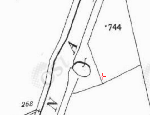
The dry dock in relation to Sallins and the Naas Branch [OSI ~1840]
As the boats of the time were horse-drawn, there must have been a towing-path on that side of the canal, perhaps just from Sallins to the dock.

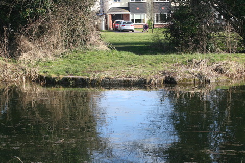
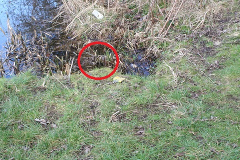
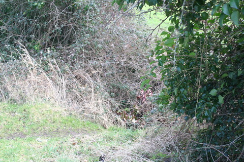
Locating the dock from the far side of the canal
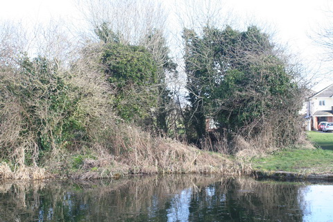
Stone edging
Note the house
On the east side, you can drive to within a few yards of the dock and there is no barrier to access. The Google map below, if it works, will show how to get there.
Shape, operation and dimensions
You can see from the map extract below that the dock seems to have been oval rather than — like most other dry docks — straight-sided. The bank opposite the entrance is indented, perhaps to allow boats room to swing on entering or on leaving. The extract from the 6″ Ordnance Survey map does not designate the dock as such and it does not show any gates, whereas the three docks in the Grand Canal Basin at Ringsend all have gates shown. My guess is therefore that the Sallins dock was disused by the time the OSI map was drawn, but I don’t know when this sheet of the map was done.
Delany says that the canal was opened from Dublin to Sallins in 1779 and a passenger service was operating to Osberstown [south-west of Soldier’s Island) by August 1780, so this dock may have been built in that period. The Leinster Mills, at Lock 2 on the Naas Branch, were built in 1790.
GRAND CANAL. — Notice is hereby given that two Passage Boats will regularly, on and after the 25th day of March inst, ply upon the Canal on every day in the week Sundays not excepted; the one to Dublin on every week day from the 25th inst to the 29th of Sept next;, at 7 o’clock precisely, and on Sunday at 8 o’clock precisely; and the other to leave Sallins on every day in the week at 8 o’clock precisely. The Boat setting off from Dublin to reach Sallins at half after 12 o’clock on every week day, and at half after one on every Sunday precisely, and the boat setting off from Sallins to reach Dublin at half after one o’clock precisely on every day in the week. — The middle stage for every Boat will be Stacumney, where passengers will be taken and accommodated either to Dublin or Sallins. — The Rates are as usual.
Signed by order, RICHARD BAGGS, Sec. Dublin, 19 March, 1784
Dublin Evening Post 1 July 1784

The dry dock with a wide place and a drainage channel [OSI ~1840]
The dry dock closed off, showing the oval shape [OSI ~1900]

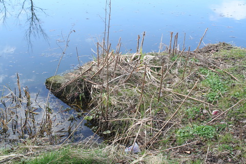
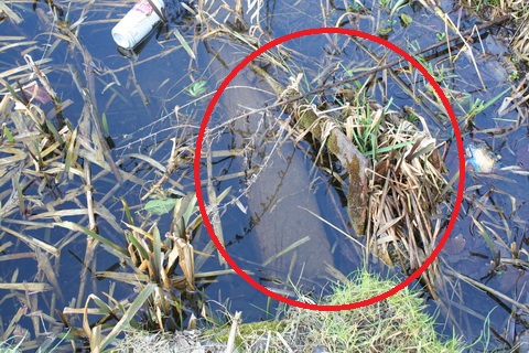
Possible small structure on Naas Branch [OSI ~1840]
Inflow on Naas Branch
The inflow
Furthermore, given that the canal is at the same level from the dry dock to this point, it is hard to see how this inflow could drain the dock. Perhaps, in the late eighteenth century, there was a deeper channel from the dock to some sump.
With nobody to hold the far end of the tape, it was difficult to measure the dock: I could do only a short length at a time and add the results. The totals are therefore only rough indications.
I think the entrance is 4.8–4.9 metres wide: say up to 16 feet.
I think the length of the dock, from where the stop planks are to the rear of the chamber, is about 19.5 metres: say 64 feet.
It would be useful if two people, with long tapes and wellies, could do a full and more accurate set of measurements.
I didn’t think of measuring the full width at the centre.
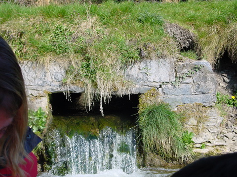
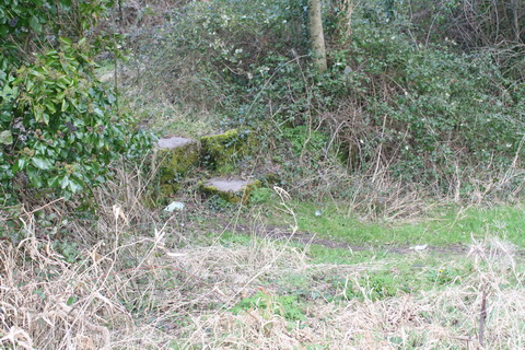
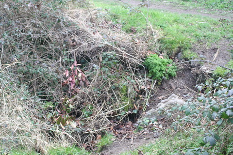
The entrance
Stone on the outer edge, wouthern side
Looking across the entrance

Earth and vegetation across the entrance
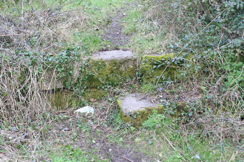
Possible stop-plank groove near the left side
There is what looks like a set of stop planks running across the entrance from the point circled
Close-up of the circled area showing plank and metal attachment
I have no idea how old the planks with metal attachment are: they could be twentieth or twenty-first century for all I know. The ~1900 map suggests that some barrier was put across the entrance; it does not appear on the ~1840 map.
I could see no provision for conventional mitre gates. Perhaps the gate recesses are buried a little way back from the entrance — but any such gates would reduce the length of the dock available for construction or repair of boats, perhaps to as little as fifty feet. On the other hand, perhaps there were no such gates: perhaps the dock was always closed by stop planks.
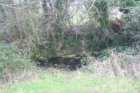
The sides
The north wall of the dock
Very little of the wall is exposed
As there is little of the wall exposed, I could not say whether the entire side is stepped.
A small part of the south wall can be seen through the gap at the right
The south wall
The rear wall
There is some water in front of the rear wall
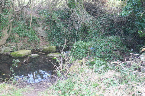
Much more stone is exposed at the rear
The boats
It would be nice to be able to see more of the stonework and perhaps even to have some of the bottom excavated. I don’t know whether that sort of thing can be done; perhaps Kildare County Council might be interested.
Establishing the dimensions of the dock would cast light on the sizes of vessels that used the dock. Perhaps the dock was used for building rather than repairing boats; perhaps it built the boats used [as Delany shows] to carry materials used in constructing the canal itself or the boats used by the carriers.
GRAND CANAL NAVIGATION.
ALLOWAY and BOAKE, No 85, Bride-Street, inform the Public, that they now carry in commodious Boats, of from thirty to forty tons burthen, heavy Goods of all kinds, between the Canal harbour in St James’s-street and Sallins, near Naas, at 2d per hundred weight, or 3s 4d per ton, which is less than one-third of the average price of land carriage for that distance.
The advantages of this Navigation to the Public, in addition to the great reduction in the price of carriage, are, that all Goods carried by the Canal are exempted by act of Parliament from all duties, rates, tolls and customs whatsoever, in all places whatsoever, save the Canal tolls, which are included in the price before mentioned; and the flour, malt, and corn premiums are the same on carriage to Dublin, by the Canal, as by land carriage.
Proper persons attend at the Canal Stores, James’s-street, Dublin, and at Sallins, to receive all Goods addressed to the care of Alloway and Boake, for the safe carriage and delivery of which, they hold themselves responsible to the public.
Dublin Evening Post 8 April 1784
![]() [gc14]
[gc14]


Very interesting article! As a local i know the areas very well but have never known any of this information.
Thanks
Thank you. I’m still hoping that someone has written an article somewhere with a full history of the dry dock. bjg
Could it just be a small inlet to discharge (say) coal to a nearby house? It seems a bit remote from everywhere to have been a dry dock.
In the early years of the Grand Canal Sallins was a very important place: the terminus of the passage boat service from Dublin, a nine-hour journey, was at Osberstown, and a hotel was built at Sallins. Then there was the construction of the aqueduct, for which special boats were built, and the several traders (such as Alloway and Boake: see Dublin Evening Post 8 April 1784) who operated on the canal between Dublin and Sallins. The importance of Sallins was reflected in this ad from Saunders’s News-Letter 19 April 1784:
The Sallins dock may have been the only one available to the company at the time.
bjg
Pingback: Walking the Grand Canal: Naas Branch – Royal Canal Runner
Thanks for that information. I paddled passed there today and noticed the stones. I read the grand canal guide and noted there was a dry dock somewhere – your Internet page gave me the bit of history i was seeking. Hopefully others with more knowledge than me will be able to add to the historical record of this place
Thanks. I’d be glad if someone were able to produce more information about it. bjg
Pingback: Medical Procedures all Round by Daquiri (Lowtown to Sallins via Naas) | Golden Boyz Narrowboat Blog
I live on the road behind this dock and have been in and out of it with the kids “investigating” more times than I can remember. There is a drainage ditch to the east and along that, about 25 M from the dock there is a newly discovered stone drainage slip from the canal, a family of foxes were living in it until recently – I can send you a picture. The work gone into the construction of the north wall does not indicate a temporary build, this was used into the late 1800s. Would love to get an archeological assessment of the floor of the dock.