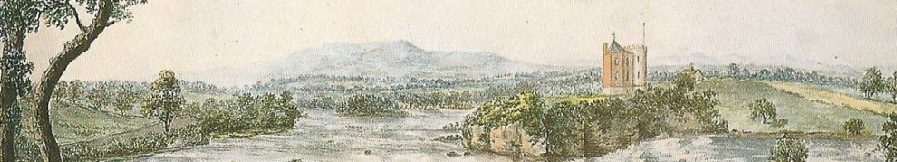
The Lough Owel feeder was the principal supply of water to the summit level of the Royal Canal. The lake is to the north of Mullingar. The canal forms a half-circle around the north side of the town; the feeder joins it there, east of the harbour and dry dock. There is now a proposal that a supply be taken from Lough Ennell, to the south of the town.

Lough Owel, Mullingar and Lough Ennell
Here is the line of the feeder on the Ordnance Survey map of around 1840. It and the canal are marked in blue on the map.

The line of the feeder
You can drive up to the lake; the road runs quite close to the feeder. There is a parking place by the shore, close to the boats; the sluice house, where the feeder begins, is just a few yards on your left (west).

Boats at Lough Owel

The sluice house in ~1840

The sluice house from downstream

The sluice house in ~1900

The intake from the lake
The water is very clear
The Irish Times angling correspondent has commented on the clarity of the water.

Looking towards the sluice house (upstream side) from the intake

Gauge above the sluices

Upstream side of the sluices

Downstream side of the sluices
There is a short path from the sluices to a footbridge downstream of the house. It follows a semi-circular route and is slightly raised; I don’t know why.

The path (upper end)

The path (lower end)
Here is the feeder coming out under the sluice house. It must have been a damp place to live.

The feeder emerges from under the sluice house

Looking from downstream up towards the footbridge and the sluice house. Note the upwelling of water

The upwelling water seen from the footbridge
I don’t know what the upwelling is. Two possibilities strike me. One is that some or all of the water is pumped or pipeds to the feeder from far out in the lake rather than flowing in to the intake above the sluice house. The other is that water from Cullion fishfarm, which is said to be recirculated into the system, is pumped into the feeder at this point. I hope that somebody will be able to tell me what the true explanation is. In the meantime, if the googlegods are smiling upon us, you will be able to see below an aerial photograph of what I presume to be the fishfarm, which is close to the feeder about one third of the way from the lake to Mullingar.
There are two small concrete structures near the sluice house; I wondered whether they might house pumps.

Concrete structure 1

Concrete structure 2
Heading back towards Mullingar, here (from downstream) is the bridge marked “Road bridge” on the two OSI maps of the sluice house above.

Road bridge
I could show you several more photos of the feeder en route to Mullingar, but when you’ve seen one small stream you’ve seen ’em all. Let us move rapidly to the canal harbour in Mullingar.

The feeder joins the canal

The feeder passes under this bridge

Grooves for stop-planks on the canal side of the bridge

Looking upstream from the bridge
It’s an interesting feeder to visit. It’s not as impressive as the Milltown Feeder on the Grand, though.
All photos taken April 2012.
![]()
RC20


any idea as to wether the dry dock is opened to barges.
As far as I know, it is not open, although some WI-sponsored vessels may have used it. For a definitive ruling, ring WI Tullamore 057 935 2300; I believe that all dry dock bookings (at least for the canals) have to be made through that office. bjg
Pingback: Royal water | Irish waterways history
Yes .You are right the upwelling is from the Fish Farm.There is a pump further down stream ,which three phase electricity had to be installed to run iThe water is circulated and flows down stream.The office of public works installed it.
The circular path you photographed is a channel for overflow.To the left of the house arch in the sluice gate side is a crows foot marked into the wall.This is a sea level indicator .Under the house is another Sluice gate which was operated from inside the house.
The houses last Occupants was a young man and a man of similar age who was asked to stay with him by the family.That was the last two years .The family who occupied it with the young man (there son) owned a business in Mullingar.The young man had attended St Finians,when the family lived in the house.When the occupants lived in the house the room above the arch was used as a living room,so I think the working for the Sluice gate under the house must have be limited,or removed .They could hear the water guggling under the house.The young man is still alive and lives in Mullingar.
The house was originally one storey,the carved block part.The smooth render above ,was the built on storey.Passed the Sluice in Lough Owel the right hand wall was used as a private pier by the family .The house was considered a Private residence on private grounds ,the entrance was to the right of the channel .The Road was a addition and didn’t exist when they lived there.
The workings of the Sluice are quite complicated ,with two Sluice gates and the semi circle over flow channel.May be it was a way to measure water release.Maybe the crows foot(sea level)had something to do with it.
After the Sluice was built the level of Lough Owen rose aleast 4feet.The raise path along Lough Owel ,known as the ramparts ,is man made to save money in compensating the owners of Levington Park for land loss.Lord Granville had his Ice House moved to a higher level for a similar reason.
How do I know so much .I went for a walk and got speaking to a old man who was standing on the bridge in front of the house,He was the one that was asked by the family to live with the young man for two years,Living there gave him a life long obsession with canal engineering.He was studying the Sluice once again and was explaining it all to me ,so as to better understand it himself.The Sluice gates between Lough Owel and the feeder channel, are still operated today,but domestic water supply is the priority ,rather than fishing and canal supply.
I have researched the Pickford family for a friend in Canada .The Pickford formed one of the oldest business in England ,moving goods ,starting in the canal era,They now are Pickfords Furniture removals today.
I had stopped off in the middle of a. 200 mile journey and spent a fascinating half an hour listening to him,I did thank him,but didn’t get his name .He lives in Mullingar,
Thank you very much for that interesting information. bjg
You probably know that the last Sluice keepers to occupy the house where Of the name Mullally,who occupied the house until the 1970s.The young man must have been the last remnants of the family.The family who owned the business in Mullingar must have been relations and the man I spoke too and stayed with him ,probably worked for them and agreed to stay.
Thank you for your very observant pictures (no other site has them)which allowed me to impart information which is often lost.
You probably know that the Mullally family where the last Sluice keepers to occupy the house,up to the 70s.The young man was probably the last remnants off.The family who owned the business in Mullingar probably where relations and it was them that asked the man I spoke to ,to stay with him for two years.The man I spoke to was obsessed with levels.He point to the green hill at the other side of the lake ,indicating that was where the tank was for Mullingars water supply.He seemed to know a lot about the relative level ,along the feeder channel , Mullingar and the canal.Quite frankly I would have needed to attend his next course on the subject ,such was his knowledge,which seemed second nature to him,I suppose if you lived with a Sluice Keepers son ,for two years, since levels would have been a big parts of living in that house.
Thank you for your very observant photos.The best on the subject ,which aided my explaination.
Pingback: Garryowen and the Royal Canal | Irish waterways history
I was talking to the man who used to live in the sluice house today, 26/4/19. He told me the upwelling of the water is from the cullion fish farm and also the crows foot benchmark on the sluice house is 325 feet above sea level.
I was also told by the man who lived in the sluice house that the semi circular stone pathway around one side of the house was built after the lake overflowed above the lock gates and around the house about 50 years ago.
Thank you for that. bjg
That’s interesting too; thank you again. bjg
I was there today at the feeder outlet and took some photos. The sluice house is all boarded up, there was no upswelling of water as in your photos. The water was very clear, no foaming.
I went down to the fish farm location too, that’s quite a distance away. There you can see how the feeder water is used to run the tanks. It was quite funny to see all the gulls perched up on the wires around the farm looking hopeful.
My interest is to find out the source of the Brosna. It appears, from as much as one can see without trespassing, that it starts at the fish farm, from the water running off the feeder. My theory is that the feeder outlet is where originally the Brosna emerged from the lake. The feeder then used the course of the Brosna up to the fish farm location, from where it was built up on higher ground to reach the canal and the Brosna continued its course down to the lower lands of the north Mullingar flats.
At the fish farm there is a St Brigid’s well, which I suppose precedes the canal and is fed from waters off the Brosna (although it’s not clear where these rise from).
Also at the lake shore, by the feeder outlet, it looks like a raised bank (dyke-like) was constructed around it for maybe 500m or more on its left side. Behind it, the land is lower than the lake, and is flooded/swampy at the moment. It looks like it was reclaimed, and that the initial portion of the feeder was also built up raised from it. I suppose the lake originally extended a bit more into the land, and from there the Brosna rose.
That’s very interesting; thank you very much. It would be interesting to see some early maps of Mullingar, say from the late eighteenth century. I wonder whether there are any in the RIA publications. Such maps might also help with the history of Lacy’s Canal. bjg
Here are the photos
Excellent; thank you. bjg
Thank you for maintaining this site. Also thank you to William Shields for the helpful information about the Mullally Sluice Keepers. I have just today learned form a Baptismal record that it seems my great-great grandfather John Mullally was a Sluic Gate Keeper at Lough Oul [sic] in 1874. I suppose he’s among the ‘last remnants of the family’ there. As best I know, they may have come to live in Mullingar. His son Daniel emigrated to the US about 1895 or so.
I hope that I can visit the place someday.
Brian Scott