Venice is sometimes called the Birmingham of the south, as it has several canals, although not as many as Birmingham does. Monasterevan, in Co Kildare in Ireland, has nothing like as many as either Venice or Birmingham, but it is very rich in waterways artefacts and well repays a couple of hours spent walking around inspecting them. Incidentally, there are at least three spellings of Monasterevan; the version ending in -evin is probably most common.

The canals of Monasterevan
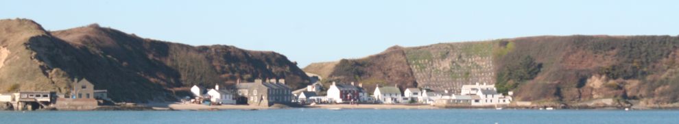
Before it was bypassed by a motorway (the M7), Monasterevan was on the main road (the N7) from Dublin to Cork and Limerick, with many fine traffic-jams on the stretch of road you can see at the bottom right of my sketch-map. It crosses the River Barrow just off the bottom of the map. I’ve coloured the Barrow brown in tribute to the Jesuit poet Gerard Manley Hopkins, who called it the “burling Barrow brown”. At the top left is the road to Portarlington, and I’ve sketched in a few of the streets, but not all of them. The street running along the river is the main street, but there are few buildings on the river side, so the town makes the most of its views of the Barrow.
The green line running across the map is the railway. It’s not quite as straight as my sketch suggests, but newfangled transport methods like railways aren’t very important anyway. The railway station in the town was reopened a few years ago, so it’s now part of Dublin’s commuter belt.
The canals are in blue; one of them, the Barrow Line of the Grand Canal, crosses the river on an aqueduct just below the railway bridge. There’s a pretty little park in between aqueduct and railway bridge, with a small car-park: a good place to leave your car while you inspect Monasterevan’s waterways heritage. The little park is a credit to the town of Monasterevan: a lovely place to relax after battling with traffic and to let children (if any) have a safe run around.

The park seen from the aqueduct, with the railway bridge in the background
Walk down to the town end of the park and climb the steps to the canal bank. The canal in question, running from top right to bottom centre in my sketch, is the Barrow Line of the Grand Canal. It leaves the main line of the Grand Canal (running from Dublin to the Shannon) at Lowtown, the highest point of the Grand, and joins the navigable River Barrow at Athy. The Barrow is navigable all the way to the sea-lock at St Mullins; downstream of that it joins the tidal River Nore, and together they flow through New Ross before joining the estuary of the River Suir downstream of Waterford. So the Barrow Line is a link in a series of waterways leading to Ireland’s south-east coast.
The aqueduct here, taking the Barrow Line over the River Barrow, used to be a favourite place for swimming before leptospirosis was invented. The drawbridge beside the aqueduct had its upper works removed some years ago, but the whole thing is due to be replaced shortly, and I’m told the replacement will have upper works, even if they aren’t needed any more.
I haven’t got a photo of the Monasterevan bridge before it lost its upper works, but here’s a photo of the similar bridge at Bagenalstown, which has lost its deck. The two bridges had similar upper works.

The Bagenalstown bridge
Here’s what the Monasterevan bridge currently looks like.

The drawbridge now 1

The drawbridge now 2

Grooves for stop planks to allow the aqueduct to be drained
For some years, the abandoned upper works lay in this field. Note the aqueduct in the background.

The aqueduct
Travelling by canal, you have to get the lockkeeper to lift the bridge for you; going under it, and over the aqueduct, is a great pleasure. I never saw a boat moving on the canal when I was young.

Lockkeeper opening the bridge

A boat approaching the drawbridge and the aqueduct
Here’s a view from the aqueduct looking upstream to the railway bridge and to the bridge carrying the road to Portarlington.

Railway and road bridges seen from the canal bridge (aqueduct)
And here’s one looking downstream. The town bridge, carrying the old N7, is just out of sight. Note the tree near the bank on the right.

Looking downstream
Walking north-east along the canal, away from the drawbridge, reveals the Bell Harbour on the north-west bank. Most of the buildings here are new (the exception is the leftmost building in the photo below), but the builders were required to re-excavate the bays, which provide a valuable asset for boat-owners.

The Bell Harbour 1

The Bell Harbour 2

The Bell Harbour 3
In 1830, Nicholas Fanning, a Director of the Grand Canal Company, reported that Monasterevan was a no-go area on Sundays. He was giving evidence to the House of Commons Select Committee on the State of the Poor in Ireland. Here is an extract from the questioning:
4712. HAS the Grand Canal, or have the traders engaged in navigation on the Grand Canal, of late experienced any difficulty in respect to the discharging of goods or commodities? — Very considerable difficulties; particularly on the Athy line, both in Monastereven and the town of Athy, no trade boat is suffered to ply during the whole of Sunday.
4713. When were those orders first given? — I think it is about three years ago; two magistrates only have given these orders, one in Monastereven and the other in Athy; and it is very detrimental in the conveyance of provisions particularly.
4714. Do those orders amount to an entire interruption of the whole traffic for the whole of the Sunday? — The entire day they will not suffer a boat to depart or to pass by Monastereven or Athy during the Sunday; it is a very serious inconvenience to the Dublin market, and is often productive of serious injury to the cargo.
4715. Are you aware whether the police have acted under written authority in stopping the boats? — I understand authority has been given both by the magistrates at Athy and Monastereven, to the police not to suffer any trade boat to ply on the canal during Sunday.
4716. What inconvenience does this rule produce? — First, the delay of the boats in carrying provisions to meet the markets; and, secondly, it is the cause of subjecting the cargoes to injury remaining stationery [sic] during the whole day; and instead of its being useful to the morals of individuals, they are constantly getting drunk all the time they are lying unemployed, either at Monastereven or Athy; they are much more regular and better conducted when they are proceeding along the line of the canal. I have made inquiries from the different companies in England, with regard to the practice, and the universal practice there, is, to allow trade boats to travel on Sundays.
Here’s another look at the map. The aqueduct is the blue line parallel to the green railway; the drawbridge carries the black road over the canal just east of the aqueduct. The bays at the Bell Harbour are the blue blobs between the canal and the railway.

Here’s a photo taken from the Bell Harbour showing some old buildings, and a modern quay wall, on the south-east bank.

Old buildings, new quay
Just opposite the Bell Harbour I’ve shown a canal branch running south-east into the town. That branch ran under Crow Bridge, which has been demolished, while the branch itself has been filled in. You can still see where it was, though; note the low wall just behind the white car.

The line of the old branch

A gate near the old harbour

I think the old harbour was here
Here’s where the branch left the Barrow Line and where Crow Bridge was.

Entrance to infilled branch
Here’s a view of it from the other side.

Entrance to infilled branch and bend
The second photo shows that the canal makes a 45-degree turn to the right, heading for the drawbridge and aqueduct. That’s because the canal originally went straight on here, through where the white bungalow now is. Look at the map again:
You can see the 45-degree bend to the aqueduct. I’ve shown the old line going under the road; it then curved down to the river, passing through one lock. Boats went across the river and then locked back up again on the far bank. Here’s the old bridge that it went under.

The old bridge
The road still goes over it, but the bridgeis now a feature of the gardens of two houses. That’s one garden above; here’s the other, seen from the far side of the river.

The old bridge from the far side of the Barrow
Crossing the river must have been fun when the river was in flood, especially as that was before engines were in use and there was no towpath across the river. So how were the boats powered? The only option I could think of was the use of poles, but perhaps there was some system of ropes …. And then, in an 1811 Statement of the Number and Salaries of the Several OFFICERS &c of The Grand Canal Company, published as part of the Papers Relating to the Inland Navigations of Ireland by the House of Commons in 1812, I came across the name of John Mulry, listed as one of the Persons in Care of Supplies &c. John Mulry’s station was “In care of rope across the Barrow”, and he was paid one shilling a week for the job. So there was a rope to enable the boats to get from one side of the Barrow to the other, although even at that it can’t have been easy. Was there a winch or capstan, perhaps?
Remember the tree I showed earlier, seen from the aqueduct?

The tree from the aqueduct
I think that’s where the boats would have reentered the canal, rising through one lock. There is much stone on the bank around that area:

The tree close up
Now for a short walk. Back to the drawbridge, and cross the aqueduct on its south bank. You’ll see that the canal branches: the branch going south is the Barrow Line, heading for Athy, while the abandoned canal to Mountmellick runs north-west. It is in water as far as the road bridge at the top left corner of the map (although with a barrier stopping boats getting up) but infilled thereafter; although there are some watered sections further on, it is not navigable. See my separate page on the Mountmellick Canal.
Walk down the Barrow Line to the lock, where a bridge provides access to the lockkeeper’s house. Here’s the lock, the last before Athy itself.

Barrow Line Lock 25
Here’s a view from the bridge back up towards the junction with the Mountmellick Canal.

Looking towards the junction
Here’s a view of the bridge from below.

The bridge from below
And a view from the bridge looking right down the Barrow Line. The object in the water is a weed-cutting machine. The blue object behind the container is a portable loo.

The canal curves right towards Athy
Looking to the left from the bridge, we see a little harbour. This is actually the stub of the old canal route that climbed up from the river through the green lawn; you can see the tree on the bank and may just be able to make out the house on the far bank with the old bridge in its garden.

The harbour below Moore’s Bridge
Enough of this excitement. Now walk up the west bank to the junction with the old Mountmellick Canal. The English canal activist and historian L T C Rolt crossed the aqueduct in a boat just after World War 2 and remarked on the sight of the wheel of the drawbridge outlined against the great window of the church. Here’s a photo taken from the bank, so they’re not perfectly aligned, alas. And there’s a tree in the way.

The wheel and the window
Here is the first bridge on the Mountmellick Canal.

The first bridge on the Mountmellick Canal
And here’s a view through the bridge from the other side, looking back towards Monasterevan.

Looking back towards Monasterevan
You can either cross that bridge and walk back on the north bank of the aqueduct or continue up the Mountmellick Canal to the second bridge. Here’s a photo taken from that bridge, looking back down.

Looking back down the Mountmellick Canal
And here’s a view, from the other side of that bridge, of the first lock. The lock cottage, just out of shot to the right, seems to be inhabited.

First lock on the Mountmellick Canal
Now for a final look at the map.
You’re at the lock at top left of the map. You can go back the way you came or walk by the road (be careful: it’s a narrow road) back to the Portarlington road bridge over the Barrow, then back to the car park south of the railway line. There is also a road down the west bank of the Barrow (not shown on my map as it’s a longer route) from which you could walk back to the aqueduct. Just south of the Portarlington road bridge is a small area with a slipway; here are two photos taken from that location.

The Portarlington road bridge

The railway bridge and the aqueduct
So there you are: lots of waterways artefacts to see in Monasterevan, and three lost waterways: the old harbour under Crow Bridge, the old crossing of the Barrow and the Mountmellick Canal.
And here is a page about Clogheen Bridge on the old N7 (now the R445) outside Monasterevan.


Lived in Monasterevin for years and use the water and never knew about some of the things contained in this article. Thanks for that. Will definitely see if I can line up the bridge wheel and church window the next time I go over the aquaduct.
Thanks for that, Paul. If you have a web page for your narrowboat hire, I’ll happily provide a link to it.
bjg
Thank you very much it was very enjoyable to look at. Do you know anything about the lockkeepers the Moore family I am trying to get the family history. Thank you yet again sinead.
Born in Monasterevan and lived all my childhood and early adulthood there, apart from boarding school terms and study at UCD. Kept a boat moored to a post in the field below the aqueduct during Easter & Summer holidays, used for exercise and fishing. 1st. bridge on Mountmellick branch is Johnny Dunne’s Bridge. The first lock on the Portarlington Rd. was Coughlan’s lock. We swam and fished above it when the canal there was still in water and the Coughlans in residence in the lockkeeper’s cottage. It makes me sad to see your photo of the remains of that lock.
I hope to launch a restoration project for the Aqueduct, sadly neglected, also a clean-up of Johnny Dunne’s Bridge….so overgrown with ivy.
I knew Jimmo Moore, so tragically lost off the parapet one filthy autumn night with the river boiling in flood. He didn’t have a chance. May he rest in peace.
Thomas: thank you for those very interesting memories and extra information. I hope your restoration and clean-up are successful. bjg
I should have known to look here first for information on Monasterevin. And I seem to recognise the boat approaching the lifting bridge.
The current lock keeper in Monasterevin Joe Moore is the fourth generation of Moore’s to hold the lock Keepers position in, Joe took over from his father Peter who in turn took over from his father Jim, Jim’s father, Joe’s great grandfather was the first Moore to hold the position, as far as I am aware he was drowned in the course of his duties sometime in the forties. The Moore family were also known for their involvement in the local CYMS hall when it was in use, they all in turn held the position of caretaker over the years
That’s very interesting; thanks, John. bjg
I spent a lot of my childhood living by the barrow river my grandad James moore and my nannie Christina IM the child of Anne moore who is there daughter of James and Christina my grandad was the lock keeper my cousin is the lock keeper to date my grandad who was known to some as Jim moore did not pass away from drowning and my uncle jimo who fell from the white railings and drown my Mum that night she tried to help him but the river was swollen and whirl pools it was so sad for the moor
Thank you for that. bjg
Pingback: Grand Canal bridge problems | Irish waterways history
Pingback: Barrow cot | Irish waterways history
BJG,Thank you very much for the pictures and lengthy interesting descriptions. When I was last in Ireland, 2008, we had this city on our itinerary but ran out of time so did not see it.
I would like to print this for my next trip, but ask that you PDF the map because only a small portion of the map shows in this article.
Would have appreciated dates given for everything, not for just a few events.
You were so refreshing that you did not bash the Irish in your narrative. Almost all geography and history narratives about anything Irish on the internet do so.
Thank you again.
Thank you. I have emailed some comments direct to you. bjg
Pingback: The habits of the papists | Irish waterways history
Hi I am Jimmo niece I live in London I am the daughter of uncle jimmos sister Anne would it be possible you could ask Thomas Kirby to contact us my mother would really like to talk to him
Many thanks Anne Moore Jr
I’ll pass on the message. bjg
Hello Brian,
I should have known to look up this first before I visited Monasterevin recently. Missed a lot of the places you have mentioned, unfortunately. Still, it’s a good excuse for another visit.
Redmond.
Thank you. bjg
Reading this article of Monasterevin(van) has brought by back fond memories of my childhood when visiting family and going swimming or fishing at 13/15 years of ago. Thanks for sending me the email 👍
Lovely article, I am a native of Monasterevin, and now in fact live in that white bungalow, where once originally ran the canal on the way to cross the Barrow. I know most of those characters mentioned, not James Moore who drowned of the Aquaduct, but the rest of the Moores, right back to Rafferty Raf) Moore, Jim the Grandad. As kids we often hand wound the Drawbridge up with him or for him. We learnt to swim in the stretch from the Lifting Bridge to the far end of the Aquaduct, with no adverse health affects, don’t know if I would voluntarily would go in to it now though.
Thanks for that. I too swam there: my grandparents lived on the Curragh and a visit to them was often combined with an afternoon outing to Monasterevan and a swim on the aqueduct. Leptospirosis hadn’t been invented in those days, of course. I have a vague recollection that the water was warmer on the aqueduct than in the rest of the canal. bjg
I learned to swim at the Aquaduct as a young boy in the 50ies.
Fond memories of my childhood there.
Michael Cullen.
This is an amazing piece of work. Thank you.
You’re welcome. bjg