Here are some photos taken in Limerick on 30 November 2011. Waterways Ireland’s Marine Notice 102/2011 (7 October 2011) describes what’s happening:
Waterways Ireland will commence dredging operations on 17th Oct 2011. The area concerned stretches from Baal’s Bridge in the Abbey River to the upstream side of Shannon Bridge on the River Shannon in Limerick City. For the purpose of these dredging operations this area is deemed to be a construction site and will be closed to navigation to all craft as and from the 17th Oct 2011 until 1st Feb 2012.
Waterways Ireland thanks its customers for their cooperation in this matter and regrets any inconvenience caused during this necessary operation of restoring water depth to affected berthage.
The tender is described on the eTenders site and the main contractors are L & M Keating.
I missed some of the more exciting dredging operations, using barge-mounted dredgers, around the Custom House and Arthur’s Quay moorings, but there were three sets of operations under way or in preparation on 30 November 2011.
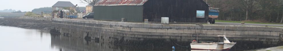
The area being dredged
![]()
Here is an extract from the OSI map of ~1840.

The Abbey River
This shows most of the area being dredged.
The main line of the River Shannon flows from top to bottom on the left-hand side of the map. At the time of the map it had mills; it still has the Curraghgour Falls, which make this stretch unnavigable except for canoes and, at high tide, for very knowledgeable locals.
The navigation route is down what is called the Abbey River, essentially a loop that bypasses the falls. It comes down the right-hand side of the map, then turns towards the left and rejoins the main part of the river. The drop on this section is the same as via the falls, so there is a considerable current unless the outflow is balanced by the incoming tide. The entrance to the canal is at the turn: the canal heads to the right about half way up the right-hand side of the map. The small island is Grove Island; there used to be a passage around it (for small boats) but it is becoming silted.

Annotated map
Some years ago the city council ran a sewer down the bed of the river and took the opportunity to build a half-tide weir on top of it, thus making navigation slightly easier. However, the weir also seems to have caused silting and the secure berths near the Custom House (now the Hunt Museum) became silted up.
The area being dredged extends from the canal entrance downstream to the twentieth-century Shannon Bridge, downstream of the sea lock.
The canal entrance
The area between Abbey Bridge and the canal entrance was being prepared for dredging — which is much needed.

Entrance to canal harbour (May 2010)
There was one excavator on the footpath (behind the wall on the right of the photo above), with protective fencing around it.

The excavator on the footpath
The spoil will be removed by trucks reversing down the bank by the canal harbour; the route has been walled off.

The spoil-removal route
There is fencing and there are signs at both ends.
There is a second excavator, on a bank of clay and whatnot, on the river side of the footpath wall.

The two excavators
I am told that this excavator can float: the tracks run around what are effectively pontoons or catamaran hulls. I guess (I don’t know) that they could be filled with water if necessary.
There are no slipways nearby. I am told that this excavator was launched into the canal, from the Pa Healy Road bridge over the canal …

The road bridge is just about visible at the far end of the canal stretch
… and floated down the canal and out through the lock’s lower gates.

The lower lock gates and the excavators

The floating excavator

I think I’d like one of these from Santa
Moving the barrier
The second area of activity was at the Custom House moorings, which are at the point where the Abbey River rejoins the main line of the Shannon.
Some time after the new weir was built, two pontoons were moored at the corner, to offer some protection to downstream boats against being swept over the weir. (One wooden boat was damaged by them, alas.)

Where the pontoons were

The pontoons seen through the footbridge
That photo shows the pontoons (in flood conditions) seen through the arch of a footbridge that is later than the date of the OSI map. The mooring pontoons are on the left with a small gap in between.
The protective pontoons have been removed; I understand that they are to be replaced by a boom like that at Killaloe. They were tied in one length along the mooring pontoon, and sticking out past the end …

The protective pontoons alongside the mooring pontoons
… and, when I visited, were being separated and tied alongside each other. The work was being carried out by a team from Marine Specialists of Foulksmills in Wexford (who have some nice pice on their site: I particularly liked their transportable tug) assisted by Pat Lysaght.

The pontoons separated

Moving the outer section alongside the inner

Marine Alpha, the Marine Specialists RIB

Pushing the pontoon

Almost finished

Marine Alpha and Pat Lysaght’s dory
An update from the Limerick Leader.
Dredging the lock
The third area of activity was at the sea lock, where another excavator was at work.

Dredging the sea lock chamber 1

Dredging the sea lock chamber 2

Dredging the sea lock chamber 3

Dredging the sea lock chamber 4

Dredging the sea lock chamber 5

Dredging the sea lock chamber 6

Dredging the sea lock chamber 7

Dredging the sea lock chamber 8
A small fleet of workboats
Finally, the waiting basin below the sea lock had a few workboats in it.

A small fleet

This little boat (a tug?) is in L+M Keating colours

A barge and an equipment-laden pontoon

I do like small tugs

Tug, pontoon and barge
The pontoon belongs to Irish Sea Contractors, also from Wexford (this time Rosslare Harbour), whose website is still under construction.
[l&mk 30]


I am pleased to note that Pat Lysaght remains active. I remember him taking me down the river from Corbally in his dory on as freezing cold New Year’s Day three years ago to see some gandelows and brocauns about which I was writing an article in UK (because nobody knows about them over here!)
Unfortunately I have not been able to re-visit him since but hope to do so before long.
Good wishes for Christmas,etc.
Colin Green
South Wales
Thanks, Colin. Pat is in good form. Best wishes
bjg
pat helped me in everything i needed to start exploring the shannon by boat many thanks pat..
He is a sound man. bjg