According to the Parliamentary Gazetteer of 1846, Ballinacally (Ballynacally) is …
[…] a village in the parish of Kilchrist, on the east coast of the barony of Clonderalaw, co. Clare, Munster. It stands near the estuary of the Fergus, about 6½ miles south-south-west of the town of Clare. A small quay on the Fergus, in its vicinity, facilitates the exportation of farm produce. Area, 12 acres. Pop., in 1841, 194. Houses 29. The ruin of Dangan tower or castle is in the neighbourhood.
Samuel Lewis, in 1837, wrote:
BALLINACALLY, a village, in the parish of KILCHRIST, barony of CLONDERLAW, county of CLARE, and province of MUNSTER, 3 miles (N. N. E.) from Kildysart; the population is returned with the parish. It is situated on the road from Kildysart to Ennis, and near the river Fergus, on the banks of which is a small quay of rude construction, from which corn, butter, pork, and other agricultural produce are sent to Limerick, in boats of 10 or 12 tons burden, and where limestone and sea manure are landed for the supply of the neighbourhood. It has a daily penny post to Ennis and Kilrush, and a public dispensary: and fairs are held on June 14th, Sept. 16th, and Nov. 8th, chiefly for cattle. A little to the north of the village is the ruined tower or castle of Dangan, the upper part of which is supported only by the winding stone staircase.—See KlLCHRlST.
Here is a close-up, showing the location of what may be the “small quay of rude construction” at Rosscliff. I am not entirely sure that Lewis and the Parliamentary Gazetteer had Rosscliff in mind, for neither of them uses the name; furthermore, neither the ~1840 nor the ~1900 OSI map shows a quay at this location. The name Rosscliff is shown on the OSI maps, but as what looks like a townland. Here is a zoomed-in version of the Google map.
Lewis’s entry on Kilchrist, the parish, gives more information about the links between land and water:
KILCHRIST, a parish, in the barony of CLONDERLAW, county of CLARE, and province of MUNSTER, 3 miles (N. N. E.) from Kildysart, on the western bank of the river Fergus; containing, with the island of Innismore, or Deer Island, 2569 inhabitants. This parish comprises 6845 statute acres, as applotted under the tithe act, and mostly under tillage; there is a small extent of bog. Sea-weed and sand procured on the shores of the Fergus are extensively used for manure. Grain and other agricultural produce are occasionally sent in boats to Limerick from Ballinacally.
The principal seats are Paradise, the residence of Thos. Arthur, Esq., beautifully situated on the Fergus, of which and the surrounding scenery it commands a most extensive view; and Fort Fergus, of Daniel O’Grady, Esq.; is also situated on the Fergus. On an eminence in the demesne of Paradise is an ornamental building, called the Temple, which forms a conspicuous landmark in the navigation of the river. […]

Looking south from Rosscliff towards Paradise
The Clare Coastal Architectural Heritage Survey (Sarah Halpin and Gráinne O’Connor, Clare County Council 2008) says of Rosscliff:
Slipway/Quay: Quay projecting east towards Deer Island. Used primarily for ferrying stock to and from mainland with animal holdings adjacent. Located in Shannon Estuary and constructed of roughly cut limestone blocks with mortar, c. 2 metres high with adjacent concrete steps leading to substantial concrete slipway into estuary measuring circa 70 metres long. […] In use by local farmers and fishermen travelling to Deer Island and Coney island. Not marked on 1st edition OS maps (1842) or 2nd edition (19th century) .
Here is the location on the OS (Ordnance Survey) maps. As the Clare survey says, there is nothing marked on the older OSI maps (select Historic 6″ and Historic 25″ to see them). There is a quay marked up Ballynacally Creek, closer to Ballynacally itself, on the ~1900 map, with a store and a disused limekiln; the ~1840 map has just the store, but a straight bank suggests the possible presence of a quay.
However, the existence of a road to (indeed through) the embankment, even on the earliest map, suggests that the shore at the Rosscliff site was used for something, if only for landing sand and seaweed for use as fertiliser. It may also have been used for carrying cattle to and from the islands.

Deer Island
However, it probably wasn’t used for moving people, because the ~1900 OSI map shows stepping-stones leading over the mud-banks, providing access to a ferry. The Clare Coastal Architectural Heritage Survey says of them:
Stepping Stones. No longer in use. 1860–1920. Not visible at high tide. Large cut stone limestone blocks connecting mainland with ferry to Deer Island across the sand banks of the Shannon Estuary.
I think “sand” is putting it politely: it looks like mud to me.
Lewis wrote of Deer Island:
DEER ISLAND, or INNISMORE […] This island is situated near the western bank of the river Fergus, about a quarter of a mile from the shore of Kildysart parish, and contains 493 statute acres, which are nearly equally divided between pasture and tillage. It is the property of the Earl of Egremont, and is also called Inchmore, or the “Great Island,” being the largest of those by which the Fergus is adorned, and is remarkable for the fertility of its soil. Flax was formerly cultivated here to a considerable extent, and afforded employment to the female population, but it is now only partially grown. There are some vestiges of an abbey still remaining, founded (according to Archdall) at a very early period, by St. Senan of Inniscattery, who appointed St. Liberius, one of his disciples, to preside over it.
Darina Tully, in her report on the Clare Traditional Boat and Currach Project 2008 (Clare County Council), has a photo of a wine-glass-sterned gandalow punt that belonged to Ada Tuohy, who was the last person to live on Deer Island. Incidentally, there are many spellings of ‘gandalow’.
The best way of getting an idea of the layout at Rosscliff is to look at the OSI map, selecting Ortho 2005. You can see that a long wall divides the harbour into two sections.However, the eastern section has as it were a tributary. Let us number them from the east 1, 2 and 3.
Here is what is in Section 1.

Cattle lighter
This is a modern wooden cattle lighter, undergoing repair by the looks of it. There is more about these boats on this page.
In that photo you can see a splash of yellow.

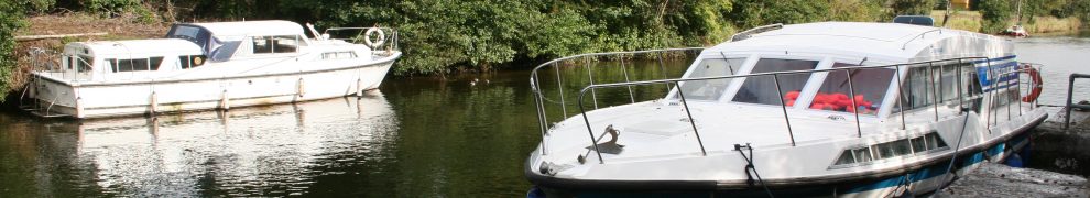
Speedboat looking somewhat out of place
Section 2 had three boats in it.

Three boats east of the wall at Rosscliff, with Deer Island in the background
Darina Tully recorded five Fergus gandalows and two gandalow yawls at Rosscliff. When I was there (in February) there were three gandalows moored between the long wall and the grassy bank; there was another boat, seemingly of the same type, lost in the grass some way away.

Red gandalow (bow view)

Red gandalow (stern view)
Here are the other two boats.

The other two gandalows, bows on
The right-hand boat may be a gandalow yawl: that is, a carvel-built gandalow.

The other two gandalows, stern on
Section 3 had no boats in it.

Section 3 empty
This may be where the cattle lighters are loaded: there is a cattle pen at the shoreward end.

Cattle pen
A 4WD vehicle with cattle trailer was parked nearby; perhaps someone was carrying cattle to or from the islands at the time.


I recall Ada Tuohy and visited the Tuohy’s many times as a child. Her mam was a childhood friend of my Nana, Louisa Toner (nee Flynn) who was also a native of Deer Island. My dad would tease her every time we visited, threatening to take her photo; the idea of which she hated.
However, Addy ( I don’t recall anyone calling her Ada) wasn’t the last to live on the island. Her sister Brighid-Ann Tuohy was. Visiting with my son Raphael, little more than a babe in arms at the time, I last saw her in 1997. She herself is passed on these last few years and, to my knowledge, was the last to be buried on Canon Island.
Thanks very much for that, Paul: it’s great to get the information corrected. bjg
Hi, Great information and research – thanks for sharing. Is there any possibility the mud could have been used to make bricks like occurred at Coonagh and Clare Abbey? There are a couple of examples in Clare also of the importation of Dutch bricks to build houses. Some of this may have happened during the 17th century during the time of George Rosse, a cromwellian officer – difficult to prove, Macanearraigh.
It’s not impossible, but I have no information on the matter. The website had a visit the other day from someone who is compiling a directory of brick-making sites in Ireland; that will be very useful when it’s finished. bjg
The directory of brickmaking will be very helpful and I look forward to it. As far as I can recall the evidence from the other sites included “brick holes” along the shoreline and the presence of kilns to fire the bricks. If used in connection with early brickmaking or importation of bricks – the business interests of George Rosse of Fortfergus House and Richard Henn of Paradise (both sites had 17th century houses) might yield some clues. Thanks for reply. Fantastic website, Brian.
Thanks. I have a page on Paradise, by the way: https://irishwaterwayshistory.com/abandoned-or-little-used-irish-waterways/the-lower-shannon/the-fergus/this-day-thou-shalt-be-with-me/
I never got to visit Fortfergus (I made a vain attempt to get there one day) so I have no page on it. Fort Furgus [sic] and Paradise are both shown on this map https://ttce.nuigalway.ie/hires/ii_image_1374834526.jpg, which I came across the other day.
bjg
Paul, I think we are related