The Stein & Brown (or Browne: both spellings are used) distillery at Thomondgate in Limerick was in business by 1809. It was a significant operation: in 1822 it distilled 231790 gallons of spirits, which was about one twentieth of total Irish production, and in 1827 about one sixteenth. There were far more distilleries in Ireland at that time than there are now.

Brown’s Quay at Thomondgate from across the river (on a rainy day)
I have little information about the Steins, but John Browne gave evidence to several parliamentary committees during the 1820s and 1830s: we learn that he was a Scot, a Protestant, but a supporter of Catholic Emancipation. He had a share in a distillery in Clonmel, which may have been Andrew Stein’s Marlfield distillery. In 1837, he responded thus to questions from the Select Committee on the State of the Poor in Ireland:
Have you employed a great number of persons as labourers in agricultural works, or in procuring fuel and turf? We have, at a bog near Castle Connel.
What is the rate of wages which you have paid to those agricultural labourers? The rate we used to pay was 10d Irish; on the change of currency we paid 9.5d British.
Were those wages also paid in money? Yes, in money.
You were the proprietor of a farm in the neighbourhood of Limerick? We had three farms, but we gave up one of them.
The bog was at Portcrusha, on the River Shannon side of the road (R525) between Castleconnell and Montpelier (which is on the Limerick end of the bridge at O’Briensbridge). The house on the site was, and is, called Mona Lodge.

Mona Lodge from the far side of the Shannon
The distillery installed what was probably Limerick’s first steam engine in 1822. We don’t know when they bought the bog, but Paul Duffy shows that the steam engines must have been running on turf by 1830 at the latest, and possibly from as early as 1822. Samuel Lewis said that Limerick received turf from Castleconnell “particularly for its large distillery”.

Brown’s Quay and Thomond Weir. The distillery was just where they meet
It seems that Brown retired from the distillery, or died, some time between 1840 and 1846: during the Famine, the firm’s principals were two Steins and a Walnutt. Walnutt was charged with having substituted inferior corn of his own for the firm’s corn when supplying the Relief Committee of Broadford and O’Callaghans Mills. By 1850 the Griffiths Valuation had two entries for Stein Brothers & Co and one for James Stein but no sign of Brown.

The site of the distillery
The other evidence is that, on 20 September 1841, the lease on the bog passed to James Macnab. He was one of three Scottish brothers who came to Ireland; two of them, including James, had worked with their father at a Stein-owned distillery in Alloa, and they came to work at the Limerick Distillery. John soon emigrated to Canada, but James was put in charge of the bog, perhaps in 1823. He died in 1865 and his son Alexander Allen Macnab took over. He achieved national recognition, as an authority on the preparation of turf as fuel, in the 1870s but emigrated to the USA in 1885. The property was sold in 1897.

Looking over the drained bog from the road
The Ordnance Survey map of 1840 shows a canal leading into the bog, with two branches; the 1893-99 map shows a more extensive system of channels, which served both to drain the land and to transport the turf. The Griffiths Valuation map, available free online, matches the 1840 OS map; you can see it here. (If necessary, search for either Portcrusha or Mona Lodge in Limerick, and zoom in step by step.) There is no sign of the wooden bridge shown on Griffith and 1840 OS.

The main stem of the canal looking east, away from the Shannon

The main stem looking west

The northern arm
We know something about the early years of James Macnab’s management of the bog. Mr J McC Meadows ME, a member of the Irish Peat Fuel Committee, wrote four papers about systems for cutting and preparing turf for fuel. Writing about it in the Irish Times in 1873, he cited the Macnab operation:
There the cutting and saving of turf as a marketable commodity has been followed for many years. Fifty years ago this land had more the character of a morass than of a firm bog, but this circumstance did not discourage enterprise. A substantial pier for boats was built; from the Shannon a canal was cut into the morass, with branches for drainage and transport. Some three hundred persons were soon employed every season in the cutting and saving of turf.
In 1842 the property passed into the hands of Mr James Macnab, who from the first conducted its management, and from that time to the present the raising of turf for sale to the public, coupled with the reclamation of the bog, has been followed as a “special business”. The cutting commences in March, and is continued until August; and five thousand tons are made and sold annually.
Mr A A Macnab, the present proprietor, states that wet weather does not prevent the safe harvesting of the turf, and during the dripping summer and autumn of 1872 he cut and saved in good condition five thousand tons, all of which was disposed of to the public a month or two before the end of the year. The present state of this tract of country, which, within the memory of many now living, was a waste, is instructive and encouraging. About fifty statute acres of the cut-away bog have been reclaimed into excellent pasturage for cattle, producing an annual rental of £85, and forty other statute acres are in progress of reclamation. About Mona Lodge are about eighty acres under grass and tillage, with fences interspersed with shrubs and hedgerow trees. Last year the turf was sold at 6s 6d per ton, and this included the proprietor’s profit and return from the work. There has since been an increase of 2s per ton, but altogether it is not a serious item when we consider the still seriously high price of coal.

Examining the “substantial pier”

Some of the stonework

The canal at the quay. The river level is much lower than it was and the land was lowered too as the bog was drained
Local information says that there was a lock gate at the entrance to the bog canal. It joins the Shannon just upstream of, but on the opposite side of the river from, the upstream end of the Errina–Plassey Canal, which would have made carriage by water to Limerick very easy.

The junction with the river

Looking downstream towards the Plassey–Errina Canal. Starting at the right, there is a solid block of trees and leaves. To the left of that, near the middle of the photo, is a lone tree with few leaves; it’s at the entrance to the canal
We don’t know whether the turf went from the canal harbour to the distillery by road or by water: turf was sold from the left (going downstream) side of the harbour, opposite the Lock Mills, and the distillery’s turf could conceivably have been discharged there to be carted to the distillery.

Canal harbour, Limerick, looking upstream. The gate to the Lock Mills survives in front of the flats on the left. The area on the right (which would have been left coming downstream) has been much tidied up recently
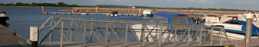
Alternatively, the crew could have worked the boat up the Abbey River and then down the main stream to Brown’s Quay at the distillery, just above Thomond Bridge, or even waited for full tide and worked the boat downstream past Merchants Quay then upstream over the Curragour Falls.

The Curragour Falls at high tide. The distillery was upstream of Thomond Bridge, on the left. The yellow buoy (foreground) marks the modern weir
The “Return relating to trade boats” in Appendix B No 6 of the Second Report from the Railway Commissioners in 1838 lists turf boats belonging to the Limerick Distillery as one of the four main types of boats using the Limerick Navigation (Limerick to Killaloe). We have no information about the types of boats in use or their methods of propulsion, although there is some information about the boats in general use on the navigation. It is unlikely that they carried more than 16 tons, and they may have been rather smaller, perhaps carrying only 5–10 tons.
")
Turf boat from W F Wakeman Three Days on the Shannon Hodges and Smith Dublin 1852

A somewhat larger Shannon boat from The Graphic 1879
A painting in the Limerick City Gallery, and displayed on their new website, may help. The two boats in the foreground (bottom right) seem to be turf boats, one empty and the other full, being propelled by men with poles. They are off Brown’s Quay, above Thomond Bridge and with the distillery out of shot (as it were) to the right. There is little sign of a current: that might be because the mills and their dam at Curragour kept the water upstream looking like a millpond (at least at appropriate states of the tide).
It seems that the distillery may have ceased using turf, perhaps after Brown departed, and that Macnab then began selling turf to the public. A A Macnab wrote about the advantages of water transport, so it is possible that he continued to send the turf by water into Limerick. He wrote too about the necessity for puddling and drying the turf properly, producing what he called “stone turf” of high quality.
I have a longer, footnoted version of this text containing the information I have been able to gather about the Stein Brown distillery on the one hand and the Macnab bog operation on the other. I would like to learn more about the histories of those enterprises; if you know anything about them, and would be interested in exchanging notes, please contact me by leaving a Comment below.


See link to the Brittish Farmers Magazine 1849, which has an article on James McNabb.
http://books.google.ie/books?id=-8sEAAAAQAAJ&dq=mona%20lodge%20farmers%20magazine&pg=PA222
Thanks for that, Ailish. Interesting that the reclamation aspect comes out so strongly in that article.
bjg
Hi Brian,
Thanks for the wonderful job you’ve done researching Mona Lodge and my ggggrandfather, James Macnab/McNabb.
Just wondered if it was the property that Browne says he gave up. Are there land records in Ireland? Can one find out to whom Mona Lodge was sold in 1897? In 1999 it belonged to Peg Ryan.
We were told that Mona Lodge was built from stones from the remains of Worrell’s Inn at World’s End about 1840ish. We also have Worrells on our family tree.
Trish: greeetings. There are land records: see http://www.landregistry.ie/eng/. I suspect you might have to visit there, or employ a genealogist to do so, to check on a property. It might be more useful to contact the current owners, who have I think done some research on the property’s history: see http://www.drakehourigan.com/. However, be aware that they were flooded recently and may not have recovered yet: http://www.limerickleader.ie/EditorialGallery.aspx?ArticleID=5860160&SectionID=3419. bjg
Pingback: Money from the bog | Irish waterways history
My family were all born at Walnut House at Browns Quay and it was common local knowledge that the manager of distillery lived in this house. Was it named Walnut house after mr Walnutt one of the owners.The large 3 storey house with 6 bedrooms still stands.
Robert Brown
There was certainly a Mr Walnutt involved in the management of the distillery during the famine period; he is mentioned in this article by Tom Donovan. However, as he seems to have left the firm (and Limerick) under a cloud, I would be surprised if the firm would name a house after him.
Another point is that, when Alfred Barnard visited in 1886 (see this article and this web page), the manager’s house seems to have been called Island View, although the name Walnut House was in use in 1911.
What all of that amounts to is that I don’t know the answer to your question. Obviously I haven’t researched the matter in any depth but I have not seen evidence that would convince me that the house was called after Mr Walnutt; nor have I seen evidence to convince me that it wasn’t.
bjg
Your reference to John McNab emigrating to Canada appears to be to the same John McNab remembered by this headstone:

I am researching this branch of the McNab family, which began its Canadian years with the sudden death of John and his wife in a cholera epidemic, but their five children were well cared for by prominent local citizens and went on to live prosperous lives. Their marriage and death notices always associated them with Mona Lodge.
The inscription on the 1832 headstone for John and Ellen is difficult to read and an inaccurate transcription is as follows:
Sacred to the memory of John McNab, Esq., eldest son of the late James McNab, Esq., of Hansy, Scotland, who died at his residence near this place, July 31, 1832, aged 42 years / In memory of Ellen, wife of the above, daughter of the late John O. Den, Esq., of the city of Limerick, Ireland, and niece of the late Reverend D. Kennedy, County Clare, Ireland, who died August 3rd, 1832, aged 32 years
Any help in correcting names of places and family members identified in the inscription would be greatly appreciated.
I’ve replied direct to Brian, sending him some suggestions. bjg
Many thanks for the leads, Brian. It’s beginning to appear that the migration to Canada by James McNab and family was part of the movement of a larger group (including Crotty and Walsh families) from the Castleconnell area to a neighbourhood around the upper branches of the Thames River in southwestern Ontario in the early 1830s. Despite the sudden deaths of John and his wife, family ties remained strong with those back in the home country, and the Scottish roots for the McNabs are also remembered with the coat of arms on John’s headstone. The Irish came in sufficient numbers in a short period that both the Church of England and the Roman Catholic Church saw the need to establish new parishes and appoint their first local clergy in the 1830s.
Many of the families made their homes around what is now the town of Ingersoll and quickly became connected with the leading families of the area, including those of the Ingersoll brothers. The Church of England appointed the first priest for that community in 1834, he being one of a string of graduates from Trinity College in Dublin who dominated the area for the next several decades, giving the C of E in southwestern Ontario a character of its own, often at odds with the ‘high church’ pretensions of the bishop residing in Toronto, and eventually resulting in a new bishop being appointed in nearby London to take charge over his local ‘Irish mafia’ priesthood.
Given the nature of your website, thought you might find the following to be of interest. One of the tasks at hand for the Irish newcomers to the upper Thames area was reclamation of swampy tracts of land in the townships south and west of Ingersoll, which is now very fertile farmland thanks to elaborate buried networks of drainage tiles, upkeep of which is financed through assessment against the property owners who benefit – all based upon laws put in place more than a century ago.
About 80 years ago it was decided in Ontario to give extensive powers to conservation authorities in each river watershed to plan flood protection, conservation measures and recreation areas in a co-ordinated manner for each watershed, in an effort to cure flood and erosion problems that had developed from the rampant deforestation that had stripped most of the land in the province for farming purposes in the mid to late 1800s. Nowadays we look to the conservation authorities here for intelligent decisions about protecting the environment and using reclaimed areas to provide programs for outdoor activities and heritage preservation. Most of the work goes on in a quiet but determined manner with grassroots support from local communities, and thankfully little interference from grandstanding provincial government politicians. Some of the best work that has ever been done assembling regional historical narratives for various parts of Ontario was accomplished a half century ago as the original planning reports were prepared for each of these watershed conservation authorities.
Hi. Just reading the history because I’m trying to trace my great grandma’s family from Ireland who we believe are from the canals there. Her great grandfather was called Charles brown/browne. His children were born in and around 1870? I know it’s a long shot but any information would be gratefully received. Thank you.
I have no expertise in genealogy, alas. You could try the Griffith Valuation site http://askaboutireland.ie/griffith-valuation/ but, unless you have some idea of the area your ancestors lived in, you could be in for a long search: Griffith found 14393 instances of Brown or similar names (which would include Browne but also, eg, Brownlee). You might narrow it down a bit if you know which canal your ancestors worked on: the principal contenders are the Grand and the Royal, the numerous northern canals and the Barrow. Waterways Ireland has a piece here https://wordpress.com/comment/irishwaterwayshistory.com/105867?action=approve about family history on the canals, but it doesn’t have all records and it doesn’t manage all waterways.
bjg
Thank you so much for replying and the info. Just interesting that that’s what they did for a living as I’ve always been drawn to canals and barges. Thanks again. Will check out the links