Askeaton is on the River Deel, which flows into the south side of the Shannon Estuary.
![Askeaton and the Deel [OSI ~1900]](https://irishwaterwayshistory.com/wp-content/uploads/2015/01/askeaton-11_resize.jpg)
Askeaton and the Deel [OSI ~1900]
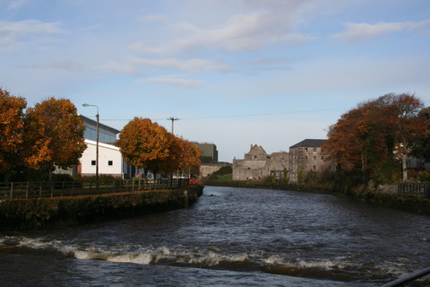
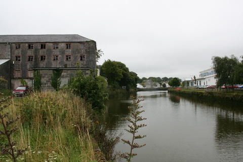
The Deel in Askeaton
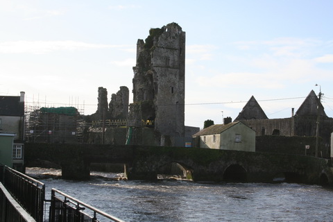
Castle ruins
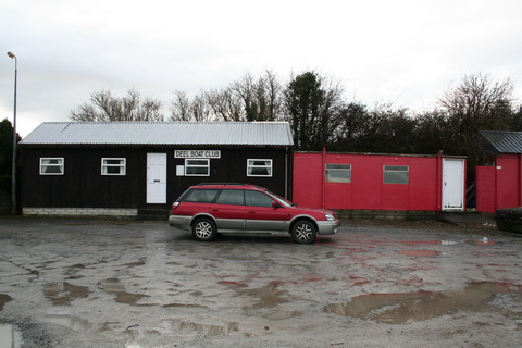
The centre of Askeaton
Lewis’s Topographical Dictionary, published in 1837, said
The trade consists principally in grain and flour, which have been exported direct to the foreign markets. There are two large flour-mills; one near the castle, the property of Mr. Hewson, is very extensive. The town is advantageously situated for trade, from its vicinity to the Shannon, and having a good river up which the tide flows, capable of admitting vessels of 60 tons’ burden, and which might be deepened at a trifling expense, so as to admit vessels drawing 15 feet of water to the bridge: the quays are spacious. In the spring, considerable quantities of sea-weed and sand are landed for manure.[1]
The Parliamentary Gazetteer of 1846 was complimentary about the river but less so about the town.
The Deel, above the town, leaps and tumbles in cascades and cataracts among rocks, winds among finely outlined hills, or between precipitous and overhanging cliffs, and presents, in its frolics and costume, a succession of decidedly picturesque aspects.
Though anciently a large walled town, it is now a poor lumpish village; and though advantageously situated for trade, and an object of attention in the plans of at least two great national works of improvement, it does not seem to be moving from stagnancy and inertion. Only about 20 of its houses are slated; and the rest, of course, possess the cabin or hut character so prevalent in poor Irish towns. Yet some of the older and roofless houses retain a ghastly appearance of having once been respectable. […]
The Shannon line of railway, as projected by the Railway Commissioners, touches Askeaton, and while passing the town, as well as over a distance of 6¼ miles between Ballyrogue and Fannamore, has a gradient of 1 in 660. The town, at present 13 hours and 33 minutes distance from Dublin, will be brought by railway time, within 5 hours and 35 minutes. Its only public conveyances, in 1838, were a caravan and a car in transit from Limerick, the former to Shanagolden, and the latter to Tralee.[2]
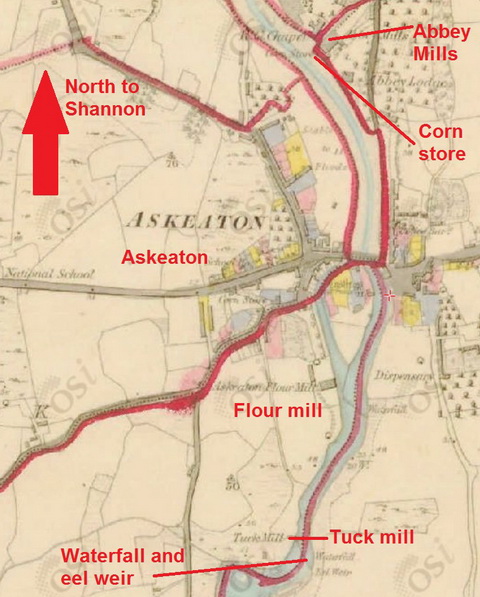
Askeaton mills [OSI ~1840]
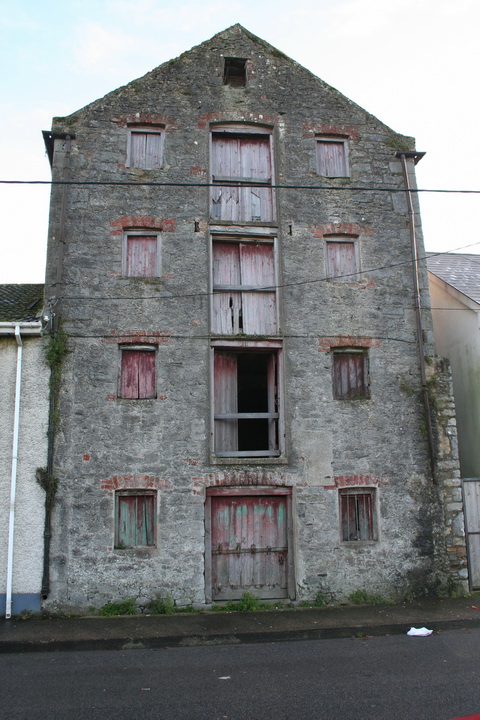
This building is on the Beechey watercolour
Wallace identifies that building as “Ryan (formally Russell’s Mill)”; perhaps “formally” should be “formerly”.
A digression: Richard Brydges Beechey
Beechey is described by Wikipedia as “an Anglo-Irish painter and Admiral in the Royal Navy”, which is an interesting way of describing a senior naval officer. Long before he reached those heights, Beechey was one of the River Shannon survey team and may have done some of the drawings of Lough Ree and Lough Derg. Ruth Delany says
It is always jokingly said that the soundings on the chart for this [Portlick Bay on Lough Ree] area are particularly profuse because one of the two naval officers, R B Beechey, was courting one of the Smyths of Portlick, whom he subsequently married; he later became well known for his marine paintings.[4]
If you google for images using the search term “Richard Brydges Beechey” you’ll find lots of them, including the drawing of Askeaton, but I have yet to find any [apart from the official drawings] of the Shannon steamers during the time Beechey was on the river.
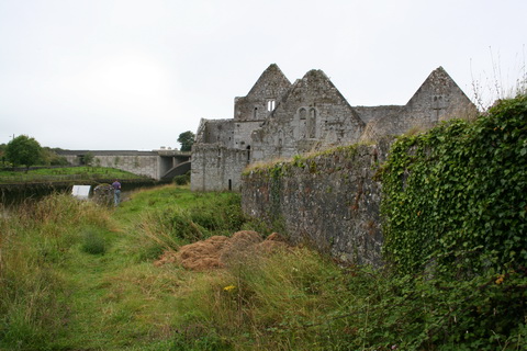
At the Abbey
Here are some photos taken around the Abbey and its mills.
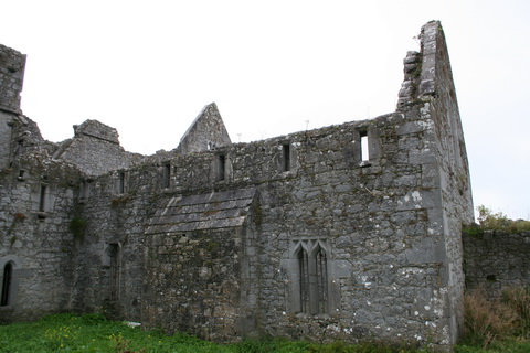
Abbey
Bare ruined choirs
Mill building
Mill and river
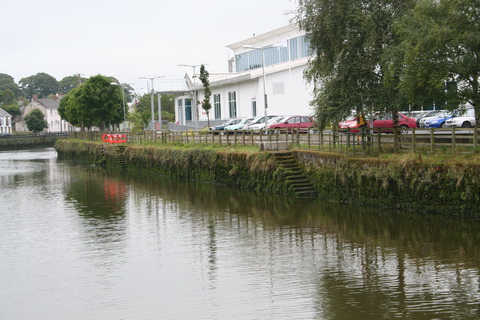
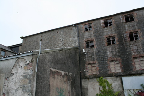
I think the white building is Askeaton Leisure Centre
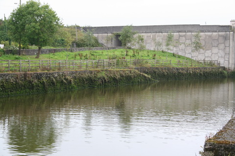
The quays on both sides are stoutly constructed, but only small boats could get to them
It’s hard to see, but there’s a flight of steps just upstream of the tree on the right
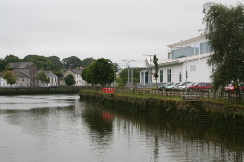
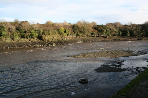
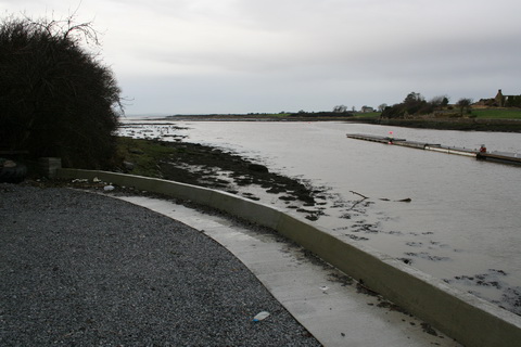
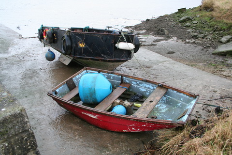
The quay below the town
While Lewis lauded the town’s advantageous situation for trade, which he attributed to its being on a tributary of the Shannon, Charles Wye Williams was less impressed by the Deel. Williams, whose company operated steamers on the Shannon estuary, was giving evidence to a Select Committee on the Shannon in 1834. Asked whether Askeaton did not supply “a considerable quantity of produce”, he said
Yes; but not so much by water as by land, in consequence of the state of the navigation up to Askeaton. That navigation is under the Government.[5]
The Parliamentary Gazetteer said
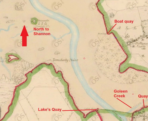
A quay exists immediately below the bridge, on the right bank of the Deel, directly opposite the main body of the town; and a good landing-place, used by vessels, occurs on the left bank, half-a-mile below the town. The river is at present navigable for small vessels at high water up to the quay: but owing to the interruption of a ledge of rock, which crosses the river’s channel a short distance below the quay, the Commissioners for the Improvement of the Shannon Navigation recommended the construction of a wharf at Corthnasoothera, the landing-place just noticed, and the site of a quondam, but ruinous pier, on the left bank. The wharf, say the Commissioners, will cost £900, and will need to be connected with the town by means of a branch road.
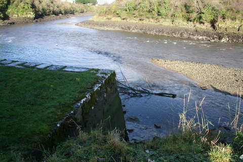
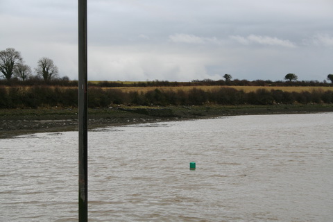
I don’t know whether there’s a ledge of rock out there in the photo below, but it’s certainly very shallow at low tide.
Ledge of rock?
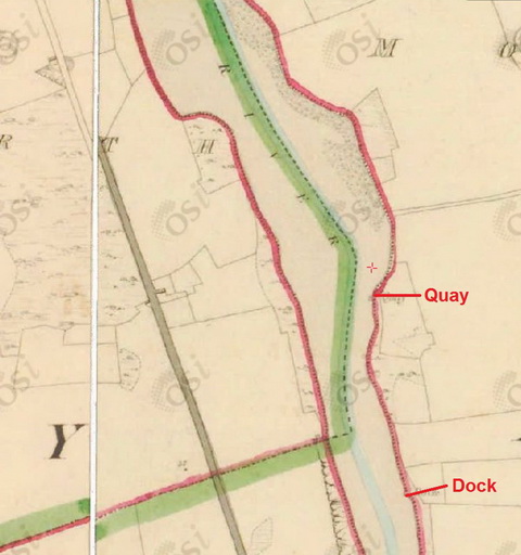
That photo was taken from the site of the quay marked on the next map extract.

The quay below the town
Google doesn’t know of any instance of the name Corthnasoothera other than in the Shannon Commissioners’ report, it’s not on the OSI maps and I’ve unsuccessfully tried several variants, including some beginning “Gortna …”. However, because the location seems to match that on the Commissioners’ map reproduced below, I am assuming that the quay marked is at Corthnasoothera. Here is what the Commissioners wrote:
DEEL, OR ASKEATON RIVER, COUNTY OF LIMERICK
This river is at present navigable for small vessels at high water up to the town of Askeaton, but owing to the interruption of a ledge of rock which crosses the bed of the river a short distance below the present landing quay, we recommend that a new wharf be erected at Corthnasoothera, on the left bank of the river, and half a mile below the town. It will be necessary to connect the proposed wharf with the town by means of a branch road. The estimate for the new wharf amounts to £900.[6]
The left bank is on your left when you’re looking downstream, so the location fits. Here is what the Shannon Commissioners proposed to do.
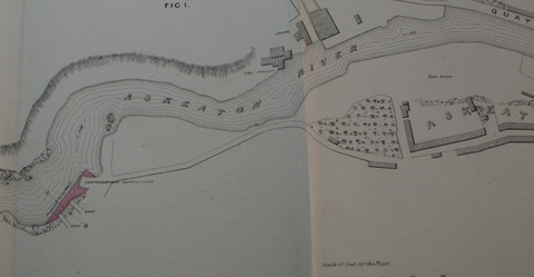
The Shannon Commissioners’ plan
It looks as if there were three small quays which the Commissioners proposed to link, making one large quay that would stretch a bit further out into the river. However, for the plans to be implemented the local landowner had to be prepared to put up half the cost and it appears that he was not willing to do so: at any rate the Shannon Commissioners did not undertake any work on the Deel.
Yet somebody did something, for the quay now at Corthnasoothera is more like what the Shannon Commissioners proposed than it is like what they showed as the old quays.
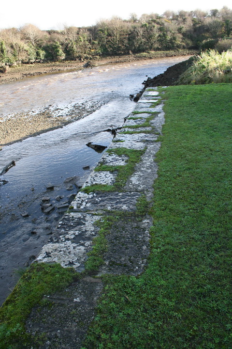
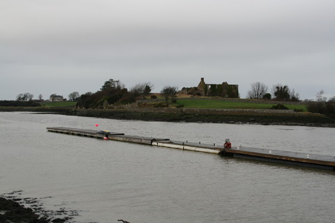
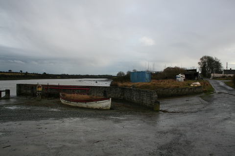
The quay at Corthnasoothera
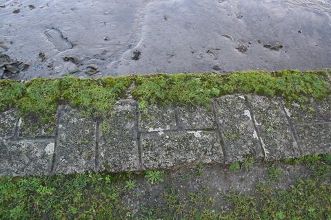
The edge of the quay
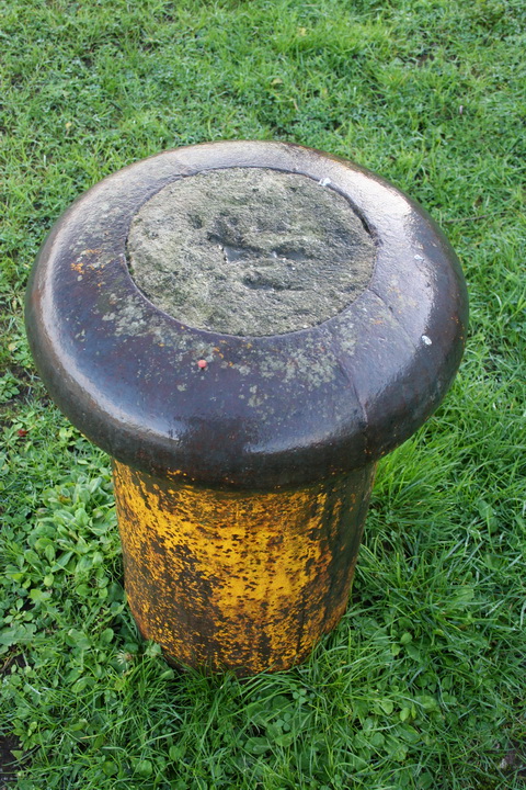
Bollard
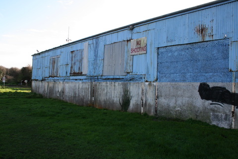
The shed on the quay
The corner of the quay
Looking downstream
The only information I have so far found is in this extract from the Limerick Reporter and Tipperary Vindicator of 1 November 1850
The ancient borough of Askeaton was lighted with gas for the first time last week. For this advantage the inhabitants are indebted to the Messrs Russell of Limerick, who have constituted themselves patres urbis in Askeaton by the many benefits they have conferred. Within the last twelve years, since these gentlemen commenced their establishment in Askeaton, it has become a stirring business town, from being fast falling into decay and disrepute for trade.
Perhaps the Parliamentary Gazetteer was not quite up to date: by 1846, when it was published, Messrs Russell would have been operating in Askeaton for eight years. But let the Limerick Reporter and Tipperary Vindicator continue.
They now employ 250 hands in their several mills. They have lately undertaken, at their own private cost, to deepen the bed of the Deel up to the quays, that barges and barques may sail up to the town. This improvement was undertaken by the Board of Works, but abandoned before complete, and the Messrs Russell, though they shall derive some benefit from it themselves, will confer a benefit on the townspeople of the most substantial kind.
Did Messrs Russell perhaps abandon the idea of deepening the river up to the town quays and build a better quay at Corthnasoothera instead? If, Gentle Reader, you know more about this than I do, please leave a Comment below with the requisite information.
I see that somebody unspecified has put up a sign discouraging visitors from the Isle of Man. Actually, it says (or said) “No motorised craft”; presumably the horse is there to provide an alternative.
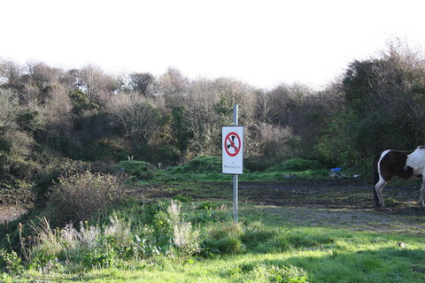
Horsepower
Traffic to Askeaton continued well into the twentieth century. Limerick Harbour Commissioners’ Register of vessels trading on the River Shannon 1945–53 [free download here, but you’ll need a DJVU viewer] shows that the Edgar left Limerick for Askeaton, light, at 06:45 on 19 September 1952. That is the last mention of Askeaton I can find in the register, but it may be that there are later registers.
Downriver
There is a remarkable number of small quays and docks on the Deel downstream from Askeaton. The Admiralty surveyors said
Vessels under 100 tons go up to load grain at small quays along its banks.[7]
As the Deel is running upside down, from south to north, you have to go from the bottom to the top of the first map and then from the bottom of the second to its top. Very awkward: there should be a law forcing all rivers to run from north to south.
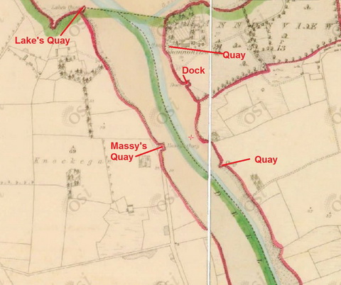
Downstream of Corthnasoothera. The dock marked here was shown on the previous map segment [OSI ~1840]
Downstream again
Massy’s Quay
What a lot of quays there are around here.
Massy’s Quay and Shannon View [OSI ~1840]
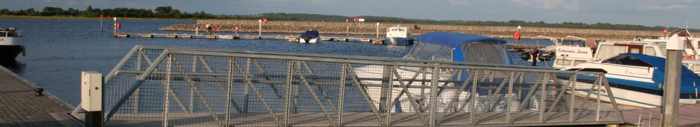
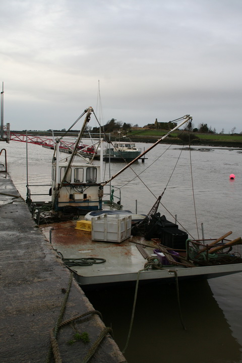
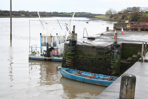
Deel Boat Club
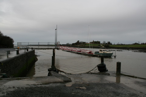
Deel Boat Club pontoon
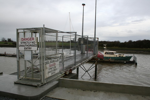
Secure access to the pontoon
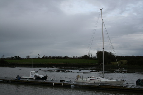
Boats on the pontoon
French-type oyster-dredging boat
There are [at least] two oyster beds nearby; the owner of one of them used this vessel.

I think those masts by a large shed are at Ryan and Roberts
Here is a link to the Ryan and Roberts website.
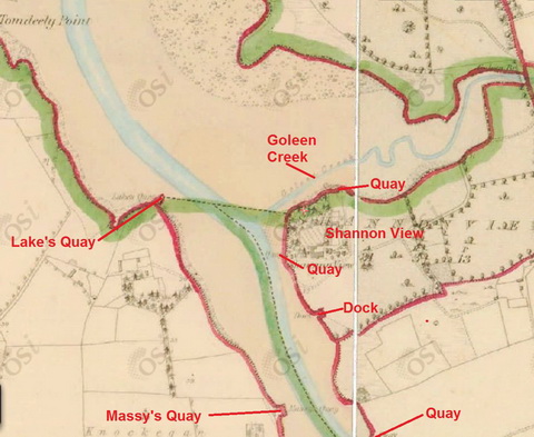
Shannon View on the far side of the river
I met Harry Blackwell, who told me that people had patches of sea marked out, off Shannon View, where they put down stones for seaweed to grow on. The seaweed, used as sea manure, was cut in October and carried by gandelows to the small quays and, according to Patrick Wallace, up into Askeaton itself. The seaweed was left to mature over the winter.
Seaweed quay
The quay towards the bottom right of the last map, on the far side of the river and a bit upstream from Massy’s, was a seaweed quay, Harry said.
Looking out to sea
Boats hauled up

I think the curious structure may be the remains of an old access ramp to a pontoon
Boats everywhere
Harry’s Co Clare gandelow, the only gandelow on the Deel
A wildfowler on the long mud
On again, further downriver.
Downstream from Lake’s Quay [OSI ~1940]
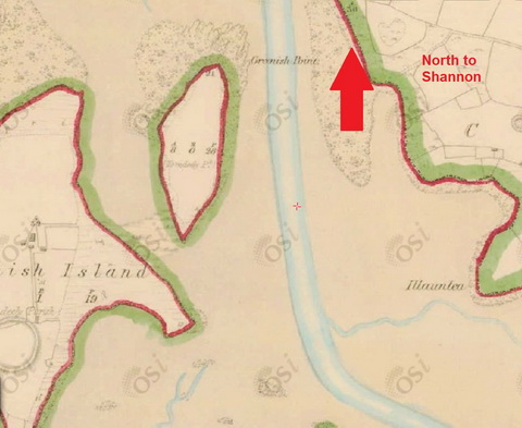
And downstream again, with Greenish Island on the left [OSI ~1840]
Moran describes “the area of the Long Mud”:
This shooting ground reaches from the north point of White Island, east to the little island of Lan Tighe and the Deel Estuary.
I think this is the area he means.
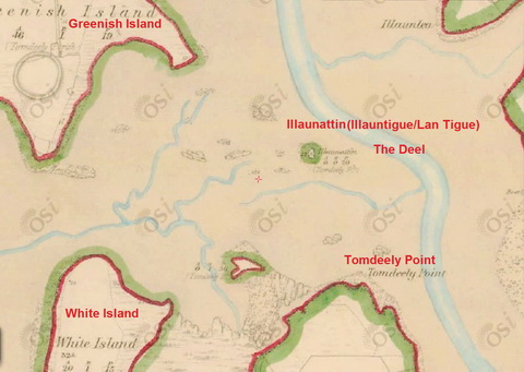
The shooting ground [OSI ~1840]
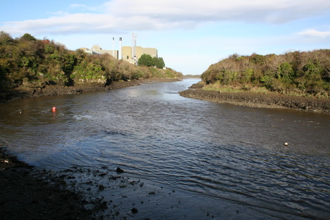
The junction with the Shannon
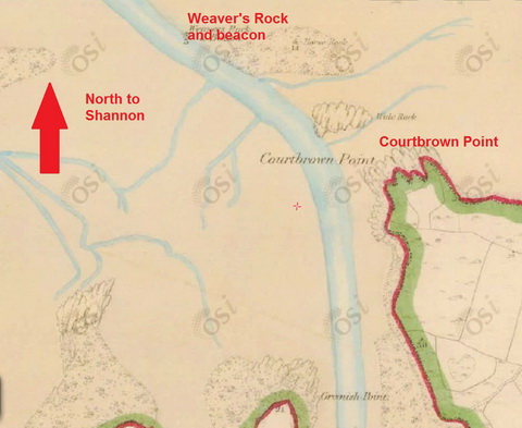
Nearing the junction
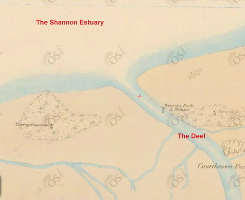
The junction with the Shannon
As the Sailing Directions put it
Three-quarters of a mile south of Beeves Tower is the entrance to the Deel, a small river with a channel of 200 feet in width at low water, and a depth of six or seven feet at the lower part, about 2½ miles from the town of Askeaton.
The Parliamentary Gazetteer said
The Deel is a tidal river, and is navigable to Askeaton; but the entrance to its channel is obscured and made somewhat perplexing by a great extent of slob, which is covered with water soon after the commencement of flood-tide. The Commissioners for improving the Navigation of the Shannon proposed to place beacons for indicating the entrance and the sailing course, to clear the channel of all rocks and shoals, and to erect a new quay a little below Askeaton.
Moran’s final chapter is about Tom the Saint, whose brother was the pilot for the Deel. Tom usually rowed his brother out to meet incoming coasters. One day the pilot was “suffering from a streaming cold, and the after-effects of an over-abundance of porter the previous night” and he allowed Tom to act as pilot. It took three weeks to dig the coaster out after it ran aground on its way upriver.
But you can see why a pilot would be useful.
More information?
If you know of any sites with historical information about the navigation of the Deel and the quays of Askeaton, do please leave a Comment below, with links, and I’ll add them here. I wasn’t able to find a website for the Deel Boat Club and, if it has one, I’d like to add that too.
And, if I’ve misidentified anything, missed anything or got anything wrong, do please leave a Comment.
References
[1] Samuel Lewis A Topographical Dictionary of Ireland, comprising the several counties, cities, boroughs, corporate, market, and post towns, parishes, and villages, with historical and statistical descriptions, embellished with engravings of the arms of the cities, bishopricks, corporate towns, and boroughs, and of the seals of the several municipal corporations; with an appendix describing the electoral boundaries of the several boroughs, as defined by the Act of the 2d and 3d of William IV S Lewis & Co, London 1837
[2] The Parliamentary Gazetteer of Ireland, adapted to the new Poor-Law, franchise, municipal and ecclesiastical arrangements, and compiled with a special reference to the lines of railroad and canal communication, as existing in 1844–45; illustrated by a series of maps, and other plates; and presenting the results, in detail, of the census of 1841, compared with that of 1831 A Fullarton and Co, Dublin London and Edinburgh 1846
[3] Patrick F Wallace “Images of Ireland before the Great Famine” in Liam Irwin and Gearóid Ó Tuathaigh eds Limerick History and Society: interdisciplinary essays on the history of an Irish county Geography Publications, Dublin 2009
[4] Ruth Delany By Shannon Shores Gill and Macmillan, Dublin 1987
[5] Evidence of Charles Wye Williams 14 July 1834 Q495 in Report from Select Committee on Shannon Navigation; with the Minutes of Evidence, and an Appendix Ordered, by The House of Commons, to be Printed 29 July 1834
[6] Second Report of the Commissioners appointed pursuant to the Act 5 & 6 William IV cap 67 for the Improvement of the Navigation of the River Shannon; with maps, plans, and estimates HMSO Dublin 1837
[7] Sailing Directions for the Lower Shannon; and for Lough Derg; with some Hydrographic Notices of Lough Ree and Lough Erne. By Commander James Wolfe RN; being the results of Surveys made by Order of the Lords Commissioners of the Admiralty
[8] Roger Moran The Wildfowler: a tale of the Shannon Estuary Blackstaff Press, Dundonald 1982
![]()
[snnest70]


Pingback: Navigations under threat | Irish waterways history