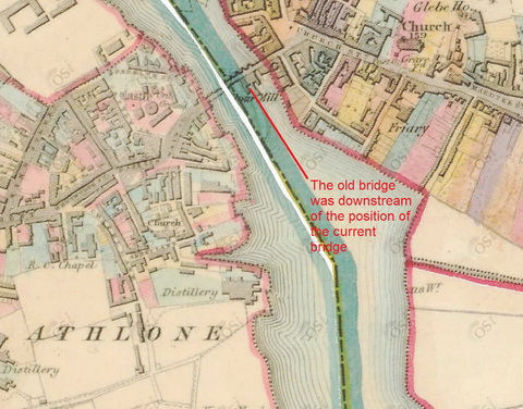
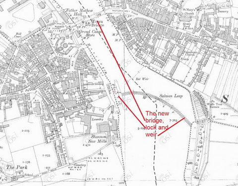
Boats passing through Athlone nowadays use a lock in the river, beside the weir and downstream of the current road bridge. Lock, weir and bridge were constructed by the Shannon navigation commissioners in the 1840s.
Before then, boats used a canal, about a mile and a half long, to the west of the river.
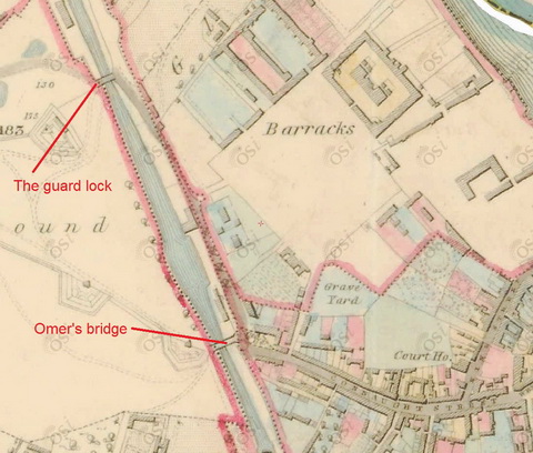
According to Ruth Delany’s The Shannon Navigation (Lilliput Press, Dublin 2008), the canal was built by Thomas Omer for the Commissioners of Inland Navigation. He started in 1757 and had over 300 men at work. He built a single lock 120′ X 19′ with a rise of 4.5′, but there was also a guard lock, further upstream, with a single set of gates to protect the canal against floods. There were two lay-bys (harbours), one above the lock and the other at the upstream end.
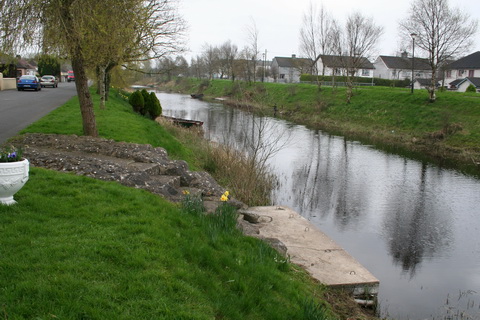
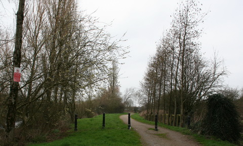
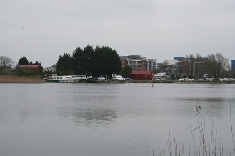
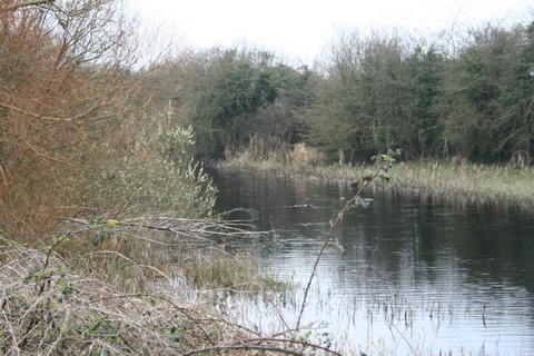
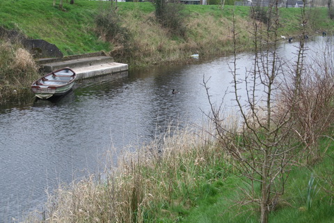
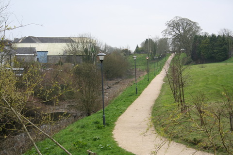
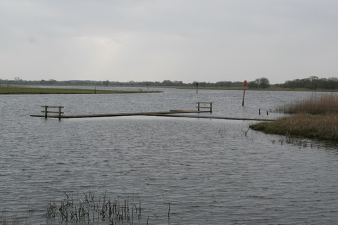
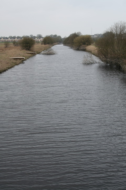
Although the old canal is no longer navigable, small boats are kept at its upper end and the entire line is easy to follow. The photos on this page were taken in March 2012; unfortunately the camera had an intermittent fault so some photos were not saved properly.
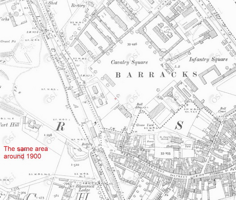
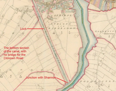
The map extracts are used by kind permission of Ordnance Survey Ireland. The coloured maps are from the survey of around 1840 (different sheets were surveyed and then printed at different times, so I refer to the survey as being ~1840) and the black and white are from the survey of ~1900.
Upper end to railway bridge
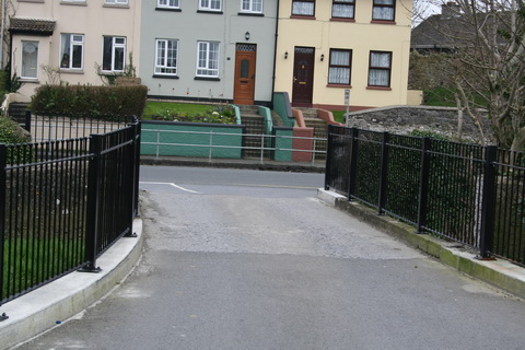
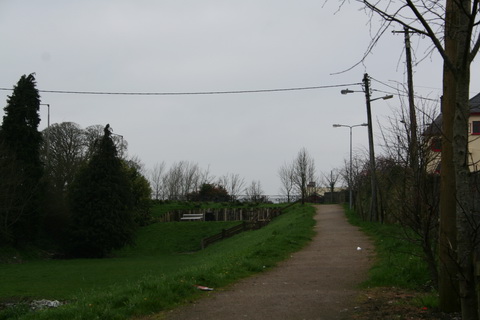
You can drive up quite close to the junction. The canal banks are neatly kept, presumably by the residents, and there are lake-boats tied to landing-stages in several places.
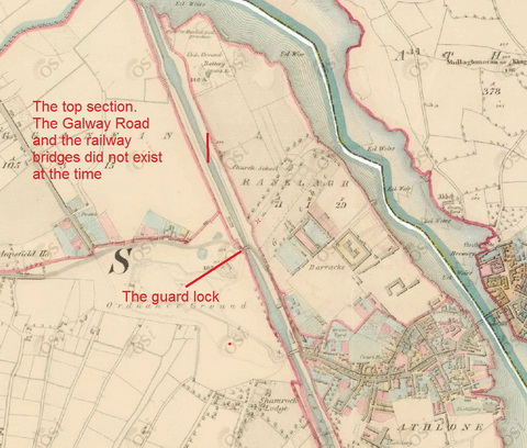
When the OSI map was drawn in around 1840, the Galway Road bridge and the railway bridge did not exist
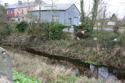
from The guard lock to battery bridge
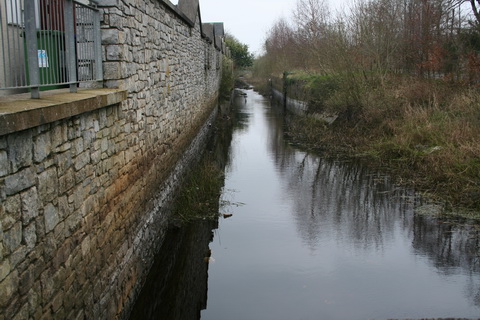
From the lock to the Shannon
Further information and corrections will be welcome; please leave a Comment below.
Here are some links courtesy of the Athlone Live forum. Cllr Aengus O’Rourke set up the Athlone Canal Restoration Group (the link on that page isn’t working: I’ve asked whether there is a different URL). The group held a meeting in September 2011 and a walk, led by the learned Dr Harman Murtagh, in December 2011.
I am all in favour of linear recreational facilities — walking and cycling routes — along waterways, but I am generally opposed to restoring to navigable status, which (at least in Ireland) is rarely, if ever, a sensible allocation of resources.
Addendum
Isn’t this interesting? First, it shows that, although the canal was bypassed in the 1840s, it was not officially abandoned until 1982 (though I wonder when the lock gates fell down). Second, it suggests that Waterways Ireland (as successor to the Shannon Commissioners and the Commissioners of Public Works) still owns the canal, although I admit I’m making an assumption there. Third, it shows why Cllr Aengus O’Rourke said that Athlone Town Council would have to be involved in doing anything on the stretch from the Galway Road Bridge to the Battery Bridge: the town council seems to have leased that section, and the next as far as the lock, from the Commissioners of Public Works. I’m not clear about the role of Westmeath County Council and I’m assuming, open to correction by Athlone folk, that Heatons Mill Bridge was the bridge over the lock as shown on the ~1900 OSI map.
[mus 30]















Well done, Brian. I’ve walked the length a few times. Think the Urban District Council look after it. Hadn’t realised about the guard lock until you pointed it out. The southern area re-entering the river I found particularily impressive. Plenty of fishermen and boat activity when I was last there. Water level seems quite high when you took photo. Whole area far better defined in summer.
Thanks, Jim. I photographed the guard lock while wondering where the other set of gates had disappeared to, then found that (as always) Ruth Delany had the answer. bjg
Lovely piece Brian! Following representation from the Athlone Canal Restoration Group, Athlone Town Council agreed to commission a comprehensive feasibility study on the Canal with a view to exploring the possibilities for it from a recreational and tourism perspective. The report will be ready late Summer 2012. We (The Canal Restoration Group) will keep the pressure on the Council in order to have the most suitable recommendations from this report implemented. This will be a long, slow process but if done right it will benefit the Town for many generations to come. Our ultimate goal is to convert this redundant waterway into an attractive, high quality linear park with good walkways, seating, planting, landscaping, proper signage of areas of interest, proper lighting and have it registered as a national walk. I will keep you posted ! Best regards, Cllr Aengus O’Rourke, Athlone.
Hello, I have a marriage certificate for my ancestor Robert Butler in 1854, and his address was Canal Lodge, Athlone. Please have you any ideas where I could find out more about this ?
Thanks.
Canal Lodge is not shown on the OSI map from around 1840 [Historic 6″] but the words “Fountain/Canal Lodge” are on the version from around 1900 [Historic 25″]. I don’t know any more than that, but you might like to ask on the Athlone Live/Olde Athlone Forum, where there are some knowledgeable folks. The canal was out of use by 1854, so your ancestor might not have been working for the Shannon Navigation/Board of Public Works. bjg
Hi I would like Hazel Tapsell to contact me. Your Robert Butler is the brother to my John Butler who died in 1878 and is buried at the Cormanagh cemetery. There is also a sister named Dorothy. Their father is named John Butler too and when he died in1860 he was living at Canal Lodge in College Lane off Connaught Street Athlone. I live in Ipswich Queensland Australia, I have moore info about the this family of Butlers and I’m sure we could help each other. You are the only person in 20 years that I have found that is a cousin! Please write me, my email is ***************** [available via the site admin. bjg]
regards………….Geoff Butler
I have forwarded your email to Hazel Tapsell. bjg
I have now been in contact with Hazell Tapsell and we are cousins andcomparing notes. Further information is sought about Canal Lodge. My John Butler died there in 1860. Was the Canal Lodge linked to the Canal? (perhaps a residence for a manager or caretaker of the Canal?) When built and when demolished? I welcome your thoughts. My email is ********** [available to well-intentioned folk via the site admin. bjg]
In 1948 ( I was aged 12) my father Alfred Eggleston (Fred) bought the houseboat, The Gillaroo, (originally a workboat on the Shannon called The Fogabola). The Eclipse Flower towed it to Athlone and we moored it in the canal exactly where the pathway in photo 2 starts. I have a photo which I can send if anyone is interested, showing boat, garage and ESB pole! Who we paid for this site I have no idea! We left for Jamestown in 1949.
Yes please: I’ll contact you directly. I don’t know whether you are aware that the Gillaroo (formerly Faugh-a-Ballagh) is still afloat on the Shannon, now called Tristan. bjg
Delighted with your swift reply and will await direct contact. Yes I met Brendan McDermott the current owner last month in Carrick on Shannon. Many changes from family home to bachelor pad cum mobile party venue! BillE
It’s gone to you. I hadn’t realised you already knew about Tristan so I sent you a (reduced file size) pic. bjg
Hello to Hazel Tapsell and Geoff Butler. It seems we are related through John Butler senior of Connaught Street.( died 1860 ) His daughter Jane was my great grandmother and she married Joseph Brady a soldier at the barracks in 1867 and died in England in 1918. We visited Athlone some years ago and got good information from Gaeroid O’Brien the librarian and from Mr Dooley at Cornamagh cemetery. We saw where John Butler junior is buried but there was no gravestone for details and I have drawn a blank on the background of John Butler senior and how he came to own so many properties. His wife was Anne but no surname given. I have a death certificate for John who died aged 65 of heart disease at Connaught Street and his wife was given as Ellen ( she could not write and gave her mark as informant.
Hi again. re Butlers- sorry I made a mistake but Jane Butler was the daughter of John Butler Junior .
My records show that John senior and Anne had son John , son Robert who married Anna Maria and a daughter Dorothy who married William Garvey. Hope this mail is not too late for someone to get in touch – regards
Its a disgrace the way they were allowed to close this canal and to cover and fill in the bridge at the top of connaught st was criminal the stone work that was put into that bridge with it 2 smaller tunnels for horses to b pass through while towing barges. The canal should be totally restored dreged and cleaned for the ppl of athlone
Given that (a) the canal was scarcely usable by 1832 (see the report by Thomas Thodes) and that (b) Athlone already has a working navigation, restoration of the old canal would be a complete waste of money. However, I’m sure that, if the people of Athlone wanted to pay for restoration, the powers that be might discuss the matter. bjg
be a great place to teach youngsters fishing
My Robinson family owned the Distillery shown in the maps. They lived across the canal at Shamrock Lodge also shown on the map. Any information about the distillery would be appreciated.
psj
I don’t know much about it myself, but the British Newspaper Archive https://www.britishnewspaperarchive.co.uk/ will almost certainly be able to find information. bjg
Pingback: An Athlone nitwit | Irish waterways history
Hi,
Looking at Maps 5 and 6, you can see what looks like a fortification immediately to the west of Omer’s bridge. That fortification is/was known as “Battery No. 6”, and there are now 2 houses built on that site. I grew up in one of them.
I distinctly remember the rebuilding of the Battery Bridge when I was a child in the early ’80s, and I also remember the bridge that preceeded it. I am assuming that the bridge that was destroyed is the old Omer’s Bridge.
A couple of points:
1) That old bridge was one of those “hump-back” bridges. Going west from Connacht St., to cross it one had to take a hard left, proceed over the hump, and then take either a hard right to travel towards The Battery Heights, or another hard left to proceed towards Clonown. While wide enough to allow two-way traffic and footpath (footpaths on both sides, if memory serves correctly!), it was under no reasonable circumstance fit for use. Even as a 9-year-old, I could appreciate that! No other crossing of the canal was configured like that, with the nearest example being that nightmare of a bridge crossing the railway at the end of Mitchell’s Terrace at https://osm.org/go/es13bNzZ9-?m=.
2) I remember that there was a culvert built under the canal infill when the bridge was being re-developed. I can only assume that it’s still functioning, unless it’s clogged with old tyres and other rubbish that have been thrown into the canal over the last 30-40 years.
Regarding the bridge at the southern edge of the canal, it’s known locally as the “Mick McQuaid Bridge”. I remember hearing the story about how there was a letter-writing campaign to have a bridge built there, and all of the letters were signed by “Mick McQuaid”, which was the brand name of a a tobacco product that was popular at the time — there was no historical person by the name of Mick McQuaid associated with the bridge. I can determine for sure that the bridge wasn’t build before 1875, but I don’t know when it was built. I have a vague memory hearing that it was built in the mid-20th century.
Éibhear
Thank you: that is very interesting.
Hump-back bridges were difficult for wheeled traffic to get over and, when Omer was working, pretty well had to be at right angles to whatever they were crossing. Skew arches https://en.wikipedia.org/wiki/Skew_arch didn’t come to Ireland until later, with William Chapman’s https://en.wikipedia.org/wiki/William_Chapman_(engineer) work on the Kildare Canal (now the Naas Branch https://irishwaterwayshistory.com/abandoned-or-little-used-irish-waterways/the-grand-canal/the-naas-branch/ of the Grand Canal). I don’t know whether the bridge was intended only to provide access to inside the fortifications.
I didn’t know about the culvert. It would be interesting to know whether it’s still there (and still working).
The Mick McQuaid bridge, I presume, is the one from Deer Park Road, not the pedestrian bridge at the Shannon end. It is not shown on the Ordnance Survey 25″ map, from around 1900: http://map.geohive.ie, select Data Catalogue and then Base Information and Mapping and then Historic Map 25 inch. (It doesn’t seem to be possible to provide links to precise locations.)
I haven’t found anything about its origins: that might require a trip to Athlone library.
Thanks again for the interesting comments.
bjg
Mick McQuaid’s bridge was completed by the autumn of 1944. It is the rad bridge at the lower end of the canal, just below thye olod lock. It join the Clonown Road with Deerpark Road