This is an account of a small-boat trip on part of the Rockville Navigation in July 2010. We arrived at Grange, in the Carnadoe Waters, on a larger boat. A car was available; we used it to transport our 10′ Walker Bay dinghy (with much equipment) and three kayaks (one of them an inflatable) to the bridge shown on the map. There were three young adults in the kayaks, two older adults in the dinghy and two dogs, one of whom liked to leap from boat to boat.
Update: here is another account of a trip on the Rockville.

Sketch map of the Rockville Navigation
It took a couple of trips to get everything to the bridge, and it was mid-afternoon by the time all the boats, equipment and crew had been assembled, so we decided that there was not enough time to explore upstream to Lough Nahincha. We would simply go downstream, via Clooncraff Lough and Lough Nablahy and thence via the Grange River to return to our boat at Grange. We knew another party had gone upriver from Grange in 2009, and had lived to tell the tale, but we didn’t know how far up they had gone. We were therefore reasonably, but not entirely, confident that we would be able to get from the bridge to Grange by boat.
Equipment
I don’t know what HIMC is, but it’s what the Walker Bay is made of. It stood up very well to the launch and to close encounters with the stony river-bed in the final stage of the journey. Water levels were very low, and an inflatable might not have been so happy, while a fibreglass boat might have had its bottom scratched. Most of the equipment was carried in the Walker Bay. We had a 2hp outboard (with spare fuel), oars, a boathook, a folding anchor, lengths of light rope, cameras, drinking water and chocolate-biscuit cake. We had, alas, no ginger beer. Everybody wore a lifejacket or a buoyancy aid suitable for kayaking; the dogs had their harnesses. We carried a GPS, a VHF set and mobile phones. We had (no doubt illicitly) printed off large-scale screen captures of the Ordnance Survey maps so that we would have some idea where to look for the exit from each lake. We kept them in a plastic envelope, but they still got wet (there was much rain). Nonetheless, they were useful.
Conditions
The weather had been relatively dry for several months and the water level was very low. On the other hand, the vegetation had flourished mightily: it was impossible to row the dinghy in the river sections and the propeller clogged with weed after a couple of minutes. We resorted therefore to using an oar (and later a spare kayak paddle) as a paddle, with the engine being used only on the lake sections. The kayaks had no problem, though. The journey took us four hours. I suspect that, without the weed, it would have been faster; the kayaks could probably have done it faster still without the dinghy to slow them down.
The launch site

The bridge (courtesy Michael Slevin)
We decided to launch the boats down the north-east side of the bridge (the right-hand side of the photo above). They had to be lowered down a steep bank, but many hands make light boats work. There was space to leave the car off the road just a few yards further north.
I was horrified to discover that the bridge – built in June 1765 — had suffered severe damage since my last visit.

Damage to the bridge 1

Damage to the bridge 2

Damage to the bridge 3

Damage to the downstream parapet

Masonry in the cut
Given the heritage and leisure value of the Rockville Navigation, I hope that the powers-that-be in County Roscommon will get this fixed immediately.
The view through the arch was attractive, but we resisted temptation and turned our bows downstream.

The arch

Looking downstream 1

Looking downstream 2
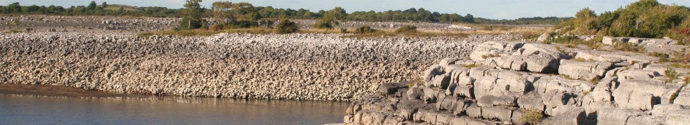
The first cut
The section over which the bridge is built is a canal, and is marked as such on the old Ordnance Survey maps (switch to Historic 6″ if necessary). It was quite shallow, but with a noticeable current through it. If you compare the 1840s map (above) with the 1900s version, you’ll see that there was originally only a short canal, which led to a winding river section and then into Dooneen Lough. By the 1900s, though, the winding river had had its bends removed.

Setting off

Marl (often found under bogs) along the bank

Sometimes it looked clear of vegetation …

… but not for long

The water was very clear and we found shells of what we think were freshwater mussels

The Walker Bay

Getting around a tree

Water lilies

Reaching Dooneen Lough
Dooneen Lough
Dooneen Lough has two sections. Again comparing the two old OS maps, it seems that the connection between them was narrowed and straightened in the later nineteenth century.

Reaching Dooneen

Kayaks

Searching for the exit

Deweeding the prop, assisted by dogs

More vegetation

Vegetation

Clear water in sight

Trees

On open water

Dooneen’s island
Clooncraff Lough
There followed another narrow passage to Clooncraff Lough. Again, this seems to have been straightened and narrowed in the latter half of the nineteenth century.

Yet more vegetation

The eye of the needle

The Walker Bay, being rowed backwards

Out on Clooncraff Lough

Clouds overhead

Towing the inflatable kayak. Efforts to tow the other kayaks were not successful (and indeed positively dangerous)

Checking the map
The Clooncraff River flows through Cloonahee Lough and joins Clooncraff Lough at its southern end. We did not have time to try going up the river.

The Clooncraff River
Lough Nablahy
Nablahy is the largest of the lakes along this route. Its link to Clooncraff is very short, but the cows were watching ….

Cows on patrol

Kayaks enter Lough Nablahy

The first boat we saw on the journey

For once, the dinghy was able to get well ahead of the kayaks

The bank

Around this corner is …

… the main body of the lake

But westward, look …

Dinghy with dog in the bow

The smaller dog is not impressed

Looking towards the next section of the lake

It’s in there somewhere …

Tree

Signs of civilisation

Looking for the Grange River

So far, so good

The return of the vegetation
The Grange River
We were now on the last stage: a descent of the Grange River.

Down the Grange River

Stone

There was a noticeable current

The kayaks take a breather …

… while the dinghy battles on

The cows were waiting

Vegetation 1

Vegetation 2

Vegetation 3

Vegetation 4

Vegetation 5

Vegetation 6

Vegetation 7

Vegetation 8

Vegetation 9

Just to prove that the underwater camera works …

A wire (electrificable, but seemingly not live) bounded a cattle crossing and had to be held up

We went cautiously past some swans

The current accelerated as we neared Bellavahan Bridge; we knew we were near the end of the journey

The water was very shallow from here on

There was a rope across the river above the bridge, but it was loose enough to be lifted so that we could pass under it

The water was just above ankle deep …

… the rest of the way to Bellanagrange Bridge

We hauled out at the slipway just below Bellanagrange Bridge
Overview
The trip was a delight. Although (at least at the prevailing water levels) it lacks the excitement that whitewater enthusiasts might like, there was much of interest. If we were to do it again, it would be better to use paddles for the dinghy from the outset. There was nothing to trouble the kayaks, which could probably have finished the journey much faster without the dinghy slowing them down.
Clearly, conditions would be very different earlier or later in the year, when the vegetation might be less luxuriant and the water levels might be higher. But although the veg slowed progress, we were not in any particular hurry, and it was very pleasant to look at.
I see no reason why large wooden cots could not have carried produce downstream in bygone days. Constant traffic would have kept down the weed, but even occasional boats would have been able to reach Bellavahan Bridge at low water levels, and Bellanagrange at higher levels. The bridge, the quay, the sections marked as canals and the changes made between the early and later OS maps show that work was done, and money spent, to keep this waterway navigable, but I would still like some documentary evidence of its use.
The future?
I greatly hope that Roscommon County Council, or some other competent authority, will restore the bridge to its former condition. But I think it could go further: the navigation could be opened up as a canoe and small boat trail, providing a new attraction for this area. After all, the trail even has that essential facility, a pub, at its terminus: the Silver Eel has recently been greatly expanded.
In the meantime, I would be glad to hear from anyone who has information about the history of the Rockville Navigation.
Thanks to CELG for the use of many photos (and for the chocolate-biscuit cake).


Really, really fascinating read. I went straight for my own Irish OS map. Found Rockville House but not a hint of these delights on a 1967 edition. A journey I would love to do.
Yep! I enjoyed the trip, the pics and the commentary. Some of us travel the world and forget that such mysteries are on our doorsteps….looking forward to the book!
Glad you enjoyed it. The old OS maps (free online) are actually more useful for things like this! bjg
Well done to all.
Hard to see how the bridge was damaged so badly. Its not near any bend. Glad to see the stone with the date survived.
Michael
Michael: true. It’s on a straight stretch of road. The bridge itself is fairly narrow, though (as you’ll remember). I hope the County Council doesn’t feel impelled to remove the stone and replace it with steel barriers or something in the interests of health and safety …. bjg
Good: thanks for reading it. bjg
Hi Brian,
We did this trip many years ago starting and finishing at the Silver eel. I was one of the most enjoyable dinghy trips we made. Thanks for bringing back the memory, in your usual excellent report.
It is wonderful, isn’t it? Have you any information (in addition to what I have on my pages) about the original uses of the navigation? bjg
hi brian, it just shows what beauty can be seen from low cost boating. regards
m
Thanks, Mick. I hope to reinforce that argument soon with some pics from the Suir. bjg