The World’s End is the name given to the area at the upstream end of Castleconnell, Co Limerick, where the weir, quay and rowing-club are. The name is said to be a corruption of “Worrall’s Inn”, but was already in use by 1817 [Dublin Evening Post 19 June 1817].
 The weir at Castleconnell
Castleconnell is on the real River Shannon: that is, on the natural course of the river, whose volume has been sadly diminished by the diversion of most of the flow through the Ardnacrusha hydroelectric power station. Castleconnell now gets the first 10 cubic metres per second, Ardnacrusha gets the next 400 and anything left over is sent down the old route. The diversion is done at Parteen Villa Weir, upstream of O’Briensbridge but downstream of Killaloe.
 Parteen Villa Weir
 The (much diminished) Falls of Doonass
The flow of water through Castleconnell is therefore much less than it was but, though much is taken, much abides. The river through Castleconnell was and is unnavigable, other than by kayaks, downstream through the Falls of Doonass to Plassey. The old Limerick navigation bypassed this stretch altogether via the Plassey–Errina Canal, which left the Shannon opposite Plassey Mill, climbed through six locks and rejoined the river below O’Briensbridge — but upstream of Castleconnell. A boat travelling to Killaloe would turn left at that point at travel upstream, whereas a boat bound for Castleconnell would turn right and travel downstream.
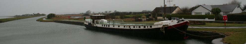
 The junction of the Plassey–Errina Canal with the Shannon below O’Briensbridge
The weir was built in the early 1840s: it keeps up the water level in the stretch of river upstream, nowadays as far as Parteen Villa Weir but formerly as far as Cussaun Lock on the Killaloe Canal. The quay was built at around the same time, using stone removed from a shoal in the river.
 The quay at Castleconnell
 The quay during winter floods
The weir is at the same level as it was in the 1840s, so the stretch of river upstream from here, through O’Briensbridge, to Parteen Villa has the same minimum depth as it had and (subject to dredging) should be just as navigable as it was back then. (However, as much more water came this way before Ardnacrusha was built, the maximum level would have been much higher.)
But there is also a canal — admittedly a very short one — joining the river just upstream of this quay. The canal is shown, and marked as such, on the 1840 OS map; it is shown but not marked on the 1893/99 map and it is still visible today.
There are two paths to it. The first leads through the gate on the left opposite the boat club …
 Leavy the black dog heads for the gate
… and along the path through the woods …
 The way through the woods
… to the canal:
 The canal
The area is now planted with trees and there are several wooden bridges (although they look a bit neglected):
 A wooden bridge
But it seems that, in 1840, this area was a bog, and the canal was probably used to take turf (peat) out of the bog and convey it by river to Castleconnell or O’Briensbridge or by river and canal to Limerick. We know that Limerick was supplied with turf both from the Shannon Estuary and from upriver, although Macnab’s bog at Portcrusha, upstream, was probably the main upriver source. Paddy Tuohy, the historian of the Castleconnell bogs, says that this was called Connolly’s Canal and that it took the turf out of Enright’s Bog.
The banks of the canal are still well defined.
 Well-defined edges
The second path to the canal is along the riverbank:
 The little bridge leads up the river bank
The canal seems to have split into two at the confluence:
 The two bridges at the confluence
The canal seems to lose definition at the confluence:
 The confluence
The wooden stumps suggest that there was an earlier generation of bridges, perhaps build when the trees were planted:
 Traces of older bridges
 The canal
It’s a short canal, though not perhaps the shortest canal ever to have carried turf in Ireland. But it’s not the only canal in Castleconnell: for example, there’s John’s Canal. And even that is not all ….


Lovely photographs. I now live in Highbury N5 but i took the kids to Castleconnell yesterday; today we walked from O’Briens Bridge to the parteen weir.
I walked the John’s Canal recently and much admired the good condition both canals are in,. parrallel for 350yds. The right 10ft wide canal reduces to 3ft width, dryish, lacking in clarity. The left side is engineered with clean cut sandy sides ,dividing in two 3ft runs ,one direct onwards towards Forge rd., the second turns right parralel to Forge rd. Why would anyone build two expensive canals parralel. A treble trunk tree exists 5 by 6ft, how old is it.?
A small steam boat remains under water a few yards this side of both canals
My guess is that these were in effect boat drains: cuts that performed the triple function of enabling turf to be extracted, providing a means of transporting that turf and helping to drain the land as part of its reclamation. If that is so, the cost of cutting may have been covered by the value of the turf. But I confess that this is just speculation; all suggestions welcome. bjg
I’d love to have more information about that! bjg
John has kindly provided some photos and a sketch, available here. bjg
Fantastic blog!
Should it not be The Worrall’s End, as opposed to The World’s End?
Ah, I should have read the first paragraph!
Thanks, Brian. I presume that’s you, in which case well done on the Plassey clean-up. I have some relevant pics at my old website, which I haven’t yet managed to transfer over here.
I haven’t yet come across an authoritative source for the Worrall’s Inn story, although I have to admit that I haven’t really looked. I’m slightly sceptical about it because I can’t see why anyone would open an inn there, given that it’s not on the road (by land or water) to anywhere. Maybe it accommodated folk visiting the spa, or maybe its remote location enabled the pursuit of other activities. If anyone can cite a contemporaneous source, I’d welcome more information. bjg