In the middle of the eighteenth century, some Limerick people decided to create a navigation that would link the port of Limerick to the deep navigable water of Lough Derg above Killaloe, thus making it possible for boats to travel between the tidal and non-tidal parts of the Shannon.
The result of their efforts was the Limerick Navigation, most of which was in County Clare. In a country with many, many navigations that were badly planned, badly designed and badly built, the Limerick Navigation was one of the worst. It also deserved an award for slowness: work began in 1757 but, although some boats used it from 1799, it was not really usable until 1814. It took 57 years to complete a navigation of 12 Irish (15 statute) miles, a rate of almost four years per mile.
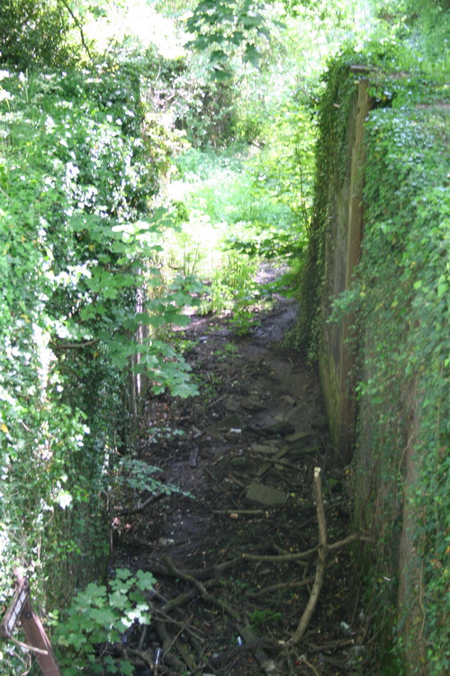
Admittedly there was the fall of about 100 feet to be overcome: that was done with eight single and three double [staircase pair] locks. The lowest section of canal, now called the Park Canal in Limerick, had two single locks; the central section, the Plassey–Errina Canal, had four singles and two doubles; the upper section, the Killaloe Canal, had two singles and one double.
Looking downhill from near the Canal Centre on the Fourteen Locks (Cefn Flight) on the Monmouthshire Canal
In south Wales, Thomas Dadford completed the main line of the Monmouthshire Canal, 12½ statute miles from Newport to Pontnewynydd rising 447 feet through 42 locks, in less than four years (1792–1796). Its extension, the 11-mile Crumlin Arm, which rose 358 feet through 32 locks, was completed by 1799; it included the Cefn flight of Fourteen Locks, a rise of 160 feet in 800 yards. Several tramways, linking to the canal, were also completed in that period.[1]
The locks are narrower than those on the Limerick Navigation, but not enough to explain the difference in completion times
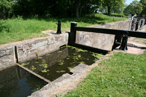
A dry lock chamber on the Cefn Flight
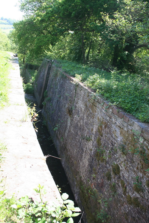
Narrower locks
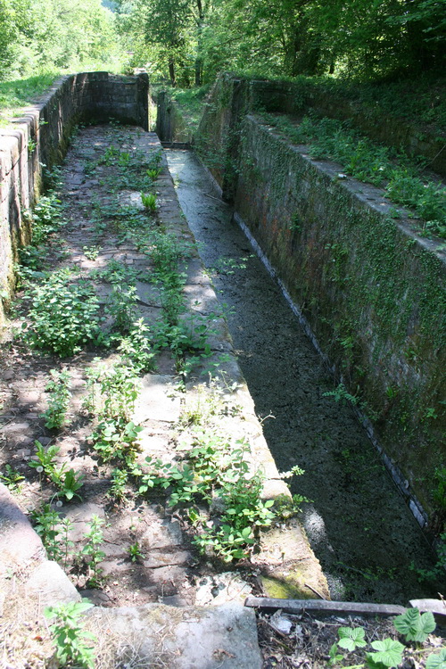
The shelf on the left has not, AFAIK, been officially explained. Could it be a dry dock?
Why, then, did Limerick take almost sixty years to produce a navigation that, even when it was finished, was often difficult and dangerous and, at times, unusable?
Sources
[1] en.wikipedia.org articles on Thomas Dadford and Thomas Dadford Jr, Fourteen Locks and Monmouthshire and Brecon Canal; Priestley’s Navigable Rivers and Canals on Jim Shead’s wonderful website. The Fourteen Locks also feature in the oeuvre (Too Sick) of Messrs Goldie Lookin Chain [NSFW].

