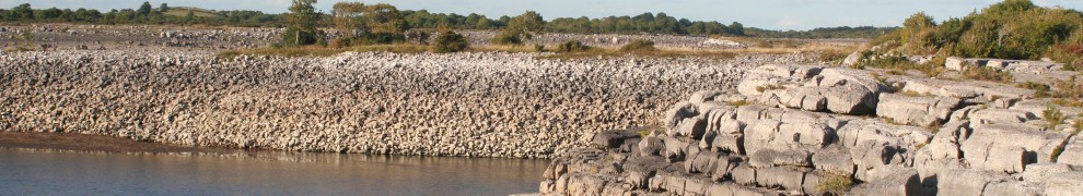
This is about some proposed canals — all to the same place – that were never actually built.
In 1803 the Grand Canal Company leased a coalfield in Queens County (Laois: just north of the Co Kilkenny border), in the hope of creating extra traffic for its canal. It planned to construct a branch canal from Athy, where the Barrow Line of the Grand Canal met the Barrow, and to have a tunnel into the coalfields that would help drain the mines as well as carrying coal. That scheme was abandoned in 1805.
Coal was sold at the pits: most of it was used in the area but some was carted, mostly to Athy, where the Company built a coal-yard. From there it was carried by canal to Lowtown, the junction of the Barrow Line with the canal’s main line. The Company built another coal-yard there, at what is now Lowtown Marine, from which coal could be carried east into Dublin or west to Tullamore or even to Limerick. Coal was also carted to Carlow and Leighlinbridge on the Barrow Navigation, and to Kilkenny. A small amount of the coal sent to Dublin went further: to America.

Lowtown Marine at the former coalyard
Places
The Grand Canal Company’s coalfields were at Doonane (which had been the site of the first steam engine in Ireland). In 1814 the engineer Richard Griffith, Inspector General of His Majesty’s Royal Mines in Ireland and Mining Engineer to the Dublin Society, wrote:
This bed of coal has also been worked to a considerable extent in the Doonane royalty, but the old colliery of Doonane has been abandoned since the year 1798. Subsequently, in 1803, the Grand Canal Company, (the present lessees of the royalty) discovered a detached bason [sic] of the coal on the lands of Boulavoneen, in extent about 60 acres. This colliery has now been worked seven years […].
Nearby, the Company established a village called Newtown, which is nowadays on the N78 road, south of Moscow and north of Geneva. The name Moscow appears on the Ordnance Survey map surveyed in 1906 but not on that of 1839: it refers to the area around a junction on the N78 (the road from Athy to Castlecomer and Kilkenny), a short distance north-east of Newtown crossroads, and seems to be regarded locally as a somewhat insulting alternative to Newtown.

Looking north-west from the open space at Moscow

The open space (Green Square?)

Looking south-west: the GAA grounds

Looking south to Newtown Cross
The suggestion on the Bilboa web page (Bilboa was another mining village) that the name reflected the proletarian militancy and class consciousness of the miners, inspired by the Russian Revolution of 1917, seems unconvincing to me, given that the name predates the revolution. Furthermore, the theory does nothing to explain the name of Geneva, further along the road, just before Crettyard and the county boundary. Are we to suppose that the miners in the Geneva pit were noted for diplomacy and international cooperation?
Here are some photographs (taken with the kind permission of the landowner) of the artefacts in a field just off the road on the Athy side of Moscow. I am guessing that the chimney-like object is an airshaft, but I don’t really know.

Airshaft (?) near Moscow

The stonework of the airshaft

Item in the same field as the airshaft

Base for a machine? Near the airshaft
The company also tried to drain the Corgee and Rushes collieries, found coal at Kilgorey and sank three pits (one of them drained by a steam engine) at the Moira colliery a mile south of Wolfhill.

The Geneva Stores, between Geneva crossroads and Crettyard

The Geneva Stores
The Grand Canal Company, in 1811, employed at its collieries one manager, one clerk and cashier and five other clerks, four overseers, an engineer and three engine men to look after the steam engine, four smiths and two helpers, two carpenters, two sawyers and a cooper, a storekeeper, a surgeon and twenty watchmen (the numbers of colliers and workmen are not stated).

This pub identifies the Newtown crossroads. The grid pattern of the roads, as shown on the early maps, can still be seen, but there are few reminders of the coal-pits

Newtown crossroads showing the R430 to Swan and Abbeyleix. Along that road, the first and second left turns go to Doonane
The coal
The collieries were on the Leinster coalfield, whereon Castlecomer — a short way to the south, in Co Kilkenny — was the main town. The coal produced was anthracite, called stone coal; it could not compete on price with the imported coal from Whitehaven and elsewhere, but it was highly valued for malting and was also used by smiths and in other rural industries. As Griffith wrote:
The principal markets for stone coal are Kilkenny, Carlow, and Athy. That brought to Kilkenny and Carlow is used in those towns, and their immediate neighbourhoods. The coal brought to Athy is chiefly sent by the Grand Canal to Dublin, Tullamore, and even by the river Shannon to Limerick. In distant places the coal is used only for malting, for which purpose it is peculiarly adapted, as it neither flames nor smokes. Stone coal is also shipped at Leighlinbridge on the river Barrow, for the supply of the Ross and Waterford markets. The culm or soft coal [slack or coal dust] of the Leinster coal district is chiefly used for burning lime, and for this purpose it is sent for by the farmers of all the surrounding counties, but particularly from the mountainous district of the counties of Wicklow and Wexford.

Could this (in Newtown) be from the mining era?

Or this?
The money
In 1813, a committee was appointed by the House of Commons to review the affairs of the Grand and Royal canal companies and the state of Irish inland navigation. It recommended a grant of £150,000 to the Grand Canal Company, but included this amongst the conditions:
That their Colliery shall be sold, and the sum it produces be applied, as soon as it can be disposed of at the fair value, to the liquidation of the principal of their debt.
In its first seven years, the colliery (and a farm) cost over £95,000 and earned revenue of just under £39,500. And even though, by 1812, its income was
nearly, if not quite, equal to the necessary expenses of their establishment, and the present interest of their debt
the committee felt that the situation was
too precarious to enable them satisfactorily to rest upon such a foundation, the substantial and extensive public advantages which depend upon the solvency of that Company.
The collieries were profitable, and only tolls (£22,457/17/8½) provided a larger income. However, the Grand Canal Company had borrowed money to buy the collieries and its total interest bill for the same period was over £32,000. Although the committee was complimentary about the Company’s current management, it was scathing about their predecessors:
They applied the funds placed in their hands for the maintenance and extension of their navigation, to speculations, which, however plausible in themselves, were remote from its concerns, and widely foreign to the principles of their incorporation.
If the collieries were profitable, it was not as a result of outstanding managerial competence. Richard Griffith was scathing about the Grand Canal Company’s efforts:
During the last twelve years more than 200 pits and boreholes have been sunk in the royalty of Castlecomer, and by the Grand Canal Company in the royalty of Doonane. […] The inconsiderate trials were made under the direction of a succession of English and Scotch coal viewers and agents, at the expence [sic] of the Grand Canal Company, who thus threw away many thousand pounds in sinking and boring for coal […]. Many fruitless trials for coal have been made in the days of ignorance by country gentlemen and farmers, in the strata beyond the outgoing of the lowest workable bed of coal; but within these twelve years none have been attempted, excepting by the Grand Canal Company. […]

South of Doonane, near Doonane Bridge, the old map shows Clogh Brewery, which may have been in the building on the right

Here is the rear of the building (photo taken with the kind permission of the current owner)

The brewery

The brewery
Working methods
Part of the problem was that the Grand Canal Company’s pits at Doonane were operated using old-fashioned methods:
The system of working that has been followed at these several collieries, is perhaps the most improper and expensive that could have been adopted. The appearance of the surface in every part where the coal has been wrought, bears a strong resemblance to a rabbit warren; there being a continued succession of hillocks and holes. Indeed the number of pits that have been sunk may justly be compared to the perforations in a cullender. […] it is to be regretted that in these times, when in England the art of coal working and mining machinery have been brought to the greatest perfection, that the Kilkenny collieries should have continued without any improvement in the underground workings, for the last hundred years […].

The church at Doonane

Cottages at Doonane
The miners seemed to proceed without sufficient understanding of the structure of the beds of coal. And they used a large number of shallow pits instead of a smaller number of deep pits, which could use machinery efficiently and which would require fewer watchmen. The Grand Canal Company’s methods were especially to be regretted:
I cannot help regretting that the Grand Canal Company should have commenced, and persisted in following the wretched system of the country, in their colliery on the lands of Boulavoneen, now called Newtown. This coal varies from 3 feet to 3 feet 4 inches in thickness, and is solid from top to bottom. The engine pit is 68 yards deep, and the shallow pits, to the rise, are from 25 to 30 yards. […]
This colliery, which originally consisted of about 60 acres of the best coal ever discovered in the Leinster district, has now been working seven years, and many pits have been sunk and wrought out, in which, as is usual, half the pillars have been left behind. Had this colliery been properly commenced, the whole of it might have been worked from the engine pit, enlarged to twice its present dimensions, and divided into three compartments, through two of which coals might have been raised by a winding steam engine, and the water through the third.
There are several much more extensive collieries at Newcastle on Tyne, worked advantageously from one pit, where the coal is nearly at the same depth below the surface as at Newtown, namely between 60 and 70 yards. But at Newcastle horses are used under ground to draw the coal to the pit bottom. Had this system been originally adopted, the quantity of coals raised per acre would have been much greater than at present. The expence [sic] of sinking the numerous pits, the erection of horse gins, and all the apparatus belonging to a pit, would have been saved, as also the whole of the horses at present employed at the different pits to raise the coal. Pillage would have been completely prevented by an enclosed yard round the pit, and instead of the present requisite number of watchmen, one would have been sufficient.
It would be endless to enter into any further detail of the savings that would have attended the adoption of the improved mode of working. I shall conclude by recommending strongly to the Grand Canal Company still to exert themselves to change the present wretched system, and if they attempt nothing else, at least a proper plan of ventilation might without risque [sic] be adopted, so as to prevent the necessity of sinking any new pits, many of which, on account of the depth, would be very expensive.
The non-existence of the canal

Clonbrock Farm, where the mine manager lived
Although the engineer John Killaly had
laid out a canal […] from the river Barrow, at Gore’s Bridge, by the city of Kilkenny, to […] Castlecomer
as well as another from Athy to Kilkenny, neither canal was ever built. There were also proposals for a canal from Monasterevan (on the Barrow Line) to Portarlington and Mountmellick, with a branch to the collieries and another to Roscrea (and with links to the Shannon near Birdhill and to the upper reaches of the Suir). But the Leinster coalfields never got a canal. In the summer of 1827 the Grand Canal Company began work on a canal from Monasterevan to Mountmellick, with a new aqueduct at Monasterevan to replace the old system of locking down into the river and up again on the far side. But this canal was not intended to reach Castlecomer: rather it was seen as part of a line to Roscrea.
At around the same time, the Grand Canal Company surrendered its lease of both its colliery and “a large tract of ground”; they were taken over by its former manager, John Edge, who attempted to collect arrears of rent due from various under-tenants. He also sacked 600 out of 800 colliers. The Company made no further attempts to develop Irish coal.
The photos
The photographs on this page are the product of a half-day drive around the area and by no means provide an exhaustive account of the mines or the surrounding area. I saw no notices or signs identifying any mining artefacts or calling attention to the area’s history, although Castlecomer Discovery Park, further along the N78, does celebrate the history of mining in the area. I was told that subsidence is a problem: that the ground does occasionally open up.


Hi Brian,
Have forwarded a link to this page to Dr Matthew Parkes of the Mining Heritage Trust of Ireland.
Ewan: excellent; thanks very much. I have written a somewhat more detailed (and footnoted) history of the GCC’s involvement in the coalfields, although I doubt if my account has anything that would be new to an expert in the field.
Errors on the page do not allow the entirety of the photos to show and some do not appear at all
Interesting history. One side of my husband’s ancestry is from the Wolfhill and Newtown area.
I am sending the site to relatives.
Joyce: thanks for your comments. The page loads OK for me. Could it be that the problem is the large number of photos? I have to confess, though, that I don’t know much about web pages; I’m using WordPress because it seemed to be simple and idiot-proof (the idiot being me).
I would be delighted to hear from your relatives, or anyone else, who could add to the information on this page, or correct any errors. In particular, I’d be glad to hear of any identifiable relics of the coal-mining days.
Thanks again for taking the trouble to comment.
I wonder if anyone has any information regarding Aerial Photography and/or topographical maps of the Doonane area past or present?
Relatives have been able to download all photos. It must be my service and the fact we do not as yet have a connection faster than dial up.
Jack
I’ve consulted the Ordnance Survey maps of (roughly) 1840 and 1910; I say “roughly” because (a) there is a difference between the date each area was surveyed and the date the map was published and (b) different areas were surveyed at different dates. I have a subscription to the OS that allows me to use those maps, but it does cost money.
Apart from Google and Microsoft, there are two other free online resources. One is the Griffith Valuation maps, done shortly after the first OS maps, and available online at http://griffiths.askaboutireland.ie/gv4/gv_place_search_form.php where you enter a placename and get a map in a pop-up window. I find that the map doesn’t always start with your placename at the centre, so you have to navigate around a bit, but maybe that’s just me.
The other resource is on the Ordnance Survey site. Go to http://shop.osi.ie/shop/ and press “Buy now” (but don’t worry: you don’t actually have to buy anything). Navigate your way to Newtown, and a bit north to Moscow, and zoom in as far as possible.
There should be a small box headed LOCATION INFO at the bottom left of your screen. If you can get to ITM Coords 660653, 680365 you should see a horizontal black bar. I think that is the shadow of the possible airshaft at Moscow, and you can take it from there!
Incidentally, I did ask Laois County Council if they had any information about the industrial heritage artefacts in the area, but they didn’t.
bjg
Thank you bjg . I neglected to notice that Joyce in an earlier email had left references also to other sources for maps. My Grandfather Tim Fennelly left Doonane in aprox. 1852 from Doonane to the U.S.A. and it has been reported due to the potato famine and the dismal prospect of having to spend his lifetime in the mines. Instead he settled in Wisconsin in a log cabin after being blinded during his service in the Union Army during the Civil war and preceded to sire sixteen children, thirteen of which lived past childhood. Still gathering information with fellow members of Finley-Ireland on our Yahoo users group.. And I will be interested in following this site.
“California” Jack Finley
Jack: I don’t blame your grandfather for leaving! I don’t know if you’ve seen the comments in Lewis’s *Topographical Dictionary* (1837) about the working conditions in the Kilkenny coalfields (of which Doonane and Newtown were a northern extension, just over the county boundary). Lewis wrote:
Wheaten bread is the principal food of the colliers, which they take with them into the pits; their earnings are generally consumed in the purchase of spirits, whence it happens that, though their wages are higher than those of other workmen, they are the most wretched class in the county. Their habitations are miserably mean, being generally built and covered with sods, sometimes without chimneys or windows; their children naked, themselves ill clad and unhealthy, few arriving at the age of fifty. A consumption of the lungs is the most fatal disorder among them: those who work in wet pits live longest, as they do not inhale so much of the volative dust of the coal.”
Later, in writing about Queen’s County [Laois], he says: “The coal at Newtown and Doonane is equal to the best Kilkenny coal, and sells at 20s [shillings] per ton at the pits; that of the other collieries, though somewhat inferior, never sinks below the price of 17s per ton. Hence the poor people, even in the immediate vicinity of the pits, cannot afford to use it […]. ”
bjg
hi, the photograph of the derlict cottage down a lane at newtown has only been derlict about 20 years. and yes that lane would have been associated with open cast mining hence the name of the the lane is engine street as there was a lot of mining machinery in operation and a lot of mining cottages.
Nicola
Thanks very much for that information. As you can see, I don’t know very much about the area: only what I learned from some old books and maps and from a single visit. So information like yours is very valuable and, if you can add any more, I would be very grateful. I was sorry to see that there is little in the area to call attention to its mining heritage: a casual visitor, who didn’t know there had been mines there, could end a visit without being any the wiser.
bjg
Did you know that ” an item in the same field as the airshaft was the site of a shrine to Our Lady erected by the miners to mark the Marian Year in 1954. When ” Hollypark” mine closed the statue was moved to a site near Newtown School. I remember as a boy watching miners coming up from the mine and kneeling and praying at the shrine before they went home. JOR
No: I didn’t know that. I’m not from the area, so all I know is what I managed to read about it and find on a quick visit. So I very much welcome extra information like yours, and if you can add any more I’d be very grateful. While the Castlecomer fields are well known, the history of the Newtown area seems to be less so, and there is little on the ground to show that history to the visitor. So I’d be happy to add any more information that anyone can provide. bjg
Great site and information. My ancestors came from Doonane (Dempsey) and Clonbrock (Daley) in Laois and Moneenroe (Tierney and Ryan) in Kilkenny. They all came to the USA to work in the anthracite coal mines of Pennsylvania. I notice that these villages are all within a “stones throw” of one another.
Thanks, Tom. Interesting that they stayed with the anthracite when they went to the USA.
Just in case anyone doesn’t know, Castlecomer has a Discovery Park with material on the mining industry in the area. It’s further south than Doonane, and worth a visit.
bjg
This site is very interesting for anyone interested in mining past and present
http://spatial.dcenr.gov.ie/ExplorationAndMining/SpatialViewer/index.html
It’s a full zoomable mineral map of Ireland available on Minerals Ireland website.
Very nice: thanks for that excellent link. bjg
The item posted by Jimmy O Reilly about the shrine I remember been there as an Alterboy with Jimmy when it was blessed in 1954 brings back lots of memories
My husbands grandmother came from Crettyard. Her family lived in geneva house in the early 1900’s and ran a post office, general store and bakery at the side of the house. We visited in June this year and saw the house just as in your picture. My husband used to holiday there as a boy. Family were Smiths. They still lived there til quite recently when last family member died in about 2005. Clare Smith lived to be 103 and is buried in Collier’s Church in Doonane.
Thanks, Joan. I am always glad to learn more about this fascinating and under-appreciated area. bjg
Very Interesting article.
I used to live in that house near Moscow opposite the football ground. My father told me it was called Moscow because there were houses there that burned down very early last century, the ruins/foundations of which were/are still in the fields beside the house, and someone compared it to what was happening in Moscow at the time. I took this to be the 1905 revolution but…
The areas east of our house had ruins in it too, as had the old football field that was opposite and slightly east of the existing one. An old track perhaps five meters wide led South from this area down to a ford across a small river – The Stripe – about a kilometer away. This was a very obviously man made and well worked. It included a covered drain channel I seem to remember and I often wondered about its purpose.
Also, across the road from the house, in the field that is now split by the football pitch, were three small opencast mines.
By the way, I never heard that Moscow was an insulting term for Newtown (Or not to my face anyway!) and they were separate places in reality. It was the small area from our house, but not including our house I was told, down towards Hollypark where you took the photos of the shaft and shrine.
My grandfather, and father very briefly, worked in the local mines.
Thanks.
Thanks very much, Liam. I’m very glad of the extra information you have provided about the area: I’m conscious that I’ve only scratched the surface. bjg
Hallo Brian
My name is Raymond Glenn Brooks, known as Greg, retired professor of education, University of Sheffield.
In the photo you’ve labelled ‘Looking north-west from the open space at Moscow’, the house was the home of my grandparents, Edward McDarby and Anne McDarby nee Murphy. My mother, Mary Brooks nee McDarby, was born in that house in 1911 and I believe some (but not all) of her seven siblings were also born there. My mother came to England in about 1927 to get work, and married here.
My grandfather, his father, William McDarby, and his father-in-law, William Murphy, were all coalminers, and my mother’s two brothers who survived children (a third died as an infant), William McDarby and James (Jim) McDarby both worked in one or other of the Newtown/Doonane area mines when young, and had the small blue scars on their hands to prove it.
On a family visit to Laois in 1957 I was standing with my uncle Jim at the drift entrance to one of the pits when we heard blasting from underground. I believe the pit had closed by the time of our next visit, in 1961.
Next time I’m over I will make a point of visiting the exhibition in Castlecomer, and searching out the ruins you show.
Many thanks
Greg
.
Thank you: that is very interesting. I know very little of the area’s history after the Grand Canal Company ceased its involvement, and that was about 200 years ago. I had not realised that mining continued until the 1950s.
I wonder whether there is a published history of the mines. bjg
Hi, there is now a local museum open in Crettyard “Wallaces Vintage Museum”, it is run by a local farmer and contains lots of local mining and general artifacts. Very interesting to visit it and they will give you a guided tour. I don’t have a contact number but I think they have a Facebook page or you can just call down to the farm located at Geneva Cross about half a mile towards the back road to Doonane Church. The farm house was once part of the Edge’s estate which owned most of the mining rights in the Mayo/Doonane area. Nicola
Thank you for that. Although Willie Wallace and his museum are mentioned in several places on tinterweb, I haven’t been able to find a website or contact details. If anyone reading this can supply them, please leave a comment below. bjg
087 691 3250 & 087 281 9157 clonbrockmuseum@hotmail.com – these are the contact details for clonbrock museum.
Thank you very much indeed. bjg
Pingback: Edge family of Clonbrock House, Laois | History Exploration with Niall
When John Edge sacked the bulk of the miners it led to a disturbance and murder of the pit manager Thomas Potts——Google—- Potts Murder Edward Delaney and see an interesting article and song in an Australian newspaper from about 1840
Thank you. bjg
Hi John, I’ve tried looking up the murder of Thomas Potts but can’t seem to get any info on it. Is there a link on the Internet available. Thank you. Nicola
Pingback: Mills on the Barrow | Irish waterways history
a friend has all the details, court cases , the songs and the story , met him in Spink and he told me he was going to put it in a book