This is another case of a watercourse that may or may not be a canal. It is referred to locally as Conway’s Canal, perhaps because it’s on land owned by a Mr Conway. And it is possible that part of the watercourse was used for carrying in small boats. However, I have found no evidence to support that suggestion.
Lewis’s Topographical Dictionary of 1837 includes this:
KILTONANLEA, or DOONASS, a parish, in the barony of TULLA, county of CLARE, and province of MUNSTER, 7 miles (S. S. W.) from Killaloe, on the road to Limerick, and on the river Shannon; containing 4061 inhabitants. It comprises 6595 statute acres, as applotted under the tithe act, mostly in tillage. Limestone, in which marine shells are found imbedded, is quarried near Clonlara and chiefly burnt for manure: there is some bog. A branch of the Shannon navigation, about four miles in length, passes through this parish, to avoid the falls of Doonass between Limerick and Killaloe, and affords a daily communication by steam and other boats with those places. At Doonass are extensive bleaching establishments ….
And of Castleconnell, Lewis says:
CASTLE-CONNEL, or STRADBALLY […] River Lawn, a mile below the town, is an extensive bleach-green and mill ….
Doonass is on the Co Clare side, and Castleconnell on the Co Limerick side, of the real Shannon: the stretch of river that lost most of its water when the hydroelectric power-station at Ardnacrusha was built in the 1920s. Here is a Google aerial photograph.
Assuming all the URLs and suchlike work properly, you should be able to see the River Shannon flowing from the “flooded area” below Killaloe down to Limerick (marked A) at the head of the Shannon Estuary. North of the river, you should be able to see the course of the headrace and the shorter tailrace for the power-station.In between, you may just be able to see the faint line of the old Plassey–Errina Canal, part of the pre-Ardnacrusha navigation from Limerick to Killaloe. Doonass is on the island between the headrace and the river; Castleconnell is south of the river, near where it makes a large right-hand bend on its way downstream.
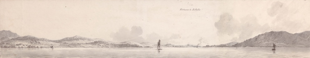
The Falls of Doonass
Nowadays, the real Shannon gets the first 10 cubic metres per second of water; Ardnacrusha gets the next 400; if there’s anything left over, it is sent down the old route. But before Ardnacrusha, the entire force of the river came down past Doonass and Castleconnell. T O Russell wrote in Beauties and Antiquities of Ireland (Kegan Paul, Trench Trubner & Co Ltd, London, 1897):
No lover of the beauties of nature should be on this part of the Shannon and not visit the great rapids of Doonass. They are only about ten miles below Killaloe. If seen when the river is full they are the grandest thing of their kind in the British Isles. The Shannon here looks like a continental river, containing ordinarily a volume of water greater than any river in France. The country round Doonass, though flat, is superlatively beautiful. The limpid, rushing river flows on among meadows and pastures of the brightest verdure, adorned with stately trees, and bright in summer-time with innumerable flowers. There is nothing terrible or awe-inspiring about Doonass. It is quiet and peaceful in the true sense of the word. Even the great rushing river, as it glides down the gentle slope of the rapids, makes no noise except a deep, musical murmur that would lull to sleep rather than startle. The rapids of Doonass form a scene so incomparably lovely, and so unlike anything to be seen in Great Britain, or to be seen in any other part of Ireland, that it is a wonder they are not better known. They can be reached best from Limerick, being not over three miles form that city. One of the most curious things about those grand and beautiful rapids, is the almost total ignorance which exists about them, not only in Great Britain, but in Ireland itself. If they were situated on a wild, hard-to-be-got-at part of the Shannon, the general ignorance that exists about them among seekers after the beautiful, would not excite so much wonder. A scene of such great beauty and uniqueness, so near a fine and interesting city like Limerick, to be so little known to those who go so far in search of the beautiful, shows how much the world at large, and even the Irish themselves, have to learn about Ireland. If the rapids of Doonass were in England, or even in the United States, there would be not only one, but perhaps three or four hotels on their banks — hotels which would be full of guests every summer. Let us hope that the beauties of this charming place will be soon better known.


A nineteenth-century view of the Falls of Doonass (W H Bartlett)
But while Russell, amongst others, drew attention to the scenic character of the falls of Doonass, and anglers visited them to catch salmon, some more prosaic folk realised that the power of the water could be put to work. It was not until the twentieth century that the Ardnacrusha power-station drew on the full power of the falls, but their potential was realised rather earlier. Robert Dennis in Industrial Ireland: a practical and non-political view of “Ireland for the Irish” (John Murray, London, 1887) wrote:
[…] at the falls of Doonass, between Killaloe and Limerick, there is an average available force of water of 33,950 horse-power for the 97 feet of fall, in continuous action day and night […]
Dennis seems to have taken the figure, and the phrasing, from Robert Kane’s The Industrial Resources of Ireland (Hodges & Smith, Dublin, 1844). And earlier still, in Volume II of The History, Topography, and Antiquities, of the County and City of Limerick; with a preliminary view of the history and antiquities of Ireland (George McKern, Limerick, 1827), Fitzgerald and McGregor quote an unnamed “highly intelligent gentleman, deeply interested in the promotion of the manufactures of Limerick”, as saying:
It would be most desirable to see the noble falls of the Shannon applied to such purposes [spinning cotton], by which the national prosperity would be promoted; and these falls must always be considered as rendering the neighbourhood of Limerick most advantageous for a cotton manufacture ….
Fitzgerald and McGregor themselves write:
The falls of Doonass and Hermitage, are some of the finest in the United Kingdom — here the whole Shannon is impelled with tremendous force and deafening noise over a succession of craggy limestone-rocks, down a descent of 55.5 feet, in about half a mile, and this spot is perhaps unequalled in its situation, and water-power for mill-sites, and almost unrivalled in its picturesque beauties — here the sublime and beautiful are united, and the lovers of nature may revel in scenery congenial to their various tastes — here are assembled the foaming cascade, the rushing torrent, the boiling flood, the craggy rock, the gently swelling lawn, the frowning cliff, the retiring vale, the wooded hill, the noble mansion, and the peaceful cottage embosomed in woods — here is the spot for those who love to study or enjoy nature, where the poet, the philosopher, the sentimentalist, the engineer, and the sportsman, may alike find food for the mind and body. Although it may be difficult to calculate the strength of these fine falls for the purpose of driving machinery, yet we have been informed, that in middling water the upper fall alone is equal to one thousand horse power, (in winter perhaps double this,) and would be adequate to driving six or seven cotton factories of one hundred and fifty to two hundred horse power each, or two hundred pairs of mill-stones for grinding corn. Is it not marvellous that this vast body of water has been allowed to spend its great powers on the rugged rocks and run uselessly here for ages, when we consider the immense sums spent annually in England and Scotland for the moving power in factories, which could be had here for one-twentieth part of what it costs in England for a steam engine and coal to work it?

Another nineteenth-century view
But the vast body of water didn’t run entirely uselessly: there was one enterprise that used the “great powers” of this stretch of the Shannon, and it may have been in operation from as early as 1760.
Hercules Browning or Brownriggs
According to Patrick J O’Connor “The Promotion of a Limerick Linen Industry: 1760–1763” Old Limerick Journal No 26 Winter 1989,
[…] the linen trade was being actively promoted in areas outside Ulster. The initiative came from landowners interested in developing their estates and from merchants eager to exploit new lines of activity. A congenial climate had been created by a growing body of literature on the benefits of the linen manufacture while encouragements of a more tangible kind were provided by the Dublin Society, the Linen Board and, from the late 1750s, parliament.
Mr O’Connor quotes the reports of Robert Stephenson to the Linen Board. They show that, in 1760, one “Her. Browning, Limerick” was amongst the applicants for the Board’s three premiums. And Mr O’Connor shows that
Hercules Browning still upheld his connection with the linen trade in 1769 when Ferrar enters him as a linen bleacher at Main Street, Englishtown [Limerick].
In 1787 Hercules Browning Esq was one of the subscribers to J Ferrar’s History of Limerick. And in 1793 Mr Browning was one of those who …
for and on behalf of themselves and several other persons who now have and shall hereafter subscribe towards completing the navigation of the river Shannon […] presented to the [Irish] House [of Commons] [a petition] setting forth, that by an act of Parliament passed in this kingdom in the twenty-seventh year of his present Majesty’s reign, intitled, An act for the directing the application of the funds granted by parliament for promoting and carrying on inland navigation, the several persons therein particularly named, were constituted and appointed commissioners for managing, repairing and governing the navigation of the river Shannon […]
… and that they hadn’t done a very good job, so that Mr Browning and his friends should be incorporated by act of Parliament as the Shannon Navigation Company and allowed to get on with the job. The petition was ordered to lie on the table.
The Limerick City Museum has several documents related to Mr Browning. They include his deed conveying property at Summerhill, Co Clare, and Bleach Yard Farm, to Sir Hugh Dillon Massy, Bart, on 1 October 1789.
An online genealogical discussion between Louise Harrison and Mike Caswell in March 2004 says that Mr Browning opened a bleach-mill at Doonass in the 1760s. A booklet about family history is mentioned:
The author refers to a bleaching mills operated by Herculus Brownriggs (who signed all his legal documents Hercules Brownriggs but traded under the name Hercules Browning), who, he states “settled many of his new employees in “Kildorras” and next door in Coolisteige, surnames like Caswell ….. all surnames with origins in Co. Down, Louth and Antrim”.
The Clare Journal of 3 April 1820 has a notice about the bleach-green at Doonass, signed by John Massy, Proprietor, and saying that
….. Linens, Diapers, &c. &c. left at the following Offices, shall be Bleached on as moderate terms as any other Green in Ireland. From the local advantages attending the Concerns, the Proprietor hopes as usual, to give general satisfaction.
The “following offices” are Mr E O’Shaughnessy, Ennis, Mr John Kain, Kilrush, Mr Hurly, Six-mile-bridge and Mr Thomas Sheahan, Killaloe.
Finally, the Ordnance Survey map of 1840 shows the bleach mill. Here is a modern Google aerial photograph.
The bleach mill today
It must be remembered that the volume of water flowing down the Shannon, past Doonass and Castleconnell, is very, very much less than it used to be. Furthermore, the bed of the river has been altered to assist either salmon or anglers: many of the thin islands in the river are of recent manufacture, designed either to force the salmon into certain paths or to allow anglers to get at them.
Castleconnell is on the right of the photo; Doonass is on the left. You can see a double line of trees leading in from the river at the upstream (north) end and staying fairly close to it: that’s the intake to the bleach mill.
This is the upstream end of the inflow to the bleach mill, with a breach on the right leading back to the river.

The inflow at the upstream end
This is a view across the river from the upstream end of the intake.

The far side of the river opposite the intake point
This is the intake canal itself.

Looking upstream along the intake canal

Looking upstream towards the intake point with the canal on the left

The walled garden on the other bank may have belonged to Rose Hill House

Roughly where the bleach mill stood

Stone removed from the canal during fisheries improvement work
The 1840 map shows the intake canal in blue, leading to the bleach mill buildings. One of them was shaped like an L lying on its back (rotated 90 degrees anticlockwise); the short arm spanned the canal and probably housed the millwheel. Just west of it is a second, smaller, rectangular building, its short end touching the river bank. To the north is Waterpark House; Summerhill House is to the south-west.
The map also shows a T junction in the canal, just downstream of the mill. A short arm rejoins the river; a much longer arm, marked “Mill Race”, travels much further before it too flows back into the Shannon. The two arms separate at this pool.

The pool, from which there are two outlets

One outlet, known locally as “the tunnel”, is under the greenery on the left, the other on the opposite bank

The tunnel, the shorter outlet

Stonework on the tunnel
The tunnel is very short. Here is the water flowing out at the far end.

Water flowing out of the tunnel to rejoin the Shannon

Stonework at the outlet

Provision for stop planks? Looks like concrete

Back at the pool, looking towards the long-distance outlet

Greenery obscuring the long-distance outlet
Brambles and other vegetation made it impossible to follow the longer arm. However, we were able to see it where a small bridge crossed it, close to Waterpark House.

Waterpark House

Upstream side of the bridge to Waterpark House

Wall upstream of the bridge

Downstream side of the bridge

Underneath the arch(es)

Stonework along the long-distance outlet immediately below the bridge 1

Stonework along the long-distance outlet immediately below the bridge 2

Stonework along the long-distance outlet immediately below the bridge 3

Stonework along the long-distance outlet immediately below the bridge 4
We were struck by the amount of stone, and thus the expense of construction, in this longer arm. We wondered why it was built, why it was so long and whether it might have been intended to carry goods in small cots: perhaps they carried bleach to bleach-greens (including the one in Castleconnell, as mentioned by Lewis). But we have no evidence. At the bottom of this page, I report a discussion with Fred Hamond, who knows about mills (and much else).
Again, the vegetation made it impossible to follow the longer arm, but you can see it in the Google aerial photograph, running west at first and then curving south in its double line of bushes. When the greenery dies back in winter, it might be possible to follow the route, but as it was we had to take the riverside path back to Castleconnell.

The path towards the mill
There is one place along the way where low walls meet at a T junction. I don’t know what they were for.

The stone walls 1

The stone walls 2

The riverbank route towards the mill

The long-distance outlet runs behind the hill with the nut grove on it

The outlet is in the trees on the far side of the field

The long-distance outlet rejoins the Shannon

The bridge just above the confluence with the Shannon

Stonework

The lower outlet rejoins the Shannon amidst the trees. This photo was taken from the far side of the river
The confluence is just below the point where the ferry once operated (nowadays there is a foot-bridge across the river) on what is nowadays a relatively flat bit of the river. Is that significant? I don’t know.
Fred Hamond says that the long arm is long (about 750m, almost half a mile) but that there are other long ones: the required length depends on the gradient of the river and the risk of backwatering. It’s hard to say what the depth of the river was before Ardnacrusha was built, let alone what it was like in 1760. We do know that there was a large variation in water levels on the Shannon between summer and winter (ten feet of a difference at Killaloe), and it struck me that the provision of two tailraces might have been intended to cope with very different summer and winter levels.
I would welcome Comments on this (see below): anything that might cast light on the Mystery of the Second Tailrace.
Here is a page about the River Lawn bleach mill (and other delights at Clareville), about a mile downstream of Doonass and on the other bank.


very very interesting keep up the good work brian
Thanks, Sean.
bjg
bjp:
not sure why there are 2 separate outlets from the pool, but it is certainly the case that during heavy floods (which would have been much more common pre-Ardnacrusha), the long millrace gets heavily flooded, and flows across the fields in front of Waterpark house. The low walls you mention meeting in a T junction are the only part not submerged at these times, so they may have been a flood break, or just a Ha-Ha between Waterpark and Summerhill Demenses.
A more intriguing feature of the long mill race, which you missed in your photos, is that there are in fact 2 parallel tunnels from Conway’s canal to it. The entrance to the second (nearer to the river) is bricked up to about 12 inches from the arch roof at the entrance, and is so overgrown it cannot be easily seen. Likewise the exit into the mill race is also overgrown, but this end is not bricked up, so if you were daring enough, you could wade or canoe into it. I have no idea why it is blocked up, but it is obvious the wall at the tunnel entrance is very old, so not a recent construction.
Interesting article though, keep it up!
Thank you bjg for a beautiful article. I am in Australia researching my family history and nothing else has given me such a feel for the area. Thank you, George
Thank you. bjg
Pingback: Relieving Athlone | Irish waterways history
Pingback: Why the Shannon floods | Irish waterways history
Thank you so much for your blog. Have recently returned from Co. Clare and visited Doonas to try and find where my family came from. My husband and I fell in love with the place and can’t wait to return. Absolutely would love to walk in your shoes when we do. My family name is Purcell/Lawler. Regards Karen
My name is Berkeley Vincent V and my family lived at Summerhill for a very long time before the property was demolished in the 1930s. I have been searching for many years for photos of the property but have had very little luck. Can any readers help?
If anyone can help, leave a Comment below and I’ll put you in touch with Berkeley Vincent. bjg
Have you seen this one [PDF; see page 10]? bjg
My great grandfather John George worked as coachman for Colonel A.H.Vincent from about 1884 to 1911 when he moved to Muckross, Killarney as Farm Manager for Arthur R. Vincent and his wife. My grandmother and her siblings grew up at Summerhill. I should have a photograph of the house which was given to me by my cousin – I just have to locate the original amongst my notes! However I have taken a photocopy of it and can send it to you. I am researching my family history and would love to know more about the house and it’s surroundings. Summerhill also features in ‘Houses of Clare’ by Hugh W.L.Weir where there is another picture of the house shown. Joan Cafferkey
I’ve emailed Berkeley Vincent to let him know about your message. Is is OK with you if I give him your email address and put the two of you in touch with each other?
bjg
Thanks so much for the connection, I look forward to future correspondence! Many, many thanks again…
Berkeley
Dear Berkeley, Summerhill House was not completely demolished. My name is Mary and I lived in the remains of Summerhill House for the past 25 years I sold it 3 weeks ago in August 2017. I have photos of Summerhill House, I can scan them and email them to you if you wish. We had a visit from Arthur Vincent’s son Billy and his French wife
a no of years ago and he brought really nice family photos with him.
I have emailed Berkeley to bring your kind message to his attention. bjg
Hello Mary Caffrey. I have written several times to the email address provided but as yet have not heard anything from you. I’m afraid perhaps my emails are lost in your spam folder. Should you come across this thread again please feel free to reach out. Thank you so much!
Interested to read – thankyou and also to hear from a descendant of Berkeley Vincent. I am researching the family of John O’Donnell who I have located in Griffiths Valuation as one of several farmers at Summerhill, tenants of Berkeley Vincent, in 1852 and also of John Quinn. John O’Donnell, wife Julia Galvin and children emigrated from Ireland to Victoria, Australia in 1853. We’ve only recently been able to decipher the Townland on immigration documents which they always gave as ‘Duness’. A daughter named her home at Camden in NSW ‘Summerhill’.
If anyone knows any more about this O’Donnell or the farming at Summerhill, I’d be delighted to hear
thanks.
Jane
Thanks. If anyone provides any information I’ll let you know. bjg
Hi Jane, since my initial request for information I have been lucky enough to obtain some images of Summerhill, and even a bit of the surrounding countryside. I have also been able to obtain information regarding the reason for its later demolition, if that would be of interest to you. I would be happy to provide any of this information via email.
Berkeley
I will pass your email address on to Jane. bjg