The River Barrow trackway [towing-path] starts at St Mullins, at the tidewater, on the east (left) bank, crosses to the west (right) at Leighlinbridge, crosses back again at Graiguecullen/Carlow and then, via the horse bridge at Athy, crosses once again to meet the Barrow Line of the Grand Canal on the west bank. I do not know why the Barrow Navigation Company decided to cross the river like that.
Furthermore, I don’t know how it worked. The problem has, I think, two aspects at two places, Leighlinbridge and Carlow.
Leighlinbridge
At Leighlinbridge, going upstream, the trackway crosses from the east (left) bank to the west (right).
![Leighlinbridge [OSI ~1840]](https://irishwaterwayshistory.com/wp-content/uploads/2015/03/leighlinbridge.png)
Leighlinbridge [OSI ~1840]
![Leighlinbridge [OSI ~1900]](https://irishwaterwayshistory.com/wp-content/uploads/2015/03/leighlinbridge-later.png)
Leighlinbridge [OSI ~1900]
I’m not clear how a horse-drawn boat would move between the quays above and below the bridge on the west bank: from the photos I’ve found online, I don’t think there was horse-headroom under the westernmost arch. Perhaps ropes and manhauling? That puzzle remains both for through-traffic and for boats loading or unloading at the malthouses below the bridge.
The second aspect is the strain on horse, rope and harness if it was walking across the bridge with a boat, subject to the full force of the stream, hanging out of it. On the Black Bridge at Plassey, where the same thing happened, the ropes wore grooves in the stone of the parapet and their marks can also, I believe, be seen on the ironwork. I don’t know anything about how the system worked: whether anything was done to reduce the strain. One possibility that struck me was that a very, very long rope might be taken to a halfway point on the bridge, and that the boat could do a ferry glide to the far bank; another was that an even longer rope could be taken to the far bank and the boat could be steered or hauled over.
And, going downstream, did a boat simply shoot the bridge and steer for the east bank, there to pick up the trackline?
Clearly the operators of horse-drawn boats had some system or systems, but it would be nice to know what they were.
The force of the current
In 1845 Loughlin Freeman of Waterford was (at least according to himself, in a letter to the Freeman’s Journal [no relation] of 11 March 1845) the principal carrier on the Barrow. According to I Slater’s National Commercial Directory of Ireland: including, in addition to the trades’ lists, alphabetical directories of Dublin, Belfast, Cork and Limerick. To which are added, classified directories of the important English towns of Manchester, Liverpool, Birmingham, Sheffield, Leeds and Bristol; and, in Scotland, those of Glasgow and Paisley. Embellished with a large new map of Ireland, faithfully depicting the lines of railways in operation or in progress, engraved on steel [I Slater, Manchester, 1846], Freeman served Carrick-on-Suir, Clonmel and Waterford on the Suir, Inistiogue on the Nore and New Ross and Graigue[namanagh] on the lower reaches of the Barrow. According to his letter, he sent boats all the way up the Barrow to Athy and had stores both at Waterford and at the Grand Canal Harbour in Dublin.
His letter suggests that a single horse was enough to tow a boat down the Barrow but that up to eight horses were needed to haul a boat, carrying forty tons, up the river, at a cost of fifteen shillings per horse.
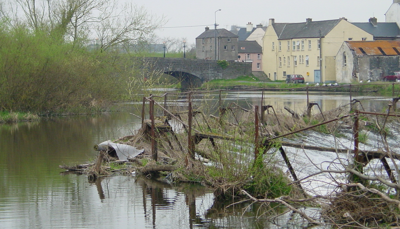
Carlow
I find it even more difficult to work out how horse-drawn boats got through Carlow. The 6″ OSI map shows the layout.
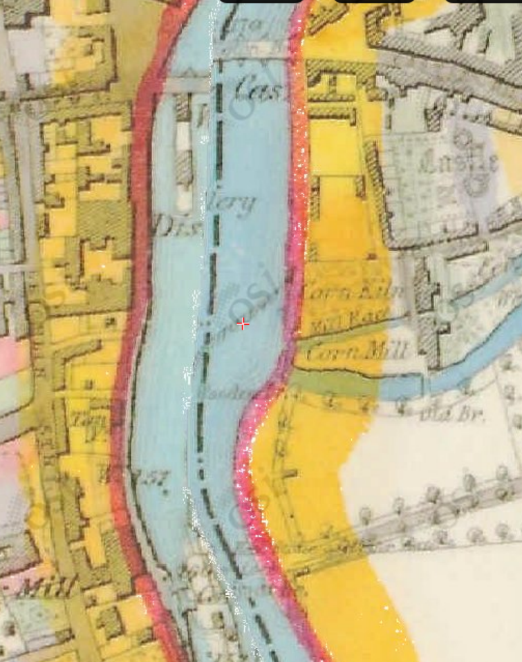
Carlow [OSI ~1840]
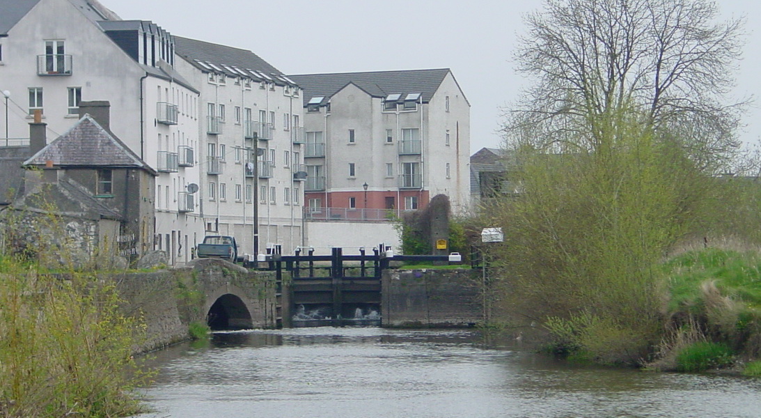
Carlow lock from downstream
Leaving Carlow lock with the weir on the right
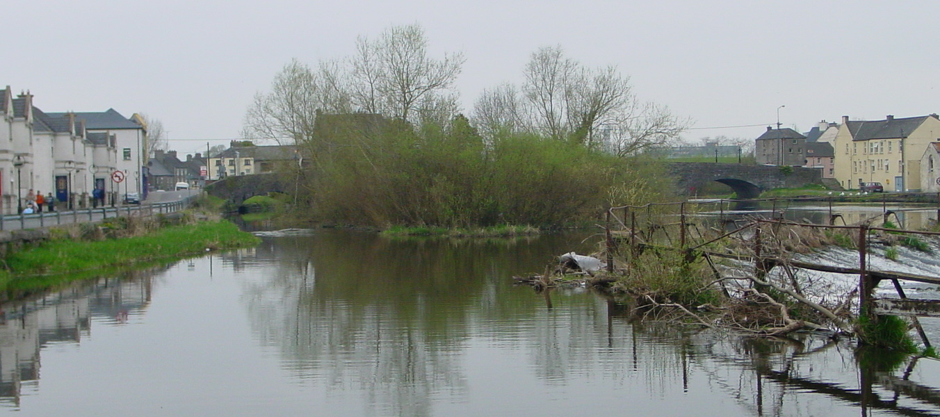
The navigation arch is the closest to the east bank, so boats must cross the top of the weir
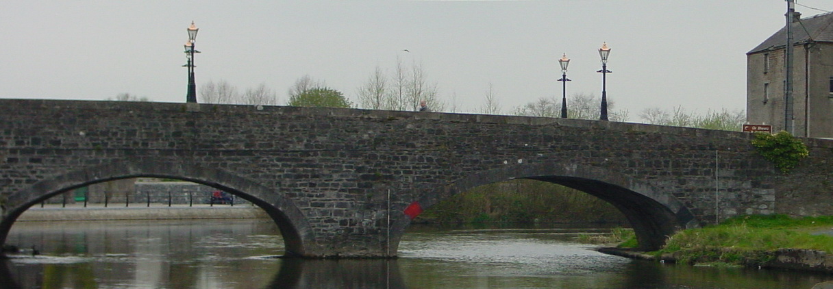
The navigation arch with the trackway under it
The route is marked in red on the map below. Clearly, the route is suitable only for motor-powered boats: a horse-drawn boat could not use it.
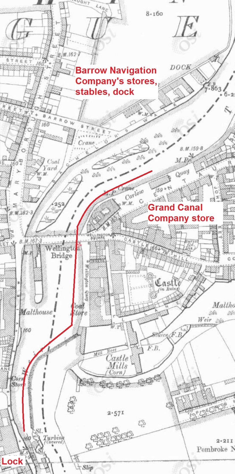
Motor-boat route through Carlow [OSI ~1900]
Looking downstream towards the bridge
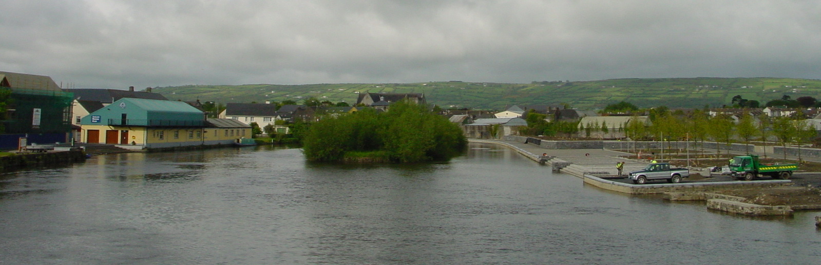
The Barrow Navigation Company’s dry dock being excavated
It seems to me that, with buildings on the peninsula below the bridge, horse-drawn boats could not have got tracklines on to the bridge and they could not have used the current navigation arch. I suspect therefore that they must have used the westernmost arch, especially if they were going to the Barrow Navigation Company’s premises. But that leaves two puzzles:
- how were they hauled through the arch? There doesn’t seem to be a trackway under it, although I’m not sure about that. It may be, again, that ropes could be dropped down through the bridge to allow the boats to be hauled up
- having berthed and been loaded or unloaded at the BNC premises, how did they cross the river to the trackway on the east bank? Or how did downstream boats cross the river to the BNC quay? Ferry-gliding might again be the answer.
But it would be nice to have some evidence of how things were done rather than speculation about how they might have been done. To the boatmen of the time, these operations were probably everyday affairs not worth recording, but perhaps some curious bystander wrote an account.
![]() [wse/bar41]
[wse/bar41]


I was wondering how horse drawn boats were hauled under the bridge at Craiguenamanagh. There is a clue in rope-worn grooves in an upright stone at the entrance to the towpath on the north side of the bridge. This suggests that the horse was still hauling the boat as it walked up and across the road, but clearly the boat must have been detached at some point.
One possibility is that boats were man-hauled. I have been told that was done at Carrick-on-Suir, which has a variant of the same problem: the navigation arch is on the south bank but the towing-path above the bridge is on the north. Furthermore, the quays are below [east of] the bridge, again on the north bank. So a boat that loaded at the quays, and was bound upstream for Clonmel, had to cross the river to the south side, get through the navigation arch, then re-cross the river to the north bank. I was told that large numbers of men were employed, with a rope down through the arch from the south-west bank and perhaps other ropes used too.
I have also been considering how the trackline or tow-rope was detached and reattached for boats to pass under Kennan Bridge at Porterstown on the Royal Canal, where again the towing-path changes sides, but at least without a strong current to complicate matters.
There is much that we do not know.
bjg
I’m wondering if there is canal boats to live in in southern Ireland,
Only on canals and other bodies of water. If you want to buy one, apolloduck http://www.apolloduck.ie/listings.phtml?cid=4 has some for sale. Check with the owner of your chosen waterway [Waterways Ireland waterwaysireland.org owns the main navigations] before you put a boat on their water or use it for a purpose that might not be approved of.
bjg