The lead article in Vol XXX No 1 of the Department of Agriculture Journal (Stationery Office, Dublin, 1931, price one shilling and sixpence net) is entitled “Mineral Metabolism in the Pig and the Addition of Inorganic Mineral Supplements to the Pig’s Diet”.

The inclusion of that article was not why I rushed to buy the copy of the Journal that came up for sale recently. Nor was it the second article, “Field Experiments, 1929”. But the third — “Arterial Drainage with some reference to the River Barrow”, by J Chaloner Smith, DSc, MInstCEI, Engineer in Charge, Barrow Drainage, for the Commissioners of Public Works — seemed likely to be of interest.
In Ireland’s Inland Waterways: Celebrating 300 Years (Appletree Press, Belfast, 1986, 1992 and 2004), Ruth Delany writes:
Both the Shuttleworth Commission and the 1922 Free State inquiry highlighted the many defects of the [Barrow] navigation but no action was taken to remedy them and matters were made considerably worse in 1935 when a drainage scheme on the upper river greatly increased the problem of silting in the lateral canals and led to an even greater current in certain sections of the river. The Grand Canal Company eventually accepted £18,000 compensation and put a more powerful steamer on the river with winches on the shore at the places where the current was most severe, but nothing could be done to prevent silting.
Chaloner Smith’s article is about that very drainage scheme. The title verso page of the Journal says:
Any of the articles in this Journal may be reproduced IN ANY REGISTERED NEWSPAPER OR PUBLIC PERIODICAL without special permission, provided that the source is acknowledged in each case.
This website is not a registered newspaper, but I’ll pretend it’s a public periodical and acknowledge the Department of Agriculture Journal as the source of the text and photos provided here. The article is quite short, and very readable.
The Barrow Navigation
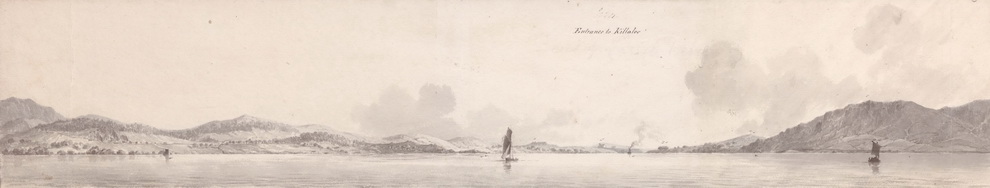
The Barrow Navigation runs from Athy, in Co Kildare, down to a sea-lock at St Mullins. From there boats can go downriver, on the tidal section of the Barrow, then up the Nore to Inistiogue or down through New Ross to join the Suir near Cheekpoint.
The Barrow Line of the Grand Canal links Athy to the Main Line of the Grand Canal at Lowtown; the Main Line runs from Dublin to the River Shannon (or vice versa).
Although Athy is the head of the Barrow Navigation, there was traffic on the river further upstream, including turf from the bogs around the Finnery River. The Ordnance Survey map of ~1900 even shows a lock in the mill weir above the main bridge (Crom-a-boo Bridge) in Athy.
![]()

Athy with canal on the left, River Barrow on the right
F E Prothero’s description
In August 1897 the indefatigable F E Prothero (Supplement to A NEW OARSMAN’S GUIDE. The Suir — The Nore — The Barrow — The Boyne by F E Prothero Esq, Rear-Commodore, Cruising Club Offices, London 1898) canoed up the Barrow from New Ross, reaching Athy in four days, then spent another day taking the canal up to Monasterevan and the Mountmellick Line from there to Mountmellick. Then he canoed down the Barrow back to Athy. He put the distance at 28¾ miles, which took him about 8½ hours. Here is his description of the Barrow between Mountmellick and Athy:
The Barrow here, and most of the way to Portarlington, is small (15 or 16 feet across at Barranagh’s Bridge), and in several places rather overgrown with bushes; but there was plenty of water, of a deep coffee colour, and a strong stream, though the sharp corners prevented any great speed. Below Portarlington it spreads out, but varies exceedingly in breadth; and, after Monasterevan, is everywhere a large river, though frequently split up by islands; and there was some trouble with rushes. […]
Now for Chaloner Smith’s photos of the drainage work. Captions are original, but in some cases I had to type them in because they were chopped from the scans. I have arranged the photos from upstream to downstream, but I am not entirely certain of some of the locations and would welcome correction.
Millgrove
Millgrove is to the north of both Portarlington and Monasterevin. It is on the River Figile, which flows into the Barrow just above Pass Bridge at Monasterevan.

Above Millgrove Weir, Figile River, untouched upstream.
Portarlington

Below Portarlington. In Mr. Odlum’s Demesne. Looking upstream.
Monasterevin
Pass Bridge is the old bridge upstream of the railway bridge and aqueduct.


Sallow Island is downstream of the town.


Ballymanus
I thnk Ballymanus is downstream of Vicarstown; further information welcome.


Bert

Toberara (Tobbera)
This is the site of a former church, graveyard and holy well, between Bert and Cardington.

Cardington
In 2011 the National Ploughing Championships will be held again at the Cardington estate, just north of Athy, between the River Barrow and the Barrow Line of the Grand Canal.

Cardington and Athy


Near Cardington House — No. 6 II Ruston in Boulder Clay.


Athy

Milford

Milford Weir (below Carlow) before Clearing
Wasn’t that fun?
[wse/bar10]


Fascinating pictures which I had never seen before. I grew up in Monasterevan in the ’40s & ’50s, fished the Barrow extensively and later kept a rowing boat on it during Easter & Summer holidays. I was always fascinated that there was a shallower area extending down the middle, effectively seperating Figile water from Barrow water for several miles downstream from the junction of those rivers, half a mile upstream of the Pass Bridge. It is now clear how this came to be.
Thanks, Thomas. Nice to have a field report! bjg
Thanks very much for the photos, the little 2ft gauge railways with side tippers, make for a very rare treat. Here is another place i never realised that used little railways as done by the Board of Works or was it the OPW by then.
When i get the time i will look up my Ruston Proctor/Horsby lists, i recall several floating navies and some others with tracks that were to the job as new. Let me have your e-mail address, i will send you the full list plus a couple of photos that you might not have seen before showing dredging at Athy.
Thanks again Andrew.
Thanks. You should have got my email address in the email I sent you this afternoon, with a copy of a Marble Mill ad from 1840. bjg
Thank you this is very interesting. I had heard stories of the deepening of the river and the hot bulb engine dredgers etc.. I was very particularly interested interested in the ‘Sallow Island’ pictures although we always knew it as the Sally Island. The river was diverted at this point, it previously flowed behind the Island predominantly with the front of the island flowing in high water. This section was deepened cutting off the occupant of the house on the island. The forestry on the island was later cleared and transported across the river using the same narrow gauge railway, some of which is still around. The stumps and debris was bulldozed into the section of the river behind the island leaving only a wide drain now. It is now a single green field. It was known as the Sally island as that is what was grown there, the island belonged to the Mooreabbey estate and it was leased out in plots to tenants who harvested the Sally. The monasterevin historical society have people who could tell you an awful lot more about this and more. I only know from stories I’ve heard.
Thanks, Ciaran. That’s very interesting and useful information. I can see what you mean about Sally Island on the OSI map here; switching between the two older (6″ and 25″) maps and the modern (Street map) and aerial pics (Ortho) shows how the channel has shifted.
You’ll have seen a comment on this page by Andrew, who is interested in industrial railways; I’ve taken the liberty of forwarding your comment to him in case he would like to have a look at the remains of the narrow gauge railway on his next visit to the area. bjg
This is fantastic news indeed, to hear a section of the 2ft rail line is still to be seen is all the more interesting, even more so i see the railway was used again to transport the forestry and again this is all news.
I would love to be able to go and inspect same on my 2014 trip, around July to August would be the time i will be over, so if either Brian or Ciaran could arrange for a viewing that would be the icing on the cake.
On another mater, i have studied all the photos on this site, i took the liberty to pass these on to a computer wiz kid who was able to get better clearer images from those used, i think he just tidied them up and used high lights to enhance them, but to that end he was able to get better more detailed views and from same i made an interesting discovery.
If one looks closely at the view of Monasterevin aqueduct with the two skips on the rail, both seen prior to the aqueduct, one can see a curious box like object sitting beyond the arch and before the rail main line bridge and this i thought might be a locomotive.
From the better views scanned via Carthach O`Mooney i could see that the said object did indeed look like a loco, to that end i posted this view to the Industrial Railway Society Yahoo Group chatline and i had two good comments back to say the object was or looks like an early petrol/paraffin 4w chain drive Austro Daimler petrol loco built in the period 1924 to 1930.
Both corespondents did not know each other and both posted the remarks that this was such a loco by that firm, hence a loco that is, we have one on this contract that was used, also horses were used to haul the skips, so in all a very satisfactory outcome.
Kind regards to all on this thread.
Andrew John Waldron.
Fascinating! Such intensive research is impressive.
Very interesting photos Brian. Thanks for the chance to view them.
Kind regards,
Redmond.
There is a rock on the east bank of the river Barrow in Athy between the boat club and the grotto. A cut grass area. My father told me it weighs a ton and was the heaviest rock lifted by (I think ) the Ruston no 4 Drag-line at the time of the Barrow drainage, “they” intended to put a brass plate on the rock to register the record at that time. I have informed the local council engineer about this so it will not be “cleared away”, and will be mentioning it to three school classes in a local primary school next week during a talk on historical interests in Athy. From Jerry Carbery – email jeremiahcarbery@gmail.com
Thank you. I wonder whether they did put the brass plate on the rock. If they didn’t, maybe it could be done now! bjg
Hi
I think you have the name Sallow Island incorrect. Should that not of been Sally Island?
Thanks
Donal
Sallow is the name used in the article I’m quoting; it’s also used on the 25″ OSI map from around 1910. I accept that, as in many other cases and places, there are likely to be different variations in use, so I could not say that Sally is wrong, but in the context of the drainage scheme I’m writing about, it’s best to stick with Sallow. Nonetheless, I am grateful to you for calling attention to the existence of variant names and spellings. bjg