
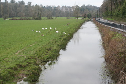
Lismore Castle from the first bridge on the Lismore Canal
The one-lock Lismore Canal went from a point upstream of the Kitchenhole, on the Munster Blackwater, to Lismore, Co Waterford, where the Duke of Devonshire owns Lismore Castle and has some rights to the fishing and the bed of the Blackwater.
The canal covered less than half the distance from Cappoquin to Lismore.
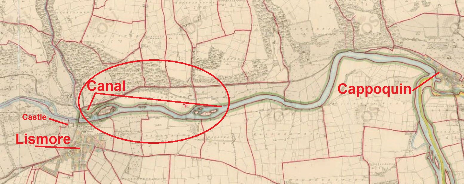
The Lismore Canal (OSI ~1840): click to expand
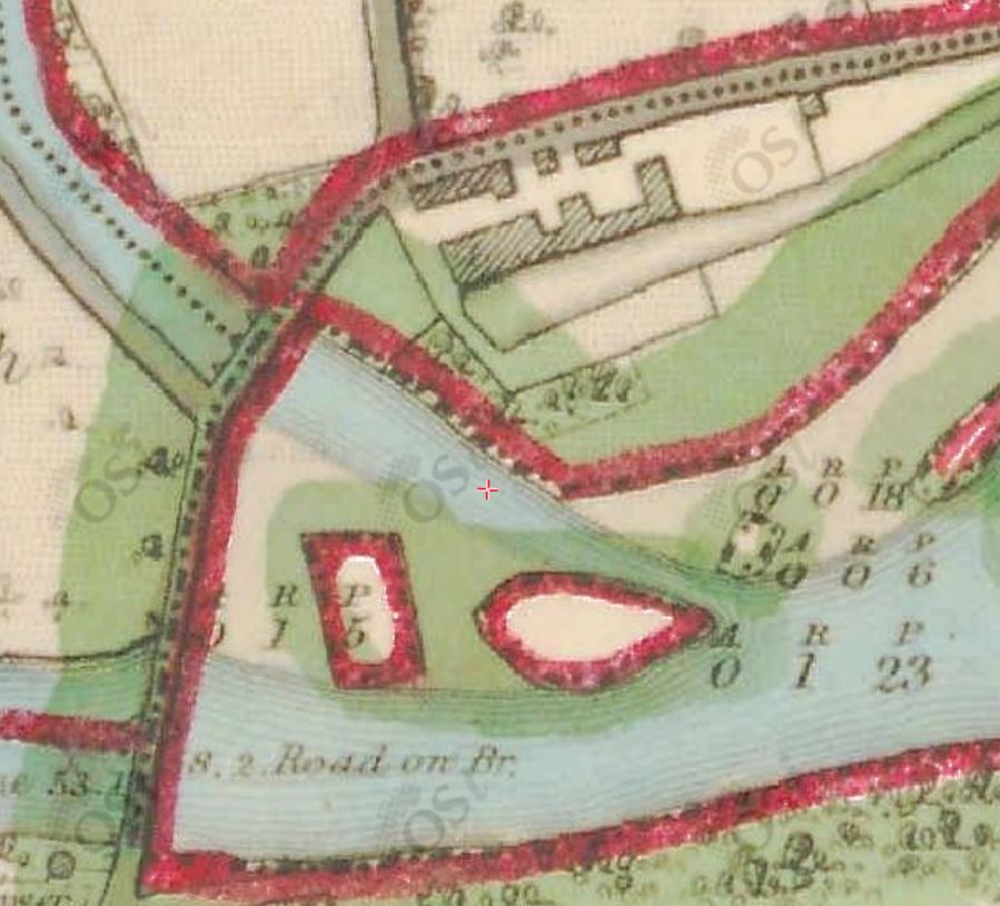
Its principal physical features are the harbour in Lismore, with surrounding buildings, and two bridges and a lock. Part of the line of the canal between the uppermost bridge and Lismore is kept in water, decorated with ducks and geese, and runs alongside the N72.

The canal’s principal features (OSI ~1840): click to expand
Brief history
As far as I know, the most comprehensive account of the canal’s history is that in Niall O’Brien’s Blackwater and Bride: navigation and trade 7000BC to 2007 [Niall O’Brien Publishing 2008]. He says that the 1½-mile canal was built by Henry Bowman, agent for the Duke of Devonshire’s Irish estates. He expected it to carry coal and timber to Lismore and agricultural produce out, in both cases for the wider region rather than just for the town. With various delays, it took from 1793 to 1796 for the canal to be completed.
The National Library has an 874-page PDF catalogue of papers of the Duke of Devonshire’s Irish estates. It made my computer run so slowly that I had to give up. Instead, I offer some information from Analecta Hibernica No 22 [Irish Manuscripts Commission 1960]. Henry Bowman, in his second report (dated 14 February 1795) to John Heaton wrote:
Having made a plan and section of the navigable canal from Lismore Bridge to Blackwater they were laid before Mr Jessop of Newark who recommended Mr Chapman an engineer residing at Dublin to be employed to direct the execution of the work. The like plan and section were accordingly laid before Mr Chapman in September 1793; he sent an assistant to direct and superintend the work with whom he corresponded throughout the progress of it.
The canal above the lock was finished in October 1794; work on the section below the lock, the link to the river, had to await lower summer water levels. However, the completed section was in use but, after six weeks, “the foundation under the lower gates of the lock gave way whilst a lighter loaden with oats was entering the other gates”.
In his next report, of 3 January 1796, Bowman said that Jessop had been called in:
The breach that happened in the lock in November 1794 as mentioned in my last report, is not yet completely repaired. Mr Jessop of Newark was consulted as to the most effectual method to be pursued. He advised a water wheel to be erected, to work pumps that should raise the very great quantity of water that springs in the lock-pit, whilst the foundation was laying; the making and fixing of that machinery took up so much of the last summer, that the autumnal rains set in and occasioned floods so as to stop the progress of the work, before the foundation of the damaged part of the lock could be entirely finished; but I am of opinion it is so far secured as to prevent the Winter floods from doing further injury to the lock; and a few weeks of dry weather next summer, when the land springs are low, will complete the whole.
And so indeed it proved to be: in his fourth report, of 23 February 1797, Bowman was able to report that the breach in the lock had been repaired:
The canal was opened for the passage of lighters and other boats upon it early in last October, and the whole of it now seems to stand very well.
Traffic
Niall O’Brien says that the canal was intended for 20-ton lighters. The lock was 71 ft 6 in by 19 ft 6 in by 6 ft 3 in.
The total rise and fall of the water was 11 feet, with the maximum size of boats set at 48 feet by 14 feet 6 inches, with a draught of 4 feet 8 inches and having 8 feet of headway (so as to get under the two bridges which crossed the canal).
The canal was used by 150 lighters (from 8 April) in 1812, 197 in 1813 and 117 (to 28 November) in 1814. By the 1850s the canal was being managed by local merchants; in 1853 about 500 lighters carried just over 9000 tons, the highest figures Niall O’Brien shows for that decade; for 1865 he shows that ~565 lighters carried just over 10000 tons, the canal’s record. Thereafter tonnages declined steadily, falling below 1000 in 1894 and reaching 144 tons in 1901.
According to Ruth Delany in Ireland’s Inland Waterways [Appletree Press, Belfast 2004] the canal was used up to 1922 (when vandals damaged the railways in the Irish civil war).
The harbour at Lismore
The harbour at Lismore (OSI ~1840)
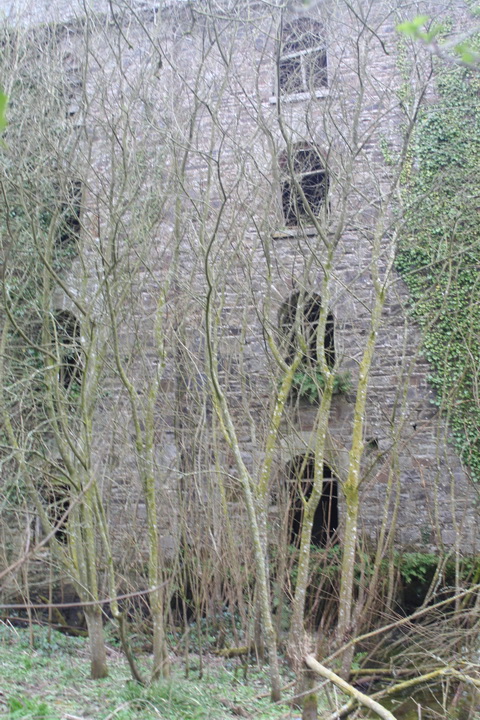
There is so much vegetation around the place that I found it impossible to get a clear photo of the harbour buildings. Here are some partial pics.

Photo taken in 2008

The main warehouse in 2015
Fine stonework
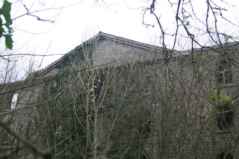
The roof line

No longer a deep-water harbour
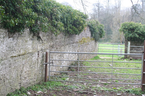
Unidentified walled enclosure on the opposite side of the harbour

The canal beside the road, looking downstream towards the first bridge
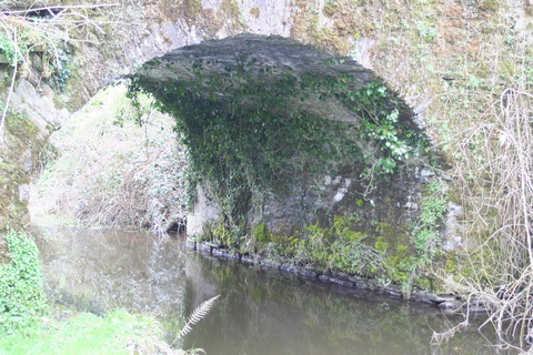
The first bridge

The first bridge seen from near the harbour
Here’s one I took earlier.

The first bridge (2008)
We tried measuring the width of the canal [it would be nice if someone would invent a tape that would stay rigid when stretched across a canal] and reckoned it was about 14 ft, with the towpath only about 20 in.
The first bridge (2015)
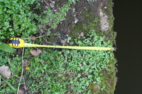
Measuring the towpath

The narrow towpath
Niall O’Brien says that the lighters were towed by ponies using chains, with two men to each pony. The chain was released at each bridge; the pony was led around the bridge while one of the men went through with the chain, which was reattached at the other side.
He says that the towpath was 2 ft wide and he gives these measurements:
It is about 8 feet from the tow path to the top of the arch while the water level was about 4 feet below. The bridge is 15 feet wide for the lighters and about 17 feet long. The workers had to keep down as the standing room is only 4½ feet.
The second bridge
The second bridge and the lock are in the grounds of Ballygalane House, which is private property; I am grateful to the owner for permitting me to take photographs.

The second bridge

The arch of the second bridge
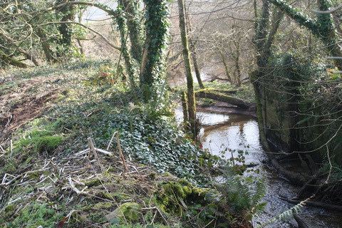
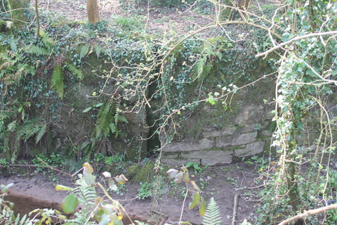
The lock
The lock is just a short distance downstream of the second bridge and close to the junction with the river.

The lock (OSI ~1840)
The lock seems to have one side on an island, presumably with water flowing by to the south. On the 25″ OSI map (~1900) the upper end of that channel has been blocked off, providing a layby or harbour; Niall O’Brien says that heavily laden lighters used it to discharge some cargo when they were too deep for the canal.
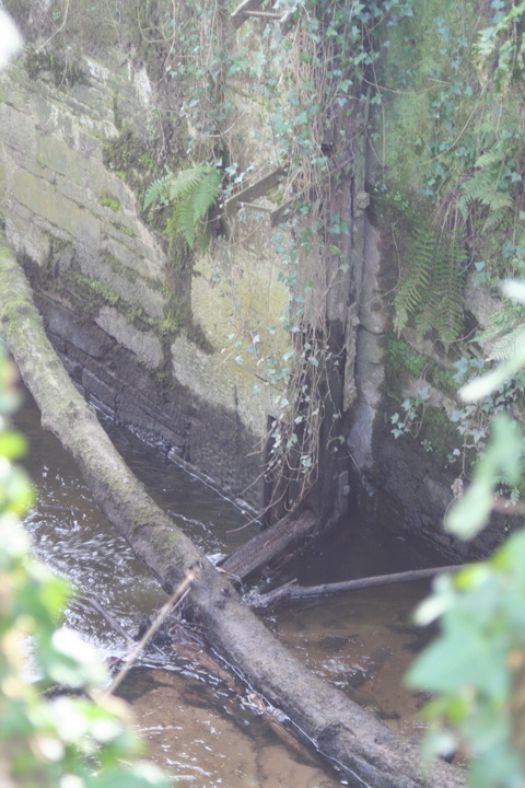
I was not equipped for a descent into the lock chamber and the surroundings were much overgrown. As a result, I have no measurements and my photos are not entirely clear.

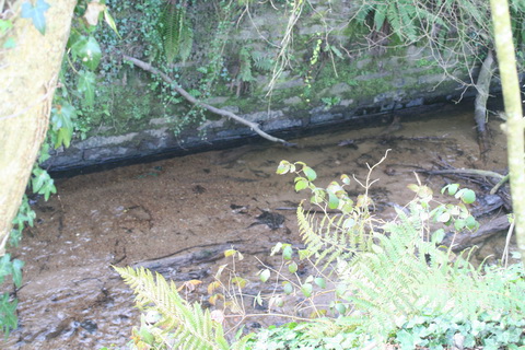
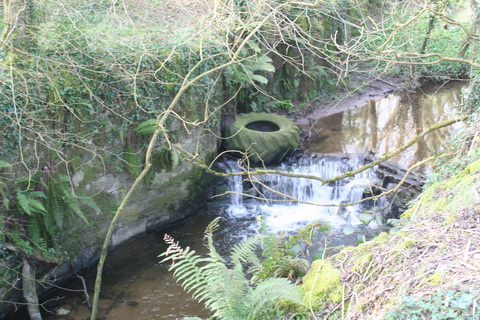
Looking from the lock side to the area below the lock
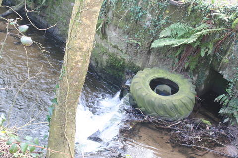
Through the tail of the lock

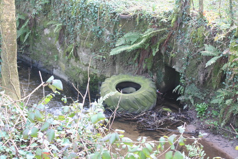
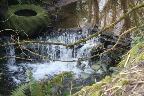
Below the lock
Niall O’Brien says that, on the river, lighters could use their sails and the tide. Masts had to be lowered in the canal, whereafter crews used poles and the remains of the tide. Ponies hauled the lighters above the lock.

The lower stop-plank recess

Lower gate recess
The remains of a lower gate

Ironwork

The lock chamber
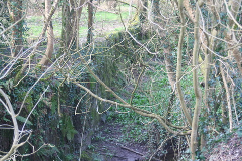
A stream runs down the bed of the canal and out through the lock
Upper sill
Upper stop-plank recess
Upper sill from below
Upper sill
That orifice might be the intake of a channel for admitting water to the lock, but I don’t know where the outlet was

Wall above the lock
Looking upstream
I would be glad to hear from anyone who has more information. If you do, please leave a Comment below.
![]()
[mbb70]


Laser measure ?
http://leica-geosystems.com/en/Leica-DISTO-S910_106377.htm?gclid=Cj0KEQjw6tepBRDLqLnxouaY_pkBEiQAPIOiBs_iRDARtoudoHqVnUdYnEyxiLAHyVjfwbDGKMc1nJwaAlma8P8HAQ
There are cheaper versions of these available
DIY shops etc have cheaper ones but they won’t measure over 15m, which is too short for most locks. bjg