To the westward of this principal entrance of the Fergus, there is a multitude of islands (some of considerable extent) and rocks; among which are various intricate channels, totally unfit for navigation, except for small vessels, on account of their narrowness, the strength of the tides, and the frequent shallows, though there are spots with 10 to 13 fathoms depth.
Sailing Directions for the Lower Shannon …. By Commander James Wolfe RN; being the result of Surveys made by Order of the Lords Commissioners of the Admiralty
Dictum sapienti sat est, as my old granny used to say.
There is a small quay at the upper end of the channel inside Inishcorker: Killadysert (Kildysart) is at the lower end. The Google map doesn’t show the small quay, or even the road leading to it, but the quay is on the mainland just above the sticking-up part of the island.
You get a better view on the Ordnance Survey map: the quay is shown on the modern map and the Historic 25″ (~ 1900) but not on the Historic 6″ (~ 1840), suggesting that it was built in the later part of the nineteenth century, although the road is shown on the earlier map so boats may have been launched there even before the quay was built.
Note that the modern map shows the site of mills (corn and timber) at the end of a cul-de-sac that leads to the north east off the road from the quay to the main road. The site is marked on the earlier OSI maps; the ~ 1840 map has no legend while the ~ 1900 shows a quarry and a pump.
This quay is not described in the Clare Coastal Architectural Heritage Survey conducted by Sarah Halpin & Gráinne O’Connor for Clare County Council in 2008. However, it is described in the Clare Traditional Boat and Currach Project report by Darina Tully, also for Clare County Council in 2008:
Lackannashinnagh near Crovraghan is an interesting harbour. Once a private harbour of the local estate, you can still make out some interesting infrastructure. The estate, which was owned by Carlo Bianconi, grandson of the stagecoach entrepreneur, had a sawmill, a flourmill and a foundry. In 1909 the estate installed a private train line with a branch line to service the pier. The family also owned a Clyde Puffer called the SS Turk, and two other ships, of which one, the Shamrock, was built at the pier. The quay is used by a half dozen or so craft including two Gandelows. The Pier can only be used for 3 hours either side of the high tide, similar to Kildysert.
That Turk was built in 1900 by and for J & J Hay of Kirkintilloch; they built a second Turk in 1929.
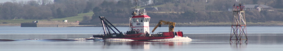
The channels
There is a ford, linking Inishcorker to the shore, at the Killadysert end of the channel. The ford is shown on all the Ordnance Survey maps, so it was there when Killadysart quay was built. I don’t know how much water there is over it at high tide, but the fact that the channel is marked suggests that access to Killadysart was from the north end of the channel, past Lackannashinnagh.
You can see what Commander Wolfe was talking about with his “intricate channels”.

Looking south-west towards Killadysert

Looking south-east towards the Fergus estuary
The smoke is probably coming from Aughinish Alumina on the south side of the Shannon Estuary, near Foynes.

Another view towards the Fergus
The quay

The quay and its pontoon extension

A close-up of the pontoon

The far side of the quay

The unidentified ruin on the quay
The boats

The boats at the quay
Darina Tully identifies several different types of gandelows, the flat-bottomed boats of the upper Shannon, the Fergus and the Cashen estuaries. I think the two boats here are of the Fergus gandelow type (which is different from that used at Clarecastle) but I am open to correction.

Fergus gandelow afloat

Gandalow in poor condition (perhaps Darina Tully's record number 22)

Another view of the gandelow on shore

The other side of the gandelow


Ther little railay as mentioned served the entire estate, it was gauge 20 inches and on it he used a small parafin powered steam rail lorry, said to have been built in 1912 by LIFU, Liquid Fuel Engineering Co at Cowes on the Isle of Wight, this lorry looked similar to another that was used on the Nocton Potatoe Estate Railway in Lincolnshire, but that later example was said to have been built by R.H Morse of Conecuit in the US, either way it was an unusual machine, horse traction was also used on the railway which opend around 1908 and closed in 1929. One wheelset from the lorry is preserved at the WCR at Moyasta.
Great; many thanks. The machine sounds fascinating! bjg
This might be of interest:
http://www.britishpathe.com/video/quaint-railways/query/quaint+railways
Thank you. I couldn’t get it to work, but that may be my fault. I was able to look at the stills, though. bjg