The Shannon floods of November 2009 affected people living close to the river and the waterways infrastructure and boats thereon. I have a page about those aspects on lower Lough Derg and in Castleconnell, Co Limerick.
This page is the second of three about the old (pre-Ardnacrusha) Limerick Navigation, from Killaloe to tidal Limerick. The floods provided an opportunity to see what the water levels on the old navigation might have been like, before Ardnacrusha laid claim to the first 400 cubic metres of water per second.
The page on the upper part of the old Limerick Navigation covers Killaloe, O’Briensbridge and Castleconnell. The third page covers the tidal section from the canal harbour to the sea lock.
Water, Ardnacrusha and Parteen Villa Weir
The floods of November 2009 caused high water levels on the River Shannon. The ESB (Electricity Supply Board) controls the water levels on the lower Shannon by using Parteen Villa weir: it can send water down the headrace canal to the Ardnacrusha hydroelectric power station (maximum 400 tons per second) or down the original course of the river through O’Briensbridge and Montpelier, Castleconnell, Plassey, Athlunkard and Corbally.
The capacity of this latter route may have been over 700 tons per second before Ardnacrusha was built, but (a) many houses, and some university buildings, have been constructed near the river since then and (b) the extent of the recent rainfall is such that even the pre-Ardnacrusha capacity of the river may not be enough to take all the water that is coming down the Shannon. In normal times, the original course of the river gets 10 tons per second; Ardnacrusha gets the next 400; anything that is left over is sent down the original course. During the floods the ESB sent more down the river; it timed its evening discharge to coincide with low tide in Limerick. The Irish Independent said that the discharge was 460 tons per second.
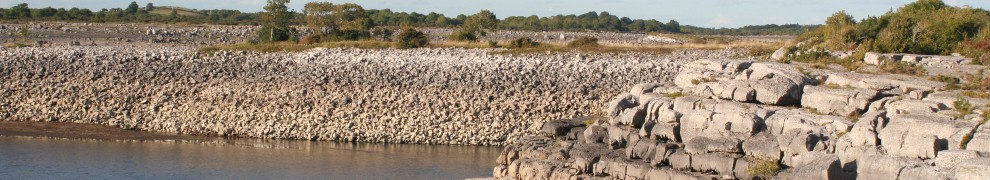
This page shows photographs taken in November 2009, with some older photographs for comparison. It covers two sections of the old Limerick Navigation plus one section of the modern navigation:
- the river from Plassey to the head of the Park Canal
- the Park Canal itself (at the bottom of my sketch-map below).

Sketch-map of the Limerick Navigations
Plassey
The old navigation used the Plassey–Errina (or Errina–Plassey) Canal, which left the Shannon just downstream of O’Briensbridge and rejoined it on the County Clare side (which I usually call the west side, but might more accurately be called the north bank at that point) opposite Plassey. Before the Shannon Commissioners made their improvements in the 1840s, the towing horses had to be ferried from one side of the river to the other, but the erection of the “Black Bridge” made the crossing much easier.

The Black Bridge from downstream (March 2007)

The Black Bridge from a boat. Note the clearance (August 2008)
Just upstream of the Black Bridge is a relatively new bridge that links the two sections of the University of Limerick’s campus.

The new bridge (March 2007)
Here is a photo of the Black Bridge, taken from the new bridge, in poor weather (wind against current) in August 2009. There is still good headroom under the bridge.

The Black Bridge on a windy day (August 2009)
And here is the Black Bridge, again seen from the road bridge, on Sunday 22 November 2009. Note the runner on the bridge, which has now been closed off. The water level shown was achieved before the ESB began releasing extra water on 23 November.

The Black Bridge during the floods. Note the headroom (22 November 2009)
There was debris lodged against the bridge.

Debris lodged against the bridge (22 November 2009)
The water rose further.

The Black Bridge (26 November 2009)

Water flowing under the bridge (26 November 2009)
On the new bridge, motorists are separated from cyclists and pedestrians, and you can look down the gap between the sections.

Looking down the gap (November 2009)
Upstream of the new bridge, the lower-lying land was flooded.

Flooding above the bridge (November 2009)
There are fishermen’s cottages, and traditional fishing-boats, on the bank between the bridges.

The cottages (August 2009)

The cottages (22 November 2009)

The fishermen’s cottages (26 November 2009)
Further down the towing-path, on the east (or, if you insist, south) bank, the university has built new premises for its rowing club. The building need not concern us, but some of the waterside facilities help to show the change in water level.

UL slipway (August 2008)

UL slipway (November 2009)

UL pontoons (August 2008)

UL pontoons (November 2009)

The height of the towing-path embankment above the water (January 2008)

The height of the towing-path embankment above the water (November 2009)
Corbally
The “regulating weir” at the World’s End in Castleconnell sets the minimum (summer) water level for the river up through O’Briensbridge/Montpelier as fas as (nowadays) Parteen Villa Weir; it also maintains the depth in the upper stretch of the Plassey—Errina Canal, from where it leave the Shannon to Errina Lock.
Similarly, the regulating weir at Corbally sets the minimum water level for the river up to Plassey; it also maintains the depth in the upper stretch of the Park Canal, from where it leaves the Shannon to the upper lock. You can see the weir in this Google satellite photo, stretching south-east from the tip of what we might call the Corbally peninsula. (You may also be able to see the Park Canal, running just a little south of west, near the bottom of the map.)

The Lax Weir (April 2007)
And here it is in flood.

The Lax Weir (November 2009)

The millstream at normal levels (July 2008)

The millstream in flood (November 2009)

The bridge over the millstream (July 2008)

The view from the bridge (November 2009)

The weir is clearly defined in normal conditions (July 2008)

Now it’s a line of trees in the water (November 2009)
The Park Canal: upper lock
The name “Park Canal” is, I think, a recent but useful identifier for the one-mile stretch linking the Abbey River to the Shannon, bypassing the rapids at Corbally. Limerick City Council has tried to restore the canal, including installing some rather silly bollards in the harbour section, but while the canal has not been made navigable it does have good paths along both sides and it is an attractive walking route.
The canal has two locks. At the downstream end, a lock allowed boats to move from the canal into the Abbey River (and vice versa). There is a second lock upstream, about half way along the canal, which is one Irish mile long (there is a milestone where it meets the river at the upstream end).

The upper lock (January 2003)
This photo is taken looking upstream. Note how low the water-level is. Note also the dam in the lock; there are no gates. Just below the dam, on the right-hand side in the previous photo, there is an aperture in the wall above the lock gates.

The aperture (March 2007)
The aperture is well above the water level, even of the level above the dam. I and others believe that to be the entrance to a covered bywash, enabling water to flow into the lower section of the canal without having to open either the lock gates or the racks or paddles thereon. Here is the exit. The tunnel has been referred to as “the lady’s hole”; the word “syphon” has also been applied to it.

Bywash exit below the lock
The bywash tunnel is clear but there is a steel plate near the upper end, preventing water from getting through. The plate presumably replaces a sluice mechanism, controlled from above, but the area has been paved and no trace of the mechanism can be seen.
I assume that normal post-Ardnacrusha water levels (ie levels since Ardnacrusha was built) are equivalent to pre-Ardnacrusha minimum or summer levels, held up by Corbally weir. At those levels the bywash would be of little use (even if the dam were not keeping the water from it). However, the floods of November 2009 have created water levels closer to pre-Ardnacrusha levels, and it is clear that the bywash would have been under water.

Water level above the upper lock (November 2009)

Water pouring over the dam (seen from above)

Water pouring over the dam (seen from below)
There is a depth gauge above the bridge. The next photo was taken from a boat in August 2008.

Depth 2.2 metres (August 2008)

Depth in floods 4.6 metres (November 2009)
The Park Canal: lower lock
Here is the lock at the entrance from the Abbey River, taken on a misty day in December 2004, not long after new gates had been installed. (I don’t think they have ever been used to let a boat through, despite the elaborate control mechanisms.)

The Abbey River entrance to the Park Canal (December 2004)
And a photo taken during the floods.

Water flowing out through the entrance lock (November 2009)
The upper gates on this lock use a patented mechanism, designed by Martin Cullen of Glasgow Caledonian University‘s Centre for the Built Environment (CBE). The gates are designed to withstand water pressure from both sides, so that this lock, for instance, could resist high water from spring tides on the outside of the gates as well as flood water on the inside. You can read about them in the CBE newsletter issue 9 of October 2004 (the link to the PDF is near the bottom of that page). When installed on historic structures, these gates do far less damage than sector (radial) gates like those at Spenceer Dock on the Royal Canal in Dublin. Here are the upper gates in normal conditions, front and rear.

The upper gates from below (June 2005)

The upper gates from above (June 2004)
And here are the gates during the floods, held open to allow flood waters out. The first photo is slightly out of focus; sorry about that.

The upper gates letting water down (November 2009)

The upper gates and evidence of higher water levels (November 2009)
One thing that is clear is that the old Limerick Navigation can cope with much higher water levels than those available since Ardnacrusha was opened.
lknav81


Pingback: The floods of November 2009: Plassey, Corbally, Park Canal, Abbey River « Irish waterways history
Those are some amazing photos, thanks.
You’ve been trawling your archives. A great selection of before and after photos – very pleasing. Not so pleasing to see people flooded out though. And getting worse. Will it ever stop raining?
Fantastic photo’s, really puts things in perspective. Hoping things improve soon. Sad to see people so badly effected.
I remember when the concrete barrage was built under locke near Musgraves Cash and Carry.
If that had been replaced during the recent restoration with proper locke gates at lot of the problems in Corbally could have been averted as at short cut to the lower shannon for the water to flow down the old grand canal system would have created.
Yes Seamus, you are right in that the concrete should have been replaced, but the canal itself would have limited capacity and wouldn’t provide a total solution to the extra water. They should look at this after Christmas though as everything helps.
Really informative.. thank you very much!
I wonder where did the water use to go before. Does it rain so much more now or is it that we have changed the topography significantly with all the building over the years?
The floodings are awful for people indeed. It is interesting also to hear the thoughts of people from so called “developing countries”, who have very bad and more continued experiences with floods, about our reactions to our floods here in Ireland.
Thanks, John. bjg
Even when it does, it will take ages to drain all the water from upriver. bjg
Thanks, Grainne. bjg
Were the old lock gates removed at the same time? Gates were to be reinstalled at that lock, but I understand that the dredging of the upper section of the canal was inadequate: perhaps not deep enough to allow lock gates to open properly.
The old canal could take a small amount of water, but nothing like the quantity coming down the river. You know the size of the Ardnacrusha headrace: that can take 400 tons per second. But there may be 700 tons being sent down the river at the moment, and the old canal is very much smaller than the headrace. Furthermore, I’m told that the canal is too narrow: if it were being built nowadays, it would be at least 10m wider at the top, to allow a less steep slope down to the water.
Not that I know anything about engineering.
bjg
Thanks, Rod. bjg
Houses too close to rivers …. bjg
I suggest that you check out the state of the riverbank commencing at the end of the Mill Road in Corbally heading in the direction of the metal bridge and onto the railway line that leads to O’Dwyer’s bridge. This stretch of bank has been badly neglected for many years (even decades)and is a very serious state of decay. In some parts it is the only protection for houses in those lower housing estates on the Mill Road. In addition what was once a lovely walk (4-6 feet wide grass pathway) for people (who could negotiate it pushing prams etc) is now a trecherous hike as sone parts of the bank have eroded to less than two feet wide. The dense overgrowth and fallen trees makes many parts impassible. In contrast the riverbank commencing at Corbally Estates and going up to the Canal (at the back of Park) is beautifully maintained (paths and mowed grass etc) and very safe for public use. How can one side of the island be protected and not the other?
Some numbers re capacity of the river: According to council sources this week, the river has increased from 180 tons per second to 863 tps.
We came very close to a major catastrophe here in Limerick city and county.
The awful thing is it’s only the beginning of winter and the water table is seriously high.
Here is an aerial panorama showing the flooding at UL
http://www.aerialphoto.ie/UL/ul.html
Thanks, Maeve. I’ve never been down that way (as I’m mostly interested in the old navigations) but will try to get over there when the place dries out a bit. Do you know who owns or is responsible for the two banks? bjg
Aha! Real figures …. I’d be delighted if you or your council sources could supply more, or even help to fill in the gaps on my story so far page. I think we (residents, civilians) need a better understanding of how flooding happens down here. Certainly my own understanding is deficient. I’m not by any means joining the “blame the ESB” gang; I’d just like to know more. bjg
Thanks, but unfortunately Flash doesn’t work on my computer, for reasons that are not clear to me, so I can’t see anything on your site. bjg
John, 80 yrs. ago,living at Plassey,myFather placed the beds,on Drums as the flood waters rose,wearing high waders, armed with a marker
and a long stick, which he marked as the level
rose and fell, the Cot was tied to the knob on the
front door, for a safe getaway, it did not come to
that,however the water subsided in due time.
i enjoyed viewing all the old Photos of Plassey,
and the River Shannon, preserving views and
history, for future Generations,great idea.
Thanks very much Gouldie, and thanks for your story about your father putting the beds up on drums. If you have any other memories you would like to share, I’d be happy to put them up here. I’m working on a page about Plassey ….
bjg
on the annaghbeg side of the blackbridge on the stone parapet as you look over towards plassey mills there are marks of tow ropes about 6 inches from the bottom of the left parapet.how come?were these parapets there before the bridge
Frank: thanks for that. Just in case you haven’t seen it, I have a page about the Black Bridge here. I hadn’t seen rope marks on the left parapet (which I take to be the upstream side). I’ve been looking through my photos but I haven’t got one that shows just the correct section of parapet; most of my pics are of the downstream parapet. I don’t suppose you have a photo you could send me?
I would be surprised to find that the parapets predated the bridge; although the accounts I’ve read about the ferry are not entirely clear, I can’t see why a ferry would need such a structure. And, before the bridge was built, the towing-path was on the downstream bank of the canal. So I’m baffled, but if you have a photo you could send me I’ll have a look, and if not I’ll inspect it next time I’m at Plassey. bjg
i have only seen your reply today..i must upskill my photo technology and put the photo on for you.i dont know if anyone else has seen these as i am a local here and only saw them after looking at your pics of the downstream ones.my email is. [email address hidden]
That’s great; thanks, Frank. I’ll email you direct. bjg
Pingback: Draining Lough Derg | Irish waterways history
Pingback: To Build A Bridge | Limerick Riverpath Volunteers