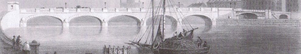
In 1837 Commander James Wolfe RN and Lieutenant R B Beechey RN surveyed Lough Ree; they produced an Admiralty Chart and Commander Wolfe wrote sailing directions (available here).
But while surveying they also made drawings — Views of Lough Ree — showing what a ship’s master might see from certain locations on the lake. Those drawings were held in the United Kingdom Hydrographic Office until 2003, when they were transferred (with other historic documents) to the National Archive of England and Wales.
I have paid the appropriate fee permitting “reproduction of images of documents from The National Archives on an open non-commercial website” and I show some of the drawings here. I am required to show them at low resolution; you’ll get a somewhat larger version if you click on each in turn, but it will still be well below full size.

From Curreen Point 1

From Curreen Point 2

From Gardentown Bay 1

From Gardentown Bay 2

From Keelogues Bay 1

From Keelogues Bay 2

From off Nuns Island

From Beam Island
The equivalent drawings of Lough Derg are here.


Great work Brian, it is good to give them a new lease of life. Sorry I missed your launch last Friday but I was working that night.
Is there any way to get some nice quality prints of these?
Yes: you can buy either a digital version or a printout from the UK National Archives at Kew; you can deal with them online. The three items on Lough Ree are on different pages: ADM344/345, ADM344/346 and ADM344/347. The “Order a copy” button begins a process whereby you will be given a price for what you want. bjg