

Taken between Villierstown and Dromore
This page exists to organise other pages showing aspects of the Munster Blackwater. The order assumes that you drive down the east side of the river, cross at Youghal and come back up the west side.
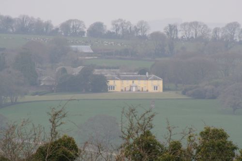
House on the west bank photographed from below Dromore on the east
You can move from place to place on this page or use the link at the bottom of each place’s page to move on to the next on the route.
The photos on these pages were taken on a single damp day in March 2015. The idea was to drive around the lower Blackwater, taking a look by road to complement the photos taken from the water and shown here. Unless you’re prepared to explore the boreens, it’s very difficult to get a good view of the Blackwater from the left (east) bank. On the opposite side, the road touches the river in several places, but they’re usually low down and show little scenery.

Looking upstream from the viewing point below Dromore
It seems that the main commercial life of the Blackwater, at least in the later nineteenth century, was on the left/east bank: that’s where the big quays are. I don’t know why that is; perhaps it’s significant that, apart from Dromana, the remaining big houses are on the other side of the river. Perhaps they wanted the trade kept well away. But that is mere speculation.
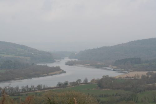
Looking upstream from the viewing-point below Dromore
If I remember correctly, the viewing-point on the road south of Dromore was the only place where you could get a decent view of this gorgeous river. I think I have read recently that the local authorities would like to make a Blackwater Drive or some such: a scenic route that would enable visitors to appreciate the river. I would strongly encourage them to do that.
The left bank (east side)
Cappoquin (1)
The River Finisk (16)
Dromana (20)
Villierstown (25)
Dromore (30)
Cooneen (32)
Coolbagh (35)
Ballynaclash (40)
Raheen (42)
Youghal bridge (50)
The right bank
Templemichael (75)
Newport East (76)
Junction of Bride and Blackwater (78)
Camphire slip (80)
Killahally (82)
The Cooples (90)
I can’t find it
Crotty’s Quay (100)

