There has been no book-length history of the Barrow Navigation and there are many things about it that we [or at least I] don’t know. One of them is the history of the trackway or towing-path [track here means tow] and of how it was used.
V T H & D R Delany, in The Canals of the South of Ireland [David & Charles, Newton Abbot 1966], say
By 1790, it was reported, the entire trackway from St Mullins [where the Barrow meets the tidewater] to Athy was finished.
In Ireland’s inland waterways: celebrating 300 years [Appletree Press, Belfast 2004] Ruth Delany gives no date for the completion of the trackway.
Some evidence
This is one of those cases where I have come across a small amount of information but I haven’t got time to research it much further at the moment. Accordingly, I’m writing it up here in the hope that it might encourage others to share any information they already have or to do some more research.
In late 1792 newspapers carried ads from the Barrow Navigation Company about the construction of the trackway. There were three large ads, with almost identical wording, for County Kildare, Queen’s County [now County Laois] and County Carlow. There was a fourth, smaller ad, which I’ll come to later.
In the Dublin Evening Post of 18 September 1792, the three main ads used this text.
Barrow Navigation Company
Whereas a Precept under the common Seal of the said Company hath been issued, directed to the Sheriff of the <county name>, requiring and commanding him to summon, impannel, and return a sufficient jury, pursuant to the several laws now in force for that purpose, in order to inquire, assess, and ascertain what satisfaction or recompence the said jury shall think fit to award to all and every person or persons, bodies politic, or corporate, for such proportion or proportions of his, her, or their Lands, Grounds, Houses, Tenements or Hereditaments, as are intended to be made use of or damnified by the said Company, and for the damage which he, she, or they may sustain by the making and completing a trackway, and necessary works thereto belonging, from the tide water to the town of Athy, as also such Lands, Tenements and Premises as shall be judged expedient for making of any collateral branch or canal along the banks of the said river, and also such wharfs, quays, yards, store-houses, and other accommodations for the use of the said Company, and to adjust what proportion of such purchase-money, or satisfaction, every tenant or other person having a particular estate in such Grounds, Houses, Tenements, or Hereditaments, shall have for his, her, or their respective estate or estates, interest or interests therein, pursuant to, and in such manner as directed by, the several Acts of Parliament in that case made and provided.
Notice is therefore hereby given, that, in pursuance of said Precept, the said Sheriff and jury will meet at the house of <meeting place>, in the said county, on the <meeting day> day of October next, at the hour of ten o’clock in the forenoon, in order to inquire, assess, and ascertain what satisfaction or recompence the said jury shall think fit to award to all and every such person or persons, bodies politic, or corporate, for such proportion or proportions of his, her, or their Lands, Grounds, Houses, Tenements, or Hereditaments as are intended to be made use of or damnified by the said Company, and for the damage which he, she, or they may sustain by the making and completing such track-way, as also such Lands, Tenements, and Premises, as shall be judged expedient or necessary for the purposes aforesaid, through the towns and lands of <placenames>, all in the said county, of which all persons concerned are required to take notice, and in the mean time are required to make a return of the several and respective estates, titles, and interests, and the respective natures thereof, which all person and persons, bodies politic or corporate, have or hath, or claim to have, to all or any of the Lands and Premises aforesaid, through which said track-way will pass, unto Robert Cornwall Esq, the Company’s Law-Agent, at his house, Myshall-Lodge, near Leighlin-Bridge. — Dated this 7th day of September, 1792.
SAMUEL CARPENTER
Secretary to the Barrow Navigation Company
Here are the counties and the places named.
County Kildare
Jerusalem, Newtown, Magany, Levetstown, Rosetown, Grangemelon, Ballyroe, Abbeyland, Ardree, Boervaran [?], the Town and Parks of Athy, and Mount Ophaley.
I’ve followed the ad by listing the places from south to north. The Kildare places are all on the east bank. I’ve provided a link to the 6″ OSI map, starting at Jerusalem; although it is considerably later than the ads, most of the places listed are still shown, and you can follow the course northwards. There is no point in my providing map extracts here as, to have the names large enough to be legible, I’d have to use very large numbers of maps.
I think that Newtown, on the list, might be Newtownpilsworth on the map. I was unable to find Rosetown, Ballyroe, Abbeyland or Boervaran [which last might not be correct: it was difficult to read]. I would be grateful if anyone can tell me where those places are.
The Co Kildare meeting was to be held on 12 October 1792 at the house of Patrick Dowly, in the town of Athy.
Queen’s County
Clogrennan, Ballahide, Crossneen, and Graigue.
These four are on the west bank, below Carlow; Graigue, or Graiguecullen, is the Co Laois town on the west bank of the Barrow, opposite Carlow on the east. Ballahide seems to be spelt Ballyhide nowadays.
The Queen’s County meeting was to be held on 15 October 1792 at the house of Patrick Hasket [Hacket?], in the town of Graigue [= Graiguecullen, across the river from Carlow; not to be confused with Graiguenamanagh further downstream].
County Carlow
Ballyellin, Clomoney, Kilgreny, Sliguffe, Kilree, Moneybeg, Knockmill, Dunleckney, Rathellin, Leighlin-Lands, Ballyknockan, Ravendon, Rathoran, Tomard, Ballygowan, Ballynabranagh, Rathornan, Clogrennan, the Lordship, Town and Lands of Carlow, Bestville otherwise Dunganstown, Newgarden, and New-acre.
Again, these run from south to north. I’ve put a link to Lower Ballyellen [Ballyellin] lock: I think it slightly more likely that Carpenter meant Lower rather than Upper Ballyellen. Note that the 6″ OSI map calls the lower lock Gores Bridge lock.
The Co Carlow meeting was to be held on 22 October 1792 at the house of James Lyons, inn-holder, in the town of Leighlin-bridge.
The construction of the trackway
The lists for Co Kildare and Queen’s County provide no surprises but the Co Carlow list has some interesting features.
First, the fact that it starts at Ballyellin suggests that the trackway from St Mullins (the tidewater) had already reached Ballytiglea, the next lock downstream. In Ireland’s Inland Waterways Delany shows that, work having started at St Mullins, the navigation, including a towpath, had been completed on just over four miles by 1767 [Delany & Delany date this momentous achievement to 1769.]. By 1783 it had reached Clashganny, the fourth lock below Lower Ballyellin and the second above the town of Graiguenamanagh. Four years later the Commissioners of Inland Navigation were abolished, control was passed to local commissioners and, says Delany, “even this desultory work ceased” until the Barrow Navigation Company took over the works in 1790.
It seems, then, that the trackway, and perhaps the navigation itself, between Clashganny and Lower Ballyellin must have been completed either between 1783 and 1787 or in the first two years, 1790–1792, of the Barrow Navigation Company’s existence. Perhaps a further search of newspaper archives would provide more information.
Some archives of the Barrow Navigation Company are held by CIE in Heuston Station, Kingsbridge, Dublin, but I have not looked at what is in them.
Changing sides
Second, the trackway is on the east bank from St Mullins to Ballyellin, and it continues on that side through Clomoney, Kilgreny [Kilgraney on the 6″ OSI map], Sliguffe [now Slyguff], Kilree, Moneybeg [at Bagenalstown], Knockmill [I presume: I can’t find it], Dunleckney [Dunleckny], Rathellin [which had a dry dock] and Leighlin-Lands [which I presume to mean the land around Leighlinbridge].
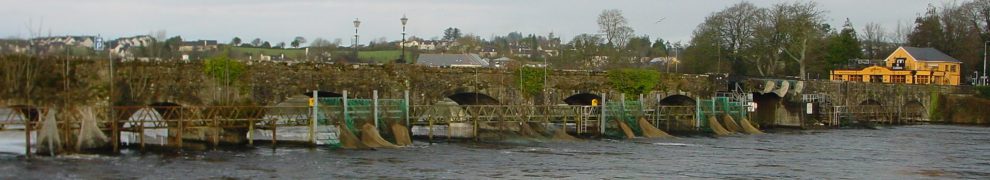
The trackway crosses the river at Leighlinbridge. The Barrow is not the county boundary along here: both banks are in Co Carlow. And Ballyknockan, Ravendon [Rathvindon], Rathoran [Rathornan], Tomard, Ballygowan, Ballynabranagh [Ballinabranagh, a little way inland], Rathornan [which I can’t find] and Clogrennan are all on the west bank. From Clogrennan, the trackway, still on the west bank, is in Queen’s County [Co Laois] until it reaches Graigue[Graiguecullen].
The trackway crosses back to the east side from Graiguecullen to the town of Carlow; the Co Carlow list continues with the Lordship, Town and Lands of Carlow, Bestville [Bestfield] otherwise Dunganstown, Newgarden, and New-acre, which is just south of Jerusalem, the first placename mentioned in Co Kildare.
The fourth ad
It is not clear [ie I do not know] why the Barrow Navigation Company decided to have its trackway cross the river twice: from east to west at Leighlinbridge and from wesst to east at Graiguecullen/Carlow. But it seems that it was considering two more crossings.
The Dublin Evening Post of 18 September 1792 had a fourth, smaller, ad.
BARROW NAVIGATION COMPANY
A General Meeting of said Company is to be held at Lennon’s inn, in Carlow, on Monday, the 8th day of October next, for the purpose of taking it into their consideration, whether it will be most adviseable to purchase a Trackway on the county Carlow or county Kilkenny side of the river Barrow, between New-bridge and Bagenals-bridge, and for ordering a Commission for purchasing such a trackway.
SAMUEL CARPENTER, Sec
17th Sept 1792
Bagenals-bridge is Royal Oak bridge; I think that New-bridge is Goresbridge. So, had this scheme gone ahead, the trackway from south to north would have been:
- on the east bank from St Mullins to Goresbridge, which is between Lower and Upper Ballyellen locks
- on the west bank from there to Royal Oak bridge, downstream of Bagenalstown
- on the east bank from there to Leighlinbridge
- on the west bank from there to Graiguecullen/Carlow
- on the east bank from there to Athy
- on the horse bridge in Athy, crossing the river to the west bank to join the Barrow Line of the Grand Canal.
Happily, the company did not proceed, but it would be nice to know more about its reasoning.
Here are some thoughts on how horse-drawn boats might have crossed the river at Leighlinbridge and Carlow.
[wse/bar40]


The means of perfecting the Navigation of the River Barrow from St. Mullins to Athy…..Written by the Main engineer on this canal might be of interest to you…(There is a cop in Carlow Library)..written 1786. He lived in Naas but kept an engineering works in Newcastle where he patented the first steam train…..
Thank you. Is that by William Chapman? bjg