[Updated June 2017]
Stephen Pile, in his The Book of Heroic Failures [Futura Publications Edition pb London 1980], described the Cong Canal as “the worst canal” because it was built on porous limestone, such that the water drained away immediately, requiring a bed of clay to be laid, and because one of the two lakes it linked was higher than the other, so that the engineers were trying to get water to flow uphill. As a result, he said, the canal was abandoned before it was ever used.
Well, anyone familiar with canals, or even with river navigations, will realise that differences in level are not an insoluble problem: they’re what locks are for. So Pile’s account, amusing as it is, should arouse suspicion: perhaps his version is not entirely accurate.
The best account of the Cong Canal, as far as I know, is that written by Maurice Semple in By the Corribside published by himself in 1981. Copies of this invaluable book, with its fold-out maps, reproductions of documents, photographs and well-researched text, occasionally come up for sale on abebooks; if you find one, snap it up immediately.
A brief history
The Cong Canal was to join Lough Mask (and Lough Carra, which is linked to it) to Lough Corrib. The scheme was to combine drainage and navigation; in 1844 the Commissioners of Public Works asked their engineer John McMahon to assess the proposal; he reported in 1846, coincidentally during the major Irish famine. Samuel Roberts was appointed as Superintending Engineer in 1848 and began work immediately. In April 1854, however, the Commissioners directed that work on the navigation aspect be discontinued; drainage work was to continue to enable the level of Lough Mask to be regulated.
The “porous limestone” to which Pile refers was well known to the engineers; they actually used it to their advantage during construction. During winter floods, they worked on the canal near Cong; in the summer, they used the disappearance of the water down swallow-holes to work on the upper reaches of the canal. For example, in his report for 1852, Roberts wrote:
During the early part of the season while the flood waters of Lough Mask were being discharged through the upper level of the canal and overflow course, the excavation for the lower levels and the several works of masonry in connexion with them, were proceeded with and have been continued throughout the entire season. […]
When the flood waters of Lough Mask had subsided to the level of 68 feet above datum, the head dam was made good across the channel at the debouch from Lough Mask, and the discharge of that lake confined to that effected through the cavernous passages; the excavation necessary for the completion of the upper reach of the canal was then recommenced, and has been carried on throughout the season with the greatest vigour, the excavated material has been removed by waggons to form the trackway embankments through the inner basin of Lough Mask.
The abandonment of the navigation work followed an investigation by Richard Griffith and Henry Drury Harness, Commissioners of Public Works acting under a special commission. They said that things had changed since the canal was proposed: railways were spreading over Ireland and scarcity of labour had driven up wage costs. Their recommendations also included the abandonment of the navigation channel between Lough Carra and Lough Mask and the river navigation to the town of Ballinrobe, which would have needed an expensive lock.
The canal and its works
According to Roberts
The channel runs through cavernous limestone rock for its entire length of 4 miles and 40 yards [7090 m], and the depth of cutting varies from 8 [2.44 m] to 20 feet [6.10 m].

Lough Mask at top left, Lough Corrib at bottom [OSI ~1840]
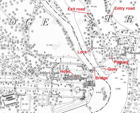
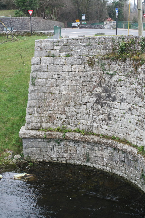
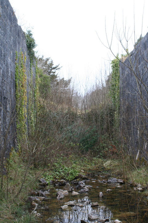
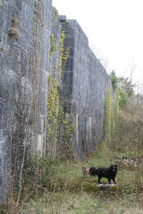
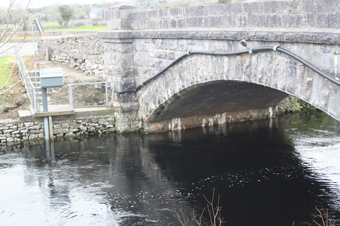
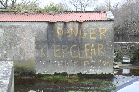
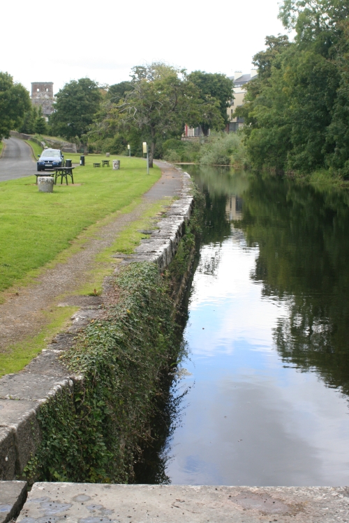
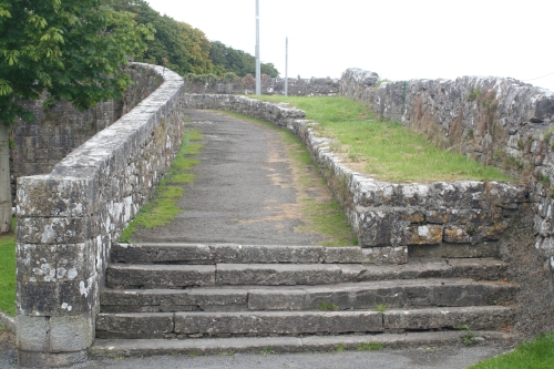
Lock 1
Begin at the downstream end with Lock 1.
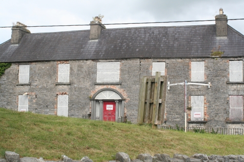
I am not clear about the attitude of Messrs Ashford Castle [bought in May 2013 by Red Carnation Hotels] to canal-seeking visitors, and it may be necessary to disguise yourself as a visiting golfer, perhaps by equipping yourself with a selection of such golfing mallets as a baffing spoon and a mashie niblick. As an alternative, driving a BMW (however elderly and decrepit) probably amounts to the same thing. At least I wasn’t asked for a shilling.
Ashford
The castle itself is an illustration of the ill-effects of the Irish population’s overspending on beer — and of why monopolies are to be deprecated.
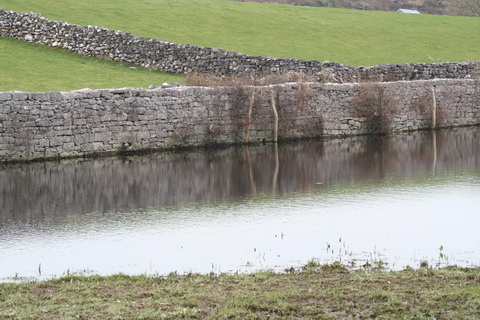
The lock here is sometimes referred to as Strandhill Lock: at the time of the ~1840 6″ Ordnance Survey map Strandhill House, on the east bank, seems to have been as large as Ashford House [sic] on the west.

Ashford Castle
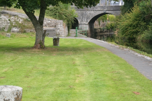
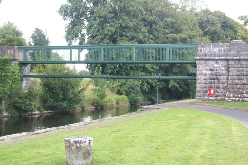
You’ll see from the map above that the lock chamber was used as a boathouse when the east bank was surveyed for the ~1900 25″ Ordnance Survey map. The current bridge would have barred access to the boathouse from Lough Corrib or vice versa for anything but small boats. There is a boathouse below the bridge; you can see it to the left of the Isle of Innisfree trip boat in the photo above.

It’ll have to go
I saw no signs drawing attention to the canal and lock.
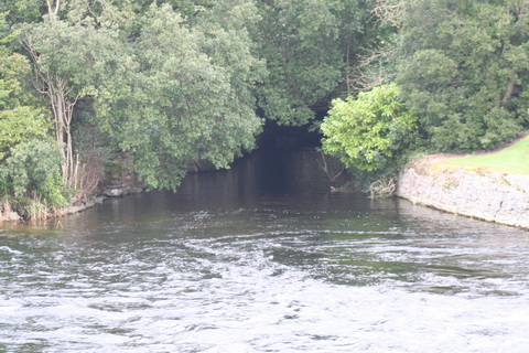
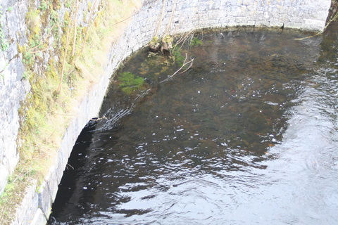
The lock from the castle end of the bridge

The quay downstream of the lock entrance
The channel between the quay and Lough Corrib had to be deepened. Roberts’s report for 1853 said:
The spoil taken from the excavation of the channel has been formed into a bank on the east side, 40 feet in breadth of which has been reserved for a trackway and landing place for boats. On the west side of the channel a guard wall has been built for the purpose of diverting the current of the river in a direction favourable for the navigation of boats entering the lock.
The trackway had a boundary wall four feet [1.22 m] high.
The channel at the quay was improved in 1856 and again in 1857; an 80′ [24.38 m] wharf was built immediately below the lock entrance in 1856, with a road along the trackway to Cong. A wooden foot-bridge was provided over the canal at St Mary’s Church (see the next map below) in 1857.

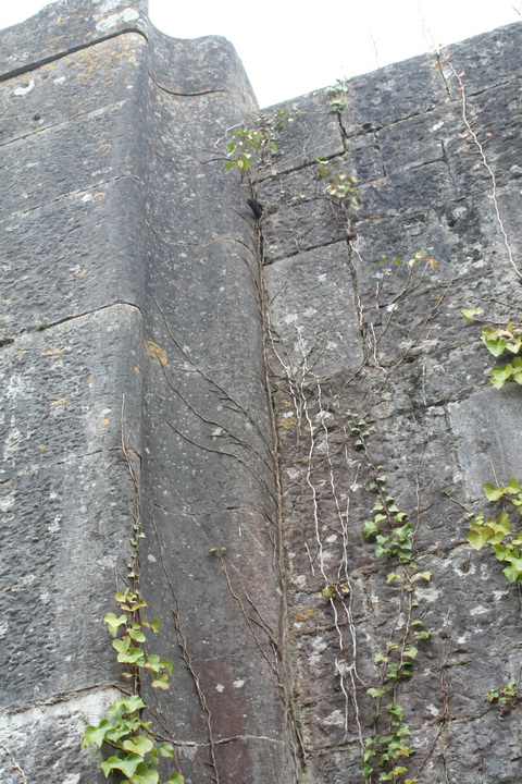
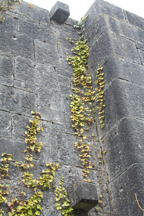
The entrance 1
The entrance 2

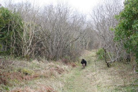
Even in February, the vegetation makes it impossible to get a clear view inside the canal
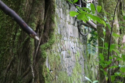
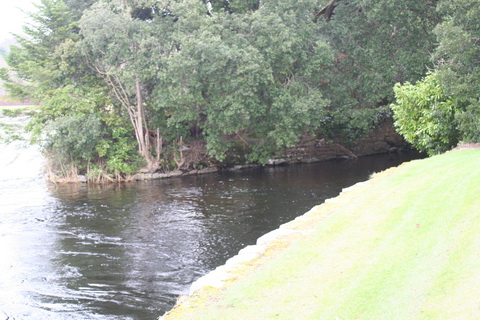
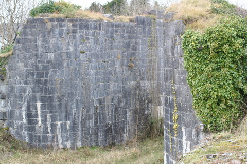
Stonework
Lock 2
The second lock was referred to as Cong Lock and, to judge from Maurice Semple’s annotated map, was right in the village. If you’re driving there from Ashford, you’ll have to go around the houses on Cong’s one-way system, but you’ll eventually reach the car park shown below. Note, incidentally, that the version of the ~1900 25″ Ordnance Survey online map which I use below has a blank patch just north of Lock 2, unfortunately covering the area where Lock 3 is. Happily, Lock 3 is only a few yards from Lock 2.
[Update June 2017: the online map now has its blank filled in.]

From Ashford to Lock 2
It looks as if the road into the car park was built across the line of the canal. The R345, entering Cong from the east, was realigned to run alongside the canal, crossing it below Cong lock, after a right-angle bend, on a bridge of “16 feet [4.88 m] span and 24 feet [7.32 m] breadth of roadway”. That means that there is no towing-path under the bridge.
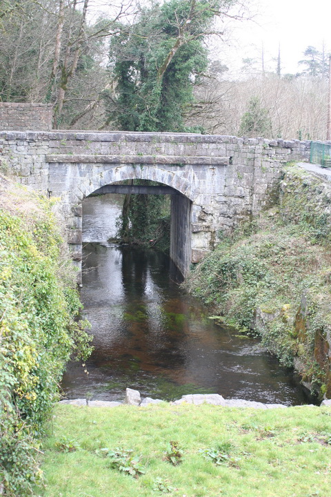
The canal bridge in Cong

The navigation below the bridge
The next photo, taken from the car park, shows the road into Cong. The canal bridge is just out of sight to the left; the larger bridge, on the right, spans the river. I do not know the function of the small bridge (and I forgot to inspect it) but, given the absence of a towing-path under the bridge, it may have provided for horses or men.
The canal bridge is just out of sight to the left; the river bridge is on the right
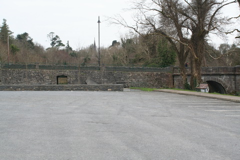
The site of Lock 2
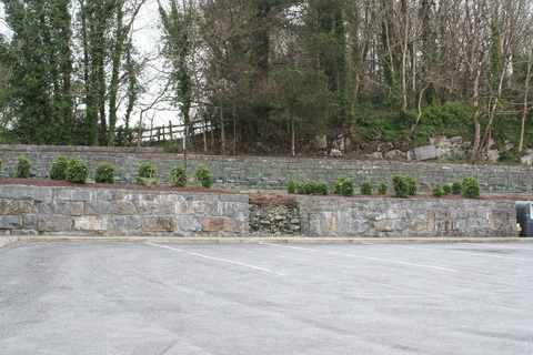
The east wall of the car park runs along the line of the canal

The south-east corner of the car park
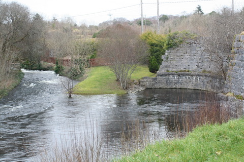
The aqueduct
Another look at the map with its Bellman’s Chart [or see the full thing, which 42B won’t need] of Lock 3, Creggaree Lock, and the aqueduct that lies between Locks 2 and 3. The Bellman’s Chart also shows (or doesn’t, if you prefer) a slight change of direction: the canal above here heads slightly west of north (or, of course, east of south coming downstream).
From Ashford to Lock 2
I hasten to reassure those readers who (quite rightly) dislike exercise that the distance to be walked here is very short. Here is a view from the road into the car park to the aqueduct and, in the distance, Lock 3.
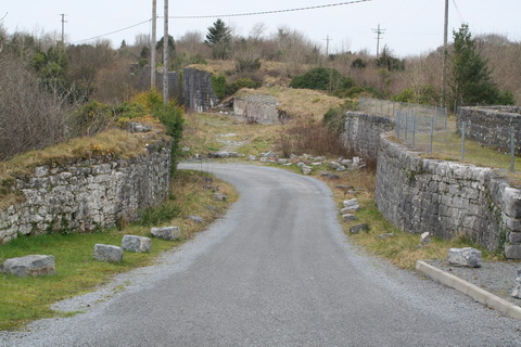
The aqueduct
Here is a photo looking the other way, through the aqueduct towards the car park.

The walls of the aqueduct now enclose a road
The Yield sign (downward-pointing red-edged triangle) is at a small roundabout; the car park entrance is to the right off that roundabout. You can see a gatepost at the right of the photo; here is a view through the gates.
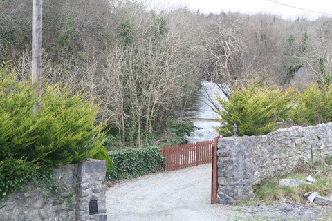
Through the gates
And here, on the far (west) bank of that watercourse, is what I take to have been a mill.

A mill, I think
It will be noted that the three locks on the Cong Canal are clustered together at the Cong end, just as the double lock on the Ardnacrusha headrace canal is at its lower end. In 1844 the millowners [the ~1840 OSI map shows four mills at Cong] had expressed interest in having their water power improved and it may be that the clustering of the locks maintained the head of water and thus maximised the power available to the mills. I’ll return later to the channel for that water.
Roberts’s report for 1852 said that “the aqueduct necessary for the discharge of the waters of this [Cong] river has been built”, and an 1859 summary of works completed referred to “the building of a Bridge under the Cong Canal at Cong, for the passage of the water of the old River Channel under said Canal”. I am assuming that the 1852 aqueduct and the 1859 bridge are the same thing and that they both refer to this mighty structure.
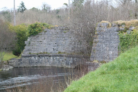
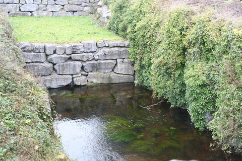
The outflow from under the aqueduct
You can see it here on the contemporary OSI map (which I don’t have permission to reproduce; hence the link). The river on the eastern side seems rather short; perhaps it is fed from underground through some of that porous limestone.
The south-eastern wing of the aqueduct

The inflow on the eastern side
Another view of the inflow

The parapet wall
The outflow and the western arm of the Cong river
Lock 3

The road to Lock 3 at Cregaree (well, it’s probably to the house whose gates we looked through earlier) from the car park roundabout has been built through the aqueduct.

Looking back from Lock 3 through the aqueduct
The canal stonework, between aqueduct and Lock 3, seems to have been used as the wall of a building at some stage
Looking upstream through Lock 3 at the upper sill

Lock 3
Maurice Semple has a photo similar to that one, but with less vegetation you can see Drumsheel Bridge in the background. His caption is
Old Photo of the second lock, being the same as in the previous photo, before the Handball alley was built, with Drumshiel Bridge in the distance
I think “second lock” is wrong and that his photo is of the third lock: with the nearby road, the narrow channel and the canal bridge, I don’t think it would ever have been possible to photograph Lock 2 from the angle shown in his book. His “previous photo” shows the lower sill.
A portion of the lower sill
Maurice Semple’s photo had people; I had dogs.
Dogs and sill
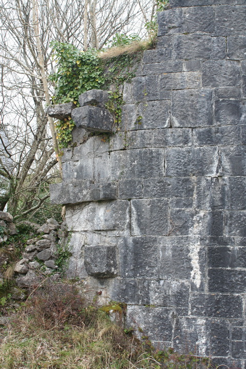
“The masonry of Cregaree lock has been completed” [Roberts’s report for 1852]
Lower end of lower west-side gate recess
Upper end of lower west-side gate recess

Looking down from the upper sill
Extra-mural courses: outside the eastern wall of the lock
The eastern wall of the lock from the upper sill
Path along the bed of the canal above Lock 3
It may be possible to walk all the way to Drumsheel, but I don’t know.
The lower entrance to the lock

Looking back to the lock from the aqueduct
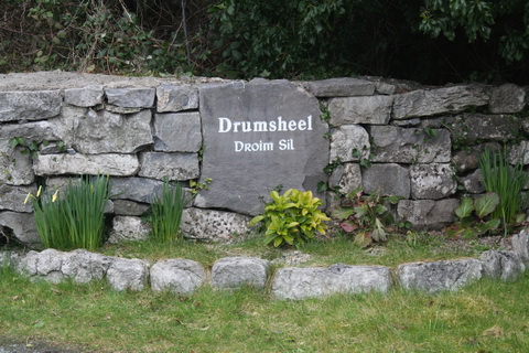
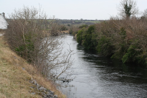
Drumsheel Bridge
The next item of interest upstream is Drumsheel Bridge, described as “26 feet [7.92 m] span and 12 feet [3.66 m] breadth of roadway”. In other words, unlike the bridge in Cong, this one is wide enough to have a towing-path under it.

Cong to Drumsheel Bridge (OSI ~1900)
After crossing Drumsheel Bridge itself, and turning left along the canal, you may be able to pull in on the left to park.
Reassurance just over the bridge
The canal is dry for a short distance upstream of the bridge

Looking downstream from the bridge; there seems to be a path

I think that’s the towing-path on the eastern side

More vegetation blocking the view
Stone from Drumsheel was used elsewhere on the canal. Roberts’s report for 1852 said:
The excavation of the half width of the canal at Drumsheel, which remained since preceding years, has been carried on for the purpose of procuring the necessary material for the erection of the locks and bridges — the stone at this place being the best suited for the work.

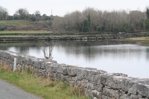
A little way above Drumsheel there is water in the bed of the canal
Drumsheel to Carrownagower
I have to do some guesswork at this stage because I’m not entirely sure what the engineer’s reports are talking about.
In his 1848 report, Roberts said:
The Overflow Course has been completed up to the site of the weir, and the excavation of the canal between the site of the last lock and the weir is now in progress.
In his 1851 report he wrote:
The canal between the third lock site and that of the proposed overfall has been formed to its full depth and breadth.
In his 1853 report he wrote:
[At Drumsheel] On the west side, the site for the overflow has been cleared, and preparations made for commencing the masonry; for a considerable distance above the overflow the foundations for the canal walls have been prepared and a small portion of them built.
The report for 1859 summarised all the work:
The Canal from Lock 3 to the site of the regulating weir at Drumsheil with side walls partly executed.
My impression, then, is that the original plan was that the canal, along most of its length, would form the main drain from Lough Mask. But from just above Drumsheel, before the start of the locks, the canal would carry only the amount of water needed for navigation. Any excess would be drained out of the canal, at a weir, into an overflow channel, and would be carried to Cong to power the mills. Removing the excess water would protect the lock gates, make them easier to operate and make navigation easier too.
I’ve marked in blue, on an extract from the ~1900 OSI map, the line of the canal and that of the overflow channel. The uppermost red circle marks a link between the two and I assume that the original weir was there. There seems to be a second connection a little further down, and I’ve marked that too in red. Finally, towards the bottom of the map, I’ve put a large red circle: at that point all of the water seems to be diverted out of the canal (which is dry below that point) into the original overflow channel. I presume that that was done when (or after) the navigation was abandoned. There might be a wall at that point to keep the canal dry: I couldn’t see properly.
If you can correct my guesswork, please leave a Comment below.

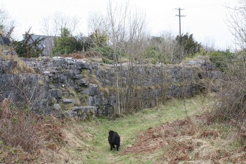
The overflow channel
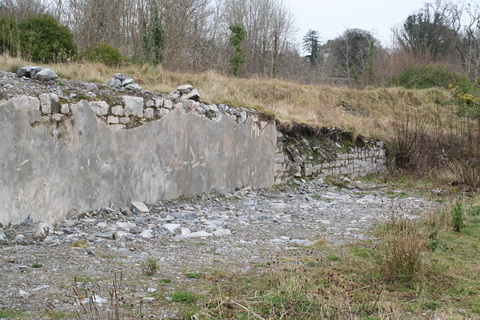
The photos below were taken from the road at several places upstream of Drumsheel Bridge. The canal gets further from the road and several of these artefacts probably have nothing to do with the canal. Stone seems to be widely used in the area.

Discouragement to research. I think the overflow is a little downstream of this point
In 1851 Roberts wrote:
As the flood in the channel subsided the operations were extended, and the formation of the channel completed for half the breadth between the sites of the overflow course and the Drumsheel Road, and the side staunching and lining wall of the canal have been executed for a length of 400 yards [366 m] above the last-mentioned point.
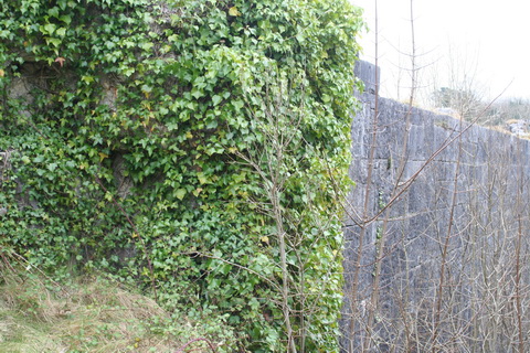
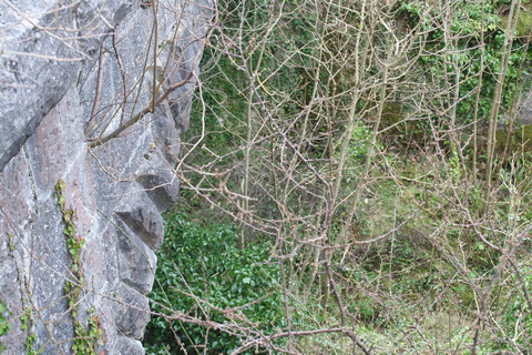
Stone wall through trees
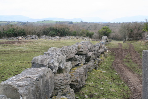
Widespread use of stone
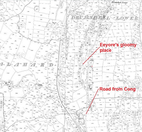
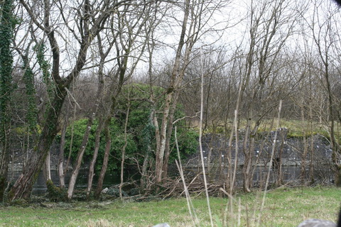
Eeyore’s gloomy place
I think that the next photo is of the flooded area at Eeyore’s gloomy place.
Looking south at Eeyore’s gloomy place
Stone wall
White stone wall
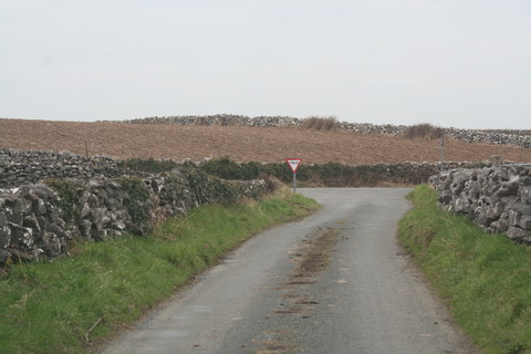
Turn left at the junction to visit Carrownagower bridge
You’ve just come up the road from Cong (marked in blue); turn left
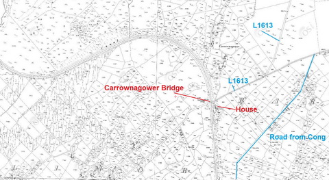
Carrownagower Bridge
There are several points of interest here, and the first is that, just north of the bridge, the canal curves around before heading west to Lough Mask. But Maurice Semple points that that was not the course originally proposed. On a fold-out map, he shows the original course running pretty well northwards to join Lough Mask in the bay inside Inishard, then run north along the bay and through the isthmus at Inishcoog, close to Ballinchalla (of which we will hear more later).
I am not entirely clear about the matter, but I presume that the original course was that proposed by John MacMahon in his report in 1846. I met a man near Ballinchalla who told me that the Ballinchalla route would have been easier to construct but would have provided less employment; he suggested that non-engineering concerns might have determined the change.

Carrownagower Bridge from the west side upstream
On 24 February 2013 the water at Carrownagower Bridge was 2.75 m deep.
Carrownagower Bridge from the west side
This bridge was not built as part of the navigation works; a report of 1859 said that the works included …
… the removal of the old and the erection of a temporary Timber Bridge at Carrownagower, to admit the construction of a new Bridge by the County of Mayo.
That probably explains why there is no towing-path. If Mayo built the bridge after the navigation works were abandoned in 1854, there would have been no point in including a towing-path.

Looking downstream from Carrownagower Bridge
I think this is the “storehouse with office and caretaker’s residence” built at Carrownagower

Looking upstream from the bridge
There are what seem to be driveable tracks upstream from the bridge on both sides of the canal. I drove that on the east side but stopped here.

Further discouragement to research
Looking downstream from the bank near the gate
I did not attempt to drive on the west bank.
Isham
In an unsuccessful attempt to get to the sluices, I tried driving west along the L1613 and looking for routes to Lough Mask. When I saw a sign offering boats for hire, I deduced that there would be water nearby.

Boats for hire
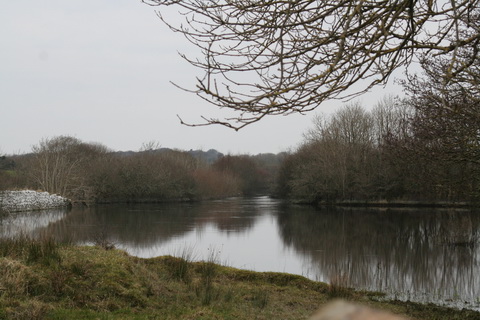
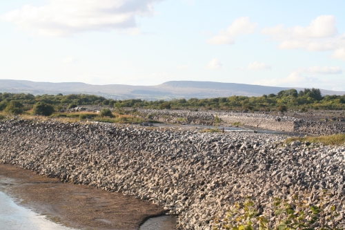
There was no access to the sluices, but I found helpful advice and a very scenic location so, even though they have nothing to do with the Cong Canal, I include here some photos of Lough Mask.

Across the lake
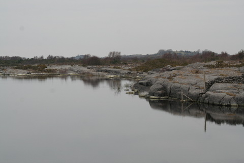
Karst landscape: like the Burren, but more interesting (because there are boats)
Shore
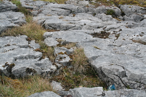
Clints and grykes
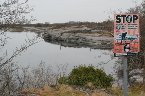
Mayo takes zebra mussels seriously
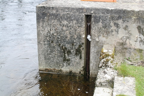
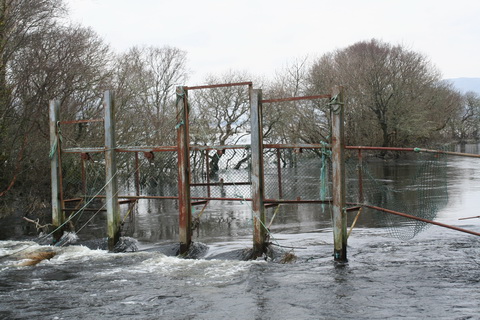
the sluices
Roberts, in his report for 1854 (after navigation had been abandoned), had recommended …
… the erection of sluices, or such other means as the Board may approve of, to regulate the waters of Lough Mask, both with the view of effecting the drainage of the lands influenced by it during the winter, and securing to the Cong mills the full amount of their working power during the summer months.
Construction began in October 1855; the two iron sluices were each ten feet wide and eleven deep, geared so that one person could operate them and mounted on “piers of massive ashlar masonry”. the work was finished in 1856. The gearing was repaired and strengthened in 1857 after it broke when the sluices were being raised during a very high flood.
Here is the OSI view and here is a link to the Google satellite view of the sluices. Clearly they rendered navigation by sizeable vessels impossible.
My local informant told me that the sluices were being used illicitly by folk seeking eels and that concrete was therefore poured into the gears so that the sluices could not be operated. I do not know whether that means that there is no longer any control of the outflow from Lough Mask.
On a later visit to the area, a volunteer very kindly guided me and others to the sluices and the embankments, and I was able to take some photos in a very dry August; most of the other photos on this page were taken in February. Maurice Semple has a photo of the canal at Carrownagower Bridge with mere puddles in the bottom, in place of the 2.75 m I saw in February.

The sluices

The canal just downstream of the sluices, dry in August
After navigation was abandoned, the intake from Lough Mask was dug out only to the depth required for drainage, not to the greater depth required for navigation. The Board of Works deepened parts of the channel in the twentieth century.
the embankments
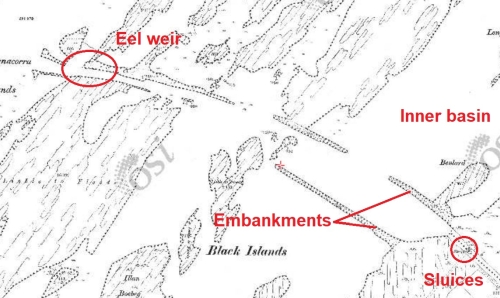
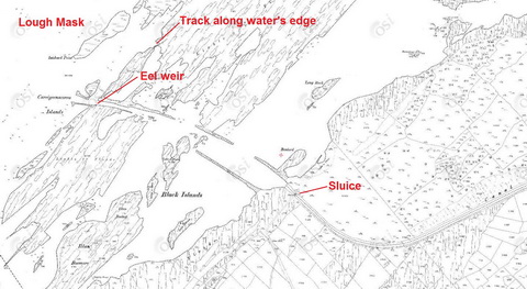
The upper end of the canal (OSI ~1900)
Two large embankments were planned, both to retain water in the canal and to provide a trackway or towing-path across the inner basin of Lough Mask to the mouth of the canal. The western embankment was almost completed and the eastern half done when the navigation work was abandoned but the massive stone structures have survived.

The two ends of the eastern embankment
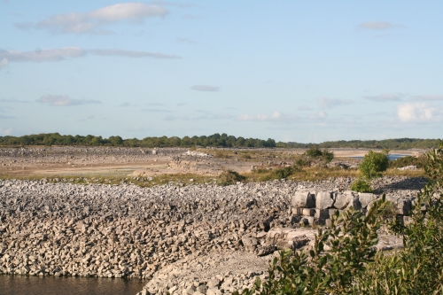
The embankment and part of the inner basin (dry in August)
The western embankment in the foreground, the eastern behind it
Incidentally, as on other Mulvany Special waterways, there seems to have been some confusion about whether vessels would be horse-drawn or steam-powered.
the mouth of the canal
To get to the mouth of the canal, cross Carrownagower Bridge to the east side of the canal, keep left along the L1612 and drive towards Ballinrobe until you see a sign to Ballinchalla Cemetery and Inishmaine Abbey (I don’t know why Abbey is in quotation marks). This photo was taken on the way back out; coming from Carrownagower the yellow house would be on the right-hand side of the road and you would turn left to Ballinchalla.
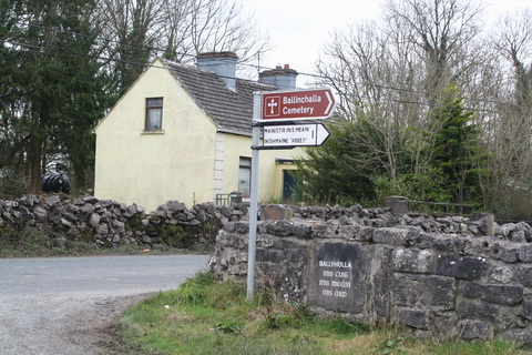
The turn to Ballinchalla
This is really for certified anoraks only. It’s a long way, mostly along a single-lane road. There are three gates, which you’ll have to open and close, and many sheep and cattle wandering about.
You can follow the route on the map from the turn, here, to the end of Inishard. You’ll see a sort of T junction on Inishard; there’s a sign there asking you to support the local fishing club. The route to the mouth of the canal is to the left; I would not advise anyone to try driving it at any time without a 4WD and it would be wise to check whether the track is under water before going any further.
The track is just inches above the water
The surface of the track seems to have been washed away in some places, leaving you to drive over rough stones.
Surface erosion
At the far end, there is a relatively small space in which to turn.
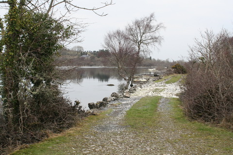
Where the canal meets Lough Mask
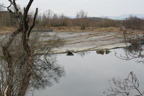
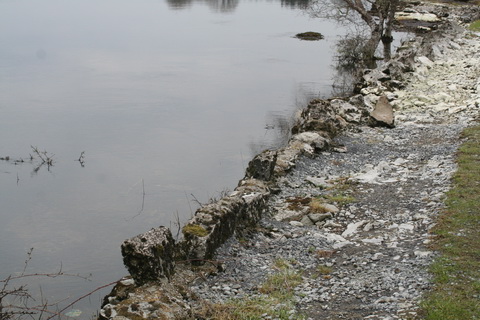
You will (all going well) arrive at the point marked “Eel weir” on the map. You will see that there is no embankment or towing-path along the canal to dry land. A channel was dug out into the lake; the spoil was used to form the embankment on the south-west side between the sluice and the Black Islands. The engineer’s reports refer to cutting a channel through the Lackbin Shoals, said to divide “the inner from the main basin of Lough Mask”, but the OSI doesn’t seem to use the term.
These photos were taken in February.

Water was visibly flowing left along here towards the canal mouth

The channel to the lake is to the left of the island

Another view of the island and the channel
The flow of water in the canal
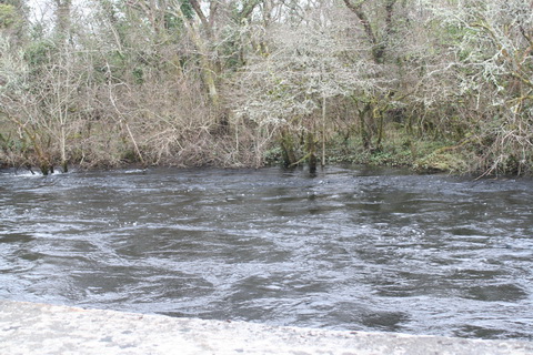
The eel weir

The eel weir (the structure carrying the nets) may have been moved a little way out into the lake since Maurice Semple took his photo
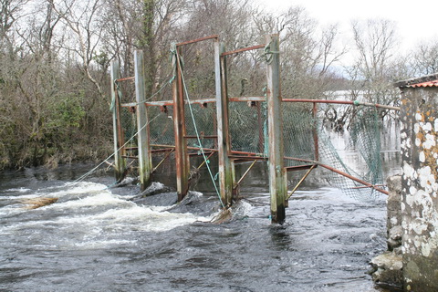
A close-up of the weir
Verb sap. Keep well back

Concrete tanks in which eels were kept alive
Underwater: tanks were built at different levels to cater for changing water levels
Pipes in the side for oxygenating the water
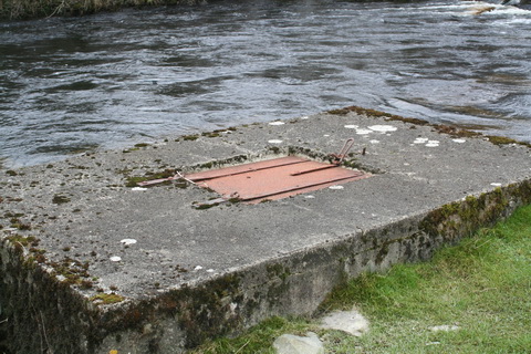
Tank lid. No eels inside (eel fishing is now banned)

I don’t know what the white container is
The flow
The Ballinrobe Navigation
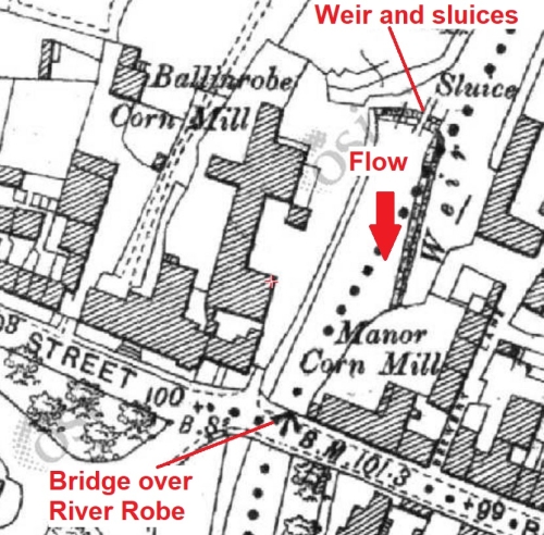
As the Cong Canal was intended to be just one link in a navigation extending from Galway Bay to Loughs Mask and Carra, it was thought that it would be a good idea to enable navigation to Ballinrobe, the only sizeable town on or near Lough Mask. It had several mills and a brewery (or at least the prospect of one) and the engineers gave much attention to the maintenance of water supply to the mills and for other uses. Making the River Robe navigable would require only one lock, which could be built near Springvale Mill.

Ballinrobe and Springvale (OSI ~1900)
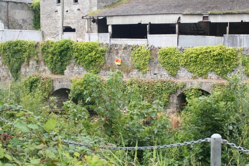
Two of Ballinrobe’s mills were above the town bridge, with a weir and sluices to provide water supply. The Board of Works undertook the work.
Ballinrobe mills
Here are some photos of the weir and sluices.

The sluices

The racks
Were those arches for water to leave the mill wheel’s pit?

Mill buildings 1
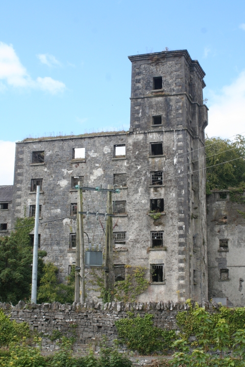
Mill buildings 2
A handsome house

The town bridge
The Board of Works also provided several iron bascule bridges and a stone bridge, as well as constructing a quay and harbour at Ballinrobe.
The quay at Ballinrobe
Looking upstream from the quay to the town bridge
Footbridge at the harbour
Steps and ramp to footbridge
Curious building on the far side of the footbridge; I don’t know what it was for
I walked some distance downstream from the harbour but didn’t have time to go on to the end.

Pleasant walk downstream

Stone bridge to cavalry barracks
The cavalry barracks

Looking downstream from the bridge
Metal bridge crossing the navigation

Sluice and fish-pass on the non-navigable branch
The Cong Canal was abandoned before the lock at Springvale was built, so boats from Ballinrobe’s mills would not be able to reach Galway — and there was nowhere else on Lough Mask where they could go. The Board of Works therefore decided to do no more work on the River Robe and the navigation from Ballinrobe to Lough Mask was never finished. However, Ballinrobe has a very pleasant waterside area and a nice walk too.
Links
Here is an account of a 1959 canoeing holiday in the area. It seems that the Cong Canal can be canoed (or kayaked), and I met a woman whose husoband had done it, but presumably not in the dry season as illustrated here.
I have some thoughts here on why it is believed that the canal was abandoned because it could not hold water. It is possible that that is true, but I have seen no evidence of it.
Here is a site about the history of Ballinrobe.
Envoi
If you can add to or correct any of this information, do please leave a Comment below.
![]()
[wow60]


I walked the canalbed in the summer when it was primarily dry. I do have photos which were online until a database error killed them!
Technology is wonderful until it isn’t! If you get them back, let me know and I’ll add a link. bjg
It has been suggested including by the late Maurice Semple that the canal was never actually finished at the behest of I think Sit Benjamin Guinness for two reasons
He didn’t want the general public traipsing across his front lawn from the old public pier of his remodelled castle just outside the dining room windows of the current hotel opposite where the tour boat is moored. There is an old right pf way from to the village which has been a point of contention over the years. He had Lisloughrey harbour built to the same aim.
He was apparently also a major shareholder in the M&GW railway who were building a branch to Ballinarobe which would been in direct competition with the canal
I didn’t see that in Semple’s chapter, but I have only three of his books and haven’t checked all of them. It’s not inconceivable, but the economic case for the canal as a navigation was, I think, pretty weak anyway. I have written elsewhere on this site about the lunatic assumptions made by proponents of Irish navigations in the nineteenth century; even thw Shannon Navigation works of the 1840s were not, in my view, economically justifiable. I don’t know what possible traffic from Mask to Corrib (or vice versa) could have justified the construction of the Cong Canal.
I’m not sure you’re right about the MGWR’s line to Ballinrobe. According to Ernie Shepherd’s history of the MGWR, the first plan to link Ballinrobe to a railway was the South Mayo Railway proposal of 1863, which got nowhere. Shepherd says “[…] the Midland had no plans to connect either of these towns [Loughrea and Ballinrobe] with its existing system”, but it did establish a cartage service in the early 1870s. Sir Benjamin Guinness had died in 1868. The MGWR didn’t become interested in Ballinrobe again until 1884.
bjg
I’m a frequent visitor to the canal. I can take you to the weir at the top of the ‘dry canal’ if you like.
Thanks, Conor. I’d love to take you up on that next time I’m up that way, but it probably won’t be for a while (I’m three hours’ drive away). bjg
Howdy
Thanks for a great write up on the canal. We were up around the canal’s northern sluice yesterday (ducked in under a fallen wall). There’s some nice masonry on the sluice and the original ironworks are still there – although not for long by the looks of the supporting wood beams. And someone unfortunately has bastardised the sluice by attaching some crude scaffolding and iron beams across it, maybe for eel fishing or poaching. Lovely limestone pavement scenery and flora around to boot.
By the way, on the 25″ map, what happens to the canal between Strandhill Lock and St. Mary’s Church, was it ever completed?
Thank you.
As far as I can see, the canal from Strandhill to St Mary’s Church was all dug out (note the footbridge at the church) but the work to make it navigable was not completed. The Engineer’s account in the 23rd Board of Works report says “The puddle-staunching, lining walls, and formation of the trackways between Strandhill lock and Drumsheel, were proceeded with as vigorously as possible” in the early months of the year, but he was told in April 1854 to stop all work on the navigational aspects. bjg
Pingback: On the Dry Canal at Cong | letitallhangout
Approx 400m Upstream of the gate with “Private Proterty Keep Out” signage is the most impressive of all the locks with all the Mechanism in place to open and close the sluice although now obviously siezed. The outflow from lough mask is visible from here and spoil heaps complete with drill holes for dynamite blasting are everywhere. Conor knows the location as we frequent the area quite regularly.
Thanks, Shane: that’s interesting. Is there evidence of provision for two pairs of gates? Are there, for instance, two pairs of gate recesses? The Board of Works reports suggest that the sluice was just a sluice and not a lock, but it is hard to see how it could have coped with varying levels unless it was a proper lock. Maybe the fact that it retained the sluice function caused it to be referred to as a sluice and not as a lock. bjg
Hi BJG – Your research into the canal is great and a very interesting read. I am a member of the Lough Mask Heritage Group and we would love to speak to you regarding an upcoming event. I wonder would you mind making contact with us – our email is loughmaskheritage@gmail.com. Many thanks
I have responded direct. bjg
Pingback: Where do correct ideas come from? | Irish waterways history
Pingback: Airija, Connemara | Kelionių užrašai
Thank you for taking to time to do such detailed research and sharing it. I grew up close to the canal (also kayed the full length of it about 10 years ago, although found it impossible to remain in the kayake for the final 50 metres before the canal reaxhed Cong)
I’m wondering would you know of where I could find information on the labour conditions during the time of building the canal? How large was the labour force, were there many deaths etc
Thanks again
The best place to start might be with the Board of Works annual reports for the period, most of which are available on EPPI. They include reports from the various district engineers, including Roberts for the Cong. I haven’t time just now to search all of them, but in the cases I checked he gave a number for those employed during the year. I think that the labour conditions depended very much on external conditions: during the famine itself workers were very weak but emplyment was sought after. But afterwards, with more opportunities available, some engineers found it hard to get enough workers. For deaths, you might try inquest reports or, better, local newspapers of the time: I use the online British Newspaper Archive.
bjg
We are thinking of buying a house in Tullaghmore, Neale. It has the Cong Canal running at the back of the house. Can the Cong Canal overflow and flood there?
Here is a link to the property:
https://www.daft.ie/11272394
You seem to be very knowledgeable about the Cong Canal. Any information would be appreciated.
I don’t know: I don’t live in the area. However, perhaps someone from thereabouts will see this and respond. If not, I suggest contacting the Office of Public Works in Headford and asking them. I’m not sure which section you should talk to, but no doubt they can put you right. The numbers are on the first page of the OPW telephone directory PDF, which is downloadable from this page. You could also have a look at http://www.floodmaps.ie, which I find very slow and clunky, but I think it says that the R334 was flooded at Nealepark/Cahernichole in November 2009 (along with much of the rest of the country). bjg
Thanks so much!
Hi, very interesting site on the Cong Canal. My wife and I visited Ireland in 1989 on a bicycle trip and we went through Cong and I saw the Cong Canal first hand. We saw a large picture book on the Cong Canal in a store at that time. It was too large for me to carry on a bike but I thought it was really interesting and tried to locate a copy when we got back to the US. It must have been only locally printed because I could never locate the existence of the book again. You should try to locate a copy in Ireland as it would give you a lot more information on the canal.
Thank you. bjg
Pingback: Cong, das Tor zu Connemara | Zeilenabstand.net - Kulturblog und Webdesign
Pingback: Architectural marvel or hideous eyesore: Sluice Leśniewo Górne? – PLESZAK
I live at Cahir Pier on the Lough Mask shoreline 3.5 miles from Ballinrobe. The Pier was built from cut limestone slabs.We were led to believe that the pier was built to facilitate boats coming from the canal to carry goods destined for Ballinrobe.Could this be true.
Is that the one near the Lakeshore Holiday Homes? The pier there is shown on modern maps (Google maps and the Ordnance Survey http://map.geohive.ie/mapviewer.html) but it’s not on the Ordnance Survey’s Historic 25″ map, done around 1900, or the older 6″ map, done around 1840. That suggests that the pier was built in the twentieth century. bjg
Some further info: Caher Wharf was built by the Congested Districts Board, at a cost of £168, in the latter part of the 1890s. Of that, £164 was spent before 31 March 1897 and £4 in the following year. It is referred to in the CDB’s fourth https://archive.org/details/op1253392-1001/page/n53, fifth https://archive.org/details/op1253529-1001/page/n63, sixth https://archive.org/details/op1253664-1001/page/n67 and seventh reports https://archive.org/details/op1253797-1001/page/n81.
I suppose there were seed potatoes too.
bjg
We were up in Cong again today (Headford locals) and I explained some history of the canal project to my 10yr son and it brought me back to your bookmarked post, it’s such a valuable, accessible resource!
And I just bought Semple’s book on Abebooks, so really looking forward to reading it and all its maps, illustrations etc.
Cheers
Pingback: The Cong Canal – industrialheritageireland.info
This canal has intrigued me ever since a brief visit in 1970 or 1971 to examine the remains of Lock 3.
Your history and exploration notes are immensely useful and revealing. Thank you for their preparation.
Indeed they tempt you to find out more which is what I plan to do when I visit next month, May 2024, during which I plan to shoot a video which will be uploaded to YouTube. I’ll provide details in due course.
I managed to obtain a copy of Maurice Semple’s excellent book which I found to be fascinating in totality, and which provides an amazing amount of detail about the canal’s construction and the cessation of same.
You mention a bridge that you failed to locate:
There was also “a Bridge on the road from Cong to Ballinrobe over same old River Channel”
I believe this to be the bridge that faces you as you turn right to approach Drumsheel Bridge.
Incidentally your embedded links to access the old ordnance maps no longer work. I managed to view them through https://www.heritagemaps.ie/WebApps/HeritageMaps/index.html though it’s not the easiest of sites to navigate.
I’m looking forward eagerly to my upcoming exploration.
There is a new local history book about the canal for anyone interested…very detailed and thoroughly researched. “The Cong Canal – Mystery of an abandoned waterway” by Peter Dillon. Published by KenilworthCollins, 2023.
I have been exploring the canal very recently having learned about it over 50 years ago!
I bought a copy of the book from the Irish History Bookshop in Cong to supplement my copy of Maurice Semple’s book By The Corribside recommended by Brian.
Peter Dillon’s book is excellent and I recommend it highly. There are a limited number of hardback copies left but it has been republished as a paperback. Clearly there’s a demand for the book.
The reason for my visit was to film the canal and I spent around ten days doing so. I am editing all my footage at present with the intent in uploading the video to YouTube in the near future.
It’s a very thorough record of the canal in 2024 and as far as I can establish it will be the only video of the canal available online.
I will post a link on here once it’s live.
The video entitled ‘The Cong Canal Today – Visiting a long forgotten Irish Waterway’ is available now on YouTube at https://youtu.be/vuu74J3zvbc?si=ZUFgKC29vvVYtNk5
I hope you enjoy watching it…