This is Page 2 of a four-page account of the abandined Main Line of the Irish Grand Canal. If you missed Page 1, you can find it here.
Update November 2009
Added a link to Pól’s web page about the Cage bridge.
Update September 2012
Added Richard Twiss’s comments, from 1776, about the City Bason.
Update October 2012
Added the Rev G Hansbrow’s description of the City Bason, from 1835.
Having come down the line of the canal as far as The Gut, accompanied most of the way by the LUAS tram, let us leap magically northwards from McCarthy Terrace to the junction of James’s Street and Echlin Street; the junction is at the top of this sketch-map the harbour and its surrounding streets. We’ll take an anticlockwise tour of the area, and we will pass McCarthy Terrace again en route to Bond Street (at which point we move to Page 3).

Grand Canal harbour and district
This is the entrance from James’s Street to Echlin Street.

Corner of Echlin Street and James’s Street
This friendly local pub is at the other end of Echlin Street, where it meets Grand Canal Place.

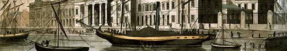
The Old Harbour
And, at the left of that photo, you can see a bit of the curved Grand Canal building — which, happily, is protected against the depredations of developers, although not against those of time and neglect. It’s difficult to get a shot that shows the whole of the building. Here’s one from the James’s Street end of Echlin Street. You can just about make out the name on the building, just under the roof.

The curved building from James’s Street

A view from the west
This next photo is taken from the western end of St James’s Avenue, looking back east.

St James’s Avenue
We’re taking St James’s Avenue to get to Basin Street Upper. Another look at the map:

Another look at the map
The sketch shows the Basin, but it doesn’t actually exist any more. The supply of water to the City Basin ceased in 1869 as the new high-pressure water supply from the Vartry scheme came into use. These blocks of flats have been built on the north end, along Basin Street Upper. Incidentally, what used to be called Basin Lane, running from James’s Street to the north end of the Basin itself, now seems to be called Basin Street Lower.
Richard Twiss, in A Tour in Ireland in 1775 with a Map, and a View of the Salmon-Leap at Ballyshannon [London 1776], wrote:
The city bason is a reservoir, capable of holding water to supply the city for some weeks, when the springs from whence it is filled are dry; both the springs and the reservoir were dry whilst I was in Dublin. In 1765 a canal was begun to be cut from this place, and intended to be continued to Athlone, which is about seventy English miles off, in order to open a communication with the Shannon; at the rate the work is at present carried on it bids fair for being completed in three or four centuries.
And here is the Rev G Hansbrow in his An Improved Topographical and Historical Hibernian Gazetteer; describing the various boroughs, baronies, buildings, cities, counties, colleries, castles, churches, curiosities, fisheries, glens, harbours, lakes, mines, mountains, provinces, parishes, rivers, spas, seats, towers, towns, villages, waterfalls, &c &c &c, scientifically arranged, with an appendix of ancient names. To which is added, an introduction to the ancient and modern history of Ireland published by Richard Moore Tims; William Curry, Jun and Co; John Robertson and Co, Dublin; King and Co, Cork; Marks, Waterford; Simms and Mairs, Belfast; Campbell, Derry; M’Kerin, Limerick; Wheelock, Wexford; Collins, Drogheda; Dunlap, Coleraine; Purcel, Tralee; Kyte, Cashel; Blackham, Newry; Bole, Castlebar; Devir, Westport; and other booksellers in 1835:
The City Bason is the pleasantest, most elegant and sequestered place of relaxation the citizens can boast of; the reservoir, which in part supplies the city with water, is mounded and terraced all round, and planted with quickset hedges, limes and elms, having beautiful green walks between, in a situation which commands a most satisfactory prospect of a vast extent of fine country to the south. The entrance is elegant, by a lofty iron gate, and the water that supplies it, is conveyed from the neighbouring mountains.
The early OS map shows a burial ground to the west of the Basin and a rope walk to the east of Basin Street.

Basin Street flats
On the other side of the street is the James’s Street Christian Brothers School. Its website has some interesting historical information.

James’s Street CBS school

James’s Street CBS school
There are some older houses along the street.

Basin Street Upper 1

Basin Street Upper 2
The canal narrowed as it passed the south end of the Basin and curved north to the harbour. This narrow section was known as The Gut. In 1974, Elgy Gillespie spoke to local residents for an Irish Times article about whether the by-then-derelict line of the canal should be filled in (most of them wanted it filled in because of the rats and the danger that children might drown). She said that there was a footbridge across The Gut and that it was called The Cage because of the sides added when a man was blown off it in a gale and drowned in The Gut. The bridge does not appear on the maps I have consulted, but it might have led to this narrow section at the bottom of Basin Street.
It is surprising how little information has been available on t’internet about this bridge, but happily the indefatigable Pól has researched the matter. He has written about the history of the bridge, mapped its location and even found a photograph: all is revealed here. And now I owe him a pint. There is also a photo here, with some other photos from the area.

Possible link between Basin Street and The Cage (footbridge). The buildings may be Brandon Terrace
And just to finish with Basin Street, here is Basin View — which, alas, I cannot locate on any map. Where does it join Basin Street?

Basin View
We emerge from Basin Street to see Grand Canal Bank (more or less) across the canal (I mean, where the canal was) from us, to the south.

Grand Canal Bank
I think this is (as it were) a subset of McCarthy Terrace .

McCarthy Terrace
Have another look at the map before we move on. We’ve come from James’s Street down Echlin Street, west along St James’s Avenue and then down Basin Street Upper to McCarthy Terrace. Now we move east for a quick look at some of the streets on that side of the harbour.

The map again
This is Forbes Lane from Marrowbone Lane. Turning right up here, from Marrowbone Lane, meant a narrow and dark approach to the glory of the canal (where I never saw a boat moving, alas).

Forbes Lane

Marrowbone Lane and Marrowbone Lane Close
This area of Dublin has been associated with the city’s water supply since the thirteenth century and it is pleasing to note that Dublin City Council’s water department is still based on Marrowbone Lane.

Dublin City Council water department offices
We return to the Harbour area. Long’s Place has some gloomy features …

Long’s Place: a bit grim
… but parts of it are attractive. The canal ran behind where the wall is on the left, and the harbour began at the far end of the road.

Long’s Place: the cheerful side
Here is Pim Street, looking towards Forbes Lane.

Pim Street
Newport Street runs at right angles to Pim Street.

Newport Street

Newport Street and Pim Street
This is the uninspiring corner of Bond Street and Pim Street.

Bond Street and Pim Street
Now another look at the map.

The map again
You can see that the harbour had five main sections:
- at the north, the section with the semicircular end, behind the curved building, connected by a narrow cut to …
- a rectangular section, connected by another narrow cut to …
- a second rectangular section, from which a short canal leads east (right) to …
- a small basin inside a building, while finally …
- three short fingers stretch south from the west side of the second rectangular section. These fingers were the dry docks. The eastern dry dock may have been covered.
You can also see that the south-east corner of the canal is defined by Bond Street and Long’s Place. We’ve already looked at Long’s Place, so here are some photos of Bond Street. You’ll recognise the building on the right as the one on the corner with Pim Street. This is a view away from the canal.

Looking down Bond Street
The next photo is looking in the opposite direction.

Looking along Bond Street towards the canal
The wall on the right (which wasn’t there in canal days) shows where the southern end of the southernmost rectangle of the harbour was. That rectangle was the last section of the harbour to be filled in.
The road ahead is curving left into Long’s Place (thus avoiding plunging into the canal). There was a swing bridge across the canal just south of where it entered the harbour; it ran from Bond Street to about halfway down the length of the dry docks.
If we go a little way south along Long’s Place, we can look across the old line of the canal.

Looking west across the line of the canal
You can see the distinctive roofline of the Basin Street flats in the background. I wonder whether the two stone flags running from left to right, about one third of the way up the photo, might define the edge of the canal. I didn’t spot them while I was there, alas.
Note the wall on the left.

Looking west again
Here’s the other side of the same wall. Little trace of the canal here.
At this stage, we’ve gone around three (well, two and a half) sides of the harbour and we’ve looked at the site of the City Basin as well. Now we move to Page 3 of 4 to look at the Guinness connection.


My Great Grandfather, Michael Daly, a shipwright, worked at James St. Harbour building and maintaining barges in the 1860s. In 1869 he was operating at Portobellow Harbour and his brother Denis took over as foreman at James Street. When he retired around 1890, his son, Edward Daly took the position. They were all shipwrights. They must have worked for the Grand Canal Co. Would you have any information on personnel?
John
I haven’t any such information, I’m afraid: I think Waterways Ireland (info@waterwaysireland.org) is the only place that might know where the personnel records of the Grand Canal Company are.
I presume you’ve had a look at the online census results: I see that Edward, 49 in 1911, was a widower by then but that his son, another Denis, was following his trade as a shipwright apprentice. Anyone who’s interested in ancestors might have a look at http://www.census.nationalarchives.ie/
bjg
I went to Basin lane school then to james st CBS from about 1970 to 1983. On our way to school from Kilmainham, we use to cross over the bridge which was almost opposite to to the small opening (arch) into Basin lane.
We always refered to it as the iron bridge. They filled the canal in in the mid 70’s. I remember all the kids in the school catching eels with their hands as the water was draining.
Where the new secondary was built beside the primary school was where the remains of the harbour was that I remember.
David
That’s very interesting. What did you do with the eels?
I don’t suppose you have a photo of the iron bridge? I haven’t managed to find one anywhere. There’s a pint of the most famous local product for anyone who can give me a photo with copyright clearance to use it!
bjg
There 2 families as you enter basin lane from the old canal end, who lived in the first two houses you come to (just before the mater dei school). The two families were baileys (cousins) I went ot school with Ray Bailey, Robert and Paul where his cousins who lived next door. I assume if the families still live there they would have plenty of info on the area and the iron bridge.
The Irish Railway Records Society has inherited peronnel records for the railways. I don’t know if they extend to the Grand Canal Company but it might be worth asking. There is a web-site at http://www.irrs.ie
David: thanks for that. I’ll try to visit next time I’m in Dublin.
bjg
Antoin
Thanks. I’m pretty sure Waterways Ireland has all the Grand Canal Company records. They have an archives room in their new HQ in Enniskillen but they haven’t got everything sorted out yet (which could take them a while). bjg
Hi I lived in the 2nd house pictured on James’s Avenue from ’66 to ’75 and palled with Peter and Derek Bailey of Basin Lane upper. All went to Basin Lane school nuns, primary and secondary. No picture of the “Iron Bridge” unfortunately but as you exited Basin Lane you would turn right on a pathway alongside the canal, walk appx 30 to 40 yrds before stepping onto the bridge. From the vantage point of the bridge looking away from the harbour and to your right you could clearly see the play area of the nun’s school. Also while we lived there it was always Basin Lane upper and lower not James’s Avenue. Directly opposite our house No.2 was the 8ft high perimetre wall of the original James’s st. christian brothers secondary school and monastery. The site of the new secondary school was commonly referred to as “the ruins” which was our main play area. This comprised of many structures, some completely levelled, some half standing walls, waterfilled cavities and 3 large nissan huts. It was reputed that a live bomb was found amongst these ruins. We also regurlary made rafts from pallets stuffed with aeroboard and actually sailed these on the harbour while sometimes we swam in the half filled dry docks unknown to our parents of course. Scutting on the old guinness trains was also a favorite pastime. I might just write a book on all the fabulous memories.
Great work, I admire the effort you’ve put into these pages! It’s interesting to read your descriptions and follow along on the Google satellite maps. It’s amazing how everything is so clearly defined from the air.
I have just seen a photo of the iron bridge on Facebook on The Fatima Mansions page, I thought you would be interested
I have copied it and will try to email it
can you send me an email address for the photo
Replied by email. bjg
Iron ridge photo over canal near Basin lane mentioned by David McNamara above.
http://www.facebook.com/pages/FATIMA-MANSION-fatima-flats-D8/113310228705562?v=app_2309869772#!/photo.php?pid=140189&id=113310228705562&ref=fbx_album
Thanks to both Davids for the info and link.
bjg
the internet is great… they are coming out of the woodwork.
2 shots of the iron bridge: One with the canal in tact and one with the canal being filled in.
Thanks to Cosmo
http://www.dublin.ie/forums/showthread.php?3847-Basin-street-St-James-street-Schools!!/page59
Great stuff, David: many thanks. Well worth looking at! bjg
Hi, this is very interesting, you’ve put an incredible amount of work into this.
You wouldn’t happen to know if ‘Canal Harbour’ or ‘Grand Canal Harbour Cottages’ were near the Grand Canal Harbour or basin would you?
I’m researching my family history and my grandfather (William Roberts) and great-grandfather (George Roberts) lived in 1 Grand Canal Harbour Cottages (aka Canal Harbour) according to the 1911 Census. It is in the Usher’s Quay electoral district, so I think it might be near Grand Canal Place, but I can’t find any mention of it anywhere.
According to the Dublin Electoral Lists the street was still in existence in 1940, but it appears to have disappeared quite a while back. I’m really curious to know where it might’ve been. If you or any readers have any ideas then I’d be extremely grateful. Thanks, Alan.
Thanks, Alan. I’m afraid it’s not shown on any of the maps to which I have access. I wonder whether the cottages might have been part of the harbour complex. We know there were some houses (occupied by senior folk like the canal company engineer) around the harbour; perhaps there were some cottages too. But I fear I have no definitive information. It might be worthwhile asking on http://www.boards.ie which has a Dublin City forum in the Regions category; there have been visitors to my Grand Canal pages from there. bjg
I’ve been researching our family tree. The Gouldings lived in No 8 Basin View in 1901 unfortunately there is no record of Basin View in that census.
There were only 8 houses at the time so it just may have been overlooked.
I’d be very interested to hear if anyone has done a similar search.
Mar.
No doubt you have seen Basin View on the Ordnance Survey map, but just in case …. Select the Historic 25″ map. bjg
Pingback: Enigmatic « But Is It Art? Photography by Declan O'Doherty.
Alan Mccormac
did you have a look at irishgenology .ie I has all the dublin churches listed
If you know your gparents or ggparentsnames you can go back to the
1700s in most churches and for anyone interested in the iron bridge there
is a photo on dublin.ieforums .dublin neighbourhoods .south west inner city
basin lane post
I think the Grand Canal curved building was once the CIÉ IT building and that I once went there for an interview
what is a rope walk?i allso saw one on the old osi. map for the ringsend basin.
A long space where the strands of a rope could be assembled. Wikipedia has a piece here and googling for ropewalk images will produce some pictures. bjg
Pingback: James Basin | intoparadiseregained
Pingback: In the fields off James’ St | Wide and Convenient Streets
My Grandfather, Bartholomew Daly was baptized at St. James Church in November of 1861. On the baptismal record at the church it lists his father as Michael Daly and his mother as Mary Kelly, and their residence as “Bell Bank.” I believe That location was just west of the Gut, just below the dry docks. I understand it was so named because it was the gathering place for passengers waiting to board the barges. They would ring a large bell as the barge was getting ready to leave. Michael was working for The Grand Canal Company as a shipwright at the time. They later moved to Portobello Harbour when he operated the barge building and repair business at that location for a number of years. I would love to have pictures of either location if anyone has any.
Thank you for that. Belle Bank is shown on the 25″ Ordnance Survey map (of around 1900) just here http://maps.osi.ie/publicviewer/#V2,713948,733636,11,9. I don’t know how it got its name, but it wasn’t for the reason you give: the passenger boats left from Portobello, not from Grand Canal Harbour. The passenger services ceased before your grandfather was born.
One place with photos and drawings is the Dublin City Library collection http://digital.libraries.dublincity.ie/vital/access/manager/Repository and the National Library has photos too https://www.nli.ie/digital-photographs.aspx
bjg
Hello all
It was great to read this article! I also enjoyed the banter within the comments.
I have but one request please???
Where can I find pictures of the Canal bar pub that was Bond street?
Thanks
Steve
I’m 74 years old. I was born in Basin lane and I remember the footbridge that led over the canal to Fatima Mansions.I left Basin Lane when i was 5 years old for Ballyfermot. It was like emigrating to a different country then. We thought we were out in the sticks. I attended the convent school in the lane and afterwards, the Christian Brothers around the corner by the old harbor, both long gone. The footbridge started at the last house at the top of the lane and went right across what is now the Luas line onto Fatima Mansions.I was very young at the time, but this what I remember
Thanks for that, Owen. Brendan Behan thought of Crumlin as Siberia https://comeheretome.com/2012/01/05/brendan-behans-siberia/ and Ballyer was even further out! bjg