A mile to the eastward of the Beeves [rocks] is the principal and only navigable entrance to the River Fergus, which comes from the NNE amid vast banks of mud, and numerous islets and rocks. Having passed the Beeves, steer up for Feenish Island till you bring the tall square tower of an old castle (called Court Brown) in one with a house near the beach, bearing SSW. Keeping this mark on, you may steer up the Fergus till another tall square tower on Cannon Island (Cannon Castle) is in one with the north point of Low Island, WNW¼W; which is studded with white houses. You must then keep rather more to the northward for the round hill of Coney Island, until Cannon Island is in one with the peak of Grady Island, W¼S; when you must bear away for the east point of Coney Island; you will then shortly come into five and six fathoms, where you must anchor with the sharp peak of Coney Island bearing N by E, and Cannon Castle WSW1/3W in about six fathoms soft muddy bottom.
Beyond this it would be impossible to proceed without a pilot. The river beyond Coney Island winds through vast banks of mud, extending from 1 to 1½ miles from the shore, decreasing gradually in width from 600 yards, and varying in depth from nine to three feet up to the town of Clare [now Clarecastle], nearly seven miles in a direct line, and about nine following the channel.
At Clare the bed of the river is dry at low water, but there is a quay, alongside of which vessels load. Clare is a miserable place, though the shipping port of Ennis. It is a military station.
Pilots may be had at Low Island, but no vessel above 150 tons should go up to Clare.
To the westward of this principal entrance of the Fergus, there is a multitude of islands (some of considerable extent) and rocks; among which are various intricate channels, totally unfit for navigation, except for small vessels, on account of their narrowness, the strength of the tides, and the frequent shallows, though there are spots with 10 to 13 fathoms depth.
From the Sailing Directions for the Shannon Estuary, completed before 1848 by Commander James Wolfe RN, being the result of Surveys made by Order of the Lords Commissioners of the Admiralty.
Here is a Google map.
The Fergus estuary is the roughly triangular area stretching north from the main line of the Shannon estuary. You can see Shannon Airport at the bottom right corner.
The Ordnance Survey map shows the “vast banks of mud”.
Here are pages about some aspects of the western side of the Fergus estuary.
The lost island of Islandavanna and the estuary embankments
The rudely constructed quay at Ballycorick
The cattle-carriers of Crovraghan
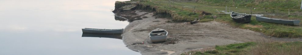
The intricate channels and interesting boats at Lackannashinnagh
Under the house of the dead at Kildysart
There is a post here with some information about the River Fergus above Clarecastle (and other interesting items).
Those are links to pages on this site. The UCD School of Archaeology has, for many years, been investigating the Fergus estuary and has found remarkable evidence of settlement and activities on the estuary stretching back to the Iron Age (about 100 BCE) and the Bronze Age (about 800 BCE). Read about the project here and see photos of mediaeval fishweirs here.


Ship Wrecks
When the slobs were being dried at Island Avanna, the Company that was drying it bought a ship named the ‘Sand Lark’. It was haunted and one of the men in it saw a ghost on deck and he never saw or spoke again. The captain hung himself in his own cabin. One night it was anchored near the Slob and the workmen were sleeping in it. When they woke in the morning they found themselves stuck in the rocks near ‘Boland’s rocks’. They were rescued by a man named McMahon from an island near by. It is said that its owner never held it and it is also said that a priest drowned himself out of it.
Michael Slattery
The Schools’ Collection, Volume 0607, Page 400C
I can’t find the Sand Lark listed in Lloyd’s Register and I can’t find any report of the ship of that name being lost in the local press of the 1880s.
Hi, Eric. There was a sailing barge called the Sandlark based in Garrykennedy; it travelled to.Limerick and could have sailed on the estuary too. I don’t know when it was built; its remains were still around on Lough Derg until recent years. bjg