
This article was written in 2002: circumstances on the Clodiagh may have changed since then. I have added some photos and some extra information about the lock.
Update: on 7 April 2010 two kayakers were drowned at a weir on the Clodiagh at Portlaw. Story here. May 2011: the official report on the drowning is on the Marine Casualty Investigation Board website.
Update October 2010: added two 1985 Chris Allen photos, the waterwheel pits and the engine house, under a Creative Commons Licence.
Update April 2011: Portlaw Heritage Trail set up.
Update August 2011: link to Portlaw Heritage Centre blog.
Update March 2017: an ad from 1785 about flour mills at Portlaw and water transport to Waterford by three rivers: the Clodiagh, the Suir and St John’s Pill.
The compilers of the Euromapping Irish waterways map didn’t miss much. Their map shows, for example, the Bride, the Castlemaine, the former Bridgetown Canal and the position of the tiny Broharris, none of them amongst the most-used waterways today. But the map doesn’t show the Clodiagh, a tributary of the Suir.
The town that stands on the Clodiagh is shown: Portlaw, about two thirds of the way upriver from Waterford to Carrick-on-Suir. If you’re on the N24 Limerick to Waterford road, and you want to go to somewhere on the Cork side of Waterford city, you can cross the Suir at Carrick or at Fiddown and follow a minor road to the south of the river. The surface is surprisingly good: it was improved for the Tour de France some years ago. But there is one hump-backed bridge, about half way between Fiddown and Kilmeaden, and it crosses the Clodiagh, a river that was crucial to one of the most extraordinary industrial empires of the south of Ireland. Turn westward off the road and you’ll find yourself in Portlaw.

The road-bridge at Portlaw
There is no towpath under the bridge.

The River Clodiagh to the left, the canal to the right
Portlaw’s beginnings
Portlaw is a small town in Co Waterford, on the river Clodiagh, a tributary of the Suir. It was developed in the nineteenth century by the Quaker Malcolmson family, and may be the only planned industrial town in the republic of Ireland. At its peak, it had over 4,000 inhabitants and, by 1844, over 1,800 people worked at the plant.
David Malcolmson, born in Lurgan in 1765, came to Clonmel in 1784 to work for Sarah Grubb at the Anner Mills. After some years, during which he held a number of different jobs, he went into the milling trade with his brother John; they also had an interest in the coal trade and boat-building.
According to Desmond G Neill
In 1819 he brought three of his sons, Joseph, Joshua and John into partnership in the firm, now named David Malcolmson & Sons.
In 1822 the Malcolmsons leased a mill at Pouldrew, which brought their operations further down the Suir, nearer Waterford. They decided to diversify, and in 1825 they built a cotton mill nearby at Mayfield, Portlaw, where there was a disused ironworks and where the river had been made navigable for barges of 20 tons. Five storeys of the original seven-storey cotton mill remain today.

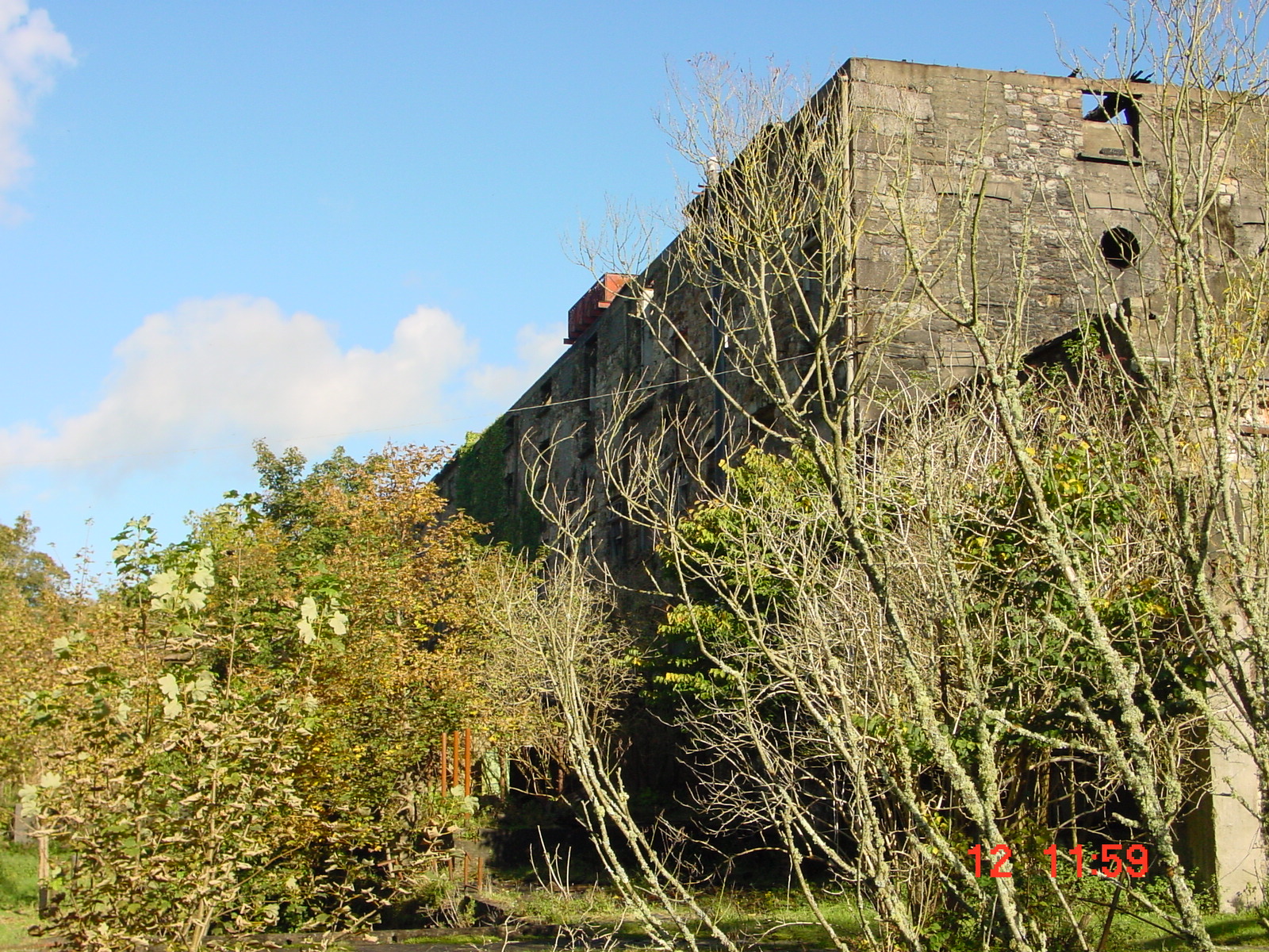
The main building at Portlaw
The importance of water
It was the Clodiagh that first attracted the Malcolmsons to Portlaw. Central to the operation was sophisticated use of the waters of the Clodiagh. A weir, with a fish-pass, diverted water to power three 30′ water-wheels and to provide water for the town and the mill: according to Bill Irish
Water was diverted with ingenuity from a sluice on the river through the millpond, and underground culverts directed it into a huge water-wheel which provided the motive power for the pumping plant. From the plant, water was pumped through pipes uphill for half a mile to a small pond 153ft above the factory roof, which gave a magnificent gravitational fall to feed the factory operations, the fire hydrant reservoir in the mill parapet, and freshwater pumps in the village.

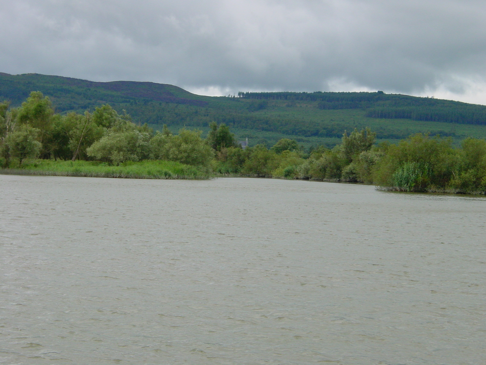
Where the Clodiagh joins the Suir
Chris Allen took some good photos in 1985 and licensed them for re-use under the Creative Commons Licence. Here is one of the waterwheel pits:
 1557367_f7a4cf4d")
Two waterwheels were sited here and drove the original cotton factory. © Copyright Chris Allen (1985) and licensed for reuse under the Creative Commons Licence
Here is the other, showing the engine house:
 1556136_80060455")
The engine house contained two rare Robey stationary steam engines: a uniflow and a side by side compound. © Copyright Chris Allen (1985) and licensed for reuse under the Creative Commons Licence
Water that had passed the water-wheels fed a half-mile stretch of canal, which rejoined the Clodiagh downstream and was used to carry goods to and from the mill. The canal ran under the factory receiving-house and (according to Bill Irish) it “intensified the fall in the head-race”. He says:
For the cotton factory alone over 60 seagoing vessels of 100–150 tons and 150 open boats of 30–40 tons made passage between Waterford and Portlaw annually.
He suggests that John Skipton Mulvaney or William Dargan may have designed the canal system. The canal is navigable, at least by small boats, up to the village.
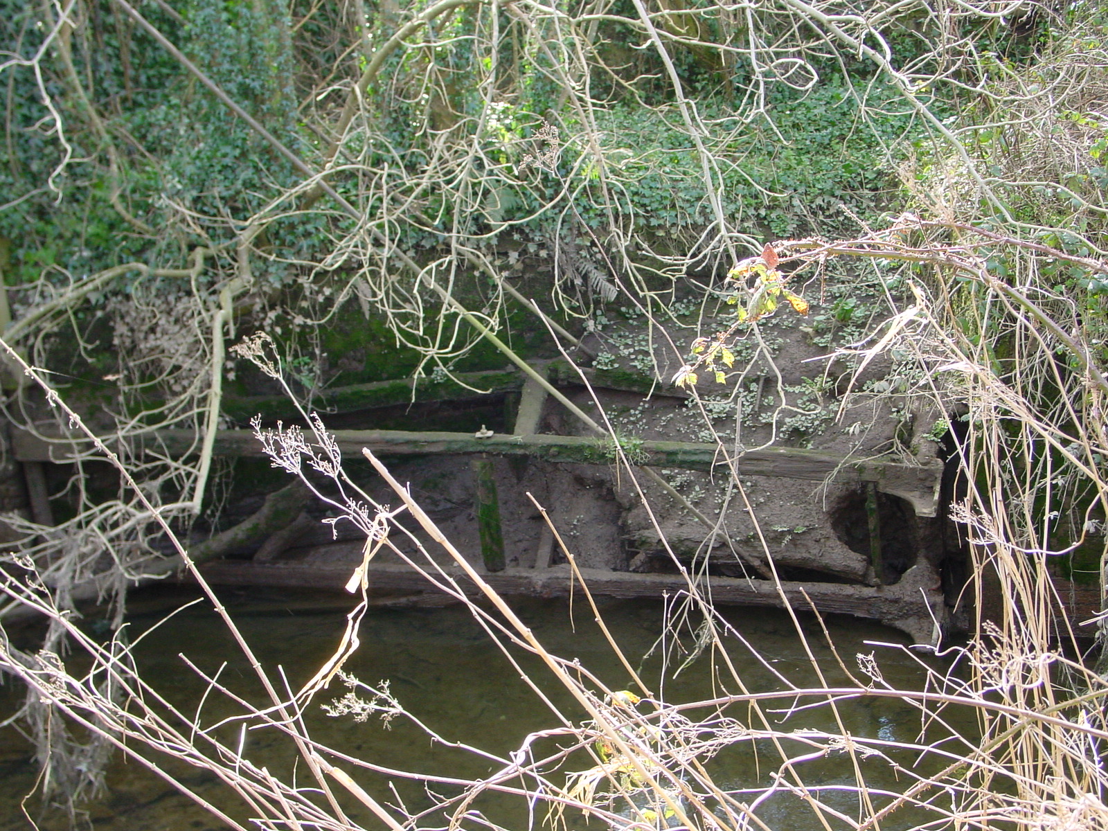
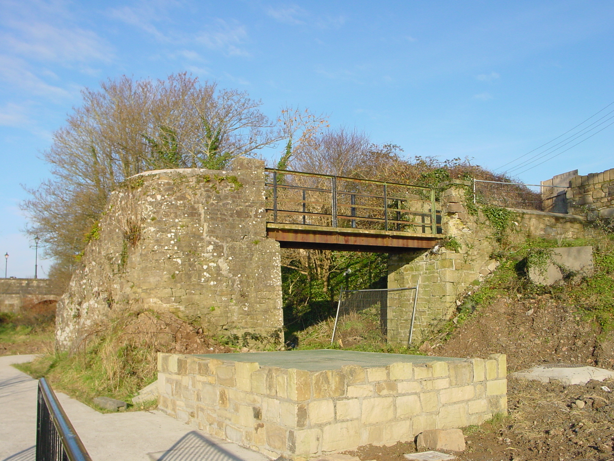
The lock at Portlaw
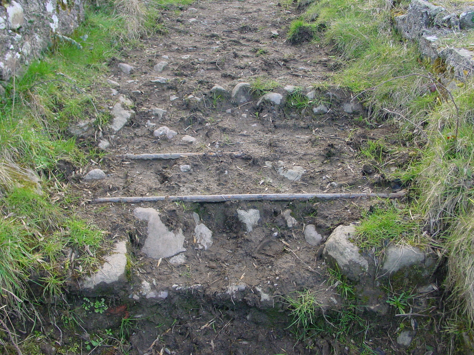
The remains of the only lock on the canal can be seen at what is probably a horse-bridge, just downstream of the town bridge.

Horse bridge with supports for lock gate
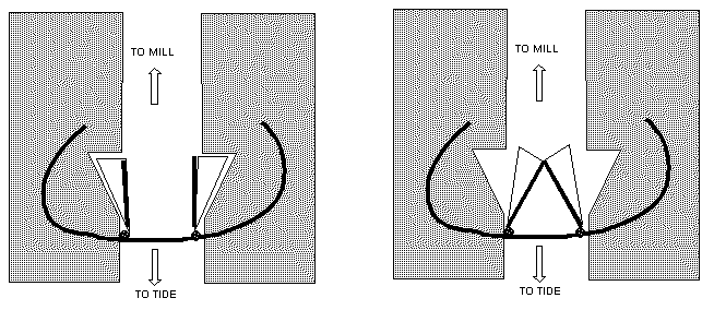
The lock had a single pair of gates. The Clodiagh is tidal up to Portlaw. It seems likely that, when the incoming tide made a level with the water above the lock, the gates would open, but a falling tide would close the gates automatically. Enquiries amongst well-informed waterways enthusiasts have found no similar lock elsewhere in Britain or Ireland, although a similar principle may be used on coastal sluices. I would be glad to hear from anyone who can provide more information or explanation.
In plan, the gates are triangles with rectangles on the end, with the apex of the triangle at the bridge end and the rectangle attached to the third, short, side remote from the bridge. The gates fit into brick recesses when the lock is open.

Gate recess
The gates have metal supports but wooden structures with wooden faces. All three sides would have been acted upon by the water: one opposing the incoming flow and two the outgoing. This sketch was given to me by the late Mike Stevens; the curve shows the bridge:

How the gates may have worked

Gate support
The weight of the gate is taken by the vertical metal post at the bridge, which has tie-bars through it transferring the load.

Tiebars

A gate from the far side
The Malcolmsons were also involved in the River Suir Navigation Company, which enabled 300-ton vessels to reach Carrick-on-Suir, with teams of twelve horses pulling pairs of flatboats further upstream to Clonmel.

The weaving shed and a chimney
Portlaw: planned town
The Malcolmsons built several streets of houses for their workers, many of which still have their distinctive round roofs, which were covered with tarred calico. The calico was produced at the mill and the tar was a byproduct of the firm’s gas works, the town being one of the first with gas public lighting. These roofs were later copied in Belfast and on the Ruhr.

Portlaw roofs

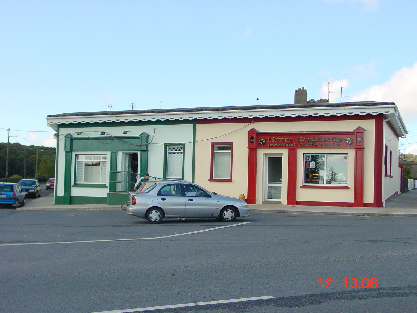
Shops in Portlaw

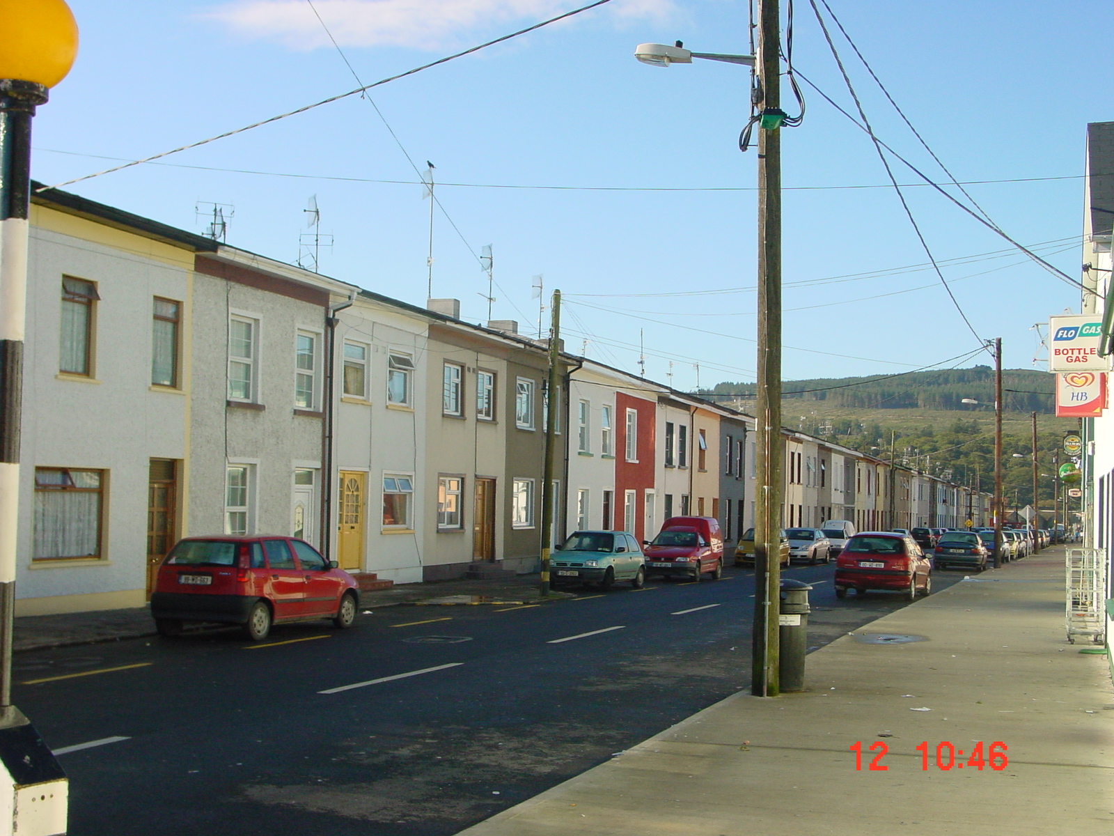
A street in Portlaw
The Malcolmsons provided a school, with seven teachers at its peak (and with Bible-based but non-sectarian education), a hospital, shops (with lower prices than those in the surrounding areas), a bakery, a Provident Society, a Tontine Club, evening classes, a Literary Society, a Philharmonic Society ….

The courthouse/school
The Portlaw planned town may have influenced the design of Bessbrook in Co Armagh, which in turn influenced George Cadbury’s plans for Bournville and Titus Salt’s model village of Saltaire. Portlaw is thus extremely important, not just to Ireland but to all of these islands.
The Malcolmson empire
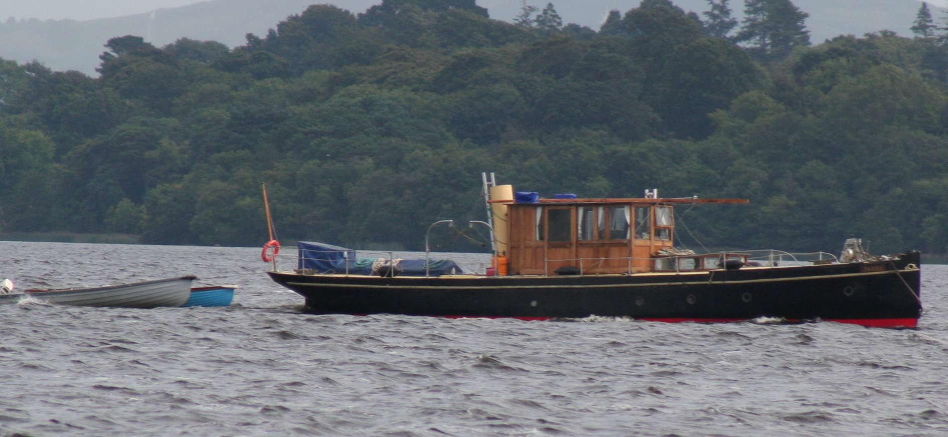
The Malcolmsons also owned the Neptune ship-building yard in Waterford, where the Phoenix was built. As well as the River Suir Navigation Co, they were involved with the Waterford Commercial Steam Navigation Co, the Cork Steam Ship Company, the London–St Petersburg Line, the London and Limerick Steamship Company and others. Bill Irish says that by 1858 they had 70 ships registered in Waterford, with interests in many others elsewhere.

The Phoenix on Lough Derg in 2008
Joseph Malcolmson (of the second generation) was a director of the National Irish Bank and a shareholder in several railways and in coalmines on the Ruhr. In Portlaw, operations expanded from spinning and weaving to include bleaching, dyeing and printing.
But Joseph died in 1858 and his widow withdrew her share of the capital from what had remained a partnership, by then called Malcolmson Brothers. He was the oldest brother, and the next oldest two, Joshua and John, were involved in the business, as their father David had intended. There were three younger brothers, whom David had expected to “strike out on their own with capital provided for them”, as Bill Irish puts it. But when Joseph died, only fourteen years after his father, William, the fifth brother, took over as senior partner.
Under William’s stewardship the business suffered one setback after another. There were unwise investments — the Lax Weir in Limerick, a turf briquette factory in Castleconnell, the Limerick–Castleconnell railway and its extension to a pier at Killaloe — some of which were William’s private investments, outside the partnership. He was involved in the Galway Line, seeking to provide a transatlantic mail service, and the partnership ran the London–New York Line.

Footbridge over former railway line to Killaloe (Ballina)
Then the American Civil War hit the cotton business, the foundation of it all. Malcolmsons’ bankers went bankrupt, with £2,000,000 of Malcolmsons’ money. John, one of the three older brothers, withdrew his capital. Joseph’s son David, one of the partners, died, and his widow withdrew their son’s capital. According to Desmond G Neill, that son died at the age of 20 after working as a fisherman in Dunmore East.
The tannery
The Malcolmsons’ firm collapsed in 1877. The Portlaw Spinning Company took over the mill, but it failed in 1897. By 1910 the town was desolate, but in 1934 it entered its second period of growth. Portlaw, in other words, was at the centre of not just one but two remarkable Irish industries, in two successive centuries, and the site has buildings from both eras.
Irish Tanners Ltd took over the site and built a tannery that, at one stage, was the largest in Europe, employing 600 people. The tannery too used the Clodiagh’s water, this time for treating the hides. Tanning was a seven-day process, with the hides suspended in pits on chains or spikes, and shaken every day. There are still traces of the bogeys used to move the hides around the yard. Sand was brought up the canal in the tannery days.

Inside the tannery
Argentina could ship leather to Britain at the same price as Portlaw could buy in untreated hides, so Portlaw had to concentrate on fine leather, including wet-look leather. Some of the company’s customers preferred leather from Portlaw to that from the other tanneries in the group; it was suggested that something in the quality of the Clodiagh’s water made it particularly suitable for treating hides.
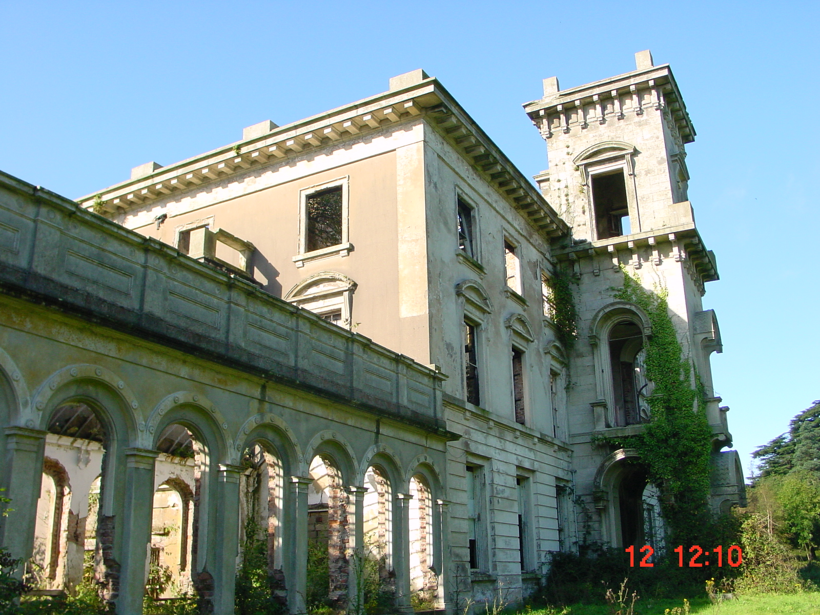
The tannery was closed in 1985, although it had two years’ orders at the time, and some employees moved to other plants in the group at Carrick-on-Suir, Gorey and Dungarvan. Mayfield House, the principal Malcolmson residence on the site, was used as offices by the tannery and for about ten years afterwards, but is now a ruin.

Mayfield House

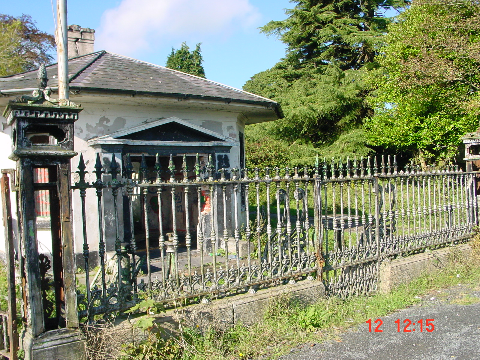
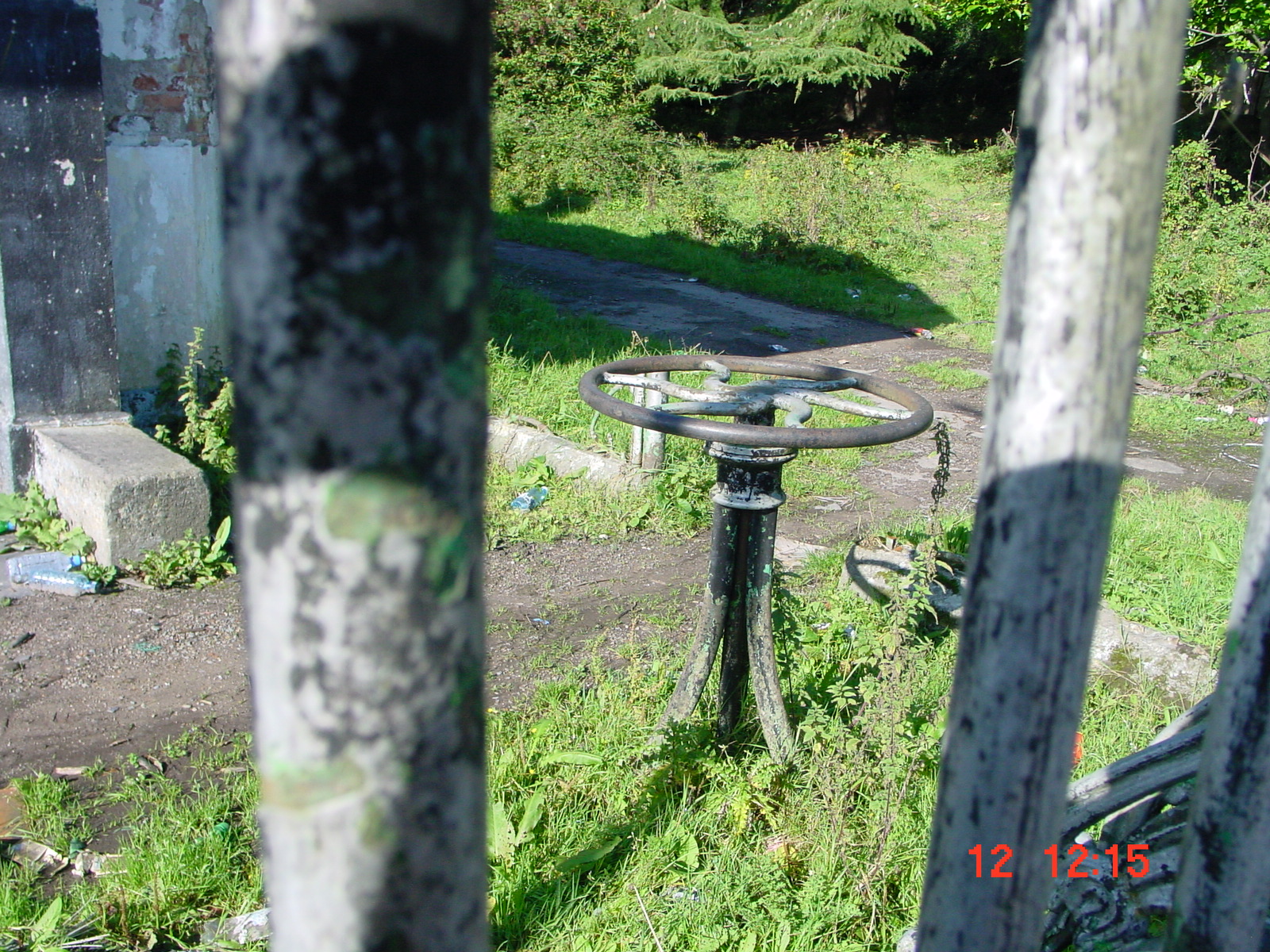
The gate-lodge: entrance to the mill on the left, to Mayfield House on the right
The entrance to the mill is on the left, that to Mayfield House on the right

Wheel used to open the gates
The former Mill Pond of 3.65 acres, and an extension of 0.69 acres, were filled with waste during the tannery years, and in 1995 the Environmental Protection Agency (EPA) found all sorts of chemical nasties in it. EPA sampling points on the river and canal at the town bridge showed decreased pollution after the tannery closed, but the landfill site is probably still contaminated, and it is known that other chemicals were used or stored on the site.
Portlaw today
In describing somewhere like Portlaw, it is all too easy to think of it solely in terms of its past, forgetting that people still live there today. But if the Portlaw National School’s website is anything to go by, http://homepage.eircom.net/~portlawns/ the town did not go to sleep when the tannery closed.
Many schools have websites and a surprising number are of waterways interest, but this is one of the best, with both a solid core of historical material and much modern news and information about Portlaw. The school’s pupils and staff, and in particular whoever manages the website, are to be congratulated.
According to the Munster Express (03/08/01), Waterford County Council appreciates the value of the Clodiagh navigation:
The unique planned industrial town of Portlaw is to benefit from the re-opening of the canal bank walk overlooking the Clodiagh River. The existing stairway to the canal bank is to be repaired and restored to create a walkway and viewing area. The plan includes the planting of a wildflower meadow and the lowering of the stone wall along Bridge Street to open up views to the surrounding hills.
The Council planned to spend £100,000 on the project.
Visiting the town today, you can see the bridge, canal and (downstream) what may be the remains of the lock: one pair of gates forming a sharp V. The mill and tannery are on private property, although the entrance, with its lodge and wheel-operated gates, is visible. In fact the past is all around in Portlaw, from the layout of the streets to the remarkable roofs.
The threat to the weir
This section has not been updated since 2002.But in a sense the most important aspect of Portlaw, the basis of the Malcolmsons’ operation, is the water power of the Clodiagh, diverted to the mill complex by the weir at the upriver end of the complex. That weir supplied the canal, the water-wheels, the factory and tannery and the town. And it is now under threat.

The Clodiagh below the weir
At present, the weir has no sluice-gates and the water gushes out into the Clodiagh. It is said that salmon are unable to swim against it, which is scarcely surprising. However, when the gates were working, excess water went over the weir to the river, and it is said that salmon were able to leap up it. There is also a fish-pass.
But the weir needs somebody to look after it: to clear debris, open and close the gates from time to time, perhaps — the Department of the Marine suggests — even to deter poachers from time to time. The weir itself also needs some repair.
The Southern Regional Fisheries Board, supported by the Department of the Marine, proposes to construct a “River By-pass channel to facilitate migratory fish passage”, to allow salmon to travel upstream. This bypass would be upstream of the weir; it would cause the channel and weir below the diversion point to dry out in average flow, although the channel would fill, and, flow over the weir, in flood conditions. No water would enter the tailrace except in high floods; it would continue to receive water by seepage from the river and by “tidal intrusion”. The Board suggests that, if necessary, a pipe could take a gravity feed from the river below the weir to the tailrace; alternatively, a small piped supply could be fed from above the diversion to the headrace, allowing intermittent operation of a demonstration millwheel.
The owner of the site is opposed to this, and fears that the canal might be permanently deprived of water instead of being restored. The SRFB got planning permission; a local Fine Gael councillor, Paudie Coffey, and the Heritage Council, have submitted objections to An Bord Pleanála. The Heritage Council has also been a partner in preparing a conservation plan for Portlaw (expected soon).
Cllr Coffey says that the weir bypass will jeopardise part of Portlaw’s unique heritage and seriously affect the canal and mill race, which are both listed as protected structures under the Local Government Act 1999. He is quoted as saying “The canal and the mill have a deeprooted affinity and attachment with the community.”
The marquis of Waterford was quoted in The Irish Times as condemning the submission of objections, saying that salmon are more important than industrial heritage. The account in The Irish Times did not say anything about the ownership of the salmon fishing rights. I have spoken to the Marquis, who confirms that he owns them. He says that he is acting in the national interest.
Comment
Salmon are important, yes, but Portlaw is unique. Removing its fons et origo, its water supply, the reason for the development of this extraordinary town, would be a very serious step. This is surely one of the richest industrial heritage sites in Ireland, and one with a strong waterways connection; it is surely worthwhile seeking alternatives to the drying out of the weir.
Sources
Tom Hunt Portlaw, County Waterford 1825–1876: Portrait of an Industrial Village and its Cotton Industry, Maynooth Studies in Irish Local History Number 33, Irish Academic Press, 2000, 0-7165-2722-7
Desmond G Neill Portlaw: A Nineteenth Century Quaker Enterprise Based on a Model Village, Historical Committee of the Religious Society of Friends in Ireland, 1992, 0-9519870-2-X
Bill Irish Shipbuilding in Waterford 1820–1882: A historical, technical and pictorial study, Wordwell, 2001, 1-869857-50-X
History section of the website of Portlaw National School
Site visit, arranged by Rosaleen Miller of IWAI Heritage & Conservation Committee, and discussions with Victor Bowers and Mikey O’Shea
Documents supplied by Waterford County Council
Telephone conversations with Cllr Paudie Coffey and the Marquis of Waterford
[middlesuir3]


This is a brilliant piece of research. What a pity that it is overshadowed by the tragedy which occurred at the weir on April 7th
Kathleen Crotty
PRO Portlaw Heritage Centre
Kathleen: thanks for that. I must admit I didn’t know that anyone canoed or kayaked upriver of Portlaw so I never imagined a double drowning in those circumstances. bjg
it has to take 2 deaths for the department to realise their mistake when they changed the course of the river!!!Again the simple people suffer!
Thoroughly informative and entertaining . I really enjoued this and learnt a lot too.
Thanks, Patricia. bjg
I am coming to Portlaw in July this year 2011.I will be bringing someone who was born there.Her name was Margaret Maher,She lived in William Street with Her Brother William and Sister Mary Rose.Both ladies are still alive but We’re not sure of the Brother.We are trying to trace William to see if He is still alive(reunion?)If anybody has any info that would help,could You e.mail Me.Also any friends that would like to see Margaret and Her niece Donna.Many thanks hope to here something soon. Jon
I have replied directly to Jon. bjg
Congratulations on well-researched and documented journey through Irish
industrial, and moreover European industrial history.
I have been researching the Malcomson contribution to German industrial
history for some years now while at the same time following Irish efforts, mainly at local level, to inform and plead for conservation.
Might I suggest that the accounable author make contact wit me, with a viewto stating the case at international level. Given the current economic situation at your end and given Germany’s role in Irelands future, I feel the time is right to return the compliment i.e Malcomson Investment in Germany’s Ruhr valley and the growth of North Rheine Westphalia as Germany’s industrial hub. I am based in its Capital – Düsseldorf on The Rhine – look forward to a concerted action! Sincerely, Maryan Tarpey.
Pingback: Deaths at Portlaw | Irish waterways history
With regard to your description of what I interpret as a set of tidal doors, I illustrate something similar at Battlesbridge in Essex here https://www.facebook.com/photo.php?fbid=155365754537188&set=a.151926091547821.41659.100001912940850&type=1&theater
That’s very interesting, Robert. How far does the water extend above the gates/doors? bjg
I really enjoyed reading this, thank you very much
W.Philip Malcomson
(Great grandson of the William M mentioned in your account)
Thank you. Your family’s business was a most remarkable one. bjg
The Malcomsons were years ahead of anyone around that time
Pingback: A Bourne mystery | Irish waterways history
I noticed that Tidal Pointing Gates above Battlesbridge on the River Crouch in Essex have already been mentioned. But there were a number of other examples of similar structures in England.
I can think of the following examples.
1) Essex.
a) The Roding Navigation (Barking & Ilford Navigation).
Where the Navigation joined Barking Creek there was a single pair of Tidal gates which were removed c.1967.
2) Kent.
b) The Faversham Navigation.
Faversham Creek was made navigable for small coastal ships and to maintain a head of water in the upper part of the navigation an area known as ‘The Pent’ a set of Tidal gates were built under the swing bridge which takes the road to Oare over the navigation.
The original Tidal gates and bridge was built in 1798. The present structures being built by the Faversham Navigation Commissioners in 1843.
Whilst the road still uses the swing bridge the bridge itself no longer functions and the gates below it are abandoned and derelict. Ships ceased entering ‘The Pent’ in the 1970’s.
The Faversham Creek Trust are campaigning for both the bridge and the Tidal gates to be fully restored to working in order. Hopefully they will achieve their objectives.
c) The Little Stour Navigation/Seaton Navigation.
The Little Stour River was made navigable in the 1820’s from its junction with the Great Stour River at Plucks Gutter upstream to Seaton. A pair of Tidal gates were erected just above the junction on the Little Stour. It appears that they had been removed by 1900.
3) Sussex.
d) The River Adur Navigation.
Following an Act of Parliament in 1803 the River Adur was made navigable from Old Shoreham Bridge to Bines Bridge (West Branch) and Mock Bridge (East Branch) The work was completed by 1807. A short distance above the junction of the two branches of the river two pairs of Tidal gates were erected at Chates (West Branch) and Betley (East Branch) They survived until their demolition by the drainage authorities following the cessation of commercial navigation (I am not sure of the dates. However Betley Lock was replaced first by a quite simple weir which the tide overtops. Chates Lock was replaced by the Sussex River Authority c.1963 by a large concrete and steel weir which the tide does overtop. In both cases this allows for the passage of small boats and canoes as the Adur is still a statutory navigation).
e) The Baybridge Canal.
This was not a true canal being a three & three eighths of mile long improvement of the River Adur above Bines Bridge to a wharf at West Grinstead beside what was then the Worthing to Horsham Turnpike (Now the A24 Trunk road! The wharf buildings and Lime Kilns etc being demolished when the A24 was upgraded c.1960) An Act of Parliament being passed in 1825 and the navigation opening in 1827. The navigation had two pound locks (75′ x 12′ 6″) About half a mile above Bines Bridge there was also a pair of Tidal gates. This was due to the fact that high tides overtopped the weir beside Chates Lock (qv).
They were removed after navigation ceased on the Baybridge Canal and now there is a small weir at the site.
f) The River Cuckmere Navigation.
The Cuckmere was improved for drainage and flood prevention purposes in the 1820’s & 1830’s This allowed navigation from the tideway at Cuckmere Haven past Alfriston up to a wharf above Shermans Bridge on what was then the Lewes to Polegate Turnpike (Today it is the A27 the main east -west road in southern England! ) To improve navigation and to guard against tidal flooding a pair of Tidal gates were erected above Alfriston known as Milton Lock the structure was demolished by the Sussex River Authority c.1970. It was replaced by a weir similar to that which replaced Chates Lock on the Adur.
g) The Royal Military Canal.
During its operational life the Royal Military Canal (RMC) in East Sussex and Kent has had two sets of single Tidal gates (both of them were in Sussex). The RMC was designed and built in during the Napoleonic Wars to improve transport and to protect the low lying coast between Cliff End in Sussex and Shorncliffe in Kent. There were two sections of true canal.
1) From Cliff End to Winchelsea.
2) From Iden to Shorncliffe.
Between Winchelsea through Rye to Iden the rivers Brede and Rother where used.
Whilst at Iden there was a pound lock between the Rother and the RMC (It had three sets of gates so that it could work at all states of the tide and river level) Below Iden at Scots Float Sluice there had been a set of Tidal gates which were replaced in 1835 by a pound lock similar to Iden Lock. This was itself replaced when the Kent River Authority rebuilt Scots Float Sluice Lock in 1985. Between Scots Float Sluice and the entrance to the Brede in Rye the river dried out at low water.
Brede Sluice was and still is a pound lock which like Iden has three set of gates to allow for the tidal conditions. The entrance to the western section of the RMC at Winchelsea is about a mile to the west. To protect the entrance of the canal from tidal flooding a pair of Tidal gates was erected. They were removed when the canal was downgraded to a drain after the end of commercial navigation c.1850.
Also whilst in the Rye and Winchelsea area it would be worth mentioning the ill-fated Rye New Harbour Canal. This was in all probability the least successful canal in these islands to be completed and fully open to traffic ! It makes the Ballinamore & Ballyconnell Canal look very successful indeed.
It was a ship canal for vessels up to 300 tons and the plan was to build a canal from the sea at Winchelsea Beach up to Rye. The idea being to avoid using the River Rother.
An Act of Parliament authorising the work was passed in 1723. Work commenced following a second Act during the following year. By the mid 1730’s the projects most complex structures the twin brakewaters at the entrance and The Grand Sluice had been completed. The Grand Sluice consisted of five six foot wide flood gates and a forty foot wide navigation channel with a single pair of Tidal gates. These structures being built out of high quality Portland Stone. Well things did not go well and the canal did not actually open until the 14th June 1787 Some 63 years after construction had commenced! In all it is believed that the project had cost at least £400,000! It was a total failure as due to the new harbour entrance being continually blocked by shingle due to the longshore drift (which on the South Coast of England runs up the Channel from west to east) Well the Canal was abandoned on and from 6th November 1787! Like the B&BC it is believed that less than ten commercial vessels actually used the canal during its brief life.
The Portland Stone in the brakewaters, bridges, quays and The Grand Sluice was sold off piecemeal for a few hundred pounds.
All that remains today are the faint traces of the foundations of the brakewaters Whilst the canal bed and the site of The Grand Sluice form a large punlic open space in the village of Winchelsea Beach.
I doubt that this list is definative and I guess that other examples existed elsewhere in these islands. Of all the structures that I have mentioned only that at Faversham still survives today so I really do hope that the Faversham Creek Trust are successful.
(Also the structure above Battlesbridge on the River Crouch in Essex still survives. However when I last saw it in the spring of 2016 the gates were being held open by what appeared to be a telegraph pole jammed between the gates. I do not know what the present situation is now).
I noticed that Tidal Pointing Gates above Battlesbridge on the River Crouch in Essex have already been mentioned. But there were a number of other examples of simiplar structures in England.
I can think of the following examples.
1) Essex.
a) The Roding Navigation (Barking & Ilford Navigation).
Where the Navigation joined Barking Creek there was a single pair of Tidal gates which were removed c.1967.
2) Kent.
b) The Faversham Navigation.
Faversham Creek was made navigable for small coastal ships and to maintain a head of water in the upper part of the navigation an area known as ‘The Pent’ a set of Tidal gates were built under the swing bridge which takes the road to Oare over the navigation.
The original Tidal gates and bridge was built in 1798. The present structures being built by the Faversham Navigation Commissioners in 1843.
Whilst the road still uses the swing bridge the bridge itself no longer functions and the gates below it are abandoned and derelict. Ships ceased entering ‘The Pent’ in the 1970’s.
The Faversham Creek Trust are campaigning for both the bridge and the Tidal gates to be fully restored to working in order. Hopefully they will achieve their objectives.
c) The Little Stour Navigation/Seaton Navigation.
The Little Stour River was made navigable in the 1820’s from its junction with the Great Stour River at Plucks Gutter upstream to Seaton. A pair of Tidal gates were erected just above the junction on the Little Stour. It appears that they had been removed by 1900.
3) Sussex.
d) The River Adur Navigation.
Following an Act of Parliament in 1803 the River Adur was made navigable from Old Shoreham Bridge to Bines Bridge (West Branch) and Mock Bridge (East Branch) The work was completed by 1807. A short distance above the junction of the two branches of the river two pairs of Tidal gates were erected at Chates (West Branch) and Betley (East Branch) They survived until their demolition by the drainage authorities following the cessation of commercial navigation (I am not sure of the dates. However Betley Lock was replaced first by a quite simple weir which the tide overtops. Chates Lock was replaced by the Sussex River Authority c.1963 by a large concrete and steel weir which the tide does overtop. In both cases this allows for the passage of small boats and canoes as the Adur is still a statutory navigation).
e) The Baybridge Canal.
This was not a true canal being a three & three eighths of mile long improvement of the River Adur above Bines Bridge to a wharf at West Grinstead beside what was then the Worthing to Horsham Turnpike (Now the A24 Trunk road! The wharf buildings and Lime Kilns etc being demolished when the A24 was upgraded c.1960) An Act of Parliament being passed in 1825 and the navigation opening in 1827. The navigation had two pound locks (75′ x 12′ 6″) About half a mile above Bines Bridge there was also a pair of Tidal gates. This was due to the fact that high tides overtopped the weir beside Chates Lock (qv).
They were removed after navigation ceased on the Baybridge Canal and now there is a small weir at the site.
f) The River Cuckmere Navigation.
The Cuckmere was improved for drainage and flood prevention purposes in the 1820’s & 1830’s This allowed navigation from the tideway at Cuckmere Haven past Alfriston up to a wharf above Shermans Bridge on what was then the Lewes to Polegate Turnpike (Today it is the A27 the main east -west road in southern England! ) To improve navigation and to guard against tidal flooding a pair of Tidal gates were erected above Alfriston known as Milton Lock the structure was demolished by the Sussex River Authority c.1970. It was replaced by a weir similar to that which replaced Chates Lock on the Adur.
g) The Royal Military Canal.
During its operational life the Royal Military Canal (RMC) in East Sussex and Kent has had two sets of single Tidal gates (both of them were in Sussex). The RMC was designed and built in during the Napoleonic Wars to improve transport and to protect the low lying coast between Cliff End in Sussex and Shorncliffe in Kent. There were two sections of true canal.
1) From Cliff End to Winchelsea.
2) From Iden to Shorncliffe.
Between Winchelsea through Rye to Iden the rivers Brede and Rother where used.
Whilst at Iden there was a pound lock between the Rother and the RMC (It had three sets of gates so that it could work at all states of the tide and river level) Below Iden at Scots Float Sluice there had been a set of Tidal gates which were replaced in 1835 by a pound lock similar to Iden Lock. This was itself replaced when the Kent River Authority rebuilt Scots Float Sluice Lock in 1985. Between Scots Float Sluice and the entrance to the Brede in Rye the river dried out at low water.
Brede Sluice was and still is a pound lock which like Iden has three set of gates to allow for the tidal conditions. The entrance to the western section of the RMC at Winchelsea is about a mile to the west. To protect the entrance of the canal from tidal flooding a pair of Tidal gates was erected. They were removed when the canal was downgraded to a drain after the end of commercial navigation c.1850.
Also whilst in the Rye and Winchelsea area it would be worth mentioning the ill-fated Rye New Harbour Canal. This was in all probability the least successful canal in these islands to be completed and fully open to traffic ! It makes the Ballinamore & Ballyconnell Canal look very successful indeed.
It was a ship canal for vessels up to 300 tons and the plan was to build a canal from the sea at Winchelsea Beach up to Rye. The idea being to avoid using the River Rother.
An Act of Parliament authorising the work was passed in 1723. Work commenced following a second Act during the following year. By the mid 1730’s the projects most complex structures the twin brakewaters at the entrance and The Grand Sluice had been completed. The Grand Sluice consisted of five six foot wide flood gates and a forty foot wide navigation channel with a single pair of Tidal gates. These structures being built out of high quality Portland Stone. Well things did not go well and the canal did not actually open until the 14th June 1787 Some 63 years after construction had commenced! In all it is believed that the project had cost at least £400,000! It was a total failure as due to the new harbour entrance being continually blocked by shingle due to the longshore drift (which on the South Coast of England runs up the Channel from west to east) Well the Canal was abandoned on and from 6th November 1787! Like the B&BC it is believed that less than ten commercial vessels actually used the canal during its brief life.
The Portland Stone in the brakewaters, bridges, quays and The Grand Sluice was sold off piecemeal for a few hundred pounds.
All that remains today are the faint traces of the foundations of the brakewaters Whilst the canal bed and the site of The Grand Sluice form a large punlic open space in the village of Winchelsea Beach.
I doubt that this list is definative and I guess that other examples existed elsewhere in these islands. Of all the structures that I have mentioned only that at Faversham still survives today so I really do hope that the Faversham Creek Trust are successful.
(Also the structure above Battlesbridge on the River Crouch in Essex still survives. However when I last saw it in the spring of 2016 the gates were being held open by what appeared to be a telegraph pole jammed between the gates. I do not know what the present situation is now).
Nick: thank you very much indeed for that most interesting account.
I would be glad to hear from anyone who knows of other examples elsewhere in these islands.
bjg
Greeat read thankyou