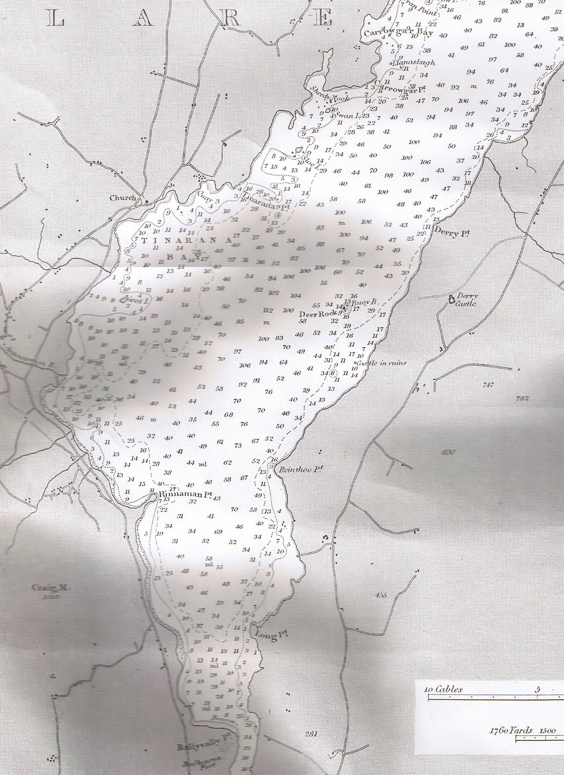
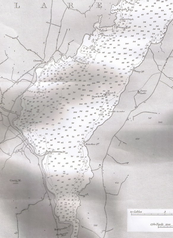
I have no idea on this but my partner would like a chart with the water depths and areas of Lough Derg as he’s been a few times 🎣 no. Please help me to find the right thing and the cost please. I am in Essex, uk
As far as I know, no full survey has been completed since the 1830s and no new charts have been made available for sale. Some years ago the hire firm Carrick Craft got permission from the Admiralty to make and sell copies of the charts; I have just checked with them and the charts are still on sale. They have charts for Upper Lough Erne, Lower Lough Erne, Lough Corrib and Lough Mask and, on the Shannon, Lough Ree and Lough Derg. The charts are available in two sizes: A1 (594 X 841 mm), at £15 each, and A2 (420 X 594 mm), at £10 each. I presume P&P is extra.
Carrick Craft don’t have a web shop but you can contact sales@carrickcraft.com or use the phone number shown here https://www.cruise-ireland.com/contact-us/ for ringing from the UK. They are based in Northern Ireland so there would be no currency charges for you.
The charts will probably be marked “not to be used for navigation” or suchlike: they are intended for hanging on your wall. After 180 years, nobody can guarantee that the charts are still accurate and nobody (including Carrick Craft and me) will accept responsibility for anything that may happen to anyone using the charts for navigation.
One point to watch for on Lough Derg is that the Ardnacrusha hydroelectric scheme in the 1920s changed and stabilised the depths. It may be necessary to add or subtract some amount to compensate for the fact that ordinary summer levels have changed.
bjg