This is an incomplete account of the upper Suir navigation. I haven’t been along the whole thing either by boat or on foot, but I have taken photographs at some of the bridges, and they may convey a sense of the difficulties that boatmen found on this fascinating stretch of the river.
I am keen to fill in the gaps in my knowledge and to have any mistakes corrected so, if you spot any errors or omissions, do please use the Comments section at the bottom of the page.
Major update December 2010
Added photos of some places upstream of Clonmel and some more of features of the navigation between Clonmel and Carrick-on-Suir. Also added a new section on the navigation infrastructure, using photos and information from visits to the Suir in 2010, including the Industrial Heritage Association of Ireland weekend trip led by Fred Hamond, who had carried out a survey (Fred Hamond Survey of Lower Suir River, Tinhalla to Knocklofty Bridge, Part 1 Built Heritage conducted as an Action of the South Tipperary Heritage Plan 2004–2009) for South Tipperary County Council November 2009.
For a slideshow of a boat trip on a small section of the Suir, upstream from Kilsheelan to Sir Thomas’s Bridge, see this page (published December 2010).
Related pages: the Anner Canal and the Middle Suir.
There is a photo of a yawl at Clonmel here.
The Suir above Clonmel

Cahir Castle on the River Suir (2002)
The Suir above Clonmel is terra incognita:
Of the upper course of this fine river we have unfortunately no information, except that in 1868 a party of canoeists, having come down the Blackwater to Cappoquin, carted their boats 12 miles to Newcastle-on-Suir, and thence descended the Suir to Clonmel. But even of this there are no particulars recorded, and the upper Suir remains for the present inter hiatus valde deflendos, which we trust some member of the Cruising Club will ere long fill up.
From Cruising Club Manual: A New Oarsman’s Guide to the Rivers and Canals of Great Britain and Ireland, edited by F E Prothero and W A Clark; London, George Philip and Son, 1896.
However, Prothero later returned to Ireland, launched his canoe at Thurles and travelled downriver, recording his portages and other excitements in Supplement to A New Oarsman’s Guide. The Suir — The Nore — The Barrow — The Boyne F E Prothero Esq, Rear-Commodore. London, Cruising Club Offices, 1898.
Major Rowland Raven-Hart visited Ireland in the 1930s. He wrote of the upper stretches of the Suir:
This river is the “Shure,” and not the “Sewer,” please.
From Thurles (rail) to Clonmel (rail) there are some twenty portages in 51 miles: it is doubtful whether the run is worth the trouble.
[…]
The scenery above Clonmel is fair […].
From Canoeing in Ireland by Major R Raven-Hart. London, The Canoe & Small Boat Ltd, 1938.
Here are some photos of places on the Suir above Clonmel.

Looking upriver from the bridge at Golden

The entrance to the ruined priory of Athassel, downstream of Golden

Athassel (west side) 1

Athassel (west side) 2

Athassel (east side)

Inside Athassel 1

Inside Athassel 2

Cahir Abbey 1

Cahir Abbey 2

Cahir Abbey stonework

The railway viaduct at Cahir

Cahir millstream

The weir in Cahir

Cahir mill buildings

Cahir Castle (2010): the other side
With a bit of luck, if you click on “View larger map”, the Google map will show Thurles at the top of the map, Golden near the left-hand edge and (from left to right) Cahir, Clonmel and Carrick-on-Suir along the bottom.
Clonmel
Neither Prothero nor Raven-Hart gives any clue that the navigation between Clonmel and Carrick-on-Suir was the scene of the worst drowning accident in the history of Irish inland waterways. But we’ll get to that ….
The course of the Suir through Clonmel is a thing of great complexity, with many channels and three weirs feeding mills and other works. Here’s a rough sketchmap showing the river in Clonmel at around Prothero’s time. The river flows from left (west) to right.

Clonmel sketchmap
The map doesn’t extend as far upstream as Workhouse Bridge, above the town; here are some photos instead.

Workhouse Bridge (2009)

Looking upstream from Workhouse Bridge (2009)

Looking downstream from Workhouse Bridge (2009)
The high banks in the distance include modern flood defence works. This older photo from the National Library may also be taken from the bridge.
Getting through Clonmel
In Prothero’s time, the rowing club was — as it still is — on Moore’s Island (left-hand set of trees). Prothero wrote in his Supplement:
The boat-house at Clonmel is 200 yards or so above the weir, which, with the old town bridge just below it, forms the last but not the least bad place on the river. I started soon after nine of the morning of the 14th, taking the boat-house lad with me to help with the portage, which has to be made out of the mill stream on the left. At the point where the boat has to be put into the lower water, the river rushes down from the weir above with great fury, while the left arch of the bridge, the only passage, though only a few yards off, is round a corner to the left, and, as if this was not a sufficiently awkward state of things, a huge boulder projects from the right hand buttress of the arch, greatly aggravating the deep fall under it. Great care therefore is required in rounding the corner not to get too far out to the right. I got through without mishap, though not before I had slipped into the river up to my waist in making a preliminary reconnaissance round the corner.
He’s talking about the weir between Grubb’s Island (Grubbs were a prominent family of millers) and the Old Bridge (top left on the sketchmap). I think that Grubb’s Island has now merged with the land and that a road runs along it; if you can correct my understanding, do please leave a Comment at the bottom of this page.
_resize")
Road alongside Grubb’s Island (looking downstream) (2009)

Looking in the opposite direction from the downstream end (2009). The angler has just caught an eel

Looking over the wall: the weir as it is now … (2009)

… and looking to the left towards the bridge (2009)

The weir seen from the bridge (2009)
Prothero said that “the river rushes down from the weir above with great fury”. Here’s what he was talking about. The photo below shows the current below the Old Bridge, with Prothero’s left arch nearest the camera. This photo and the one below were taken in September 2008, after several dry days.
 7_resize")
The current at the Old Bridge (September 2008)
The Old Bridge is just above the Old Quay: it was already called that in the 1840s. But I don’t understand why anyone would want to haul a boat up along that stretch, against such currents!
 3_resize")
The current past the Old Quay (September 2008)
A diversion: the millstreams and weirs
You can see why the navigation did not continue above Clonmel. But let us leave the navigation for a moment and have a look at the millstreams and weirs of Clonmel. Here’s the sketchmap again. We’ve been looking at the river flowing past Grubb’s Island, over its weir and down along the Old Quay: the bodies of water along the top of the map.

Clonmel sketchmap
The centre of the map is dominated by a number of islands. Stretches Island divides the river at the western end, with a channel flowing around its south-west side.

The channel south-west of Stretches Island (2009)
There is also a channel along its eastern side (which I forgot to colour blue).

The channel east of Stretches Island (2009)

Interesting building on the north-east corner of Stretches Island (2009)

The two channels meet, with flood defence work going on (2009)
The water here is held up by a weir so that it can supply the Grubb mills on Suir Island (to the left, out of shot).

The Suir Island weir (2009)
The water that makes it over the weir is held up again by another weir downstream.

Looking downstream to the third weir (2009)
The 1904 map shows a smithy at the south end of this weir. Did it use water-power or a water-supply from the river? If not, what was the weir for?

The smithy weir (2009)
The tailraces from the Suir Island mills rejoin this channel and they join the north channel at the tail (east end) of Suir Island.

Downstream end of Suir Island (right) (2009)
The New Quay
Back to the navigation. The channels rejoin opposite New Quay, and just above Gashouse Bridge.

Looking across Gashouse Bridge from the south (2009)

Looking upstream from Gashouse Bridge at Suir Island … (2009)
The National Library has an older photo.

… and at the New Quay (2009)
Compare this photo and this one from the National Library.
The Gashouse Bridge itself is puzzling. Boats travelling upstream from Carrick-on-Suir to Clonmel were horse-drawn (more on this below). So did they have very small horses? Or were boats man-hauled through the bridge? Or has the towing-path been raised since carrying ceased? If you know the answer, please leave a Comment at the bottom of this page.

The towing-path arch (2009)
The inner arch has an extract from a poem on it.

Poem (2009)
The towing-path arch has unidentified strings hanging from its ceiling. What are they? Why are they there? Do please leave a Comment if you know.

Strings (2009)
There are the remains of some old buildings along the quay.

Old buildings (2009)

There is a flight of steps along the quay … (2009)

Depth gauge (2009)
But the most interesting features are the bollards, deeply scored (presumably by ropes). I don’t know whether they are in their original positions. If you know, do please leave a Comment at the bottom of the page.

Bollard 1

Bollard 2
Below Gashouse Bridge
Here is Gashouse Bridge from the south side of the river. The block of flats on the far side is on the old gasworks site.

Gashouse Bridge (2009)
It has its own depth gauge. You can see why the citizens want flood defences. But imagine hauling a loaded boat upstream against that lot.

The depth gauge (2009)

Looking downstream along the towing-path from Gashouse Bridge (2009)
A little way down, on the south bank, is the Hotel Minella, whose central building was built for a member of the Malcolmson family, who developed the village of Portlaw.

Hotel Minella (2009)
The navigation runs past its grounds; here is a photo looking upstream towards Clonmel.

Looking upstream from Hotel Minella (2009)
A diversion: poetry
C J Boland was from Clonmel; his parents, I learn from the Sunday Independent, were master and matron of the workhouse in the 1880s. He became Commissioner of Valuations in Dublin and died in 1918. If that is so, I believe that his epic The Clonmel Flood is out of copyright, but do please let me know if I’m wrong.
This is the first verse:
Come all ye boatmen circumspect
That navigate the Suir,
Set all abaft, desert the craft,
And every lighter moor;
Unbend the sail, put down the bale,
Lave all things taut and true;
For I’ll sing a song of the good ship Sprong,
Her captain and her crew.
An anonymous author wrote of the voyage of the Fury which, navigating by the Gashouse chimney, sailed all the way from the Old Quay to … a little further downstream. This is the final verse:
‘Sure, we might have been blown
To the cowld Torrid Zone,
Or the deserts of Nova Zimbley’;
As the skipper’s voice sank,
They jumped out on the bank,
And walked home by the Gashouse Chimley.
But the unfortunate Gwendoline ran aground on Dudley’s Weir and had to be towed off by twenty horses. The anonymous author’s account of this tragedy (the crew, and the dog, walked ashore and went home in an ass and car) begins:
From the day I was nine, the wish was mine
A sailor bold to be;
I began to pine for the stormy brine
And a life on the deep blue sea!
And soon upon the old Bridge Quay,
I kissed my blue-eyed Nell,
And shipped with joy as a cabin-boy
To a boatman of Clonmel.
Traffic on the Suir: Waterford, Carrick-on-Suir and Clonmel
According to The New Commercial Directory for the Cities of Waterford and Kilkenny and the Towns of Clonmel, Carrick-on-Suir, New Ross, and Carlow, printed by T Shearman of High-Street, Kilkenny, for F Kinder & Son, 1839,
Though not a seaport, the town, from its situation at the head of the Suir navigation, is the medium through which the corn and provision export trade is carried on between the southern and eastern portions of this large county and England. There are generally about 120 lighters, of from 20 to 50 tons burden, employed in the trade of this town.
The Clonmel boat-owners were listed (I give their addresses as the book does, save that I have guessed that the first letter of Patrick Hogan’s address, illegible in the original, is B):
Breen, Daniel ducket street
Breen, John irishtown
Breen, Roger main street
Danks, Thomas duckett street
Darcy, Michael spa water
Farrell, James old quay
Grubb, Thomas Samuel new quay
Hayes, Richard and James old quay
Hayes, Patrick old quay
Hogan, Patrick blue anchor
Jacob, Joseph new quay
Moore, Thomas N. (and store keeper) old quay
Power, Nicholas main street
Ryan, Thomas flag lane
Smyth, John, old bridge
Stein, John and Co., new quay
Troy, Jeremiah abbey street.
Whitten, Anthony old quay
No boat-builders were listed: it seems likely that the Clonmel owners bought their boats in Carrick-on-Suir, where the Directory lists amongst the shopkeepers and traders:
Conway, Jeremiah, boat builder, carrickbeg
Kehoe, Wm, boat builder, river side
Dr Patrick C Power, in his invaluable article “The Lower Suir – Boats and boatmen long ago” in the Tipperary Historical Journal of 1991, says:
Lighters were made in Carrickbeg at the graving dock of the Kehoe family, which had plied this trade there since the 18th century. By the time that the 20th century had arrived they merely repaired lighters and yawls, while a man named O’Brien still made some craft. He was illiterate, but had the ability to gauge precisely the exact amount of wood needed to build a lighter or a yawl without detailed measurements. There is no vestige of O’Brien or the Kehoes there now.
Dr Power had his information from Michael O’Callaghan, who had worked at the graving dock when he was young.
V T H & D R Delany, in The Canals of the South of Ireland (David & Charles, Newton Abbot 1966) say that
Between Carrick-on-Suir and Clonmel there does not seem to have been any authority in charge of the navigation, though the local Grand Juries had certain functions with respect to the towing-paths under the 1836 statute.
The statute in question was 6 & 7 Will IV c. xc An Act for improving and maintaining the navigation of the river Suir and for making and constructing a ship canal at Carrick-on-Suir although perhaps 6 & 7 William IV, c. cxxvii An Act to rectify a Mistake in an Act passed in the present Session of Parliament, for improving and maintaining the Navigation of the River Suir, and for making and constructing a Ship Canal at Carrick on Suir is also relevant. I have not, alas, read either of them.
The Delanys tell us that the Shuttleworth Commission heard, in 1906, that there were 70 “barges” on the Suir, of which 20 traded between Carrick and Clonmel. Of the 138 000 tons carried on the navigation, 110 000 went from Waterford to Carrick and just 28 000 went on to Clonmel. I have little information about the cargoes; my guess is that coal was an important cargo going upstream, especially to the gasworks, and that the mills provided downstream cargoes. I don’t know whether there was any loading facility on Suir Island.
If the evidence of the songs is to be believed, beer may have been an important cargo. The Sprong was loaded with Indian ale, to be carried downstream to Fiddown (The Clonmel Flood), and the Fury was changing berth to lie alongside the brewery north of the quays (Changing Berth). The Gwendoline had a cargo of oats (The Wreck of the Gwendoline) but the Avondale (qv) was loaded with coal for the gasworks (The Wreck of the Avondale). The OS map of 1904–06 shows a mooring post downstream of Gashouse Bridge, beside the gasworks.
John Ernest Grubb, whose Suir Steam Navigation Company (with its tug the Father Mathew) controlled much of the trade on the Suir, retired in 1912. He sold the Suir Steam Navigation Company to Thomas Walsh & Son in June of that year. In 1927 they sold the Father Mathew to the Tarpey family of Carrickbeg (the town on the south side of the river) but sold the Waterford–Carrick business to Edward J Dowley & Sons (who had bought the Grubb stores at New Street in Carrick).
Thomas Walsh & Son had continued the trade to Clonmel until 1920 or 1921; in 1923 it was revived but lasted for only a few months. The Canals and Inland Waterways Commission of the new Irish Free State reported in 1923, according to the Delanys, that the trade suffered from labour troubles, difficulties of navigation higher costs after WW1 and competition from the railway. The Carrick boatmen went on strike in 1916, seeking an extra ten shillings a week, and traffic was suspended; some of the boatmen went to England to work. And in 1922, horse-drawn barges travelling between Carrick and Clonmel were raided and looted by armed men.
The late William O’Callaghan of Carrick told me about the unpowered lighters — pitch pine, 71′ X 16′ — used by his family, and many others, on the middle Suir from Carrick to Waterford. They used the tide to ascend and descend the Suir; the crew of two used 30′ steel-shod poles for manoeuvring at close quarters; for steerage, to keep in the tidal stream, they each had a 35′ or 36′ sweep, each stroke of which meant walking six steps forward and six back. The oars swivelled on 2″ oak dowels.
I am indebted to Pat Kennedy for the photo below, taken in 1934, which I believe to show the Knocknagow towing two unpowered lighters up the Suir.
 1B adapted by Beth O'Loughlin_resize")
Knocknagow towing two lighters (1934)
The National Library has a good photograph of two lighters above the bridge in Carrick.
The yawls
On the upper Suir, from Carrick to Clonmel, the standard vessel was the yawl, a smaller vessel carrying. according to William O’Callaghan, 16 tons; Dr Power says 14 tons “or a little more”. I note that the Avondale (The Wreck of the Avondale) was carrying thirteen tons of coal.
Dr Power’s is, as far as I know, the most comprehensive account of the yawl. He says it was 60′ long with a 6′-high oak towing-mast, about one third of the way back from the bow. The mast had a forked head; it was 9″ in diameter and was secured by an iron collar in the bottom of the boat and by ropes to both sides at deck level.
Clearly, a 60′ boat carrying only 16 tons was shallow-draughted: the Sprong (The Clonmel Flood) drew only 20″. However, Dr Power says that a yawl might carry 40 tons in winter when water levels were high.
William O’Callaghan told me that lighters were sometimes hauled up to Clonmel: in such cases a yawl would be tied aft “on the Waterford side” (further from the towing-path) to do the steering. Dr Power, in contrast, says
Sometimes one or two lighters were towed after a yawl with ropes.
Dr Power describes the method of towing the boats by four horses, with four extra horses for each extra boat. One man led the horses while another steered the boat, extending the tiller when extra leverage was required. But there are accounts of eleven, twelve, thirteen and even fifteen horses being used to haul a pair of boats (Killaly and Prothero, see below, both say “three boats”) upstream against strong currents. The boats drifted back down to Carrick with the current, two boatmen using poles to control the boats. The dangers of this method are shown in the accident at Carrick bridge (see below).
The navigation and its difficulties
The Delanys tell us that, in 1821, John Killaly reported on the navigation for the Directors-General of Inland Navigation; he said that there was a fall of 57′ in 10.75 miles between Clonmel and Carrick and that the water level could change by 6’—8′ within a few hours. He did not think that the traffic would justify the building of locks but he recommended dredging and the improvement of “the existing flash weirs”. No locks were ever built. And neither steam nor motor boats were ever used: the fall of 57′ was overcome by horse power alone. Dr Power tells us that the upstream journey usually took about five and a half hours and that the horses came back to Carrick by road in about two and a half hours.
Prothero remarked, in the Cruising Club Manual, on the problems for rowing boats:
The Suir is navigable from Clonmel to the Barrow at Cheek Point, though the up-stream navigation from Carrick, the limit of the tide, to Clonmel is carried on under difficulties; 11 horses being required to haul up three small barges. A rowing boat can only get up by aid of the tow-line, which must be a very long one; 60 yards having proved insufficient in at least two places. The rapids, in 12.5 miles, number from 25 to 30, none of them however at all formidable on the descent; while the pretty scenery is set off by a number of ruins remarkable even in Ireland.
Raven-Hart, travelling downstream by canoe, reported no problems (Canoeing in Ireland):
From Clonmel (rail) to Carrick (rail) the navigation is quite amusing, and these thirteen miles should certainly be done: there is no danger whatever, and this part would be a valuable introduction to comparatively shallow-water canoeing for the absolute novice. The current here is always good, and there are several small rapids […].
On the whole run from Clonmel to the sea there is no portage, nor is it ever even necessary to float the boat down, unless perhaps in exceptionally low water […].
The scenery above Clonmel is fair, from there to Carrick excellent […].
The Shuttleworth Commission reported three main problems: insufficient depth, strong currents and an inadequate towing-path.
To judge by the OS maps, the first item on interest on the way downstream is the set of weirs linking islands at Millbrook House. Robert Dudley’s grain mill was built in 1782; the premises, called Suirville Mills on the 1840s OS map, changed hands several times until Thomas Russell converted to a woollen mill in 1887. Cleeves took over in 1896 and installed a condensed milk factory, shown on the 1904 OS map, but closed the premised in 1906. There was a tannery in the second half of the twentieth century. The long weir supplying the water-wheels was Dudley’s Weir, on which the Gwendoline was wrecked (The Wreck of the Gwendoline) “half-a-mile from home”.
The next obstacle — and it is a significant one — is Sir Thomas’s Bridge.

Sir Thomas’s Bridge (2005)
This is taken from upstream on the north (towing-path) bank. By 1904 St Joseph’s Industrial School was in the area behind the spot from which the photo was taken. The next photo shows the flow downstream of the bridge, with Kincor Castle on the south bank. Again, it is taken from the towing-path bank.

Downstream of Sir Thomas’s Bridge (2005)

Looking downstream through the navigation arch (2006)

The flow through the navigation arch (2006)

Looking upstream at the navigation arch (2006)

The drop (2006)

The river below the bridge (2006)

The depth gauge at the bridge (2006)
Have you noticed anything odd? Remember that this is a horse-drawn navigation ….
The horses have to enter the water to get under this bridge. As Dr Power points out:
The leading horse [was] chosen for strength and courage …. The horses each had bunches of hay tucked under the winkers on the riverside to ensure that they did not see the river-water. […] One man led the four horses, sometimes mounting the leader, particularly at Sir Thomas’s Bridge at Ferryhouse, where the whole team went into the river in order to pass underneath the arch. On days with the river in full spate, the water could reach to the horses’ collars.
It was here that the Avondale came to grief (The Wreck of the Avondale, published in the Clonmel Chronicle in 1903):
O brave Sir Thomas Osborne, you little did suspect
Against your bridge the Avondale was fated to be wrecked;
The cruel pier in her poor side conveyed a dismal hole,
Scamandering her precious freight of thirteen ton of coal.
Happily, Captain Britt, his son and his “tarrier dog” survived.
Here. from the National Library, is an older photo of the bridge.
A short distance below Sir Thomas’s Bridge, the Anner flows in: the Anner Mills of the 1840s were replaced by Anner House in the 1900s.There was a mooring post at the confluence. A further short distance below, the 1904 map (but not the 1840s map) shows a channel joining the Suir: it leaves the Anner above Inchanabraher, where there are stepping stones, runs along the edge of a small wood and passes a lodge and then goes under a road before it joins the Suir. The road bridge is marked Canal Bridge. I have no information about the canal and would like to know more, but I have some photos here: if you can help, please leave a Comment below or on that page.
The next bridge is at Kilsheelan, the only village between Clonmel and Carrick-on-Suir.

The bridge at Kilsheelan (2009)

Looking upstream from Kilsheelan Bridge (2009)
The towing-path is on the right of that photo. Here’s an older photo from the National Library.

The bridge from downstream (2005)
In that photo, you can see the edge of the towing-path (which looks as if it has been modernised) and the navigation arch on the right-hand side.

The Kilsheelan monster (2005)
Here’s a close-up of the object under the second arch. It looks like a turbine but I didn’t know what it was for. Thanks to nslatz (see Comments below) for identifying it as a salmon-counting machine.
Here is an older photo from the National Library.
Below Kilsheelan, there is a severe bend at Poulakerry, where the 1904 map suggests that the towing-path is a little inland from the river, but I haven’t seen it so I don’t really know. It is then some considerable distance to Coolnamuck salmon weir, a Z-shaped weir across almost the whole of the river, which is the highest point to which ordinary tides flow. After that, it’s a short distance to Carrick.
Navigation infrastructure: along the towing-path
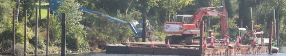
The Suir between Clonmel and Carrick-on-Suir has many weirs, which may have served several different purposes: providing power to mills, trapping fish and perhaps keeping up the levels in the river for navigation. Fred Hamond identified fifteen weirs, excluding those in Clonmel itself. In some cases only vestiges remain, indicated by ripples on the water; in others the stonework can still be seen.
Many of the weirs were built before 1800 as fishing weirs, to catch eels or salmon or both, and for many of them no other function has been identified. Such weirs include Cor na mBráthar (Friars’ Weir), Coradh Mór (the Great Weir), Coolnamuck (the upstream limit of normal tides), Disney’s at Ballynoran, an unnamed weir at Ballydine, Hogan’s, an unnamed weir at Poulakerry, Power’s at Gurteen/Kilsheelan, Gurteen Eel Weir, the Black Weir at Kilheffernan, Neal’s Weir at Killaloan Lower and Power’s at Ferryhouse.

Coolnamuck Weir 1

Coolnamuck Weir 2

Coolnamuck Tower, a folly used for watching the weir
The weir above the old bridge in Carrick seems to have had just one function: that of powering a mill (now disappeared) on the north bank, via what is now known as the “blind arch” (photo below). Roderigo Flash at Ballyloan Lower was a navigation weir, designed to keep up water levels. Dudley’s Weir, on which the Gwendoline was wrecked (see above), was originally a fishing weir but then powered the mills at Suirville.
What is not clear is the extent to which the older fishing weirs were adapted to function as navigation weirs (like the summer weirs on the Barrow), maintaining the water levels above them.

Swimming from a cot above Carrick
The towing-path itself is worthy of attention. Sections form popular walking routes, although the path is blocked in two places by what I believe to be unauthorised incursions.

A section of towing-path near Carrick with one of many angling huts

Buttressed wall separating towing-path from private land
The towing-path has many small bridges or culverts spanning streams or providing access underneath; the most elaborate is where the River Anner joins the Suir.

The Anner
At one point, a pair of ramps would have enabled towing horses to walk in the river to the mouth of a small bay, making the tow more manageable than would a very long towing-rope.

The downstream ramp

The bay

The upstream ramp
Many other artefacts are recorded in Fred Hamond’s survey.
Carrick-on-Suir
I have written about some aspects of Carrick-on-Suir in my page on the middle Suir, but there are some aspects yet to be covered.

Looking north across the bridge (2009)
Carrickbeg is on the south bank of the river and Carrick-on-Suir is on the north. Kehoes’ graving dock was on the south bank, but I don’t know where it was or whether there is any trace of it now. Nor, as far as I know, have we any remains of any of the lighters or yawls that travelled on the Suir. William O’Callaghan showed me some of the iron shoes used by the lightermen on their poles, but there seem to be few other reminders of the unique heritage of the Suir boatmen. Now, even some fishing cots are being laid up as the snap-net fishery has been closed.

Carrickbeg looking downstream from the old bridge (2009)
There were quays and mooring posts on the north bank above the old bridge, between the two bridges and below the new bridge (seen in the distance in the photo below. The pontoon is modern, of course). The area between the bridges is the Town Pond.

The north quays in Carrick (2009)
There was also a quay with mooring-posts on the south (Carrickbeg) bank above the old bridge.

The Carrickbeg quay above the old bridge (2009)
That photo also shows the weir in Carrick; here are two more views of it.

The weir in Carrick 1 (2009)

The weir in Carrick 2 (2009)
You’ll see that flood prevention works have been undertaken here too.
The gasworks was on the north quay, above the old bridge, about half way along the wall you can see in the photo above.

Looking towards the gasworks from the south end of the bridge (2009)
But the navigation arch was on the south side of the bridge. I presume that it was chosen because it is higher and wider than the others.

The old bridge from upstream with the navigation arch on the far right (2009)
So (William O’Callaghan told me) a boat carrying coal to the gasworks, or indeed with a load to be hauled upstream to Clonmel, had to be manhauled across the bridge from north to south, hauled up through the arch (probably using a rope floated down through the arch from the Carrickbeg quays) and then manhauled back across the bridge to the north side.
It’s difficult to say what conditions were like up to the 1920s, when that was happening, but I presume it could be done only when the tide was relatively full, so that the lighter could clear the shoals between the arches on the downstream side, as well as the weir upstream. You can see some of the shoals in the next two photos. If any Carrick people can help to clarify this, I would be grateful: please leave a Comment at the bottom of the page.

Shoals between the arches looking north (2009)

Shoals between the arches looking south (2009)
Here is the towing-path upstream from Carrick heading for Clonmel.

The towing path heading west towards Clonmel (2009)
The flood wall, built on top of the older wall, makes it difficult to see any traces of the quay or the towing-path downstream of this point.

Looking back east, downstream, towards the town bridge (2009)
I draw attention again, therefore, to this National Library photo. These boats do not seem to have towing-masts, so they may be lighters rather than yawls. They seem to be moored above the weir.
There are some interesting traces near this point.

Mooring ring (2009)

Steps (2009)
Finally, I was delighted that there were still some cots to be seen.

Cots (2009)
The cries at the bridge
The old bridge at Carrick was the scene of the worst ever accident on Irish inland waterways. A plaque on the bridge gives the numbers and dates.

The plaque in Carrick bridge (2009)
Michael Coady’s piece “The Cries at the Bridge” in Full Tide — a miscellany (Relay Books 1999) gives an account of the tragedy. Three boats were hired in Clonmel to take an army detachment downriver. The first boat carried women, children and baggage with eleven men; the other two carried the remainder of the troops. The boats, which were to run down with the current, left at intervals of half an hour.
The river was swollen by thawing snow and the current was very strong.Coady quotes a letter from James Fitzgibbon, one of the officers; here is the central paragraph:
When the first boat came within half a mile of Carrick Bridge a boy jumped on shore and took the hawser with him. He made it fast to a stake but the boat on coming round snapped it in two. They fell away immediately down towards the Bridge. Their terror at that moment was not to be conceived. Death was inevitable. The boat ran full speed against one of the cut-waters sideways and was dashed to pieces — the men, women and children spread all over the flood.
Four out of eleven men survived, as did six out of forty women. All the children died. Those on the two later boats landed safely, although one of them was damaged. Michael Coady concludes his piece thus:
The horror of that mass-drowning and the piteous cries of women and children have long since receded, but still have power to evoke remembrance and compassion in anyone who stands on Carrick Bridge and reflects on all its tides and tidings.
Amen to that.


I’m probably one of the few people who have actually navigated the Suir from Clonmel to Carrick in a boat in recent years. It was in the mid 1980s and the occasion was a charity canoe race. I was asked to provide a boat to act as a support for the canoeists and I agreed to do so with almost no information about conditions on the river. Myself and two friends were in a 9ft dinghy with only a 2hp motor and to be quite honest, we would have been no help to the canoeists had anything gone wrong. All we could do was keep the boat pointed more or less downstream. The flow in the river was ferocious and aside from the weirs, the main hazard was the bridges. In particular I remember the flow through the navigation arch of Kilsheelan Bridge. There was a drop of three feet through the bridge and we shot through it like a cork out of a champagne bottle. Happily we all survived to tell the tale.
Almost entirely unrelated to that was the fact that for a time I lived in an apartment in Suir Island House. One corner of the house was in danger of subsiding into the mill-race which ran under the house and it was held up by stout timber beams in the corner of the house. Including in my bedroom.
Thanks for that, Colin. I’d like to hear from any more adventurous readers who have been down that way — although I imagine that if you’re kayaking, for example, you might not have much time to take photographs!
bjg
Hi Brian, I suspect the ‘unidentified strings’ hanging from one of the bridges have been left there by canoeists as part of a slalom course. Chris D
Thanks for that, Chris.
Incidentally, some readers believe that I am wrong to suggest that, in the old photo above, the Knocknagow is towing the two lighters. However, I had read in your book of long-lining on British waterways. Does the distance between the tug and the lighters look odd to you? And what about the close coupling of the lighters?
bjg
Hi Brian,
Congratulations on a very good ( no Excellent) account of the Suir.
I ran 2 dinghy rallies from Clonmel to Carrick, One was called the “sheer pin rally”. Look at IWN for report by Barrow Branch. One rallier decided to pass under Sir Thomas’s bridge with outboard up and spun all the way down through the rapids. I also did most of the tow path on a motor bike.
Suggest that you do it yourself as it is a very interesting trip, but not when in flood.
There are charts of the proposed Carrick to tipperary? canal in the Heritage Centre in Carrick
Pat Power and Michael Coady have lots of info.
M&R on the River Sava Belgrade
Thanks, Mike. I’d love to travel down (or, even better, up) the Suir, but I need someone to take me so that I can take lots of photos en route!
bjg
I noticed that Carrick on Suir have a self closing flood barrier, is there anybody I could talk to regarding this and how it has worked since it was installed.
Kind Regards
Frank Kelly.
Frank
I’m afraid I don’t know the answer, but one of the bodies mentioned in this leaflet should be able to help you. Carrick-on-Suir itself is in Co Tipperary; Carrickbeg, on the south side of the river, is in Co Waterford. Maybe it would be best to contact the Office of Public Works first.
bjg
The Kilsheelan monster, as you’ve called it, was there to count the number of salmon swimming upstream to spawn, unfortunately, it never worked properly, so was replaced further downriver by an even more complicated and costly device. This also failed to produce any results. I believe efforts are ongoing.
I have heard that Sir Thomas’s bridge is 400 years old this year, I also heard that it is the only bridge that remains crossable when the Suir bursts its banks, as it has this week. (22/11/2009)
Thanks, slatz: I’d never have guessed what it was.
bjg
hi, as far as i know the strings are left over from the time the bridge underwent maintainance a number of years ago when the underneath was resurfaced with concrete, hope this is of some help to you.
Hi Chris,
Just stumbled accross your site…very interesting.
I’m the daughter of a Carrick woman who is now in her 80s. She has asked me to see if I can find out anything about the drowning of a relation of hers inthe River Suir in the early 1900s. His name was Frank Hurley. Perhaps some of your contacts may have some information on this? Or know where to direct me to find out about it?
Looking forward to hearing from you
Dennis: thanks for that interesting information. Any idea what the strings were for during the maintenance? bjg
Ursula: I don’t know who Chris is ….. I don’t know anything about Frank Hurley and a quick look in the Irish Times archives produced no information. The archives of the local newspapers might be your best bet. I think that the archive of the Clonmel Nationalist is in the library in Thurles http://www.tipperarylibraries.ie/branches/thurles/index.shtml
bjg
stumbled across your site, very interesting and very well done.Dan O Callaghan and Phil Hennessey were the last two men to hawl a yawl to Clonmel in 1927, I remember these stories been relived by the fireside with Dan (grandfather)and Mickey,Paddy,Danny and my father Wilmo.I travel from Carrick to Clonmel and back by water on a regular basis,my boat is a 27ft shallow draft handmade freighter powered with a four stroke outboard and you are welcome to journey back in time with me on one of these trips!What a fantastic river!
Thanks to my post on this site… a great-grand-nephew of Frank Hurley has been in touch with me. Many thanks.
Ursula.
I’ve replied direct to Ralph. I’d love a trip on the Suir!
bjg
You may be interested in something I came across in “The History of Clonmel” written by William P. Burke in 1907. The text from the book is between the brackets { }. He is referring to a report of the Royal Commisson in 1537 which apparently found that most of Tipperary was close to anarchy, and the relevant bits are as follows:
{ In 1537 a Royal Commission was issued to inquire into the state of Ireland. The Commissioners, Antony St Leger, George
Poulet, T. Mayne, and William Berners opened an ” inquest ” in Clonmel, the October of that year, when the following report was made.
” The Verdyt of the Heddes and Comyners of the Towne of Clonmell [October 18, 1537]— …}
After a number of references to issues (Itms) relating to the hazards and complications of doing business and carrying the various trades we come to the following……
{….From the next item it would appear that the navigation of the Suir extended to Cahir.
Itm of the werys [weirs] made from Clonmell to the Carryk they fynde the greate daunger and enormyties of them that both men and goods byn dayly in daunger of loseing, and by west toun into the cahyrd (c). }
I can find no other reference to navigation west of Clonmel in the book but who knows what evidence might be out there.
pjd
Paul: that’s very interesting; many thanks. Michael Fewer, in *Rambling down the Suir* (Ashfield Press 2009) mentions 12th century Vikings “sailing” their vessels up the Suir as far as Cahir. No source given, though.
bjg
look at above website
interesting times ahead
“A built, cultural and natural heritage audit has been undertaken along a 33km stretch of the River Suir by Fred Hamond and Dr Helen Sheridan, for the Heritage Office, South Tipperary County Council with funding from The Heritage Council.”
http://www.southtippcoco.ie/en/aboutus/news/mainbody,6305,en.html
Lots of interesting reading in the PDF files available on the above page.
Thanks for giving the link. I consulted Fred Hamond’s reports for my section on infrastructure and for my account of the trip from Kilsheelan to the Anner Bridge. I completely agree about the value of the reports; in fact I think Fred’s is now the best single resource for anyone interested in the navigation of the upper Suir (although I have better pics!). I strongly recommend that folk interested in the Suir should go to the page as you suggest.
bjg
Well done for very interesting blog. I have an old letter dated 1828 from a Clonmel gentleman who is placing an order for a large quantity of claret from a Dublin spirit merchant. What is interesting is the delivery route he has specified. He wanted the order placed on the Kingstown steamer headed for Waterford, and from there handed over to his broker who would place it on the first boat to Clonmel. I would assume that this delivery method was more expensive than transporting overland but he says with this method, the load would be delivered ‘without much shaking’. Probably less chance of theft as well.
great read wonderful river.carrickbeg is in tipperary..could anybody give me details of who is resposible for the upkeep of the towpath from carrick to clonmel as some of the banks are in bad need of repair.
That’s very interesting; thank you. I’m not completely sure that water transport would have been more expensive than road: I have seen some accounts from the UK suggesting that, at least for bulk goods, water transport was cheaper. At the time, it would certainly have been faster, although the water route might have been less direct. bjg
Thanks, James. Your best bet is to contact South Tipperary County Council’s Heritage Officer who takes a great interest in the Suir. I’ve corrected the reference to Carrickbeg. bjg
Tom Hahessy:
I stumbled on this while browsing “Clonmel”. Congratulations on an excellent piece of work.
The History of Clonmel referred to by PJD claims that the first settlement in Clonmel was by Viking traders, on the Island in your sketch. This trading centre was protected by the local chietains, presumably for some payment.
Here is the link to an online version.
http://www.archive.org/stream/historyclonmel00burkgoog/historyclonmel00burkgoog_djvu.txt
By copying it into a WORD document you can search the text for more information by EDIT FIND.
An interesting fact is that Sir Thomas’ bridge was built by Sir Thomas Osborne, the ancestor of the currrent UK Chancellor of the Exchequer, who will succeed to hs title.
Thanks, Tom. A very useful link and I’m delighted to learn of the connection to the Chancellor of the Exchequer! bjg
Reading all this discourages me from taking part in a rowing tour on the Suir from Clonmel downstream. We were hoping to use touring quad sculls. Any thoughts?
Frank D.
Being discouraged sounds like a good plan …. The problem is that you couldn’t predict what conditions you might encounter: anything from shallows (as on this page https://irishwaterwayshistory.com/abandoned-or-little-used-irish-waterways/waterways-of-the-south-east/the-upper-suir-carrick-to-clonmel/up-the-suir/) to a raging torrent through the bridges. I’ll give you a ring. bjg
Pingback: The Suir towing-path | Irish waterways history
Sadly, the Bollards at newquay Clonmel, have been removed. I will enquire if it is intended to replace them.
Thanks, Mick. More info welcome. bjg
Pingback: Canal carrying 1846: Dublin to Waterford | Irish waterways history
Just read this blog and found some very interesting facts. I am trying to find any information or photographs about my Great Grandfather who was a fisherman by trade back in 1901. His name was William O’Dwyer but on the Sensous of 1901 was named as William Dwyer and my Grandfather again William Dwyer and my uncles Jack, Mickey, Paddy and Willie were all fishermen in the 1930, and forties. They lived in Ashpark. Any help would be greatly appreciated. geraldinegavigan@ hotmail.com
Geraldine: I’m not in the area myself so I can’t provide any information directly, but if any other visitor to the site can do so I’ll pass it on. In the meantime, have you considered contacting these people? bjg
Pingback: Carrick-on-Suir to Clonmel towing-path | Irish waterways history
I am probably the last living person to work the lighters from carrick to Waterford .my father was paddy o callaghan and uncles mike , William , Danny .I now live in tralee co kerry. Eugene o callaghane
Eugene: if you would be willing to write up your memories of it, that would be invaluable. I would be delighted to post your account on this site if you did. bjg
Just came across a site that may be of interest to you or others reading here. You may already be familiar with it but just in case: http://www.dowleyhistory.com/ has two sections on the River Suir including one about commercial activity and some interesting archive photographs.
Fascinated to see the evidence in Athassel regarding the Dundry Stone. A large row boat would easily navigate most sections of the river when there is a reasonable flow, even upriver, so it is conceivable that stone was transported this far. Now lets find evidence for Thurles :)
Thanks, Paul. The Dowley History site has some information that I did not have. However, I note with regret that it uses some of my photos and text without my permission.
On early water transport, this might interest you. bjg
Ooops! I’m a supergrass.
Pingback: Remember, remember the twenty-fifth of November | Irish waterways history
Excellent blog
Thank you. bjg
Great stuff
Great research. Clonmel boat owners, Blue Anchor should read Blue Anchor Lane. I don’t think you considered all methods of propulsion on the R. Suir !
This blog may be of interest,
Thanks on all three points. bjg
Came to Clonmel 40 years ago and learned more from this research than I did in those years! Thank you. Mary O*Gorman
Fáilte. bjg
Just today, Christmas Day 2019, I cycled the Suir Blueway from Clonmel to Carrick On Suir. It’s an amazing amenity, with such beautiful scenery and wildlife, along with the calming companionship of the river. I had walked a section from Clonmel to Kilsheelan during Summertime, but in Winter the river is much higher, and makes for an exciting trip. The history is very interesting to read about. Hi to Ralph O’ Callaghan. I had the pleasure of seeing him in action in the Munster Final of 1984, my greatest hurling memory. Even though we didn’t win it, I will never forget the atmosphere and the quality of hurling on display.
Thank you. I’m glad to hear it’s still usable after the weather we’ve had. bjg
Well said Joseph
Brian Phelan
I am the last survivor of the carrick sand and gravel barges plying sand and gravel from riverbed to Waterford and carrick also timber from Irish pine and Irish oak ships from Waterford to new Ross and Fiddown my father was pat o Callaghan a brother of William I now live in Tralee