
Waterways Ireland is still pumping water from the River Inny into the Royal Canal at the Whitworth Aqueduct near Abbeyshrule, but the level is still well down. I imagine that that makes it impossible, at least for larger boats, to travel the canal at present.
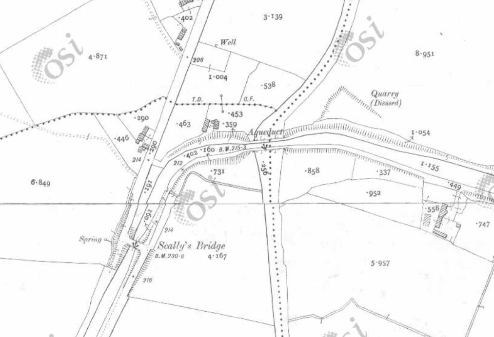
The location

The inflow from the pump
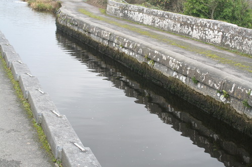
The level on the aqueduct


leaks?
Hi Brian,
On the october bank holiday weekend we (IWAI Royal Canal) brought three boats to the Longford Junction for an overnight stay. Plenty of water and weed not too bad right up to the junction. The next day one boat went back to Clondra while another cruiser (Bounty 34) and I (Powels 42 drawing 3′) continued on intending to make Abbeyshrule.
A couple of hours into the journey the Bounty stopped, overheating and making slow progress through the weed, he turned back. I continued on, with grilles on my two intakes I take in very little weed. However levels became lower from one level to the next. I made it to Foigha and stayed for a week, hoping that the level would improve, but in fact it dropped further.
Knowing there was plenty of water in Abbeyshrule I planned to winter there. I cycled the towpath from Abbeyshrule to Foigha only to find the level below Abbeyshrule was nearly 2′ down. Getting to Abbeyshrule in a reasonable length of time and before we get any serious freezing seemed impossible so I turned around too.
The levels above Abbeyshrule are also low and become progressively lower the higher you go. We have a boat stuck in the mud at Coolnahay below the lock.
It’s going to take a considerable amount of pumping for a lengthy period to get the canal back to anywhere near normal levels. I have yet to hear a credible reason to explain how it got into this state this year. We brought several boats through in april-may, including a couple of ‘M’ boats. In july the summit level was virtually dry.
Boat traffic and leaks are the only issues which should affect levels in the canal, I have been offered the excuses of evaporation and vandalism too.
I’m going to laugh off the idea of evaporation making any considerable difference in our climate but vandalism is a possibility. But to loose the volume of water that was lost on the summit level would require racks being lifted and left unnoticed for possibly a day. That would have caused flooding on lower shorter levels unable to cope with the volume of water. It would seem more likely that one rack was left partially lifted causing a slow but consistent drop in level.
It is going to be some years before we see the Royal supply returned. Mullingar and Dublin will rightly have to get their water first. In the interim, it would seem to me that we need a monitoring system in place. Doing that electronically where level drops can be immediately identified and acted upon to isolate an issue before it becomes a serious problem. If you do that I see no problem why boat traffic and indeed tourism potential should not increase dramatically.
Here’s hoping that the powers that be see it the same way.
Kind regards,
Denis Baker
(Chair IWAI Royal Canal)
Thanks for that, Denis. I was following the Inny rather than the Royal yesterday [pics to be added to my Inny page soon] so the aqueduct was the only bit of the canal I looked at. It struck me that the volume being pumped in was well below what would be needed to raise the levels again (although I’m no engineer).
My own impression https://irishwaterwayshistory.com/abandoned-or-little-used-irish-waterways/the-royal-canal/water-supply-to-the-royal-canal-the-feeders/ was that inadequate supply was the problem, with no effective replacement for the Lough Owel supply https://irishwaterwayshistory.com/abandoned-or-little-used-irish-waterways/the-royal-canal/the-lough-owel-feeder/.
It’s some time since I looked into the matter, but a while ago WI seemed to have worked put a scheme with Westmeath Co Co to extract water from Lough Ennell; that, if I remember correctly, got pushed down the priority list when Irish Water took over.
As I passed through Athlone on Saturday, I saw a few barges that usually overwinter at Confey; I presume they won’t be able to get there unless there’s a major increase in the water supply.
bjg
PS There is a monitoring system. On https://www.waterwaysireland.org under “About Us” click “Water Levels”, which should bring you this page http://netview.ott.com/waterwaysireland-le/
At the bottom left is a block of text saying “Click here to obtain list of todays 9am Values. Please Note – Levels are recorded in meters to MSL Malin Head”.
After a very long time (at least on my internet connection) you should get a long list http://netview.ott.com/waterwaysireland-le/backend/nineoclock, categorised, of places at which the water level is monitored; you may be most interested in the Royal Rural group.
The information is almost useless to civilians in its publicly available form: you’d need to know the usual water level expressed in MSL Malin Head terms and you’d also want a record of recent readings to know whether the level was rising or falling; I presume that WI has all that and feeds each day’s readings into its model or Excel spreadsheet or something. It would be nice if it would publish the data in more meaningful form, as both OPW and ESB do, but at least it does show that WI has a monitoring system. bjg
And here http://waterlevel.ie/0000025213/0001/ is the data for the last five weeks from the OPW’s gauges at the Culleen Fish Farm, on the feeder from Lough Owel to the Royal Canal in Mullingar. The level has been up and down (I don’t know how to interpret the negative figures) but the readings are almost all below the 95th percentile, ie very low.
That seems to be confirmed by what Irish Water is saying https://www.water.ie/news/night-time-restrictions-m/index.xml?&county=1490174366-24&keyword=mullingar.
bjg
Pingback: Garryowen and the Royal Canal | Irish waterways history