Material has been added today to the pages on
- non-WI workboats
- traditional boats and replicas
- Waterways Ireland workboats
- Irish waterway bogs.
See links to the right.
Material has been added today to the pages on
See links to the right.
Posted in Extant waterways, Irish inland waterways vessels, Irish waterways general, Operations, Scenery, shannon estuary, The fishing trade, Uncategorized
Tagged Barrow, boats, canal, Cashen, Castleconnell, gandalow, Inishee, Ireland, Killaloe, Limerick, loo, O'Briensbridge, Operations, Shannon, Spirit of Lough Derg, Suir, turf, waterways, Waterways Ireland, workboat
On recent visits to two waterways sites, I found old loos that had been provided for the use of the workers. Here are some photographs. There must be more such loos out there; I’d love to hear from anyone who knows of any.
Posted in Irish waterways general, Operations
Tagged Ballylynch, Carrick-on-Suir, Dowleys, ferrous sulphate, Grand Canal, Ireland, loo, Shannon Harbour, Suir, waterways
I’ve added four photos of Dowleys quay at Ballylynch to the Middle Suir page, two recent photos of the Dunbrody to the Tidal Barrow page, one unusual boat to the Boats that are different and numerous sailing boats (including a Romilly) to the page where you would expect to find them.
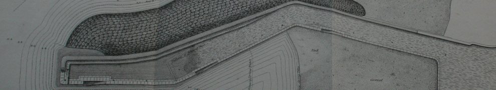
Just east of the Bulmers factory in Clonmel, Co Tipperary, the Anner runs southwards to its confluence with the River Suir. A short distance north of the N24 (the road to Waterford), a canal separates off from the river and runs down the far side of a field, passing under the N24 a short distance to the east of the Anner. The bridge under which it passed is (or was, on the 1904 Ordnance Survey map) called Canal Bridge, which is the only information I have to suggest that this watercourse was thought of as a canal. I have a few photos of it here.
Posted in Forgotten navigations, Irish waterways general
Tagged Anner, bridge, canal, Clonmel, Ireland, lost, Suir, waterways
I have just put up a page about the Upper Suir navigation, from Clonmel downstream to Carrick-on-Suir. This was an extraordinarily difficult navigation, with a fall of 57′ in about twelve miles — and not a single lock of any kind. There were shallows, rapids and floods: the level of the Suir could change very quickly in response to rainfall, and the currents, bad enough at the best of times, could rapidly become extremely dangerous. It is not surprising, therefore, that the worst accident in Irish inland waterways history was the drowning of over 100 people, most of them women and children, who were travelling downstream from Clonmel to Carrick.
And this navigation was worked entirely by horse power, with up to fifteen horses employed at times to haul the boats upstream.
This account includes extracts from poems and links to old photos, as well as many, many photos of major sections of the navigation. There is also a diversion to cover the millstreams and weirs of Clonmel and there are opinions from the authors of early guidebooks for oarsmen and canoeists. However, there are undoubtedly errors and omissions, and I welcome Comments that might help to improve this account.
Posted in Forgotten navigations, Irish inland waterways vessels, Operations, Scenery
Tagged boats, canal, Ireland, lost, Suir, vessels, waterways
It’s not that the tidal section of the Irish River Barrow is lost or closed down or abandoned, but its current traffic is but a shadow of what it was. This page follows a journey upstream, from Cheekpoint and Barrow Bridge (where the Barrow joins the Suir) to St Mullins (where the Barrow Navigation begins). En route, it notices railway bridges, old quays and ferry routes, limekilns that were supplied by river, mills and sprat weirs.
Posted in Extant waterways, Irish inland waterways vessels, Operations
This navigation is still used by pleasure boats, notably by the members of the Carrick-on-Suir Boat Club, but its once-busy commercial traffic has largely ceased; the final nail will be hammered in when the new Waterford bypass road-bridge crosses the Suir and prevents tankers from supplying Morris Oil at Fiddown. This account includes some historical material and photos taken on a trip downriver aboard the barge 31B.
I’m referring to it as the middle Suir as there was a horse-drawn navigation upstream from Carrick to Clonmel and of course ships can come up to Waterford from the sea (as well as more interesting vessels from the Nore and the Barrow).
Here is a very long page showing working boats that are not operated by Waterways Ireland. They include hotel boats, restaurant boats, trip boats, rescue boats, police boats and sand barges.
Posted in Extant waterways, Irish inland waterways vessels, Irish waterways general, Operations
Tagged barge, Barrow, Blackwater, boats, canal, cattle ferry, community barge, Devenish, dredger, DUKW, Enniskillen, Erne, ESB, Garda, Grand Canal, Guinness, hare krishna, hotel boat, Ireland, Ireland waterways rockville, Killaloe, Lagan, Limerick, Lough Neagh, Monasterevan, Nore, Operations, PSNI, rescue, restaurant boat, RNLI, sand, Shannon, Shannon–Erne Waterway, Suir, theatre barge, trip boat, vessels, waterways, workboat

