I hesitate to criticise the Newry & Portadown Branch of the Inland Waterways Association of Ireland, admirable folk who conduct regular work parties improving the Newry Canal. So perhaps I should say that I disagree with them instead — at least on the proposal for a Southern Relief Road, aka bypass, around Newry, linking “the Warrenpoint Dual Carriageway to the A1 Dublin/ Belfast Road“.
Such a bypass is a very good idea and, of course, far better than the insane Narrow Water handsacrosstheborder project. But the new road must cross the Newry River and the Newry Ship Canal, and I would be vastly surprised if there were any economic justification for the cost of an opening section or for the disruption that each opening would cause to traffic. Certainly six or twelve sailing vessels would no longer be able to reach the Albert Basin in Newry, but the greatest good of the greatest number should surely prevail.
I can’t see that the absence of sailing pleasure craft from Newry would in any way diminish the heritage or historic value of the ship canal or the basin, and they are of course entirely irrelevant to the stillwater canal.
A spokesman from the Inland Waterways Association of Ireland” says that
The IWAI was formed in 1954 to stop the building of low bridges on the River Shannon. Fortunately this campaign was successful otherwise there would be no hire boats on the Shannon today. Think of the loss of revenue. This should be a lesson to the bridge builders in Newry.
This is rubbish, for two reasons. First, sailing vessels on Carlingford Lough are never going to be available for hire on the Newry Canal, so their inability to reach Albert Basin would have little effect.
Second, the IWAI campaign on the Shannon was notably unsuccessful. Instead of swivelling bridges that would allow masted vessels through, the Shannon now has fixed bridges (Banagher, Shannonbridge, Athlone) and lifting bridges (Roosky, Tarmonbarry) that lift enough to allow motor cruisers through, but not enough for sailing vessels.
Ruth Delany [in Ireland’s Inland Waterways: celebrating 300 years Appletree Press, Belfast 2004] says that the IWAI Shannon campaign resulted in there being a minimum clearance of 4.3m on the Shannon, which is a long way from the 35m that the Newry & Portadown folk are seeking. The only Shannon bridge providing that clearance is Portumna, a swivel bridge, which (unlike the others mentioned above) was not — or its ancestor was not — built by the Shannon Commissioners.
By using the Shannon as a model, the N&P folk have actually weakened their case: the 9m clearance suggested for the Newry bypass is more than twice what the Shannon provides.


yes because what Northern Ireland needs is more roads and cars and gridlock! lmao
If it wasn’t for the IWAI, the Grand and probably the Royal canals within Dublin would have been filled in. The Thomas Street branch, Portobello Basin, and the spur that came to Blessington Street WERE filled in, as were the graving docks in Grand Canal Dock. You may also be aware that George’s dock, and the next one in, were filled in too, just more recently. Very few similar things have been done elsewhere in Europe. Have alook at St Catherine’s and the Royal Docks in London for an indication of the value THEY place on urban water bodies.
IMO, the extra cost in raising the Newry bridge would be fairly minimal compared to the overall cost. Alternatively, having an opening span, if done properly, would cause little inconvenience. The Eastlink cycle time is just 1.5 minutes, and except for VIP vessels, that will only be done during off-peak traffic times. building an effective barricade is very short-sighted, as were pur government’s plans for The Dublin’s canals in the 60s.
I gather it already has several sorts of gridlock. It’s not clear how any of them would be relieved by providing mast-up access to the Albert Basin. bjg
Your first paragraph is entirely irrelevant. There is no proposed reduction in the area of water bodies in Newry. On your second, do feel free to submit costings. bjg
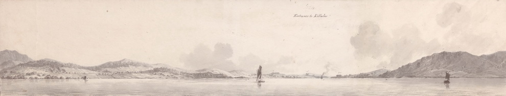
Also, Newry is tidal (just). The canal was built to facilitate vessels coming in at other than high tide. To compare that with the the length of the Shannon is way off the mark.
The canal was built to facilitate vessels going out, carrying coal from the Tyrone coalfields to Dublin. bjg
If this is supposed to be a question of economics, it is not clear to me how building more roads with public money would provide any economic benefit to Northern Ireland in general or Newry in particular. The province already infamously has had the most miles of road per capita of any portion of these islands (if not the whole of Europe) for most of the last 50 years, and still manages to have amoungst the lowest economic activity of the UK, requiring huge net annual subsidy from her majesty’s treasury. The causes of this economic disaster have most certainly not been due to it taken people in Warrenpoint too long to get to their favourite shops in Newry.
One of the few net contributors to the meagre economy is tourism, and excluding fancy tall ships from Newry and giving the locals an extra 20 minutes off their journey to Aldi is not going to improve that.
We’re not really worried about the good folk of Warrenpoint: it’s the citizens of the Free State who need to get north quickly to buy duty-free. You will say, and rightly, that they will be able to do so on the car ferry, but what if it’s not running in the winter gales? What if it’s blockaded by French trawlers?
As for job creation, one of Northern Ireland’s most successful growth industries in the last recession was the roadside car-wash sector. Quite obviously, for that to be a success, there have to be cars.
None of the tall ships is a ship: the largest seems to be a brigantine.
bjg
“None of the tall ships is a ship: the largest seems to be a brigantine.”
Fascinating, could you expand on your definition of a ship. This is a genuine question
A ship is (or, I suppose, was) a sailing vessel with at least three masts, each in three parts (lower, top and topgallant masts) and square-rigged on all three. There is a good intro on Wikipedia here https://en.wikipedia.org/wiki/Full-rigged_ship with links to pages on other types of sailing vessels; the page on sail plans https://en.wikipedia.org/wiki/Sail_plan#Types_of_ships has sketches that make it easy to see the similarities and differences between the types of vessels.
Nowadays, every duckpond or stream is called a waterway and every sailing vessel, even a modern sloop-rigged yacht, seems to be eligible to be called a “tall ship” when the organisers of some gathering of boats want to cast a false glow of tradition over a boaters’ pissup. I think it worthwhile retaining the original specificity of some such terms. You may object that I am a grumpy old git, but you knew that anyway.
bjg
Pingback: Shinners to the right of them … | Irish waterways history