Tag Archives: canal

Saving the Clones investors

I’ve moved most of the original contents of this post to Ulster Canal 13.

I mentioned elsewhere that the Department of Community, Equality and Gaeltacht Affairs is known to some people as Craggy Island. Wikipedia tells us that

The real Craggy Island seen from helicopter shots is Inisheer.

And we learn in today’s Irish Times that Craggy Island is helping to provide subsidised electric cars on the Aran Islands including Inisheer (Inis Oirr), the “real Craggy Island”.

In other news

My most recent email to the Department of Community, Equality and Gaeltacht Affairs about the funding of the canal has not yet had a response.

My Freedom of Information request to the Department of Community, Equality and Gaeltacht Affairs about the funding of the canal has been acknowledged.

Ephemera 14: Ulster Canal: departmental bullshit

I have created a new page covering correspondence with the Department of Community Equality and Gaeltacht Affairs in January 2011. I have accordingly removed postings Ephemera 11 and Ephemera 13; the correspondence with the department is now on the new page.

I don’t know why the Irish government finds it so difficult to provide a straight answer to a straight question (well, actually, I can guess, but let’s be polite). But if funding were available, the government would be issuing press releases to beat the band, especially with an election coming up. So I deduce that there is no money, although I wouldn’t be at all surprised to find a press release or two making some vague announcement or lauding the start of some low-cost activity.

But I won’t believe in the restoration or rebuilding of the Ulster Canal until I see evidence that real money has been allocated to cover the cost.


Old boats

I’ve set up a new page on which I intend to collect pics showing older Irish inland (and estuarial) working boats. I’ve started it off with a copy of the posting (below) about Portobello and a photo of a yawl at Clonmel; this is a page that will have material added as I come across it.

Nineteenth-century Irish canal boats

Illustrations of early Irish inland waterways vessels are relatively scarce. The drawing below shows the sterns of two of them.

Portobello Harbour 1882

This is from The Graphic of May 13, 1882, and shows the lighting of tar-barrels in Portobello Harbour, on the Grand Canal in Dublin, to celebrate the release from prison of Charles Stewart Parnell and two colleagues.

The layout of the harbour in around 1900 can be seen on the OSI Historic 25″ map. Where were the vessels tied? What are the buildings in the background? What can be said about the vessels? Presumably wooden horse-drawn barges, but they look rather narrow to me. Comments welcome.

The harbour itself is, alas, no more.


Ephemera 9: the flash lock at Killaloe

As part of its new mooring scheme at Killaloe, Waterways Ireland has commissioned contractors (L&M Keating Ltd) to carry out various works including the installation of a lock at the upper end of the canal, beside the Phoenix boathouse and just downstream from the Pierhead. The lock is to control access to the canal; presumably the stop planks in the existing lock chamber will be removed, allowing boats to pass down under the bridge.

The lock under construction

As I understand it, this lock is to have a single pair of gates. Boats wishing to pass through will tie up temporarily and use a squawk-box (or similar technological marvel) to communicate with the bridge-keeper at Portumna, who will cause the gates to be opened and then, presumably, closed after the boat has passed through. This system will prevent the use of the canal by cads and bounders using jetskis, speedboats and other excrescences.

Stanked off and pumped out

However, the water through Killaloe Bridge has a gradient or slope, especially in flood and when Ardnacrusha power station is running. The canal above the lock will be at the higher level; the canal below the lock will be fed from the bottom end, where it rejoins the river. So is there not likely to be a difference in height at the lock? Is this the equivalent of a flash lock?

I’m sure there is an engineering answer to this; I would welcome enlightenment.


Ephemera 7

The view from Dromod 30 December 2010.

Dromod

The Swiss Army Knife is no longer sprawling across the canal above Noggus Bridge on the Grand: it’s parked in the middle of the canal, closer to the bridge.

Locks at locks

Here‘s a thing.

Clondra Lock

The lock at Clondra may be the only one on the Shannon that is in the same place, and doing the same job, since the days of the Commissioners of Inland Navigation in the middle of the eighteenth century. The lock itself has been refurbished several times, and in recent years the lock furniture has been altered to make it impossible for boaters to work their own boats through it. But it has a very interesting collection of gear and it is well worth using, even if you’re not going to the Royal Canal at Richmond Harbour.

Up the Suir

I don’t know if you remember, but a few months ago we had sunshine, and it was warm outside. Back then, at the end of May in fact, I went on the Industrial Heritage Association of Ireland‘s tour of Carrick-on-Suir, Clonmel and areas in between.

In Carrick, Ralph O’Callaghan showed us some of the sights and addressed the group in the Heritage Centre. Here are some of the things he showed us.

Ralph O'Callaghan shows a model of a yawl (a horse-drawn boat used to carry goods between Carrick and Clonmel)

This yawl is equipped for sand-dredging

Note the large rudder

The yawl

A steel shoe for one of the 30' poles used by Suir and Barrow boatmen

A hand-made net for snap-net fishing

After lunch, I was fortunate to be one of two people who got a trip in Ralph O’Callaghan’s canoe, from Kilsheelan upstream to the Anner bridge just downstream of Sir Thomas’s Bridge, which is itself downstream of Clonmel.

I have set up a small (approx 120-photo) slide show to give an idea of the conditions on the Suir at the time. The water level was low after several dry weeks, but the previous winter’s floods may have left more silt than usual. At any event, a successful passage required Ralph’s skills and his intimate knowledge of the river and its weirs. You can see some of the weirs, and the gorgeous scenery, in the show.

I am very grateful to both Ralph O’Callaghan and Fred Hamond for facilitating the boat trip and for sharing their immense knowledge of the Suir.

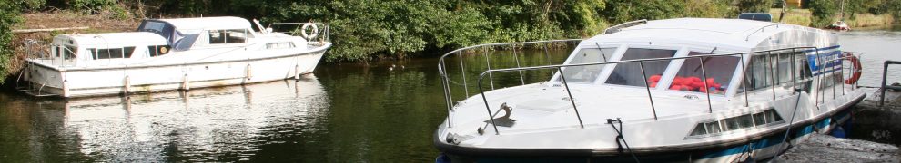
If you like interesting boats, you’ll like Ralph’s canoe.

An update on the Suir

I have updated my page about the River Suir above Carrick. I have added photos on some locations above Clonmel (Cahir, Athassel, Golden); I have also added a new section about the infrastructure of the navigation between Carrick and Clonmel. That section has benefited greatly from the information provided by Fred Hamond on the tour he organised for the Industrial Heritage Association of Ireland earlier this year. Several of the photos taken on the tour show warm, sunny weather. They will also, I hope, help to draw attention to the delights of the Suir.