
Ballina and Killaloe May 2010
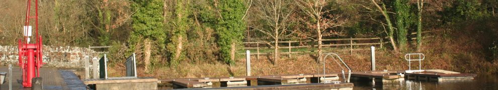
Ballina and Killaloe May 2010
Posted in Extant waterways, Irish waterways general, Scenery, Uncategorized, Weather
Tagged Ballina, bridge, Clare, Ireland, Killaloe, Lough Derg, Pierhead, Shannon, Tipperary, waterways
… didn’t cross the Rine, which is a river in County Clare, flowing into the estuary of the River Fergus which, in turn, joins the estuary of the River Shannon. The Rine is also known as the Quin and the Ardsollus and its downstream end is called Latoon Creek, no doubt because it flows by the townlands of Latoon North (which is to the east) and Latoon South (to the west). There is a quay there, hidden under one of the three road-bridges that cross the Latoon side by side. Sea-manure (seaweed used for fertiliser) was landed there and Samuel Lewis tells us that fifty-ton lighters were used, but more information is needed about their operations.
Read about it here.
Posted in Extant waterways, Forgotten navigations, Industrial heritage, Irish inland waterways vessels, Irish waterways general, Operations, shannon estuary
Tagged Ardsollue, boats, bridge, Clare, Clarecastle, creek, Ennis, Fergus, fertiliser, Hely Dutton, Ireland, Latoon, lighters, lost, M18, N18, pier. three German officers, quay, Quin, Rine, Samuel Lewis, sea-manure, seaweed, Shannon, turf, vessels, water level, waterways
It’s a long way from Trinity College, Dublin to the pier at Saleen on Ballylongford Creek, on the south side of the Shannon Estuary. But the college owned large amounts of land in the area, including bogs, and turf was one of the cargoes exported from Ballylongford. There was a battery on Carrig Island at the mouth of the creek and a Coast Guard Station at Saleen Pier, which was built by the Commissioners for the Improvement of the Navigation of the Shannon. Read more about Saleen here.
Posted in Extant waterways, Forgotten navigations, Industrial heritage, Irish waterways general, Scenery, shannon estuary, Steamers, The fishing trade, The turf trade, Water sports activities
Tagged Ballylongford, battery, boats, bog, bollard, Carrig Island, Coast Guard, Commissioners, Front Square, goat, Ireland, jetties, Kerry, Kilrush, Limerick, lost, Operations, potatoes, Saleen, Saleen Pier, Shannon, slipway, Tarbert, TCD, tide, Trinity College Dublin, turf, vessels, water level, withy
Beginning a section about the piers, quays and harbours of the Shannon Estuary, especially those noticed in the mid-nineteenth century. At that time, and while the Shannon Commissioners were at work, the estuary was seen as a part of the river, just as Lough Derg was, although nowadays the Shannon Foynes Port Company controls the estuary and Waterways Ireland (and the ESB) the river upstream from Limerick.
Noel P Wilkins, in his recent biography of the engineer Alexander Nimmo (Irish Academic Press 2009), says that Kilbaha was the only place where Nimmo selected an unsuitable site for a harbour. Within a couple of years it had been abandoned and replaced by a pier.
Kilbaha is the westernmost harbour on the north side of the Shannon Estuary and the closest to Loop Head. It exported turf (peat) and imported sea-manures; it was also a pilot station. A lot of activity for a small place. Read about it here.
Posted in Extant waterways, Forgotten navigations, Industrial heritage, Irish waterways general, Scenery, shannon estuary, The fishing trade, The turf trade
Tagged boats, canoe, currach, estuary, fisheries commission, Ireland, kilbaha, loop head, nimmo, pilot, sea-manure, Shannon, shannon estuary, turf
One beneficial aspect of the floods is that there is lots of water for kayakists. Here are some pics taken at Curragour, on the Shannon in Limerick city, on 28 November 2009.
Posted in Extant waterways, Forgotten navigations, Industrial heritage, Irish inland waterways vessels, Irish waterways general, Operations, Scenery, Water sports activities, Weather
Tagged boats, bridge, Curraghgour, Curraghgower, Curragour, ESB, falls, floods, Ireland, kayak, Limerick, Shannon, University of Limerick, vessels, water, water level, waterways, waves
Here are the Sailing Directions for the Shannon Estuary (completed before 1848) and for Lough Erne (1835-6), Lough Ree (1837) and Lough Derg (1838-9). They were compiled by Commander James Wolfe RN, who was one of those who drew up the relevant Admiralty Charts. Like the Charts, these Directions have not been updated, so boaters should not rely on them for navigation.
The Google Books Team have kindly permitted me to extract these from a larger document, which was one of those they had scanned and placed online, and to make them available (free, of course) to visitors to this site. Note that I have omitted part of the description of the smaller Lough Derg, which is not part of the connected waterways system.
The fall of the Shannon is concentrated between Killaloe, at the bottom of Lough Derg, and Limerick, at the head of the Shannon Estuary. It is that fall, of almost 100 feeet, that made possible the construction of the hydroelectric power station at Ardnacrusha in the 1920s. Its designers were not the first people to realise the usefulness of the water-power of the Shannon in that area, but they were almost the first to use it: there were few mills between Killaloe and Plassey, and that at O’Briensbridge used water from the Bridgetown direction rather than from the Shannon.
There were, however, two bleach mills, one at Doonass on the County Clare side of the Shannon and one at Castleconnell on the Co Limerick side. The Doonass mill seems to have been set up, around 1760, by Hercules Browning or Brownriggs. There is little trace of the mill itself, but its intake and outlet canals are still to be seen. The really interesting thing is that there are two outlets: the shorter returns to the Shannon almost immediately below the mill while the longer runs for almost half a mile, behind a hill, before it rejoins the river.
I don’t know why it has two outlets. It is possible that the system catered for much higher water levels with greater variation between summer and winter. It is conceivable that the longer arm might have been used to carry the produce of the mill downstream, although I have no evidence for that and I’m not sure where the goods would have gone after the outlet rejoined the river. The watercourse is referred to locally as Conway’s Canal, but I don’t think that is evidence that it ever carried anything.
Anyway, here are maps, photos and as much background information as I could find. Comments, suggestions and explanations will be welcome.
Posted in Extant waterways, Forgotten navigations, Industrial heritage, Non-waterway, Scenery
Tagged bleach, bleach mill, Browning, Brownriggs, canal, Castleconnell, Doonass, Ireland, linen, lost, Shannon
Here is a short page with a few photographs showing a Waterways Ireland crew at work in Athlone, where they were laying buoys to mark a course for the swimming element of a triathlon. Waterways Ireland is the main sponsor of the event and had evidently committed staff resources as well as cash.
Posted in Extant waterways, Irish inland waterways vessels, Operations
Tagged boats, Ireland, Operations, Shannon, vessels, waterways, Waterways Ireland, workboat
This page has a photo of a barge with a mysterious device on its back end. Can you help to identify the device and say what it’s for?
Many thanks to all who replied, and especially to Balliol for naming the beast and to Pete for finding similar devices elsewhere. I was looking for a replacement outboard for my inflatable dinghy, but I don’t think I’ll buy one of them.
Posted in Irish inland waterways vessels, Operations
I’ve added some extra photos of
– Waterways Ireland workboats (four photos down the bottom of the page)
– non-WI workboats (several photos in several categories)
– sailing boats (a single photo taken on Lough Ree)
– traditional boats (three photos of Nore cots).
If you don’t want to have to scroll through everything on each page, ask your browser to find “July 2008” (all pages except Traditional boats) or “June 2008” (Traditional boats).
Posted in Irish inland waterways vessels, The fishing trade
Tagged boats, Ireland, Operations, Shannon, waterways, Waterways Ireland, workboat

