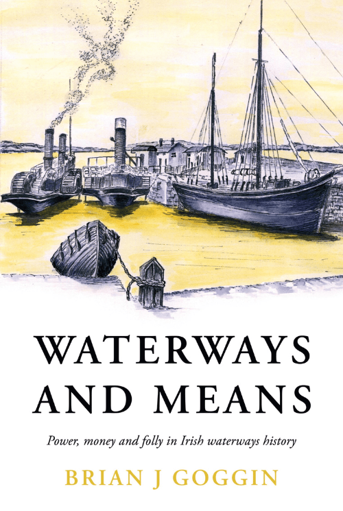
Waterways and Means is a selection of writings mainly on the late 18th and 19th century, a boom period for Irish waterways. HM Treasury had cash to burn and influential Irish MPs were keen to bring that money home in the form of infrastructure investment.
As navigation by water became faster and easier, new possibilities opened up: fresh eggs and bacon to Liverpool for breakfast, a ready supply of turf to Limerick to fuel the distillery, bogs drained for arable land, and fast, comfortable trips to Kilkee to take the sea air.
Based on a collection of Brian’s extensive research and writings on Irish waterways, this book tells the story of those improvements and of many diversions along the way: waterways which were never completed, debauchery in the canals of Dublin, cargoes stolen, workers on strike and boats sunk.
Where to buy the book
Ireland
You can get Waterways and Means directly from 2 sources in Ireland
Outside of Ireland you can get the book directly from Anne Goggin by emailing waterwaysandmeans@gmail.com with your order – please include your full name and address. Payment will be arranged via Paypal.
“Waterways and Means” won the RCHS book of the year this year and there are not many copies of it left, so get your copy for your friend for Christmas now.
A new batch has just gone to O’Mahony’s in Limerick, and the IWAI online bookshop also has some available. I can supply UK based customers directly. We don’t intend to re-print, so this may be the last chance.
I’m amazed at the number of hits that continue to arrive on this site in spite of no new content.
Thank you all for your support. It’s been a great ride!
We were thrilled to receive awards from the Railway and Canal Historical Society for “Waterways and Means”. We were awarded Waterways book of the year, as well as overall book of the year. His association with the RCHS meant a lot to Brian, who exchanged information regularly with their members. He led a field trip for them around Killaloe and the Shannon estuary a number of years ago, as well as speaking at their annual Clinker lecture. They published his book on the Royal Canal at the time of the lecture.
The following is their press release from the awards ceremony:
PRESS RELEASE from the Railway & Canal Historical Society
On 27 May the Society announced the results of its 2023 Transport History Book Awards. Now in their 20th year, these Awards were initiated by the Society in 2004 to encourage the writing and publication of well-researched, interesting, and readable books in the field of transport history. Their continuation has been ensured for the foreseeable future by a generous legacy left to the Society by the late David St John Thomas, author, and co-founder of the publishing house David & Charles.
The winner of the Canal & Waterways category and the overall Book of the Year 2023 was:
Waterways and Means – Power, Money and Folly in Irish Waterways History by Brian Goggin
Brian Goggin was diagnosed with terminal cancer in the summer of 2020. During his time remaining he assembled a collection of articles from his website and elsewhere which could be published posthumously. His family completed the task and this volume is the result. It is gratifying to learn that the website now forms part of the Irish National Archive.
Brian adopts a broad definition of ‘waterway’ – any body of water, natural, adapted or constructed which is used for the transport of people or goods. He also points out that waterways can be viewed from different perspectives, for example, as obstacles to land communication, as convenient rubbish dumps or even as unofficial swimming facilities. They had many unrecorded uses and users. Other writers have tended to concentrate on the ‘official’, documented waterways. Brian identifies gaps in the literature, particularly in the areas of political and economic factors, and in this book attempts to fill some of them whilst identifying further areas that he thought should merit attention.
Focussing on the late 18th and early 19th centuries, around half the book explores the history of navigation on the Shannon Estuary and Limerick Navigation, including steamer services on the estuary, use of steam tugs on the loughs and the traffic in agricultural produce sent mainly to Liverpool and described in Brian’s 2014 RCHS Clinker Lecture ‘Steam, the Shannon and the Great British Breakfast’. The remainder of the book is a series of essays, arranged thematically, exploring some of the little researched areas identified by the author, some of them quaintly referred to as ‘rabbit holes’ by his editors – fascinating diversions discovered in the course of his research. These include subjects such as navigations that were never completed, waterways built to drain land but found useful for transport purposes, internal canal systems on Irish estates and an account of unofficial bathing in the Dublin canals. There is little documentation for many of these subjects but, nevertheless, Brian found sufficient material to tell their story – the extensive endnotes list more than 1500 references. He suggests that waterways historians could work profitably with local historians to dig deeper into these matters.
The specially commissioned maps are particularly helpful in supporting an understanding of the text. The reproduction of the photographs is perhaps not fully up to the best contemporary standards, and the book lacks an index. These are minor criticisms, however. Readers will encounter a mixture of scholarly articles and story-telling. To borrow a term usually applied to fiction, this is a book of short stories, some on unexpected topics, which can be dipped into and revisited. It deserves a wide audience both for its coverage of Irish waterways history and for its novel and innovative approach.
Full details of the Book Awards, including the judges’ report and list of previous winners, can be found on the Society’s website http://www.rchs.org.uk
Readers of this site will be aware that in the final months of his life Brian brought together a collection of his writing to be published posthumously. That book – Waterways and Means – is now finished, and we, his family, would love you to join us for its launch and to remember Brian.
Please come, and spread the word to anyone who may like to join us.
——————————————————————————————————————
Waterways and Means is a selection of writings mainly on the late 18th and 19th century, a boom period for Irish waterways. HM Treasury had cash to burn and influential Irish MPs were keen to bring that money home in the form of infrastructure investment.
As navigation by water became faster and easier, new possibilities opened up: fresh eggs and bacon to Liverpool for breakfast, a ready supply of turf to Limerick to fuel the distillery, bogs drained for arable land, and fast, comfortable trips to Kilkee to take the sea air.
Based on a collection of Brian’s extensive research and writings on Irish waterways, this book tells the story of those improvements and of many diversions along the way: waterways which were never completed, debauchery in the canals of Dublin, cargoes stolen, workers on strike and boats sunk.
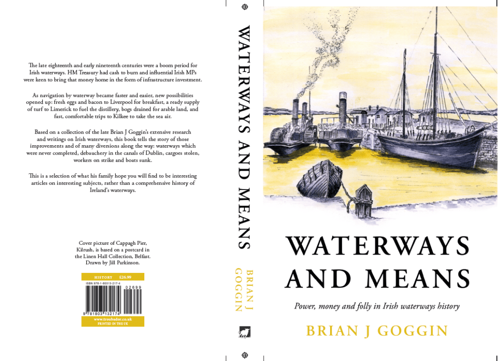
It is a selection of what his family hope you will find to be interesting articles, rather than a comprehensive history of Ireland’s waterways.
—————————————————————————————————————-
The book will be available for purchase at the event at a special price of €30, and on the IWAI website after launch. The event will be about remembering him, as much as launching the book.
Other launch events:
Waterways Ireland will be hosting a launch event on 1st June in Dublin for both the book and the archival materials that have been donated to them by Brian’s family. As numbers will be limited at this event, please let me know if you would like to attend it and I’ll send details.
The Heritage Boat Association is hosting a launch of the book on Sunday 5th June at their 21st anniversary gathering in Ballinasloe. If you are not attending the gathering and wish to attend this, please let me know as the HBA would like an indication of numbers.
Contact can be made by leaving a comment in response to this post. The comment won’t be published unless relevant to a wider audience.
The final proof of Brian’s book, “Waterways and Means – Power, money and folly in Irish Waterways History”, has just gone to the publisher. Watch out for more news here as we arrange for launch, and celebrations of Brian’s life, on 1st to 5th June in Dublin, Killaloe and Ballinasloe.
This website has now been preserved for many generations to come by the National Library of Ireland as part of the National Collection.  You can access it directly at https://wayback.archive-it.org/12408/20201215095118/https://irishwaterwayshistory.com/
and it will also be made accessible through the NLI's catalogue.

We, Brian's family, intend to keep the Irishwaterwayshistory domain for the foreseeable future, but Brian's work is now futureproofed.

We are working hard on the publication of Brian's book and intend to have it ready for a celebration of his life in the autumn.  In the meantime, stay safe.

Anne
Today we have lost a much loved husband, father and grandfather, the author of the material on this website, Brian J Goggin.
Brian was dedicated to his research work on the waterways and loved to share the material he discovered. This website is the fruit of that labour, and it contributed to many friendships and interesting conversations over the years. He was an entertaining speaker and loved to share his knowledge with those who he hoped would share his passion for the history of the waterways.
Some of you may have met us as a family while we were on the River Shannon on our barge, Knocknagow. Brian loved to chat to everyone he met, particularly if they had stories about canals, boats, and related history.
Beyond his work and personal interests, Brian was a loving and generous husband, and a hugely supportive parent. He chose to be called Grumpy by his grandchildren but delighted in making them giggle, reading bedtime stories with great animation, and encouraging them to drum on every surface possible. He was rarely without our dogs: at least one of Newby, Leavy, Pippa and Goldie are in almost every photo we have of him.
He was curious about the minutiae of the world in a way few are. He read widely, always diving deeply into other points of view and always broadening his knowledge. Even in his final days he was devouring books – and leaves behind a hefty collection that his family may one day read 2% of!
We’ll miss him for everything that he was, and everything that he helped the people around him to be. We’ll remember his constant encouragement, and his quiet efforts to help others succeed. We’ll remember his love of the waterways, and the times we shared with him there.
Remembering Brian
With Covid limiting events, we are not holding an open service. Instead we ask three things of you, depending on how you wish to remember Brian:
Share a memory or appreciation
If you have a memory of Brian or a message to share please leave a comment on this post, or contact us at the email address below. That could be as a friend, a loved one, or simply as a reader of the website.
Remember Brian’s love of the waterways
We can’t be together to remember Brian, but we can have a shared experience: remembering Brian by the places he loved so much.
If you want to remember Brian, find a stretch of waterway (he particularly loved the Shannon), or industrial heritage on the waterways, and spend some time in quiet reflection there, thinking of any memories you have of him.
Celebrate his life and come to book launch next year
In a year’s time, we are hoping to have an opportunity to remember Brian, and to publish the first of two books. After his terminal diagnosis in August he worked intensely to arrange much of his writing so that it can be published posthumously, and left behind at least two books’ worth of material, which we will be preparing for publication.
We’ll publicise the event closer to the time, but we hope to see as many of you as possible there when the time comes – to celebrate his work, and to celebrate the legacy of our wonderful man.
In my page about the Monivea navigations I wrote that I would be glad to hear from anyone who can provide more information about them, past or present.
Marian Hardiman has very kindly put up photos of the flax mill and a windmill near Monivea on Facebook.
She also drew my attention to the excellent site of Skehana & District Heritage, which is packed with interesting articles. A search said that there were 158 on Monivea alone.