
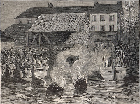
How they got the dredgers past the distillery in 1857. No pics, alas, but it’s worth using the links to the OSI maps.
-

Waterways and Means by Brian J Goggin available now -
Join 585 other subscribers
RSS links
Pages
- Waterways & past uses
- Saving the nation
- Turf and bog navigations
- The Bog of Allen from the Grand Canal in 1835
- John’s Canal, Castleconnell
- The Canal at the World’s End
- The Finnery River navigation
- The Lough Boora Feeder
- The Little Brosna
- The Lullymore canal as wasn’t
- The Roscrea canals
- The Monivea navigations
- Lacy’s Canal
- The Rockville Navigation page 1
- The Rockville Navigation page 2
- The Rockville Navigation page 3
- Rockingham
- The Colthurst canals
- The Inny navigation
- The lower Shannon
- The piers, quays and harbours of the Shannon Estuary
- Nimmo’s non-existent harbour
- The Doonbeg Ship Canal
- Querrin
- Kilrush and its sector lock
- The Killimer to Tarbert ferry
- The Colleen Bawn at Killimer
- Knock knock. Who’s there?
- Cahircon: not at all boring
- Ringmoylan
- The hidden quay of Latoon
- The stones of Kilteery
- The Maigue
- Sitting on the dock of the Beagh
- Massy’s Quay, Askeaton and the River Deel
- Saleen Pier
- The Lord Lieutenant’s Visit to Limerick — trip down the Shannon [1856]
- The Fergus
- The Limerick Navigation
- The boundaries of the Shannon
- The power of the Shannon
- The locks on the Limerick Navigation
- Plassey
- Worldsend, Castleconnell, Co Limerick
- The bridge at O’Briensbridge
- The Limerick Navigation and the Monmouthshire Canal
- The Limerick Navigation (upper end) in flood November 2009
- The Limerick Navigation (lower end) in flood November 2009
- The Limerick Navigation (tidal section) in flood November 2009
- Floods in Limerick (1850)
- Limerick to Athlone
- The piers, quays and harbours of the Shannon Estuary
- The middle and upper Shannon
- The Grand Canal
- Monasterevan, the Venice of the west
- The Grand Canal lottery
- Grand Canal carrying: some notes
- The dry dock at Sallins
- The Naas Branch
- The Mountmellick Line of the Grand Canal
- Dublin to Ballinasloe by canal
- The Ballinasloe Line
- A Grand Canal lock: Belmont
- South of Moscow, north of Geneva
- Water supply to the Grand Canal
- The Grand Canal Company strike of 1890
- The Royal Canal
- Water supply to the Royal Canal: the feeders
- The Lough Owel feeder
- The proposed Lough Ennell water supply to the Royal Canal
- From Clonsilla to Clew Bay
- Kinnegad and the Royal Canal
- The sinking of the Longford in 1845
- Steamers on the Royal Canal
- Leech of Killucan: horse-drawn boats on the Royal
- Horses on board
- Royal eggs
- Prothero on the Royal
- The whore who held the mortgage on the Royal Canal
- Waterways in Dublin
- The Naller
- Visit Dublin. Walk canals. Drink beer.
- The Broadstone Line of the Royal Canal
- Effin Bridge: its predecessors
- Between the waters
- The abandoned Main Line of the Grand Canal 1
- The abandoned Main Line of the Grand Canal 2
- The abandoned Main Line of the Grand Canal 3
- The abandoned Main Line of the Grand Canal 4
- Waterways of the south-east
- Waterways of Cork and Kerry
- Waterways of the west
- Waterways of Ulster and thereabouts
- People
- Systems & artefacts
- Irish waterways furniture
- Irish waterways operations
- Miscellaneous articles
- Irish inland waterways vessels
- Cots -v- barges: defining Irish waterways
- Waterways Ireland workboats
- Wooden boats on Irish inland waterways
- Traditional boats and replicas
- Non-WI workboats
- Older Irish working boats
- The barge at Plassey
- Dublin, Athlone and Limerick
- Waterford to New Ross by steam
- The steamer Cupid
- Liffey barges 1832
- Steam on the Grand Canal
- The Mystery of the Sunken Barge
- Steam on the Newry Canal
- Guinness Liffey barges 1902
- Up and under: PS Garryowen in 1840
- Watson’s Double Canal Boat
- The Cammoge ferry-boat
- The ’98 barge
- Late C19 Grand Canal Company trade boats
- Chain haulage
- Ballymurtagh
- The Aaron Manby and the Shannon
- A sunken boat in the Shannon
- Sailing boats on Irish inland waterways
- Some boats that are … different
- Square sail
- 4B mooring
- Irish waterways scenery
- Engineering and construction
- Irish navigation authorities
- Opinion
- The folly of restoration
- The Ulster Canal now
- The Ulster Canal 00: overview
- The Ulster Canal 01: background
- The Ulster Canal 02: the southern strategic priority
- The Ulster Canal 03: implementation
- The Ulster Canal 04: Ulster says no
- The Ulster Canal 05: studies and appraisals
- The Ulster Canal 06: the costs
- The Ulster Canal 07: the supposed benefits
- The Ulster Canal 08: the funding
- The Ulster Canal 09: affordability
- The Ulster Canal 10: kill it now
- The Ulster Canal 11: some information from Waterways Ireland (and the budget)
- The Ulster Canal 12: departmental bullshit
- The Ulster Canal 13: an investment opportunity?
- The Ulster Canal 14: my search for truth
- The Ulster Canal 15: spinning in the grave
- The Ulster Canal 16: looking for a stake
- The Ulster Canal 17: the official position in November 2011
- The Ulster Canal 18: Sinn Féin’s canal?
- The Ulster Canal 19: update to February 2012
- The Ulster Canal 20: update to April 2013
- The Ulster Canal 21: update to August 2018
- The Barrow
- A bonfire at Collins Barracks
- Living on the canals
- Waterways tourism
- Guano
- The Park Canal: why it should not be restored
- The Park Canal 01: it says in the papers
- The Park Canal 02: local government
- The Park Canal 03: sinking the waterbus
- The Park Canal 04: the Limerick weir
- The Park Canal 05: cruisers from the Royal Canal
- The Park Canal 06: What is to be done? (V I Lenin)
- The Park Canal 07: another, er, exciting proposal
- Accounting for risk
- Tax-dodging boat-owners
- Rail
- Waterways & past uses
Blogroll
boats
- Canal steamers [UK]
- Chris Deuchar's boating page
- Douglas Self retrotech and steam
- Grace's Guide: British Industrial History
- Heritage Boat Association
- Historic Inland Working Boats
- Irish maritime history
- irish shipwrecks database
- Kilrush & District Historical Society
- Lough Corrib charts and scans
- Railway and Canal Historical Society
Book sales
Industrial heritage
Inland waterways
Ireland
Overseas
Seafaring
Sources

