Category Archives: Industrial heritage

The Lartigue: the Listowel & Ballybunion Railway

The Listowel & Ballybunion Railway operated between 1888 and 1924, using perhaps the most eccentric railway technology ever invented: the monorail developed by Charles Lartigue.
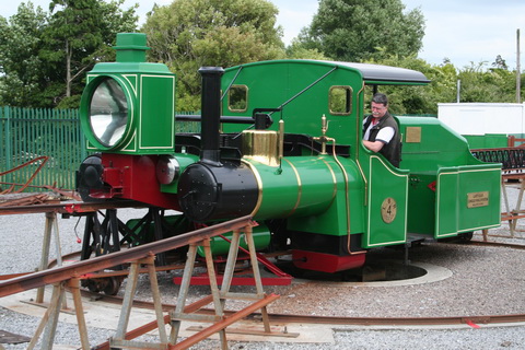
Very little original material was left after the railway closed, but a short section of railway has been recreated in the town of Listowel, Co Kerry, with a single locomotive (now diesel rather than steam) and two carriages. However, it shows the more exciting features of the original: the ingenious turntables and switches. There is also a small display of models, photographs and artefacts, and a showing of three short films, with some original newsreel footage of the railway in operation. The volunteer staff are knowledgeable and happy to chat and, all in all, it makes for a very entertaining few hours for anyone interested in transport or engineering.

Listowel is close to Ballybunion on the south side of the Shannon Estuary; anyone visiting the industrial heritage artefacts of the Lower Shannon Industrial Heritage Park could easily build in a visit to the Lartigue – and then take the ferry from Tarbert to Killimer and visit the West Clare Railway.

Read about the Lartigue here.
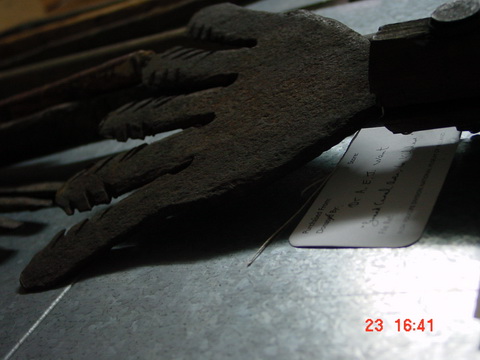
Anguilla anguilla: the ESB eel fishery

This photo shows an eel spear from the National Folklife Collection‘s overflow material, stored in the former “reformatory” at Daingean, on the Grand Canal in Co Offaly. There were many spears there, with different designs from different rivers. This one, to judge from the label underneath it, came from the extraordinarily prolific and observant Dr A E J Went.

If you look at pretty well any Irish river on the 1840s Ordnance Survey map (here’s the Shannon at Killaloe; switch to Historic 6″ if necessary), or indeed on the 1900s map (same URL but switch to Historic 25″), you’ll find evidence of eel weirs. Ireland’s shortest canal was built to allow the eel-boats of Anthony Mackey’s fleet to reach the trains at Banagher.

But the European eel is a “critically endangered species” and all eel fishing has been banned in Ireland. As far as I know, though, the Lough Neagh fishery, in Northern Ireland, continues.

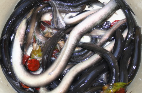
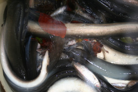
The Electricity Supply Board (ESB) is in charge of the eel fishery on the River Shannon. It has nets and a storage unit (packing station) at Killaloe and, until recently, it also had nets at Clonlara on the headrace supplying the power station at Ardnacrusha; the Clonlara nets have just been removed. This page is about the Clonlara and Killaloe operations, but includes a look at an eel survey conducted for the ESB in 2008, before eel fishing was banned in Ireland. The aim now is to make it easy for eels to reach the sea to reproduce, and that sometimes involves “trap and transport”: catching the eels and moving them past obstacles, whether on their way to the sea or, for the young glass eels, on their way upriver.

The photos on this page are a tribute to what was an important activity on the Shannon. I hope that the European eel stocks can recover.

Ordnance Survey maps

Let joy be unconfined. The OSI has further improvements to its online maps, with a beta of a street map application and the return (I think) of the 25″ 1900s maps. Start from here.

bjg

Shannon Harbour dry docks

My dry docks overview page had a bad link in it, which was my fault, but I hope that’s now fixed as the Shannon Harbour dry docks

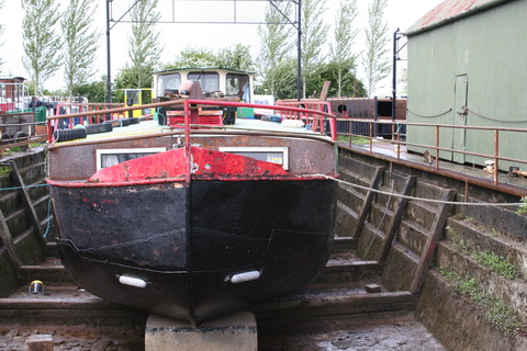
34B in the dock

page is now up. Comments, corrections and suggestions for improvements and additions will be welcome.

Dry docks

I’m starting a new section on Irish inland waterways dry docks. The thing is, I have photos of very few of them, and even my list of docks is almost certainly incomplete. So this page has photos of a few of the docks, but I’m hoping readers will be able to help with lots more.

Knock knock …

Knock in Co Mayo is well known, having its own airport; Knock in Co Clare is less well known, though it has its own port. Here is a short account of its history, with some photographs, but more information would be welcome.

Three German officers …

… didn’t cross the Rine, which is a river in County Clare, flowing into the estuary of the River Fergus which, in turn, joins the estuary of the River Shannon. The Rine is also known as the Quin and the Ardsollus and its downstream end is called Latoon Creek, no doubt because it flows by the townlands of Latoon North (which is to the east) and Latoon South (to the west). There is a quay there, hidden under one of the three road-bridges that cross the Latoon side by side. Sea-manure (seaweed used for fertiliser) was landed there and Samuel Lewis tells us that fifty-ton lighters were used, but more information is needed about their operations.

Read about it here.

Saleen Pier

It’s a long way from Trinity College, Dublin to the pier at Saleen on Ballylongford Creek, on the south side of the Shannon Estuary. But the college owned large amounts of land in the area, including bogs, and turf was one of the cargoes exported from Ballylongford. There was a battery on Carrig Island at the mouth of the creek and a Coast Guard Station at Saleen Pier, which was built by the Commissioners for the Improvement of the Navigation of the Shannon. Read more about Saleen here.

Nimmo’s non-existent harbour

Beginning a section about the piers, quays and harbours of the Shannon Estuary, especially those noticed in the mid-nineteenth century. At that time, and while the Shannon Commissioners were at work, the estuary was seen as a part of the river, just as Lough Derg was, although nowadays the Shannon Foynes Port Company controls the estuary and Waterways Ireland (and the ESB) the river upstream from Limerick.

Noel P Wilkins, in his recent biography of the engineer Alexander Nimmo (Irish Academic Press 2009), says that Kilbaha was the only place where Nimmo selected an unsuitable site for a harbour. Within a couple of years it had been abandoned and replaced by a pier.

Kilbaha is the westernmost harbour on the north side of the Shannon Estuary and the closest to Loop Head. It exported turf (peat) and imported sea-manures; it was also a pilot station. A lot of activity for a small place. Read about it here.

Tralee Ship Canal

Tralee Ship Canal, about 2 km long, links the town of Tralee, in County Kerry, to the sea. It might be the most westerly canal in Europe (query Belmullet).

The canal was restored recently, courtesy of the taxpayer, but seems to be little used. It has a sea lock (but no other locks) and a swivel bridge. Here are some photos taken on a very wet and windy day.