Seen near a waterway
Seen near a waterway
Visiting the Royal Canal at Clonsilla recently, I noted some interesting features of the canal’s stonework. I do not know how old they are or what they were for; I would welcome information from readers.
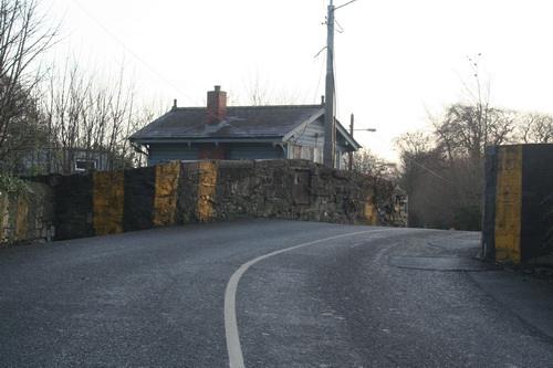
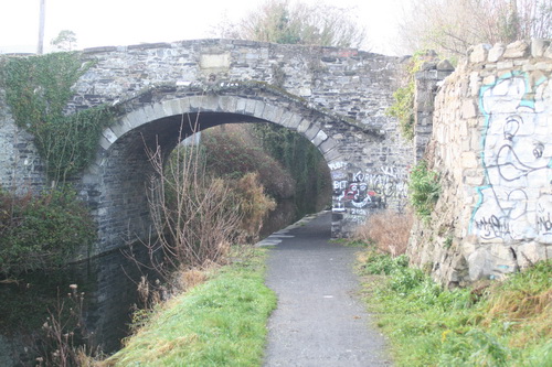
Clonsilla (Callaghan) canal bridge in the foreground; a railway signal box behind it
The towpath crossed from the south to the north bank at Porterstown (Kennan) Bridge, just east of this one. The passage boat Longford sank in 1845 between these two bridges; fifteen people died.
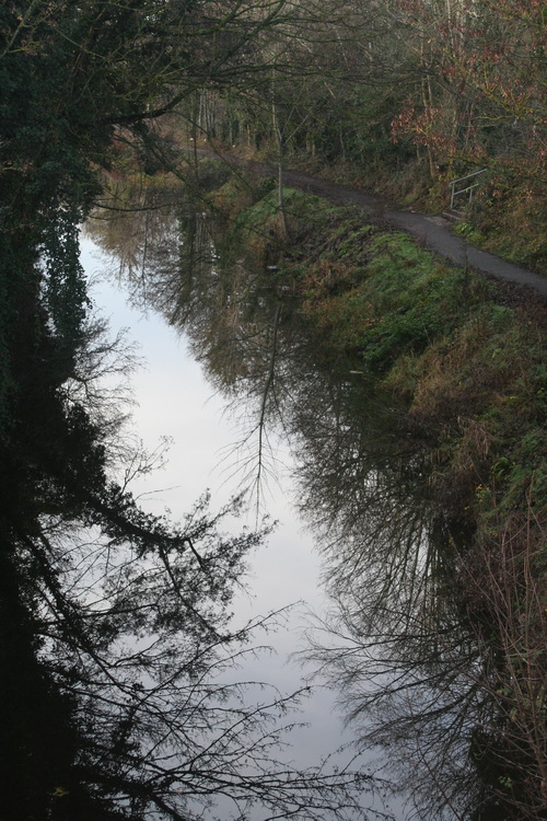
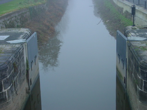
Looking west from the bridge

Clonsilla (Callaghan) Bridge (OSI ~1900)
The Ordnance Survey of Ireland 25″ map of around 1900 shows what looks like a ramp leading up from the towpath, on the east side, to the level of the bridge and the road; the earlier 6″ map (late 1820s to 1840s) is less clear and I cannot tell whether the ramp existed then. However, the recent photograph, taken from the bridge, does suggest that the wing wall of the ramp has been built up, with newer stone, and that much of the area of the ramp has been taken in to the gardens above. This, of course, is speculation on my part and I would welcome clarification (leave a Comment below).
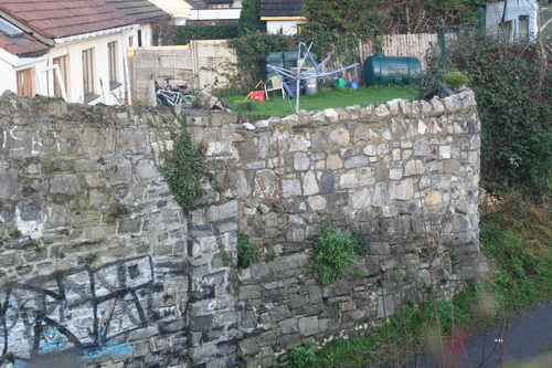
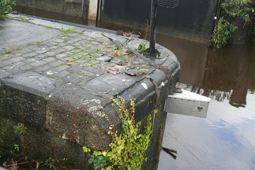
Built-up wall
Note what looks like a very tall gate pillar half way along. I don’t know much about architecture or construction, but the fact that the canal side is vertical makes it look to me more like a gate pillar than a supporting buttress for the wall of the ramp.
The eastern pillar from the towpath
Here’s a close-up. You can also see what looks like the dividing line between the older stone of the ramp, which slopes away from the towpath, and what I assume to be newer stone, built vertically, integrating part of the ramp (presumably with infill) with the garden above.

The eastern pillar from the towpath (close-up)
Here it is looking eastward (away from the bridge).

Looking eastward
There is a similar structure on the west side of the bridge.
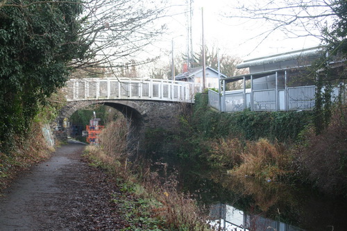
The west side of the bridge with a pedestrian bridge beside it; the railway station is on the right
Here is what looks like the remains of a similar gate pillar.
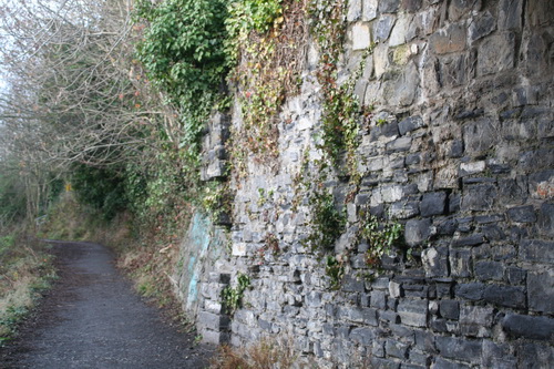
Western pillar (looking west)
Note the vertical face of the pillar against the slope of stones on the embankment,
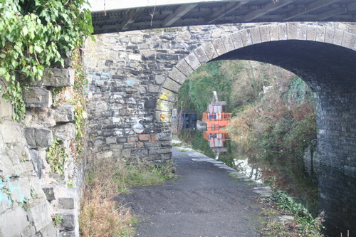
Vertical face (with missing stones)
These pillars may have some engineering significance in holding up the embankment, but I wonder whether they might have been used to hang gates closing off access to the towpath for some reason. I don’t know whether other bridges have similar arrangements.
Waterways Ireland commissioned a Heritage Survey of the Royal Canal, which is available here [PDF], but that document does not contain any of the details and, judging by WI’s Heritage Surveys page, it does not seem that the “detailed database report” on the Royal will be made available on the WI website. Accordingly, I do not know what the survey says about these pillars.
All information welcome.
Peter Clarke, in The Royal Canal: the complete story Elo Publications, Dublin 1992, points out that, in 1807, there was a passenger service from Dublin to Clonsilla: the six miles cost 1/7½ in first and 1/1 in second class.
Could it be that the passenger station was under the bridge, with access controlled by gates at either end? Horses could have been changed too, with the ramp providing access for horses to the road. Passengers too could use the ramps, but horses could not use steps. And, as modern canal users will attest, it is always easier to embark and disembark passengers under bridges, where there is deep water at the edge and where the boat does not have to go off its course.
If that is so, there might be similar stonework at the other passenger stations that were located at bridges rather than at harbours. There would be traces of gate pillars at either side of a bridge. Ramps would be required only where the canal bank’s level was significantly above or below that of the road.
![]()
Posted in Ashore, Built heritage, Canals, Economic activities, Engineering and construction, Extant waterways, Historical matters, Industrial heritage, Ireland, Irish waterways general, Modern matters, Operations, Rail, Restoration and rebuilding, Roads, Safety, waterways, Waterways management
Tagged Callaghan, Clonsilla, embankment, gate, Kennan, pillar, Porterstown, ramp, Royal Canal, wall
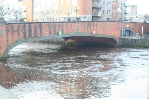
Abbey Bridge
Baal’s Bridge
Mathew Bridge
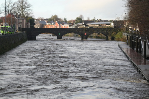
Current heading for Mathew Bridge
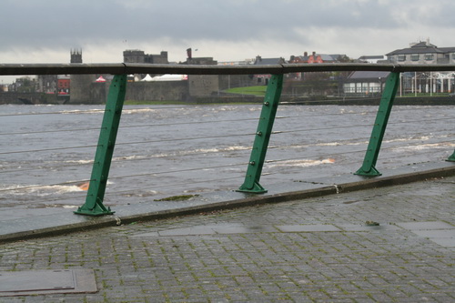
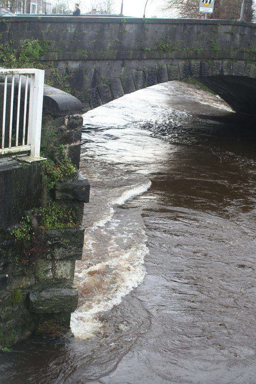
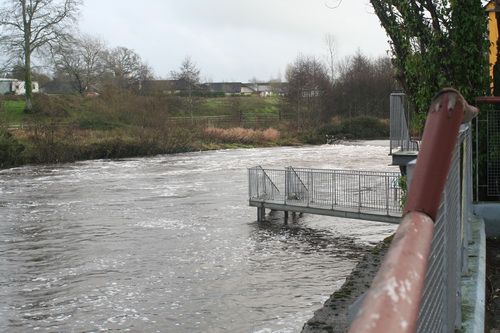
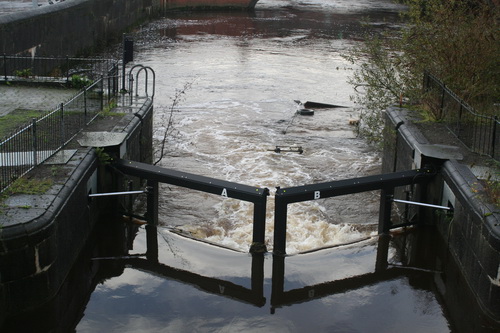
The weir
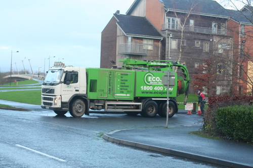
Lots of pumps running and equipment trundling about the place
Trouble at t’mill
T’millstream
Cots on the bank
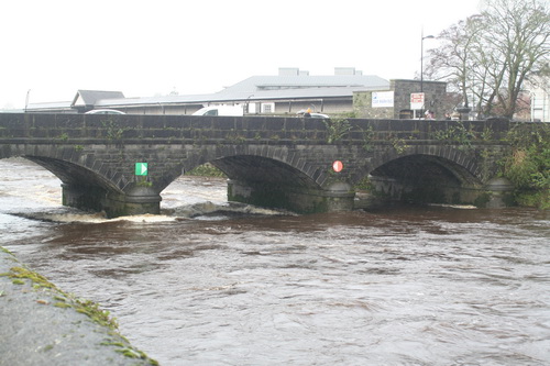
The Black Bridge getting another hammering
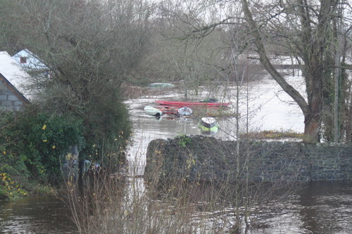
I have been told that the Mulkear River rose very rapidly on Saturday night and that, at one time, it was feared that the (older) bridge would be swept away. I gather that folk working in other areas were called to Annacotty to deal with the emergency.
The old bridge at Annacotty (downstream face)
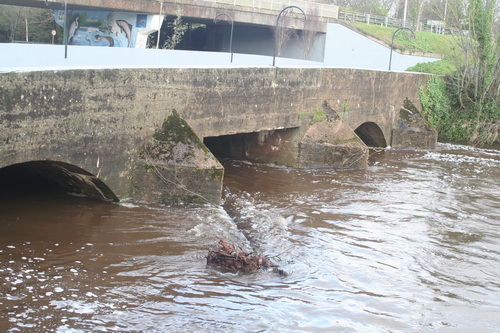
A tree in the water above the bridge
There’s a weir in there somewhere
The Mill Bar in Annacotty was closed today after being flooded.
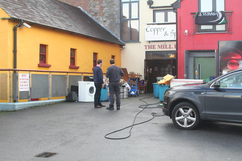
The Mill Bar
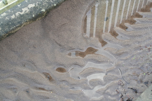
This, from a small garden beside the bridge, suggests that the Mulkear may have carried and deposited a lot of silt
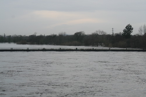
I gather that the Mulkear’s waters, added to those of the Shannon itself, raised the level of the Park Canal (the bottom section of the Limerick Navigation). A problem with opening the lock gates, to release the water, meant that a few houses in Corbally were flooded. A Sinn Féin councillor, whose party colleague has been responsible [with her southern counterpart] for slashing Waterways Ireland’s budget in recent years, is quoted as saying
I am in no doubt it was primarily caused by the ineptitude of Waterways Ireland.
Alas, the news story does not tell us the source of the councillor’s certainty.
The article also says that
[…] the force of this water meant it was not possible to open the lock gates by hand.
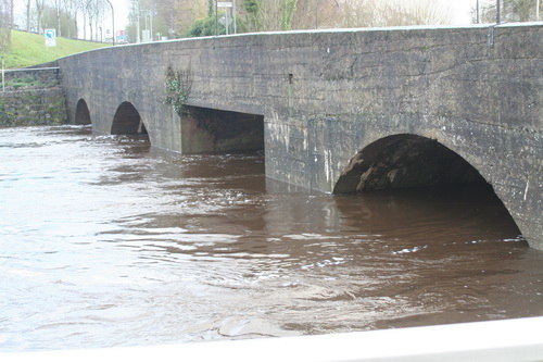
That is, I think, misleading: neither set of gates has gate beams, so they are not opened by hand.
The upper gates in 2004, shortly after installation. Note the absence of gate beams. Note also the two sluices or paddles on each gate
Control pedestal and gear
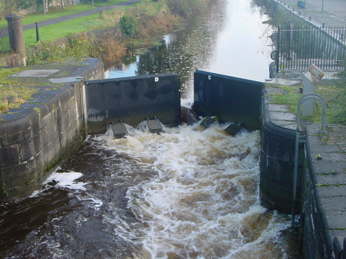
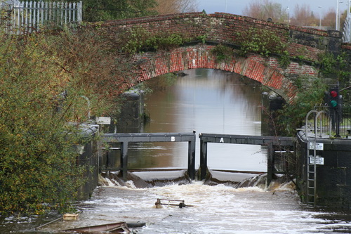
The upper gates open today
I see no sign of the paddles or sluices. Perhaps the level is so high that they’re underwater. I must try to check next time I’m at the canal harbour.
The upper gates in the floods of 2009
In the floods of 2009 the upper gates were held slightly open and all four sluices were discharging water. That would have lowered the level in the canal; it would also, I think, have made it easier to open the gates fully.
I am guessing, but I imagine that on Saturday night some sort of hydraulic machine was brought in this way …
Two bollards have been moved from the gateway and stacked beside it
… and used to push or pull open the near-side upper gate. There seems to be some slight damage to the stone and iron work.
Slight damage
One other possibility that struck me is that silt from the Mulkear might have built up behind the gates, making them difficult to open, but I have no evidence on the matter.
The lower gates
From the outside looking in
Posted in Built heritage, Canals, Charles Wye Williams, Drainage, Economic activities, Engineering and construction, Extant waterways, Forgotten navigations, Historical matters, Industrial heritage, Ireland, Modern matters, Operations, Safety, Shannon, waterways, Waterways management, Weather
Tagged 2009, Annacotty, Anney River, Baal's Bridge, Black Bridge, bridge, cot, flood, gate, harbour, hydraulics, lock, Mulcair, Mulkear, Park Canal, Plassey, Shannon, silt, University of Limerick, water level
My dry docks overview page had a bad link in it, which was my fault, but I hope that’s now fixed as the Shannon Harbour dry docks

34B in the dock
page is now up. Comments, corrections and suggestions for improvements and additions will be welcome.
Posted in Extant waterways, Industrial heritage, Irish inland waterways vessels, Irish waterways general, Operations
Tagged 34B, 59M, acro, boats, bridge, canal, dry dock, gate, Grand Canal, grille, Ireland, Knocknagow, lock, loo, Operations, paddle, prop, rack, Shannon, sluice, Swaine, vessels, waterways, Waterways Ireland, winch

