
See the Irish Times story.
![]()
Posted in Ashore, Extant waterways, Ireland, Natural heritage, Operations, Shannon, waterways
Tagged boats, eagle, Ireland, Lough Derg, Mountshannon, Shannon
I mentioned the other day that extensive searches of tinterweb had failed to find any data on the heights of overhead power lines above the Shannon and that I had been forced to resort to the telephone.
I am pleased to report that the ESB expert duly rang me back today, and further pleased to report that he had himself measured the height of every cable over the Shannon. Oh joy, oh happiness, I thought. But not for long.
The ESB, it seems, does not reveal the actual height of power lines above the water. This, if I understood the reasoning correctly, is because the water level varies and a boat-owner might not understand that, hit a line with a mast and then sue the ESB [where “ESB” means “electricity transmission or distribution operation”]. I have been told that a boat-owner in coastal water did just that (presumably between the mainland and an island) and that the lawyers have advised ESB to take no further risk; I would welcome information about the incident.
So, if you want to find the height of a power line, you’ll need to polish up your trigonometry (and then relate the height to Ordinary Summer Level). But the ESB does supply the information to one organisation that makes charts: the United Kingdom Hydrographic Office. That’s OK for coastal charts, but the UKHO (to the best of my knowledge) has not surveyed the inland Shannon since 1839, and I don’t think its inland charts have been updated since then. It is possible, of course, that the UKHO supplies the data to other (electronic or paper) chart-makers; I have emailed them to ask.
The quest continues again. More info when I get it.
Posted in Ashore, Built heritage, Economic activities, Engineering and construction, Extant waterways, Industrial heritage, Ireland, Irish inland waterways vessels, Operations, Politics, Shannon, shannon estuary, Sources, waterways, Waterways management
Tagged boats, clearance, ESB, height, Ireland, Lough Derg, Operations, OSL, overhead power line, Shannon, transmission, vessels, water level, waterways
Went out without the camera today, alas, and found Waterways Ireland crews at work at the canal harbour in Limerick. One crew had launched a Pioner Multi (I didn’t see them do it, alas, but it may have come on the back of a truck with a HIAB or suchlike) and were hauling rubbish out of the water. Another were welding new railings to prevent access to the old hotel/canal manager’s house and installing a steel plate in a window aperture on one of the Shannon Navigation buildings.

I presume the new plate will soon be decorated. I rather like the artwork, I must say, and I think it a pity that Young Folk should not have somewhere to go to do the things that Young Folk like to do.
Posted in Ashore, Built heritage, Charles Wye Williams, Economic activities, Engineering and construction, Forgotten navigations, Industrial heritage, Ireland, Non-waterway, Operations, Scenery, Shannon, waterways, Waterways management
Tagged harbour, Limerick, lock, Operations, Park Canal, Shannon, Waterways Ireland, workboat
So you’re out in your sailing-boat, heading for Portumna, and you see that there’s an electricity cable crossing the waterway ahead of you, just downstream of the bridge. You think you’ll fit under it but it would be nice to know the clearance ….
Electricity is ESB, isn’t it? Well, perhaps not: it could be ESB Networks, which seems to mean distribution, or EirGrid, which means transmission. It could also be one of the other companies that sells volts, but I don’t think they run big wires.
Half an hour of searching the websites of the three bodies failed to produce anything about the heights of pylons or cables or overhead powerlines. Safety advice said not to go near them, but that’s what you are trying to do: it would help to know how near is near. Another half an hour of general googling; still no result.
So, as it’s a smallish line on wooden poles, rather than a large one on very tall steel pylons, you guess that it might be distribution rather than transmission, and thus ESB Networks rather than EirGrid.
I rang; someone will ring back within 48 working hours. The quest continues ….
What is the magic combination of search terms that will find the heights above water of all power lines over Irish waterways?
Posted in Ashore, Economic activities, Engineering and construction, Extant waterways, Ireland, Operations, Shannon, Sources, waterways
Tagged boats, distribution, ESB, Ireland, Lough Derg, mast, Operations, power line, Shannon, transmission, waterways, yacht
For many years Molly enlivened the Sunday market at Killaloe with her mini-pizzas, breads, chocolate biscuits and other delights — and her good humour. Then, she says, she realised that if she could sell cold pizza in the rain in Killaloe, she could sell hot pizza from the pizza oven, indoors, in Mountshannon. She is now running the Snug restaurant in Mountshannon and has a Facebook page and a website. Hot wings followed by a pizza? I’ll be there ….
Posted in Ashore, Economic activities, Extant waterways, Ireland, People, Shannon
Tagged bruschetta, Clare, coffee, crostini, Ireland, Killaloe, Lough Derg, Molly, Mountshannon, ot wings, pizza, Shannon, Snug, waterways
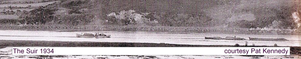
The waterway power stations are back in the news again.
Posted in Ashore, Built heritage, Economic activities, Engineering and construction, Extant waterways, Ireland, Non-waterway, Operations, Shannon, Suir, waterways
Tagged Endesa, ESB, estuary, Great Island, power station, Shannon, Suir, Tarbert, waterways
Conservation of Silver Eels on the River Shannon
Expressions of interest are invited from all interested parties to assess eligibility for a competitive tender process to award Silver Eel Operations contract on the River Shannon at ESB Eel Weir Killaloe, Co Clare.
To be eligible for consideration interested parties must have:
To register your interest, please contact:
ESB Fisheries Conservation,
Ardnacrusha Generating Station,
Limerick, Co.Clare
before 16.00hrs on Friday 13th April 2012.
Phone: 061 350598/350538; Fax 061 344560
Email: tom.obrien1@esb.ie
================================
More on the eel fishery here.
Posted in Ashore, Built heritage, Economic activities, Engineering and construction, Extant waterways, Industrial heritage, Ireland, Natural heritage, Operations, People, Shannon, Sources, The fishing trade, waterways, Waterways management
Tagged anguilla anguilla, boats, canal, Clare, eel, ESB, fishery, Ireland, Killaloe, Shannon, Silver Eel, waterways
Nobody has attempted to identify this quay, so the competition is now closed and I’ll drink the sherry myself.

It is, of course, the downstream quay at Clarecastle at the head of the Fergus Navigation.

Clarecastle downstream
Here is the upstream quay, just around the corner.

Clarecastle upstream
The upstream quay bears the following inscription.

Inscription at Clarecastle
I really must return and get a better photo when it’s less slippy. Note that, although this is on tidal waters, Thomas Rhodes was the engineer.
Did you know that Clarecastle still has its own port authority? Go to this excellent pub and ask John Power about it. His brother (Dr Joe) wrote the definitive history of Clarecastle. John has lots of interesting old photos and maps on display in a really good traditional pub. He’s got a facetweet thingie too.
Posted in Ashore, Built heritage, Charles Wye Williams, Economic activities, Engineering and construction, Extant waterways, Forgotten navigations, Industrial heritage, Ireland, Operations, People, Politics, Shannon, shannon estuary, Sources, Steamers, The cattle trade, waterways, Waterways management
Tagged boats, Clarecastle, Commissioners, estuary, Fergus, Ireland, Operations, quay, Shannon, Thomas Rhodes, vessels, Waterways Ireland

