
Learned Readers will be aware that you can moor cheaply for the winter in a Waterways Ireland Shannon harbour; see Marine Notive 111/2012 about half way down this page.
Now, anyone paying commercial rates in a Shannon marina will tell you that WI’s charges represent extremely good value: cheaper even than a year’s canals permit.
But I have noted recently that there seem to be only four boats in Dromineer for the winter). Pottering about today, I found Portumna Castle Harbour deserted.
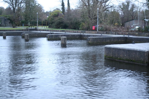
Portumna Castle Harbour December 2012
Terryglass had more boats, but most of them are on the county council’s jetty with only seven on the Waterways Ireland extension.
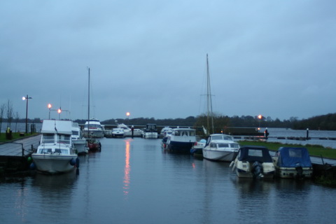
Terryglass December 2012
There were only four boats on the west bank below the bridge in Portumne. There were a few more in Connaught Harbour, but all in all the numbers were lower than I had expected. And I don’t think they’re in Shannon Harbour, which seemed to have fewer boats than usual.
So have boat-owners found that their insurers won’t cover them if they are not in supervised marinas, or out of the water, for the winter? Are private marinas, especially those that can haul boats out of the water, more crowded than usual? Or has the number of boats decreased even more drastically than I had imagined?
I don’t know. Readers’ observations welcome.

