Category Archives: Scenery

Killaloe to Limerick Docks via Ardnacrusha

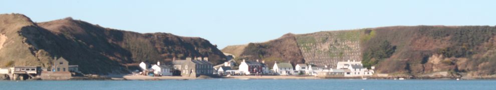
Join the ex-Grand Canal Company motor-barge 68M on its trip from Killaloe to Limerick Docks, carrying barrels of stout for Dolan’s Pub. The trip marked two occasions: Arthur’s Day, the annual Guinness marketing opportunity, and the fiftieth anniversary of the last commercial cargo on the Grand Canal and the Shannon, which was a shipment of stout to Limerick.

This page provides a slide-show of 300 photos taken from 68M on its journey. If you can’t make the trip in person, do it this way.

Note that the page takes some time to load. And, even clicking through pretty fast, the show is likely to take at least ten minutes.

Click on the first photo to bring up the controls. If you have any problems with it, leave a Comment to let me know. I haven’t done this before. I may not be able to fix any problems, but I can at least look into them.

Who took the arch? A Shannon whodunnit

O’Briensbridge is a village in Co Clare, islanded between the headrace of the Ardnacrusha hydroelectric power station and the River Shannon. Up to 1929 the river was the navigation between Limerick and Lough Derg (and eventually Dublin), and the bridge itself was something of an obstacle to navigation.

In 1832 the engineer Thomas Rhodes drew a sketch of the bridge with 14 arches, whereas nowadays it has only 12. We know when the seven arches on the Co Limerick side were reduced to six, but it has not been clear when an arch was removed from the Clare side. I think I know the answer; you can read it here.

Arthur’s Day

I spent today helping the skipper of a barge to carry a cargo of Guinness by water to Limerick, fifty years after the last Grand Canal Company commercial cargo, which was of Guinness to Limerick. (Actually, my help was minimal, confined mostly to acting as ballast, a role I fill very well, and taking 1,439 photographs.) There will be a ceremony at Dolan’s in Limerick tomorrow at the appropriate time.

Folk in other parts of the country may find it easier to undertake a pilgrimage to Uncle Arthur’s final resting place.  Here are links to some maps:

in relation to the Grand Canal. Towards the top right of the page, you can see a little castle symbol, which is roughly where the graveyard is. Notice that the road to the right of the symbol has a sharp bend; the entrance to the graveyard is just north of that bend. It’s a narrow country road, so be careful
– in relation to the N7. The orientation is slightly different on the Google map but you’ll recognise the shape of the area enclosed by the roads
– with the path into the graveyard on the OSI map.

Eh?

Some things that provided a moment’s amusement for a simple mind. To be added to when material presents itself.

Down the Rockville

Some time ago I wrote three pages about the Rockville Navigation, which is linked to Grange on the Carnadoe Waters in Co Roscommon.

I recently revisited the area. I was horrified, first, to find that the bridge — built in June 1765 — has been severely damaged, with large chunks of masonry in the cut beneath and with a crude wooden repair. How many bridges of that age are there in Co Roscommon? How many that are associated with one of the oldest navigations in the country? Please, someone, restore the bridge!

Damage to the bridge

Anyway, the more pleasant part of the day was the four hours that we spend descending, by dinghy and kayak, from the bridge to Grange. The route took us through artificial cuts, small lakes and sections of river, with very clear water and an extraordinary abundance of vegetation. This route would have been easily navigated by large wooden cots or similar boats, and it should be developed today as a canoe-and-small-boat trail. Even with very low water levels, we had no real problems, although someone has to end up with wet feet …. Here is an account of the trip.

Wading in the water

Ordnance Survey maps

Let joy be unconfined. The OSI has further improvements to its online maps, with a beta of a street map application and the return (I think) of the 25″ 1900s maps. Start from here.

bjg

Knock knock …

Knock in Co Mayo is well known, having its own airport; Knock in Co Clare is less well known, though it has its own port. Here is a short account of its history, with some photographs, but more information would be welcome.

Additions

Material has been added today to the pages on

  • non-WI workboats
  • traditional boats and replicas
  • Waterways Ireland workboats
  • Irish waterway bogs.

See links to the right.

Fiat lux

Here is a page for photos in which the main interest is the light. More photos will be added in time.

From the Pierhead

Ballina and Killaloe May 2010