Category Archives: Steamers

Killaloe bridge

More on the new bridge here with the full public notice here [PDF]. Interesting to see how many of the names of landowners are known to me.

I see on page 6 of the notice that the ESB owns two rivers, which are occupied by the ESB, Waterways Ireland, the Inland Waterways Association of Ireland and other unknown persons. There is a canal, whose owners are unknown, which is occupied by WI, IWAI and the persons unknown, as is an island. I do hope that the council will return the canal, rivers and island when they’ve built the bridge.

Killaloe and Ballina

Nice to see they’re going to get a Discover Day.

Where is it?

Troll on over to the National Library website and see what you think of this drawing. Click on the thumbnail to expand it; you may then need to click “PRINTABLE VERSION”.

The black object between the sailing boats and the church looks to me like a paddle steamer, but the image is quite blurred so I’m not certain.

If you can identify the location, I would be glad if you left a Comment below.

Killaloe bridge

The Irish Times tells us that the proposed new bridge at Killaloe will be built. The preferred route would cross the canal at Moys, below the breach in the wall,  and, on the Tipperary side, feed into the existing roundabout at the junction of the R494 and R496.

The Preliminary Design Report for the project said:

There is an existing canal alongside the river on the west side, which served a navigational function up to the time of the construction of the Parteen Weir and the raising of the water level in the river. The canal is now inundated by the river as a result of the raising of the water level, and now merely forms a parallel channel alongside the river. A strip of land some 25m wide separates the river from the canal, which is approximately 10m to 12m wide at the bridge site. As the river is now fully navigable, the canal serves no navigational function except that recreational vessels wishing to access properties on the western shore can only do so by entering the canal through certain access points, and travelling along the canal to their desired destination on the shore.

It seems that Waterways Ireland (god bless ’em) insisted that the canal remain navigable:

[…] Waterways Ireland have now requested that passage along the canal be retained, and have advised that they intend to refurbish the canal as a recreational amenity.

A culvert is therefore to be built over the canal, but not a low-level culvert:

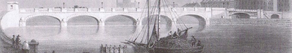
[…] Waterways Ireland require that the structure provide a minimum of an 8 metre wide waterway with a 4 metre wide towpath for vehicle and pedestrian access. They require the provision of a minimum headroom of 3.86 metres above normal water level, and a bed level not higher than the downstream cill of the canal lock at Killaloe/Ballina Bridge.

The section of canal will be dewatered during construction work.

These quotations are from Shannon Bridge Crossing Preliminary Design Report Rev F01 by RPS Consulting Engineers in October 2006. I am unable to find, on the Clare County Council website, any later documents that might assure me that the canal crossing provisions still apply. That’s not to say that they don’t; it may just be that the Council doesn’t think citizens need up-to-date information on the matter.


Annoying the neighbours

It would be unfair to condemn the proposed opening of a canal to Clones without also condemning the proposed reopening of the Park Canal in Limerick (and the Newry, when I get around to it). The link is to a top-level page; the first substantive page has a lead to the second, the second to the third and so on up to the fifth.

The Limerick Navigation

As a preliminary to increasing coverage of the old Limerick Navigation, I have improved the section’s top-level page. I added maps of the separate sections of the navigation and distances (in eighths of miles) from Prothero and Clark.


Royal Canal steamers

According to Lewis’s Topographical Dictionary (1837),

The principal trade is in wool, for which this is the greatest mart in the county, its central situation and facility of communication with the Shannon and with Dublin having rendered it the commercial centre of a wide extent of country. The City of Dublin Steam Company commenced operations here in 1830: a steamer plies twice a week between this town and Shannon Harbour, where it meets the Limerick steamer and Grand Canal boat for Dublin.

It is interesting that the steamer went west and south (37 miles, 21 locks to the Shannon, then river, lake and river to Shannon Harbour), rather than directly eastward (52 miles, 25 locks) to Dublin, but its route would have enabled it to serve Longford, Tarmonbarry, Lanesborough and Athlone. Lewis, however, does not mention steamer services at any of those places other than Athlone.

More research required ….

Inland waterways enthusiasts …

… will be delighted to hear of today’s victory by Colin Becker, the result no doubt of many years of practice at rally table quizzes.

We are reminded of the Christmas cartoon in Private Eye some years ago, depicting two choirboys, one saying to the other “I can’t believe it’s not Rutter”.

SS John Randolph

The SS John Randolph, described as “America’s first successful iron ship in commerce”, is commemorated by a historical marker in Savannah, Georgia, USA.

The John Randolph was one of the first six iron vessels built by Lairds of Birkenhead (later merged into Cammell Laird). The other five were built for use on the River Shannon.

Lough Derg 1839

Drawings now uploaded. Much more activity in these than in the Lough Ree equivalents, with steamers towing barges, turf boats, the surveyors’ cutter and other excitements.