Tag Archives: bridge

The Junction Navigation

Here are some pages about the Junction Navigation in the Ballinamore & Ballyconnell drainage district. It later became known as the Ballinamore & Ballyconnell Canal and later still as the Shannon–Erne Waterway.

The role of the cads and bounders of the Ulster Canal Company in getting a canal built at taxpayers’ expense

The construction of the Junction Navigation at Aghoo (Lock 4)

Lock gear old and new

And here’s a reminder of an old page about the Belturbet-built dredger used in constructing the navigation.

Looping the Loop

The proposed Doonbeg Ship Canal. Can anyone produce evidence to show that work ever started on it?

Garryowen and Dover Castle

In 1840 the rival steamers Dover Castle and Garryowen competed for traffic on the Shannon Estuary. While I know of no pictures of the steamers (if you know of any, please let me know), we have a reasonable amount of information about their operations. I discuss some aspects of those operations here. For an explanation of the page title, see here, but do not be diverted down this byway.

Sailing in Athlone

Athlone, from The Tourist's Illustrated Hand-Book for Ireland 3rd ed David Bryce, London 1854

The Broadstone pontoon

On my page about the Broadstone Line of the Royal Canal, I say this:

In 1845, the Midland Great Western Railway Company (MGWR) bought the Royal Canal. Doing so allowed it to run its lines beside the canal, which it did most of the way to Mullingar, without having to conduct lengthy negotiations about wayleaves with individual landowners. The company built a terminus at the Broadstone, with a pontoon bridge (which was moved out of the way when boats entered or left the harbour) to provide passengers with access to the station.

I have found a picture of the arrangement. Here it is.

The Broadstone, from The Tourist's Illustrated Hand-Book for Ireland 3rd ed David Bryce, London 1854

The pontoon looks rather solid, but there is a canal-boat heading for it and the canal clearly continues on the far side.

I have added the pic to the Broadstone page.

Semper aliquid …

… novi Africam adferre, as my old grandmother used to say.

Waterways Ireland’s Marine Notice 45/2011 says:

[…] there will be restrictions on boat movements on Level C5 of the Grand Canal Circular Line between Leeson Street Bridge and Charlemont Bridge, Dublin over the next two weeks.

This is the first time I have seen an official name of any kind, much less an alphanumeric designation, applied to Irish canal levels (pounds). Is this a New Thing? And what are the names of the other levels, on the Grand and elsewhere?

I do hope the new naming of parts works better than this.

RIBs on canals

According to the Sunday Business Post:

Army and Garda sub-aqua unit divers and armed personnel carrying ribs (rigid-hulled inflatable boats) will also be placed at strategic points along the Liffey and Dublin’s canals to ensure that there are no attempts to mount any attack from the water.

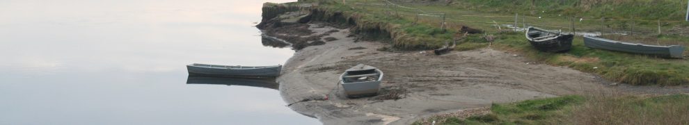
RIBS on canals? Well, that should be useful.

Er … they have heard of locks, have they? I mean, no matter how fast either the terrs or the Army and Garda folk zoom along the canal by Mespil Road, for instance, they’re still going to spend ten to fifteen minutes getting through the lock. And maybe the same clearing their props.

I do hope the terrs are not planning on launching attacks from the Royal: they won’t be able to see out from the bottom of the canal along most of the way.

Perhaps they could all be made honorary participants in the IWAI Dublin Rally, which will be on at the time.

Update 5 May 2011: Waterways Ireland says (Marine Notice 45/2011) that:

[…] there will be restrictions on boat movements on Level C5 of the Grand Canal Circular Line between Leeson Street Bridge and Charlemont Bridge, Dublin over the next two weeks. Dublin City Council are currently constructing a boardwalk at this location as part of its wider ‘Premium Cycle Route’ project to improve cycling facilities in the city and along the Grand Canal route. Due to unforeseen delays, and in order to facilitate completion of the boardwalk, it will be necessary to reduce the water level in Level C5 during the period of Monday 9th May 2011 to Thursday 19th May 2011. Waterways Ireland requests that any vessels wishing to pass through level C5 during this period should contact the Eastern Regional Office on 01 868 0148 well in advance to make the necessary arrangements.

I hope that WI has brought this to the attention of potential terrorists intending to zoom along the Grand Canal to attack HMtheQ and to the brave and noble police and army folk, in their RIBs, who will be trying to stop them.

Canals and labour history

The building and the use of Irish inland waterways, by navvies and boatmen respectively, will be discussed at the May Day Labour History School, to be held at Athy Community Arts Centre on Saturday 30 April 2011. The events of the day (copied from here):

12pm-4.00pm: photographic exhibition commemorating the workers who built the canals and the boatmen who transported the goods throughout the canal network.

2pm-2.15pm: Official Opening of the Festival by the Mayor of Athy

2.15pm-4.00pm: series of talks examining the socio-economic and cultural impact that the opening of the canals had on provincial life. The typical life of the early navvies and boatmen will be brought to life, and the struggle for improvement in conditions leading to early Trade Union formation will also be explored.

8.00pm: A concert of Labour and Workers’ songs, featuring two of Dublin’s well-known balladeers, Tom Crean and Jimmy Kelly. The concert will be preceded by a Wine Reception at 7.30pm.

More details of the weekend here or here (PDF). I wouldn’t bother trying the SIPTU site: I couldn’t find the info there.

Killaloe

The installation of the new pontoon, the flood control gates (flash lock) and the walkway continues apace.

Walkway (left) and pontoon from the lockhouse

The lower (nearer) section of pontoon may be for the lakeboat hire business

Boats mooring on the lower end of the pontoon, and turning to approach upstream, may get quite close to the bridge. The navigation markers may confuse too: perhaps they’ll be relocated.

The flood control gates (flash lock?)

From upstream (and uphill)

It all looks very nice. There are lots of people working on site.

Clontarf to Clondra II

Maark Gleeson of Clontarf Yacht & Boat Club has kindly given me details of the Club’s recent trip along the Royal, with notes on the time taken and some useful advice, especially about the tides in Dublin.