I’ve added some more pics of wooden boats to the main page here. I’ve also added links to some pages about a boat that was built for use on Lough Derg, the Gleeson hydroplane Sereia:
Sereia history (note links to pages on restoration and photos)
I’ve added some more pics of wooden boats to the main page here. I’ve also added links to some pages about a boat that was built for use on Lough Derg, the Gleeson hydroplane Sereia:
Sereia history (note links to pages on restoration and photos)
I’ve made some additions to three pages:
Several people have very kindly sent me photos of boats I hadn’t seen or photographed myself; I’m grateful to them and always happy to hear from people who can help to fill the gaps.
I have more updates to make, including many, many sailing-boats and some nice wooden boats.
Posted in Extant waterways, Irish inland waterways vessels, Water sports activities
Tagged African Queen, Berky, boats, Carrybridge, cattle ferry, Erne, Ireland, Killaloe, Lough Derg, Operations, pontoon, Portumna, Shannon, Shannon Princess, Spirit of Lough Derg, Swiss Army Knofe, Travel Blue, vessels, waterways, Waterways Ireland, WB2, weed, workboat

This photo shows an eel spear from the National Folklife Collection‘s overflow material, stored in the former “reformatory” at Daingean, on the Grand Canal in Co Offaly. There were many spears there, with different designs from different rivers. This one, to judge from the label underneath it, came from the extraordinarily prolific and observant Dr A E J Went.

If you look at pretty well any Irish river on the 1840s Ordnance Survey map (here’s the Shannon at Killaloe; switch to Historic 6″ if necessary), or indeed on the 1900s map (same URL but switch to Historic 25″), you’ll find evidence of eel weirs. Ireland’s shortest canal was built to allow the eel-boats of Anthony Mackey’s fleet to reach the trains at Banagher.
But the European eel is a “critically endangered species” and all eel fishing has been banned in Ireland. As far as I know, though, the Lough Neagh fishery, in Northern Ireland, continues.
The Electricity Supply Board (ESB) is in charge of the eel fishery on the River Shannon. It has nets and a storage unit (packing station) at Killaloe and, until recently, it also had nets at Clonlara on the headrace supplying the power station at Ardnacrusha; the Clonlara nets have just been removed. This page is about the Clonlara and Killaloe operations, but includes a look at an eel survey conducted for the ESB in 2008, before eel fishing was banned in Ireland. The aim now is to make it easy for eels to reach the sea to reproduce, and that sometimes involves “trap and transport”: catching the eels and moving them past obstacles, whether on their way to the sea or, for the young glass eels, on their way upriver.

The photos on this page are a tribute to what was an important activity on the Shannon. I hope that the European eel stocks can recover.
Posted in Economic activities, Extant waterways, Industrial heritage, Irish inland waterways vessels, Irish waterways general, Operations, The fishing trade
Tagged anguilla anguilla, Ballina, boats, bridge, canal, Castleconnell, Clare, clonlara, eel weir, eels, ESB, floods, flow, Ireland, Killaloe, Limerick, Montpelier, net, O'Briensbridge, Operations, packing station, Shannon, trap and transfer, vessels, walkway
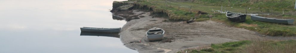
I’ve added photos of some more wooden boats at the bottom of this page. Some are unidentified; I would welcome information.

Ballina and Killaloe May 2010
Posted in Extant waterways, Irish waterways general, Scenery, Uncategorized, Weather
Tagged Ballina, bridge, Clare, Ireland, Killaloe, Lough Derg, Pierhead, Shannon, Tipperary, waterways
Here are the Sailing Directions for the Shannon Estuary (completed before 1848) and for Lough Erne (1835-6), Lough Ree (1837) and Lough Derg (1838-9). They were compiled by Commander James Wolfe RN, who was one of those who drew up the relevant Admiralty Charts. Like the Charts, these Directions have not been updated, so boaters should not rely on them for navigation.
The Google Books Team have kindly permitted me to extract these from a larger document, which was one of those they had scanned and placed online, and to make them available (free, of course) to visitors to this site. Note that I have omitted part of the description of the smaller Lough Derg, which is not part of the connected waterways system.

