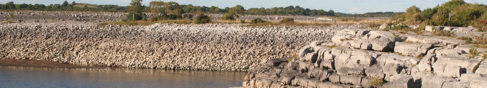
Scarriff Harbour after a haircut
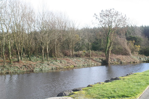
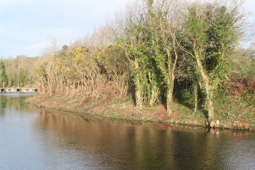
Looking downriver
I hope that the same is being done on the Shannon—Erne Waterway.
Scarriff Harbour after a haircut
Looking downriver
I hope that the same is being done on the Shannon—Erne Waterway.
Posted in Engineering and construction, Extant waterways, Ireland, Operations, Shannon, Waterways management
Tagged river, Scarriff, tree-cutting
Both the OSI and Logainm.ie show the spelling as Scarriff, but the version with one R seems to be common in the area and is used on the area’s website. I’m sticking to the longer version, so that I can at some future time work up a joke about Scaelbowiff.
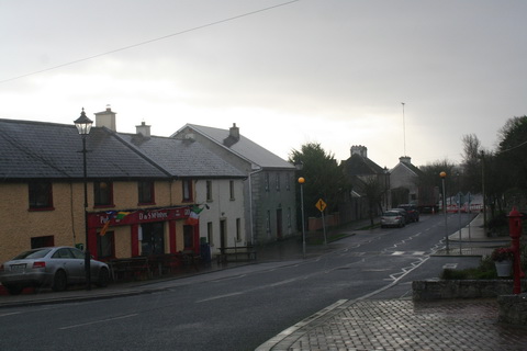
Scarriff is a small town in County Clare, a little distance upriver from the end of Lough Derg’s western arm.
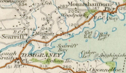
Lough Derg’s western arm (OSI ~1900)
In the 1840s the Shannon Commissioners made the river navigable to the town: before then Reddan’s Pier at Tuamgraney seems to have been the head of the river, at least for larger boats.
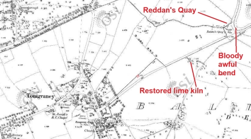
Reddan’s Quay at Tuamgraney (aka Tomgraney) (OSI ~1900)
Tuamgraney is a pleasant spot. A short distance up the road to the village is a restored limekiln.
However, Reddan’s Quay is on a bloody awful bend in the river. Large boats may have difficulty in making the turn without assistance, especially if they’re coming downstream with a flow. Anyone moored at Reddan’s Quay in such circumstances might need a new paint job afterwards.
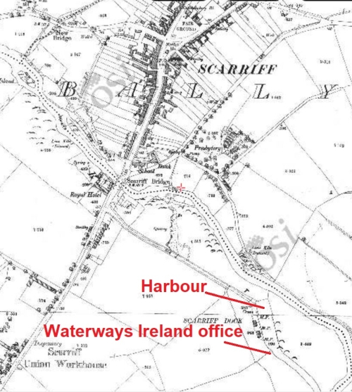
Scarriff Harbour (OSI ~1900)
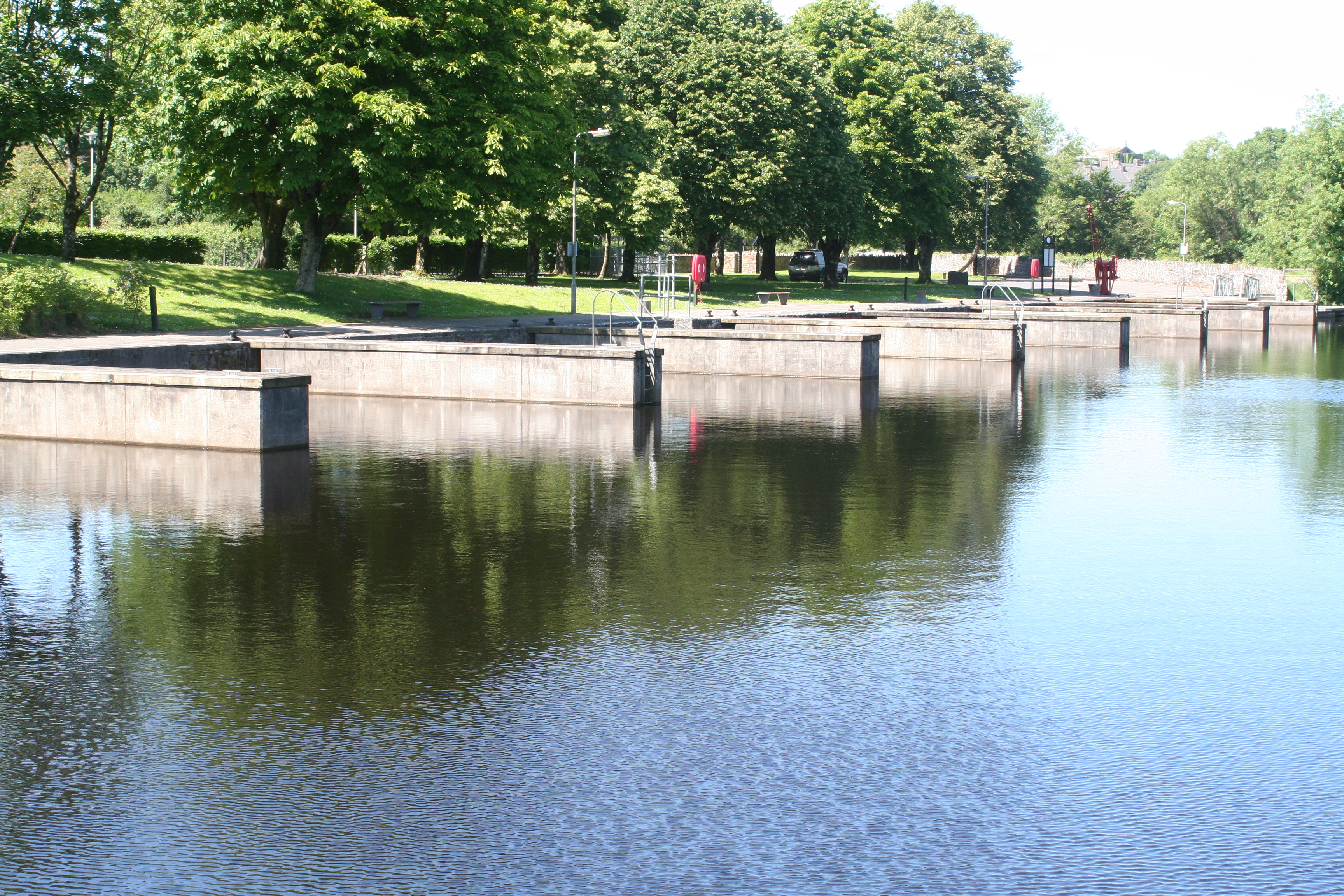
Scarriff Harbour was expanded in recent times by the addition of concrete finger jetties, which provide more mooring spaces for modern cruisers. The jetties don’t touch the old quay: I gather that this was to preserve the ancient monument or something [perhaps, Gentle Reader, you can correct me on that]. The quay still sports a Shannon Commissioners crane (no longer working) . Two long berths were provided during the expansion: half of one long berth is occupied by a boat (one of three such) that was not occupied last weekend and the other is the pump-out berth.
At the inner end of the harbour are some floating pontoons suitable for open boats and for launching kayaks and canoes. However, despite the presence of a lock-up cage for the safe storage of kayaks and canoes, indicating that small-boat activity is welcome, low barriers (only 1.8m) at the entrance to the harbour require those arriving by car to unload the kayak or canoe outside the harbour and carry it in, then return to drive the car in and unload the vessel’s equipment and cargo.
There is no slipway.
The barriers might deter camper-vans, alas: another example of discrimination against RV-users.
The harbour has a toilet-and-shower block, a pump-out, two double-socket mains electricity pillars, lights and a supply of water, which latter is used by persons arriving by car with numbers of plastic containers.
However, the harbour has not a single bin of any kind. Thus, late-evening carousers are forced to jettison their empty bottles and cans and their cardboard containers around the harbour, smashing some on the concrete in the process. A civic-minded citizen might try to sweep up the broken glass but then has nowhere to put it. [Incidentally, the carousers had left by about midnight and there was none of the threatening atmosphere that is sometimes to be felt: apart from their regrettable habits in the matter of rubbish disposal, these seemed to be quite civilised carousers.]
But back to bins. A civic-minded dog-owner who cleans up after Fido must then carry the remains around. In hot weather, dog poo on a boat begins to smell after a while; any outbreaks of cholera can be attributed to what Waterways Ireland calls its “Leave no trace” policy, which might better be termed “Pay no local authority bin charges”. As a policy, “Leave no trace” is simply an encouragement to dog-owners not to clean up: it’s far, far less trouble to leave the stuff for someone else to walk in.
In 1997 Síle de Valera, a local TD, became Minister for Fairytales. Waterways Ireland was set up during her reign and cursed by being given several regional offices; the Western region (ie Shannon) office was built at the harbour in Scarriff, in Ms de Valera’s constituency, and some unfortunate staff were sentenced to transportation to East Clare.
However, with a high population of yoghurt-knitting yurt-dwellers, East Clare is quite an interesting place. The Friday smallholders’ market had lots of good breads and cakes, jams, preserves and mushroom salt, as well as a stock of African decorative items. The fruit and veg shop on the same side of the road had a good range, while across the way the Graney sells healthfoods, veg, good cheeses, chocolate and much other stuff. No doubt other shops in Scarriff are equally good in their own fields, but I didn’t get to visit them.
On a sunny weekend (and no doubt at other times too) Scarriff was an extremely pleasant place to be, yet there were very few boats there (apart from the three unoccupied boats). [In the next photo, taken early on Friday, the unoccupied boats are out of shot to the left.] One occupied boat left at lunchtime on Friday when we arrived; one more came later, so there were two occupied boats in the harbour that night.
Saturday was slightly busier: the boat that had arrived on Friday left, but two other private boats arrived and, between 2230 and 2245, two large Emerald Star hire boats arrived too, making five occupied boats in the harbour.
Some small boats, mostly of the zoomy variety, visited briefly on Saturday. I realise that drivers may find it exciting to travel fast on a narrow, winding river where they can’t see what’s coming, but paddlers of canoes and kayaks may find less amusement in dealing with the wash from the speedsters. They in turn might find it less amusing were they to collide with 45 tons of steel coming downriver. Perhaps purchasers of fast boats should be required to demonstrate the possession of IQs in at least double figures before being allowed to take the wheel.
Scarriff June 2017
The small numbers of boats made it seem that a fine facility was being wasted (although it is dangerous to make generalisations on the basis of a single visit). It also seemed that local people made little use of the facility: I saw two anglers, a few dog- or baby-walkers and one or two others.
Here are some (cheap-to-implement, I hope) suggestions to bring more life to the harbour by encouraging both residents and visitors to use it.
On the same weekend, Dromineer seemed to be packed with boats and with non-boat people; Scarriff didn’t have many of either, and it seems a pity.![]()
Posted in Ashore, Built heritage, Charles Wye Williams, Economic activities, Engineering and construction, Extant waterways, Historical matters, Industrial heritage, Ireland, Irish inland waterways vessels, Modern matters, Operations, Passenger traffic, People, Politics, Restoration and rebuilding, Safety, Scenery, Shannon, Steamers, The grain trade, Tourism, Water sports activities, waterways, Waterways management, Weather
Tagged Clare, Lough Derg, Reddan's Pier, Scariff, Scarriff, Shannon, Tomgraney, Tuamgraney, Waterways Ireland
The Red Island green
Posted in Engineering and construction, Extant waterways, Ireland, Modern matters, Operations, Safety, Scenery, Shannon, waterways, Waterways management
Tagged buoy, green, Lough Derg, marker, Red Island, Scariff, Scarriff, Shannon
There are two Lough Dergs in Ireland. One is in the County of Donegal, within four and a half miles of Pettigoe, and is celebrated for its St Patrick’s Purgatory. The lake is but six miles long and four miles broad, and can hardly vie for scenery with its namesake in the south.
In order to reach this, probably one of the most exquisitely beautiful loughs in Ireland, it is necessary to make for the town of Killaloe. This can be done by leaving Euston at a quarter-past ten at night, when Killaloe is reached by 3.10 the following afternoon; or should the tourist prefer the Irish mail, he can leave at a quarter to nine in the evening and arrive at Killaloe at half-past eleven the following morning.
Few Irish towns contain so many antiquarian relics, combined with such beautiful scenery, for Killaloe stands on a hillside tufted with wood and surrounded by mountains. The old cathedral occupies the site of a church founded by St Dalua, in the sixth century. The present building dates from the twelfth century, with a central square tower whose effect is somewhat spoiled by a modern crown. Its gem is a Hiberno-Romanesque doorway, which has, unfortunately, been blocked into the south wall of the nave. The precincts also contain a small stone-roofed church, said to date as far back as the sixth century.
The fishing is generally extremely good, though many prefer Castleconnell, some five miles to the south on the road to Limerick. In any case few portions of the United Kingdom furnish better salmon fishing than that reach of the river Shannon that lies between Killaloe and Castleconnell.
Lough Derg must, however, remain the greatest attraction of the district. It is twenty-three miles in length, and varies in breadth from two to six miles. Nothing can surpass the loveliness of the scene, especially on a fine summer’s day. On the one side the well-wooded and smiling hills of Limerick and Tipperary, where Thomthimia, with its slate quarries, slopes down to the water’s edge; while on the other the darker and more rugged mountains of Slieve Bernagh, Ballycuggeren, and the Crag form the most effective contrast.
Kincora was once the residence of Brian Boroimbh, King of Munster, and its magnificence was long the main theme of the ancient bards. But little now remains of the ancient palace beyond a long circular earthen fort, with a single vallum some twenty feet in height.
Inishcaltra or the Holy Island is, however, well worth a visit, and for this purpose it would be better to utilize the local service from either Scariff or Killaloe to Mountshannon, which faces the island. It possesses a round tower some eighty feet high, and seven churches, or cells, and oratories, the most remarkable of which is that of St Caimin, originally erected by him in the seventh, but subsequently rebuilt by Brian Borombh in the tenth century.
Scariff may this year be approached by steamer, and is a very prettily situated village, within access by road of Woodford, in County Galway, and Ennis in County Clare. The steamer then crosses the lake to Dromineer, at the mouth of the Nenagh river, where the ruins of the castle stand out with such picturesque effect. The bay is one of the most popular resorts, both of the angler and of the yachtsman; for to the latter it has earned a well-deserved reputation for its annual regatta.
The steamer then stops at Williamstown while a boat from Kilgarvan occasionally lands passengers and conveys them to the steamer. As soon as the new jetty has been constructed by the Board of Works, Woodford will be equally accessible; but there is no doubt that the approach to Portumna pier at the head of the Lough, lying as it does between the well-wooded demesnes of Portumna Castle on the one side and Belleisle and Slevoir on the other, presents one of the finest pictures that the lake discloses, for there we see the most striking contrast between the tame verdure of the river Shannon and the bold mountain scenery of Lough Derg.
It would be tedious to dwell on the varied beauties of those innumerable seats that dot the shores of the lake on all sides; suffice it to say that few parts of the United Kingdom present as many diverse attractions as this wide expanse of water. Much as one may appreciate Loch Lomond, Loch Maree, or the Caledonian Canal, this Irish lough certainly surpasses them; and much gratitude is due to the Shannon Development Company for bringing within such easy access of the average tourist a wealth of scenery that certainly equals, if it is not finer, the finest spots that either Scotland, Norway, or Switzerland can offer.
This is, however, but half the trip from Killaloe to Athlone. Portumna is chiefly remarkable for the ruins of a Dominican priory founded in the thirteenth century, as well as for the Castle, the property of Lord Clanricarde, in which he has not resided since his succession to the estate. The village of Lorrha, three miles further up, also contains the ruins of a Dominican abbey, an oblong pile 120 ft long, as well as a castle and two old ecclesiastical buildings called by the peasantry the English churches, owing to their having been built by Norman settlers.
The river now assumes a totally novel character, winding by graceful curves through low-lying but rich meadow lands. Their luxuriant appearance is largely due to the fact that they are usually submerged under the waters of the river during the winter months.
Meelick Abbey is next passed. It was founded by the Franciscans in the twelfth century, and was at one time a sumptuous structure, but is now a roofless and mouldering ruin; and a beautiful pillar which formerly supported the arches on the south side has been torn away with ruthless vandalism, in order to make headstones for the graves in the cemetery.
Banagher can boast of a fine stone bridge, opened some fifty years ago to replace the preceding structure, which displayed no less than twenty-three arches of various forms, with massive piers between, and was so narrow that only one carriage could pass at a time.
Shannon Harbour is best known from the description of its hotel in Lever’s Jack Hinton, but that building is now let in tenements. Shannon Bridge is one of the three fortified passes built to guard the Shannon, and is but four miles from Clonfert, whose cathedral, now being restored, contains one of the finest Hiberno-Romanesque doorways to be found in the three kingdoms.
Few spots, however, offer greater attractions to the antiquary than do the celebrated seven churches of Clonmacnoise. The most remarkable of these are the Diamhliag Mhor or Great Church, which dates from the fourteenth, and Fineens Church, built in the thirteenth century. The former was originally the work of Flann, King of Ireland, in 909, and contains several bits, more especially the sandstone capitals of the west doorway, that may be traced to the earlier period. Besides these churches, there is much to be seen at Clonmacnoise, which includes among its ruins the episcopal palace and castle of the O’Melaghlins, a nunnery, two round towers, Celtic crosses, and inscribed stones. The grand cross, formed of a single stone 15 ft high and elaborately carved, surpasses every other in beauty of execution and elaborate detail.
Though the tourist may gaze upon Clonmacnoise as he approaches and leaves it and enjoys a particularly fine view of its beauties as he passes by the curve of the river on whose banks it is situated, no provision has yet been made to enable him either to land or to make a closer acquaintance of its many beauties as he passes by. This is due to the refusal on the part of its proprietor to meet the proposals of the company. It is, however, to be hoped that more favourable terms may be made in the future, as the traveller must now proceed straight to Athlone and visit the ruins from there either by road or by water.
Much more might be said of Lough Derg as well as of the Shannon from Killaloe to Athlone. Fair hotel accommodation may be obtained at Killaloe, Dromineer, Portumna, and Athlone at from eight to nine shillings a day. Lodgings can also be procured at Killaloe, where the proprietors have learned to cater for the requirements of those anglers who frequent this highly-favoured spot.
Return tickets may be obtained from Euston to Killaloe by the North Wall at
£4 13s 6d first, £2 16s second, and £2 third class. Lough Derg may also be visited from Athlone by the Midland Great Western Railway from Broadstone. The fares by Kingstown and the mail are somewhat dearer.
Pall Mall Gazette 1 August 1898
From the British Newspaper Archive run by Findmypast Newspaper Archive Limited, in partnership with the British Library.
Posted in Ashore, Built heritage, Drainage, Economic activities, Engineering and construction, Extant waterways, Historical matters, Ireland, Passenger traffic, Rail, Roads, Scenery, Shannon, Steamers, The fishing trade, Tourism, Uncategorized, waterways, Weather
Tagged angler, Athlone, Banagher, Belleisle, Board of Works, Broadstone, callows, Clanricarde, Clare, Clonfert, Clonmacnois, Clonmacnoise, Derg, Donegal, Dromineer, Galway, Holy Island, Inis Cealtra, Kilgarvan, Killaloe, Kingstown, Limerick, Lorrha, Meelick, MGWR, Midland Great Western Railway, Mountshannon, Nenagh, North Wall, Pettigo, Pettigoe, Portumna, Scariff, Scarriff, Shannon Bridge, Shannon Development, Shannon Harbour, Shannonbridge, slate, Slevoir, steamer, Tipperary, Williamstown, Woodford
Shannonbridge upstream
Shannonbridge downstream
Shannon Harbour: 36th lock
Shannon Harbour: below the 36th
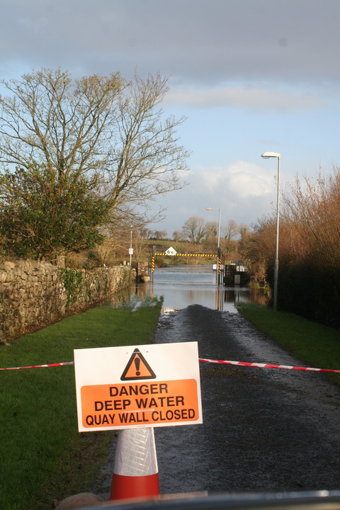
Shannon Harbour: road to Banagher closed
Banagher: the harbour above the bridge
Banagher: the harbour’s sole inhabitant
Banagher: work goes on
Portumna Bridge: Hawthorn moving
Portumna Bridge
Below Portumna Bridge
Above Portumna Bridge
Portumna Bridge: Waterways Ireland yard
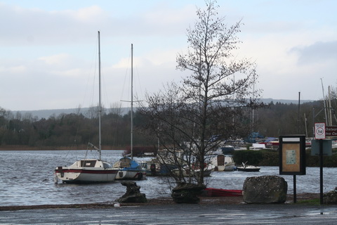
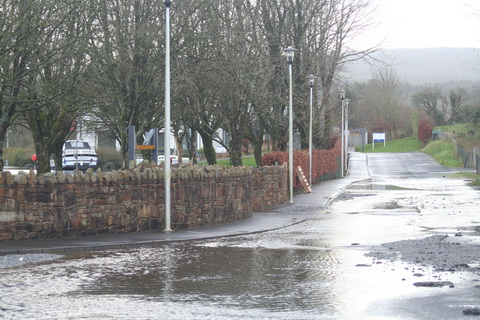
Mountshannon
Mountshannon: the main quay
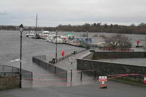
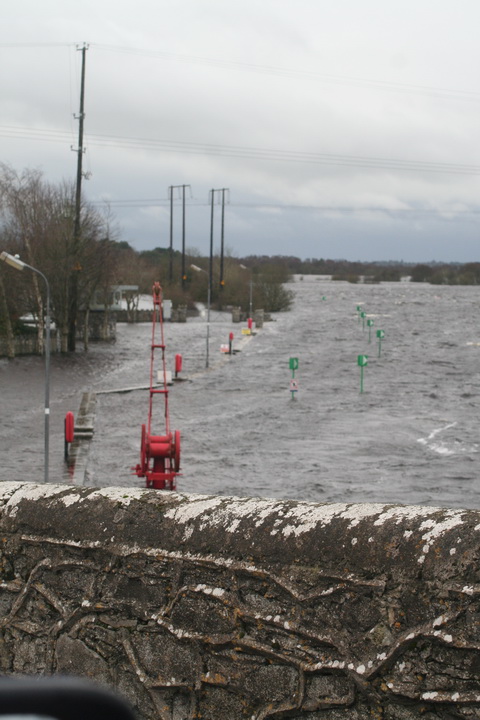
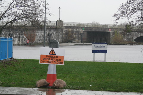
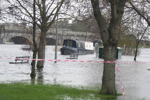
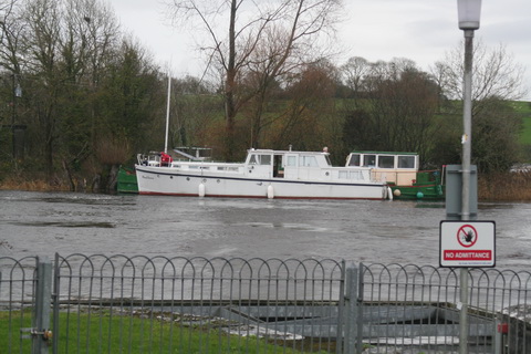
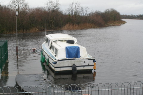
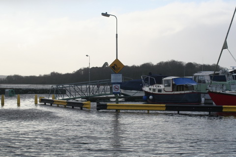
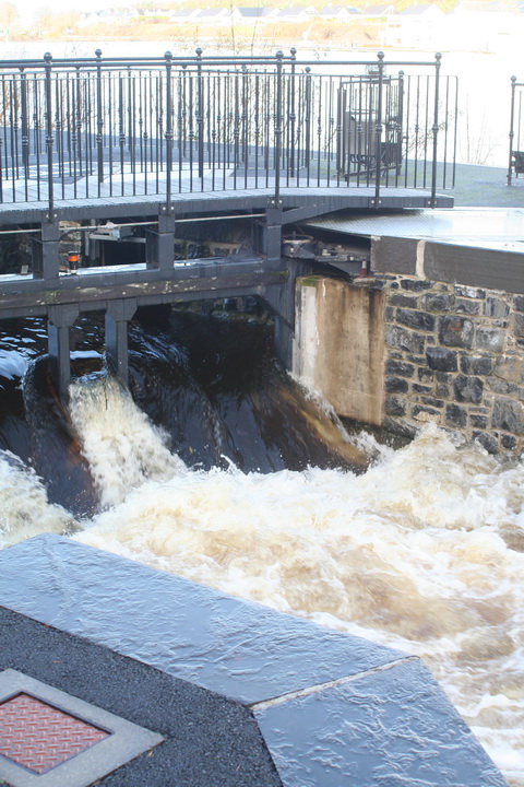
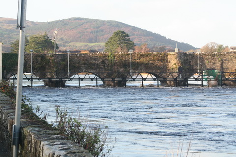
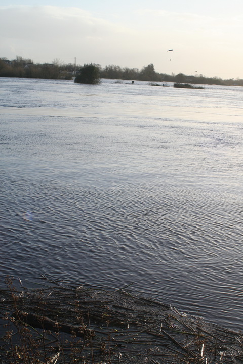
Scarriff: the river in flood
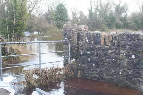
Scarriff: the river flowing on to the road to the harbour
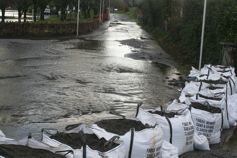
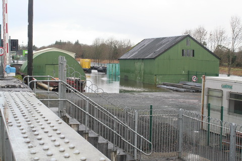
Scarriff: sandbags blocking the road …
… to the Waterways Ireland Shannon HQ. Anyone in the building must have waded there
Tuamgraney
Killaloe: the flash lock
Killaloe bridge from downstream
O’Briensbridge
Water level with the quay at O’Briensbridge
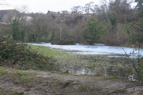
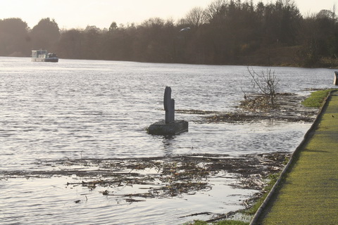
Flooded fields at O’Briensbridge
O’Briensbridge is on the original course of the Shannon, downstream of Parteen Villa Weir, which controls how much water goes via the original course and how much goes to the hydroelectric power station at Ardnacrusha.
Normally, the original course gets the first 10 cubic metres per second (10 cumec, they say) of water and Ardnacrusha gets the next 400, 100 for each of its four turbines. In floods, any excess is sent down the original course, through O’Briensbridge, Castleconnell and Plassey. One newspaper today said that, on Monday 7 December 2015, 315 cumec had been sent down the original course and, on Tuesday 8 December, 375 cumec.
The water levels are still below the peak achieved in November 2009, but there is more to come: as the Shannon drains a very large amount of Ireland, and as it is falls very little in its upper reaches, it takes a long time for the runoff to reach Killaloe and Parteen Villa. It may be that the ESB, which controls Ardnacrusha and Parteen Villa, is now running down the level of Lough Derg to make room for the water that has yet to arrive from the upper Shannon.
Posted in Ashore, Built heritage, Drainage, Economic activities, Engineering and construction, Extant waterways, Ireland, Irish inland waterways vessels, Modern matters, Operations, Safety, Scenery, Shannon, Waterways management, Weather
Tagged Ardnacrusha, Banagher, cumec, ESB, flood, Killaloe, Mountshannon, O'Briensbridge, Parteen Villa Weir, Portumna, Scarriff, Shannon, Shannon Harbour, Shannonbridge, storm desmond, Tuamgraney, water level
Leitrim Observer story here.
If Carrick is being reviewed, I presume other offices are too. I’m sure Scarriff is lovely, but ….
It seems that at least some folk are beginning to realise how bad Waterways Ireland’s financial position and prospects really are.
I’ve just been reading some particularly nitwitted Dáil discussions and I need some time to calm down enough to report on them to the Learned Readers of this site. Let me just say that anyone who thinks that politicians cannot distinguish fact from fiction is absolutely right. But enough of that for the moment.
I reported earlier on an oddity in the results from the OPW’s Athlone waterlevel gauge. I emailed the OPW about it and a helpful chap got back on more or less immediately.
He explained that the data we see on the waterlevel.ie site is, as it were, live: raw unfiltered data with nothing added, nothing taken away. The same data goes in to the OPW and they spotted that the Athlone gauge was reading too high. They found the sensor was faulty; they have now adjusted it and the new, lower readings are correct.
The disappearance of the placenames is because of some work in progress on improving the website; they will be back.
He kindly pointed me to a list, in .xlsm format, downloadable from here; it shows all hydrometric stations in Ireland. It shows who operates them, whether they’re active and whether they use telemetry (which I take to mean that they can be monitored remotely). Unfortunately OPW itself doesn’t seem to have any gauges on Lough Derg and nor does Waterways Ireland. OPW does have a rather excitable gauge at Scarriff and gauges upstream of Meelick Weir and Meelick (Victoria) Lock. The ESB has gauges with telemetry at Ballyvalley (25073) and Killaloe (25074) but I can’t find any website giving the levels. If, Gentle Reader, you can find one, perhaps you would let us know.
The consoling part of dealing with the OPW is that you get the distinct impression that they know some useful stuff. Unlike, say, some folk working in Kildare Street ….
Posted in Ashore, Built heritage, Drainage, Economic activities, Engineering and construction, Extant waterways, Industrial heritage, Ireland, Non-waterway, Operations, People, Politics, Safety, Shannon, Sources, waterways, Waterways management, Weather
Tagged Athlone, canal, Clare, Dublin, ESB, floods, flow, gauge, Ireland, Killaloe, Lough Derg, Meelick, Office of Public Works, Operations, OPW, Scarriff, Shannon, telemetry, Victoria Lock, water level, waterways, Waterways Ireland
TOOMGRANEY, situated in the county Clare, province of Munster; famous for the vagaries of a Sir William Read.—Fair days, Thursday after Trinity, and October 10.
Thus the Rev G Hansbrow in his An Improved Topographical and Historical Hibernian Gazetteer; describing the various boroughs, baronies, buildings, cities, counties, colleries, castles, churches, curiosities, fisheries, glens, harbours, lakes, mines, mountains, provinces, parishes, rivers, spas, seats, towers, towns, villages, waterfalls, &c &c &c, scientifically arranged, with an appendix of ancient names. To which is added, an introduction to the ancient and modern history of Ireland [Richard Moore Tims; William Curry, Jun and Co; John Robertson and Co, Dublin; King and Co, Cork; Marks, Waterford; Simms and Mairs, Belfast; Campbell, Derry; M’Kerin, Limerick; Wheelock, Wexford; Collins, Drogiieda; Dunlap, Coleraine; Purcel, Tralee; Kyte, Cashel; Blackham, Newry; Bole, Castlebar; Devir, Westport; and other booksellers; 1835].
Tuamgraney is on the Scarriff River, which flows into the west side of Lough Derg on the Shannon; it has a small quay on a sharp bend in the river.
Posted in Ashore, Extant waterways, Ireland, People, Shannon, Sources, waterways
Tagged Clare, East Clare, Hansbrow, Ireland, Lough Derg, Scarriff, Shannon, Sir William Read, Tuamgraney, waterways
Bealkelly Woods, on the south side of Scarriff Bay near the mouth of the Scarriff River, will host another CELT Weekend in the Woods on 29 and 30 September 2012:
CELT Weekend in the Woods – 29th / 30th September – Bealkelly Oak Woods, Tuamgraney, Co.Clare.
Choose from 17 traditional and ecological skills introductory courses: Wood Carving, Longbow making, Felt-craft, Needle-felting, Basketry, Herb Lore, Sugan Chair making, Silversmithing, Natural Building, Coppersmithing, Blacksmithing, Bowl & Spoon making, Knife making, Musical Instrument making, Spinning / Weaving & Natural Dyeing, Dry-stone and Lime-mortar Walling, – and, for 8-14yrs, Adventure Bushcraft.
Cost 130 euro (concessions and group rates available). Free camping. Good lunch and refreshments available – also evening pizza from clay oven. Music and song round campfire Sat night. See website for more info.
More info on the CELT website.
Posted in Ashore, Built heritage, Economic activities, Extant waterways, Ireland, Natural heritage, People, Restoration and rebuilding, Scenery, Shannon, waterways
Tagged Bealkelly, CELT, Ireland, Lough Derg, Scarriff, Shannon, Tuamgraney
Why, when speaking of the branded product Plasticine, did [do?] Irish teachers insist on using the Irish word marla? Even that word was, according to Terry Dolan’s Dictionary of Hiberno-English [Gill & Macmillan, Dublin 2004; new ed forthcoming], derived from the English marl.
At least in the nineteenth century, marl was a valuable manure or fertiliser and, on Lough Derg, Mr Head of the Derry Estate introduced a system of dredging it from deep water. Read about it here.
Posted in Economic activities, Engineering and construction, Extant waterways, Industrial heritage, Ireland, Irish inland waterways vessels, Operations, People, Scenery, Shannon, Sources, Steamers, The cattle trade, waterways
Tagged "marl dock", boats, broadford, Clare, Derry Castle, Derry estate, dredging, Dublin Society, fertiliser, Hely Dutton, Ireland, Killaloe, Lough Derg, manure, marl, Mr Head, Operations, Scarriff, Shannon, shelly, Spaight, Tipperary, vessels, waterways, workboat

