Tag Archives: Shannonbridge

Co Offaly: too dangerous to visit?

One Marcella Corcoran Kennedy, a Fine Gael TD in Co Offaly, has been issuing press releases (I presume) to get her name in the local blatts. It seems that there is a major crime wave in Co Offaly and that armed Gardaí are required to counter it, as well as Garda stations every couple of hundred yards. Perhaps tourists should be advised to avoid the county.

Anyway, the blatt’s account ends with this:

I intend also to support An Garda Síochána with their proposal to have Shannonbridge Garda Station re-opened due to its strategic location on the Shannon River.

Shannonbridge is strategically located if you want to be able to repel a French invasion force that landed on the west coast. It is also strategically located if you want to protest against Ireland’s unwillingness to slow global warming. Otherwise it is hard to see any strategic value, unless the Gardaí are reviving their nonsensical idea about smuggling by boats along the Shannon.


Holiday tours in Ireland VII

On Lough Derg

There are two Lough Dergs in Ireland. One is in the County of Donegal, within four and a half miles of Pettigoe, and is celebrated for its St Patrick’s Purgatory. The lake is but six miles long and four miles broad, and can hardly vie for scenery with its namesake in the south.

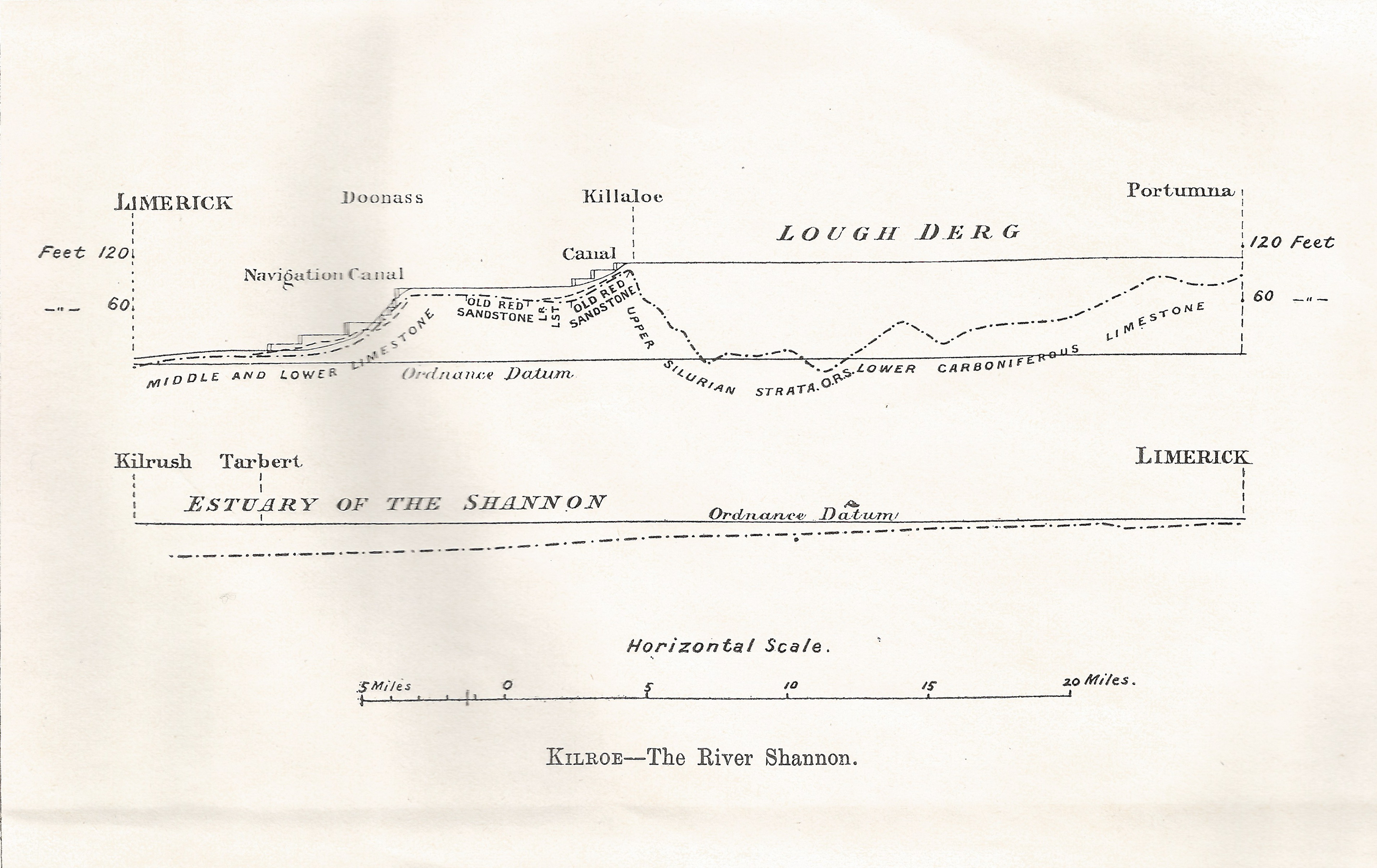
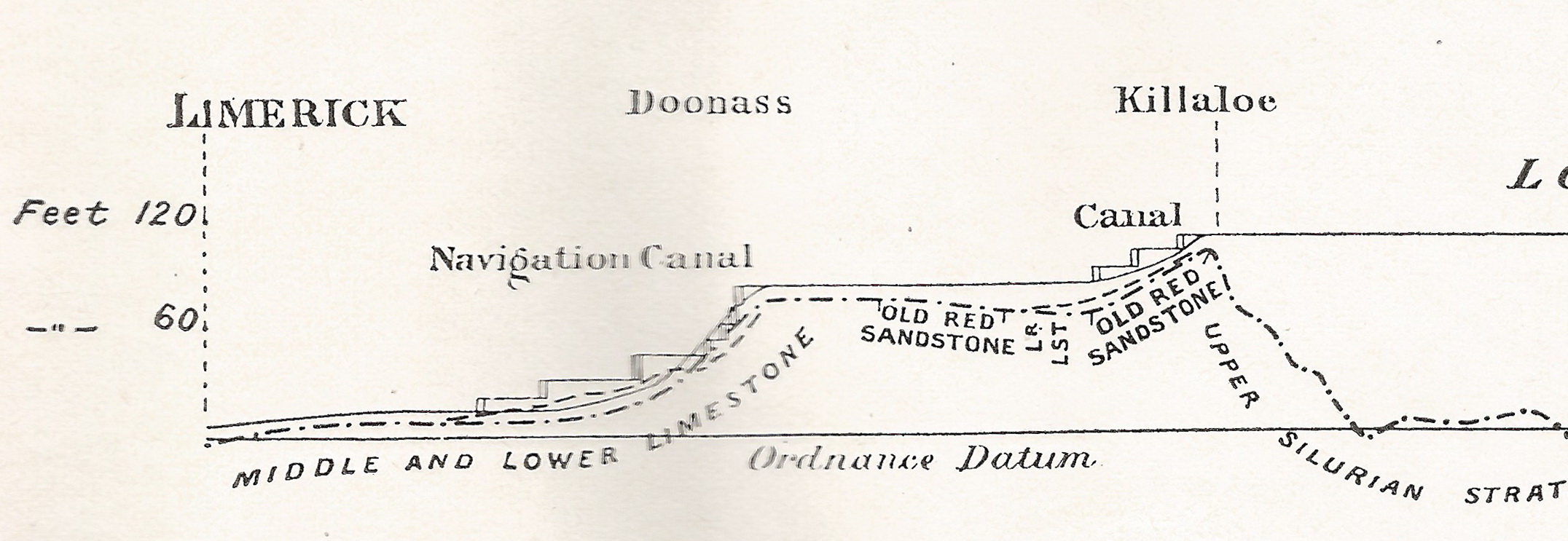
In order to reach this, probably one of the most exquisitely beautiful loughs in Ireland, it is necessary to make for the town of Killaloe. This can be done by leaving Euston at a quarter-past ten at night, when Killaloe is reached by 3.10 the following afternoon; or should the tourist prefer the Irish mail, he can leave at a quarter to nine in the evening and arrive at Killaloe at half-past eleven the following morning.

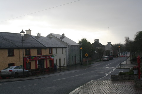
Few Irish towns contain so many antiquarian relics, combined with such beautiful scenery, for Killaloe stands on a hillside tufted with wood and surrounded by mountains. The old cathedral occupies the site of a church founded by St Dalua, in the sixth century. The present building dates from the twelfth century, with a central square tower whose effect is somewhat spoiled by a  modern crown. Its gem is a Hiberno-Romanesque doorway, which has, unfortunately, been blocked into the south wall of the nave. The precincts also contain a small stone-roofed church, said to date as far back as the sixth century.

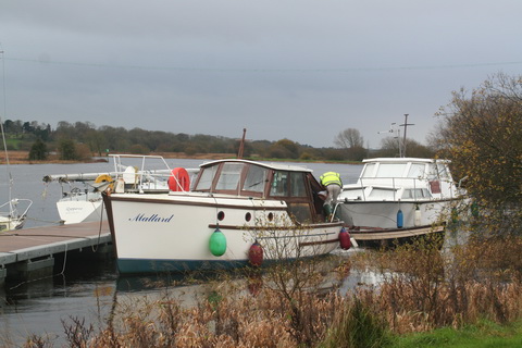
The fishing is generally extremely good, though many prefer Castleconnell, some five miles to the south on the road to Limerick. In any case few portions of the United Kingdom furnish better salmon fishing than that reach of the river Shannon that lies between Killaloe and Castleconnell.

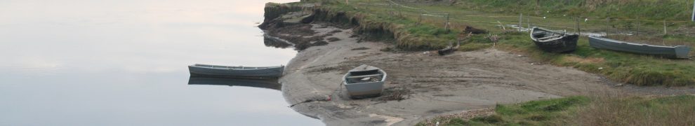
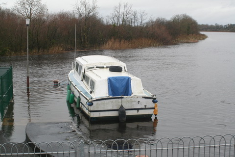
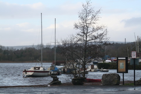
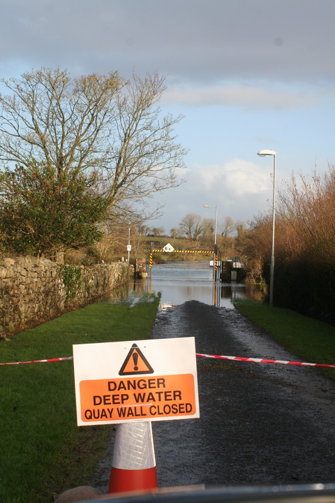
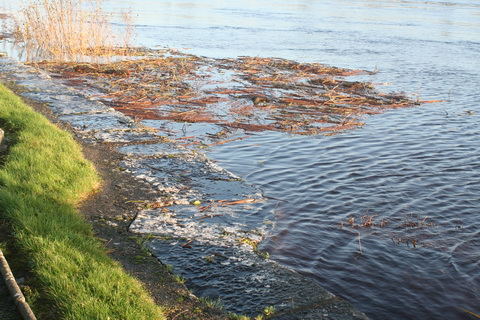
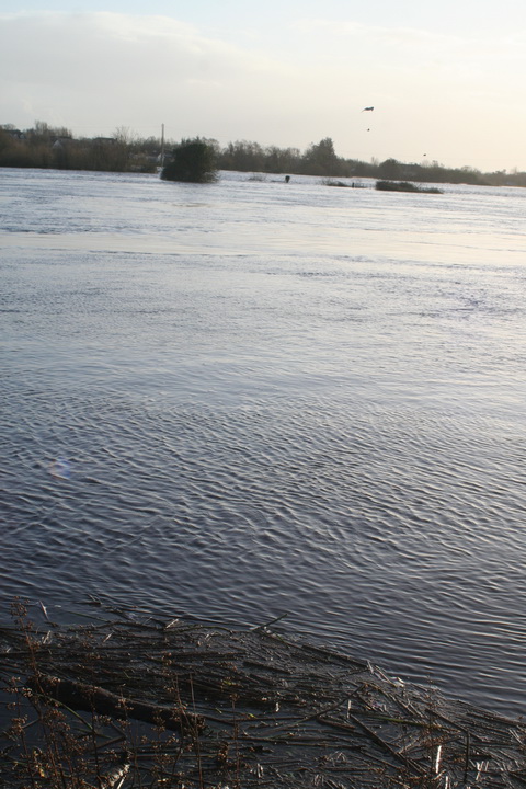
Lough Derg must, however, remain the greatest attraction of the district. It is twenty-three miles in length, and varies in breadth from two to six miles. Nothing can surpass the loveliness of the scene, especially on a fine summer’s day. On the one side the well-wooded and smiling hills of Limerick and Tipperary, where Thomthimia, with its slate quarries, slopes down to the water’s edge; while on the other the darker and more rugged mountains of Slieve Bernagh, Ballycuggeren, and the Crag form the most effective contrast.

Kincora was once the residence of Brian Boroimbh, King of Munster, and its magnificence was long the main theme of the ancient bards. But little now remains of the ancient palace beyond a long circular earthen fort, with a single vallum some twenty feet in height.

Inishcaltra or the Holy Island is, however, well worth a visit, and for this purpose it would be better to utilize the local service from either Scariff or Killaloe to Mountshannon, which faces the island. It possesses a round tower some eighty feet high, and seven churches, or cells, and oratories, the most remarkable of which is that of St Caimin, originally erected by him in the seventh, but subsequently rebuilt by Brian Borombh in the tenth century.

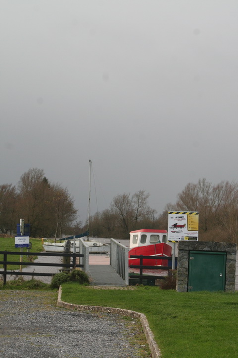
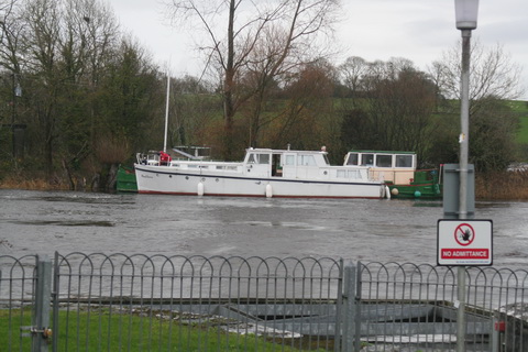
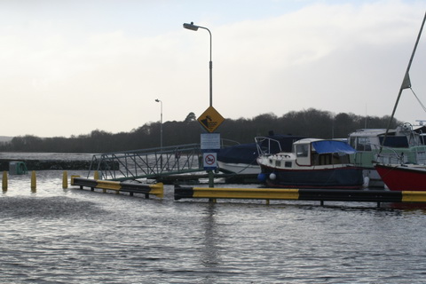
Scariff may this year be approached by steamer, and is a very prettily situated village, within access by road of Woodford, in County Galway, and Ennis in County Clare. The steamer then crosses the lake to Dromineer, at the mouth of the Nenagh river, where the ruins of the castle stand out with such picturesque effect. The bay is one of the most popular resorts, both of the angler and of the yachtsman; for to the latter it has earned a well-deserved reputation for its annual regatta.

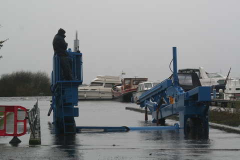
The steamer then stops at Williamstown while a boat from Kilgarvan occasionally lands passengers and conveys them to the steamer. As soon as the new jetty has been constructed by the Board of Works, Woodford will be equally accessible; but there is no doubt that the approach to Portumna pier at the head of the Lough, lying as it does between the well-wooded demesnes of Portumna Castle on the one side and Belleisle and Slevoir on the other, presents one of the finest pictures that the lake discloses, for there we see the most striking contrast between the tame verdure of the river Shannon and the bold mountain scenery of Lough Derg.

It would be tedious to dwell on the varied beauties of those innumerable seats that dot the shores of the lake on all sides; suffice it to say that few parts of the United Kingdom present as many diverse attractions as this wide expanse of water. Much as one may appreciate Loch Lomond, Loch Maree, or the Caledonian Canal, this Irish lough certainly surpasses them; and much gratitude is due to the Shannon Development Company for bringing within such easy access of the average tourist a wealth of scenery that certainly equals, if it is not finer, the finest spots that either Scotland, Norway, or Switzerland can offer.

This is, however, but half the trip from Killaloe to Athlone. Portumna is chiefly remarkable for the ruins of a Dominican priory founded in the thirteenth century, as well as for the Castle, the property of Lord Clanricarde, in which he has not resided since his succession to the estate. The village of Lorrha, three miles further up, also contains the ruins of a Dominican abbey, an oblong pile 120 ft long, as well as a castle and two old ecclesiastical buildings called by the peasantry the English churches, owing to their having been built by Norman settlers.

The river now assumes a totally novel character, winding by graceful curves through low-lying but rich meadow lands. Their luxuriant appearance is largely due to the fact that they are usually submerged under the waters of the river during the winter months.

Meelick Abbey is next passed. It was founded by the Franciscans in the twelfth century, and was at one time a sumptuous structure, but is now a roofless and mouldering ruin; and a beautiful pillar which formerly supported the arches on the south side has been torn away with ruthless vandalism, in order to make headstones for the graves in the cemetery.

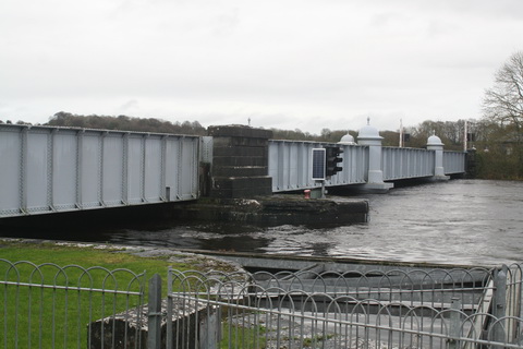
Banagher can boast of a fine stone bridge, opened some fifty years ago to replace the preceding structure, which displayed no less than twenty-three arches of various forms, with massive piers between, and was so narrow that only one carriage could pass at a time.

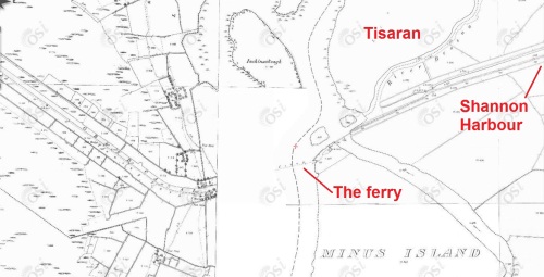
Shannon Harbour is best known from the description of its hotel in Lever’s Jack Hinton, but that building is now let in tenements. Shannon Bridge is one of the three fortified passes built to guard the Shannon, and is but four miles from Clonfert, whose cathedral, now being restored, contains one of the finest Hiberno-Romanesque doorways to be found in the three kingdoms.

Few spots, however, offer greater attractions to the antiquary than do the celebrated seven churches of Clonmacnoise. The most remarkable of these are the Diamhliag Mhor or Great Church, which dates from the fourteenth, and Fineens Church, built in the thirteenth century. The former was originally the work of Flann, King of Ireland, in 909, and contains several bits, more especially the sandstone capitals of the west doorway, that may be traced to the earlier period. Besides these churches, there is much to be seen at Clonmacnoise, which includes among its ruins the episcopal palace and castle of the O’Melaghlins, a nunnery, two round towers, Celtic crosses, and inscribed stones. The grand cross, formed of a single stone 15 ft high and elaborately carved, surpasses every other in beauty of execution and elaborate detail.

Though the tourist may gaze upon Clonmacnoise as he approaches and leaves it and enjoys a particularly fine view of its beauties as he passes by the curve of the river on whose banks it is situated, no provision has yet been made to enable him either to land or to make a closer acquaintance of its many beauties as he passes by. This is due to the refusal on the part of its proprietor to meet the proposals of the company. It is, however, to be hoped that more favourable terms may be made in the future, as the traveller must now proceed straight to Athlone and visit the ruins from there either by road or by water.

Much more might be said of Lough Derg as well as of the Shannon from Killaloe to Athlone. Fair hotel accommodation may be obtained at Killaloe, Dromineer, Portumna, and Athlone at from eight to nine shillings a day. Lodgings can also be procured at Killaloe, where the proprietors have learned to cater for the requirements of those anglers who frequent this highly-favoured spot.

Return tickets may be obtained from Euston to Killaloe by the North Wall at
£4 13s 6d first, £2 16s second, and £2 third class. Lough Derg may also be visited from Athlone by the Midland Great Western Railway from Broadstone. The fares by Kingstown and the mail are somewhat dearer.

Pall Mall Gazette 1 August 1898

From the British Newspaper Archive run by Findmypast Newspaper Archive Limited, in partnership with the British Library.

Shannon water levels 8 December 2015

North to south (more or less)

Floods 20151208 Shannonbridge 01_resize

Shannonbridge upstream

Floods 20151208 Shannonbridge 07_resize

Shannonbridge downstream

Floods 20151208 Shannon Harbour 04_resize

Shannon Harbour: 36th lock

Floods 20151208 Shannon Harbour 06_resize

Shannon Harbour: below the 36th

Floods 20151208 Shannon Harbour 16_resize

Shannon Harbour: road to Banagher closed

Floods 20151208 Banagher 03_resize

Banagher: the harbour above the bridge

Floods 20151208 Banagher 05_resize

Banagher: the harbour’s sole inhabitant

Floods 20151208 Banagher 09_resize

Banagher: work goes on

Floods 20151208 Portumna bridge 01_resize

Portumna Bridge: Hawthorn moving

Floods 20151208 Portumna bridge 03_resize

Portumna Bridge

Floods 20151208 Portumna bridge 02_resize

Below Portumna Bridge

Floods 20151208 Portumna bridge 10_resize

Above Portumna Bridge

Floods 20151208 Portumna bridge 12_resize

Portumna Bridge: Waterways Ireland yard

Floods 20151208 Mountshannon 01_resize

Mountshannon

Floods 20151208 Mountshannon 04_resize

Mountshannon: the main quay

Floods 20151208 Scarriff 01_resize

Scarriff: the river in flood

Floods 20151208 Scarriff 02_resize

Scarriff: the river flowing on to the road to the harbour

Floods 20151208 Scarriff 06_resize

Scarriff: sandbags blocking the road …

Floods 20151208 Scarriff 04_resize

… to the Waterways Ireland Shannon HQ. Anyone in the building must have waded there

Floods 20151208 Tuamgraney 01_resize

Tuamgraney

Floods 20151208 Killaloe 16_resize

Killaloe: the flash lock

Floods 20151208 Killaloe 26_resize

Killaloe bridge from downstream

Floods 20151208 O'Briensbridge 02_resize

O’Briensbridge

Floods 20151208 O'Briensbridge 05_resize

Water level with the quay at O’Briensbridge

Floods 20151208 O'Briensbridge 10_resize

Flooded fields at O’Briensbridge

O’Briensbridge is on the original course of the Shannon, downstream of Parteen Villa Weir, which controls how much water goes via the original course and how much goes to the hydroelectric power station at Ardnacrusha.

Normally, the original course gets the first 10 cubic metres per second (10 cumec, they say) of water and Ardnacrusha gets the next 400, 100 for each of its four turbines. In floods, any excess is sent down the original course, through O’Briensbridge, Castleconnell and Plassey. One newspaper today said that, on Monday 7 December 2015, 315 cumec had been sent down the original course and, on Tuesday 8 December, 375 cumec.

The water levels are still below the peak achieved in November 2009, but there is more to come: as the Shannon drains a very large amount of Ireland, and as it is falls very little in its upper reaches, it takes a long time for the runoff to reach Killaloe and Parteen Villa. It may be that the ESB, which controls Ardnacrusha and Parteen Villa, is now running down the level of Lough Derg to make room for the water that has yet to arrive from the upper Shannon.


Down to the sea in steps

On 28 January 1907 James Robinson Kilroe [near the bottom of the page] of H M Geological Survey read to the Royal Irish Academy a paper on “The River Shannon: its present course and geological history” [Proceedings of the Royal Irish Academy Vol XXVI Section B No 8 Hodges, Figgis & Co Ltd, Dublin; Williams & Norgate, London 1907]. I thought that Plate V was interesting.

Shannon Derg to sea

Plate V

Kilroe wrote:

It will be perceived that instead of the river being shallow over the unyielding Silurian slate-rock, set almost vertically, and striking across the river-course, it is deeper than over the limestone of Lough Derg, and much deeper than over the comparatively easily eroded Old Red Sandstone at Killaloe. The river-bed actually drops below the datum line above the town, while at the town it is 100 feet above datum.

Old Red Sandstone strata are here to be seen in the river-bank, and Silurian rocks in situ in its bed. A barrier is thus formed, partly of Silurian, and partly of Old Red Sandstone rocks, which without the artificial impounding weir would retain the waters of Lough Derg to a depth of some 104 feet opposite Derrycastle — two miles above Killaloe.

One might have expected to find a fairly level shallow bed from Killaloe northward, a sudden drop from slate-rock to the sandstone floor, and  a pronounced wide, well-formed valley in the limestone district southward to Limerick.

None of these elements exist; instead, we have the formidable barrier at Killaloe, naturally damming up a considerable depth of water in Lough Derg, and the river falling away southward by a series of rapids which correspond with drops in the canal, south of O’Briensbridge […], along an alternative course, possibly one used by a branch of the Shannon.

Here is an extract from the Plate V map, showing the steps of the (pre-Ardnacrusha) Limerick Navigation between Lough Derg and the sea.

Shannon Killaloe to Limerick

The steps of the canal (click to enlarge)

Upstream

Kilroe wrote of Lough Ree:

The waters of Lough Ree stood some 10 feet higher within recent times than they now do, as proved by evidence of solution, with under-cutting of limestone blocks, to be seen about five miles north-west of Athlone, close to the railway, in the townland of Cornaseer.

Under these conditions the lake must have been, perhaps, twice its width, and for a considerable period. Its ancient surface-level is clearly indicated by the caps of the mushroom-shaped blocks.

And of the Shannon between Lough Ree and Lough Derg:

The extreme flatness of the river between Athlone and Meelick is such that, consequent upon the completion of the Suck Drainage-works in 1892, it was found that the callows along the Shannon above the confluence of the Suck at Shannonbridge were much more liable to sudden and frequent floodings than they previously had been.

The more rapid discharge of the Suck waters into the Shannon, before ordinary extra water had time to pass away, had the effect of modifying the regimen of the main stream to an extent which resulted in an action at law [La Touche -v- The Suck Drainage Board].

I have found only one account of that case, in the Freeman’s Journal of 1 July 1893. The plaintiffs, Messrs Harrison and La Touche, owned land at Cappaleitrim, on the west bank of the Shannon above Shannonbridge. They said that the actions of the Suck Drainage Board had caused their lands to be flooded:

[…] that the defendants brought water from the Suck into the Shannon, containing a drainage of 40 miles, with such velocity and such volume that the Shannon was penned back, and that the back water caused the damage to the lands complained of.

[…] The jury disagreed and were discharged.

I don’t know whether the matter ever again came before a judge.

Marty Whelan, St Saran, Colonel l’Estrange and the Tessauren Ferry

Marty Whelan, a youthful disk-jockey chap with an insignificant amount of facial hair, presents a morning programme on the wireless. One day last week, discussing traffic problems with a chap from AA Roadwatch, he considered the origin of the name of L’Estrange Bridge, whose location neither he nor his collocutor knew.

L'Estrange Bridge (2003)

L’Estrange Bridge (2003)

It had been mentioned on this site as the location of a fatal motoring accident in December 2011 and it is, of course, a useful stopping place for those who, driving to Athlone, like to stop to consume the coffee (and any comestibles) they may have purchased in the award-winning Spar shop in Cloghan.

I emailed Mr Whelan, with a link to the location on the OSI map.

Tessauren 1

L’Estrange Bridge and Moystown House

I speculated that, as the nearby Moystown House was owned by the l’Estrange family (as was Huntston or Hunstanton, across the road), the Grand Canal Company might have had to buy land from them and, with the aim of keeping the cost down, have agreed to name the bridge after the landowner (a tactic that the National Roads Authority might adopt).

I should make it clear that I have not researched the land purchases of the Grand Canal Company in the area, so this should not be taken as definitive. I note, from Fred Hamond’s Bridges of Offaly County: an industrial heritage review (for Offaly County Council, November 2005), that the date on the bridge is 1800, although the canal was not opened until 1804; as Fred says:

Most [bridges] were built before their respective stretches of canal opened […].

The Parliamentary Gazetteer of 1846 says:

The principal artificial features are the mutually adjacent demesnes of Moystown and Hunstanton, the residences of the Messrs L’Estrange, situated on the Brosna. “Though Moystown,” remarks Mr Fraser, “has not extensively diversified park scenery to boast of, and is environed by deep brown bog, there is, in the style of the house, in the arrangement of the plantations, and in the beautiful evergreen oaks and other ornamental trees which adorn the lawn, a character which carries us back to the gentlemen’s seats of the olden times. This demesne is watered by the Brosna, which pays its ample tribute to the Shannon at thetermination of the grounds, and where also the Grand Canal crosses the river in its progress to Ballinasloe.”

Lewis’s Topographical Dictionary of 1837 says that Colonel l’Estrange was living at Moystown at the time, William l’Estrange was living at Kilcummin, a little distance north of Huntston, and Major Carlton (a relative, I think) at Huntston.

A quick search suggests that the l’Estranges did occupy land there in 1800, but I cannot claim to have carried out a thorough investigation.

What was of more interest to me was that the Parliamentary Gazetteer extract was from an item headed Tessauran, Tiseran or Kilcally:

Tessauren 2

The parish of Tisaran

TESSAURAN, TISERAN, or KILCALLY, a parish in the barony of Garrycastle, 2¼ miles north-west by west of Cloghan, King’s co., Leinster. Length, south-westward, 3¾ miles; extreme breadth, 2½; area, 7,316 acres, 2 roods, 12 perches, — of which 106 acres, 3 roods, 38 perches are in the river Shannon. Pop., in 1831, 2,032; in 1841, 2,029. Houses 346. The north-western boundary is traced by the Blackwater; the south-western boundary, by the Shannon; and the south-eastern boundary, by the Brosna. All the northern district, part of the eastern, and most of that along the Blackwater, are bog; much of that along the Shannon is lowland meadow; and most of the remainder is dry limestone land, pleasant in appearance, and possessing a considerable aggregate of embellishment.

Some time ago, I asked here about Tessauren Ferry, but had no response. I found the term in F E Prothero and W A Clark eds Cruising Club Manual: A New Oarsman’s Guide to the Rivers and Canals of Great Britain and Ireland George Philip & Son, London 1896. His entry for the Grand Canal included this at 79¼ miles from Dublin:

Entrance into the Shannon at Tessauren Ferry.

I have not seen the term used anywhere else. The ferry is of course that provided by the Shannon Commissioners to enable horse-drawn boats to cross the Shannon to the Ballinasloe Line of the Grand Canal. It would be nice to find other instances of the use of Prothero’s term.

Tessauran, Tisaran, Tiseran, Tessauren (and perhaps there are other variants) is the name of the parish north-east of the junction between the Brosna and the Shannon. It is odd that the ferry’s eastern departure point was actually outside the parish, because the Brosna was the boundary and the ferry started from the south side of the canal and the Brosna.

Tessauren 3

Tisaran parish and the ferry

The other link I had not made was that between Tessauren and St Saran, whose well I photographed some years ago, which means that I was on the grounds of Moystown House.

Tessauren 4

St Saran’s well (Tobersaran)


St Sarans Well near Shannonbridge 03_resize

St Saran’s well

St Sarans Well near Shannonbridge 04_resize

Looking into the well


So one mystery solved, as an accidental result of a remark on the wireless, but more information about the use of the term Tessauren Ferry would be welcome.

My OSI logo and permit number for website

Ballinasloe and Bord na Móna

Senator Michael Mullins (FG) in the debate on the Second Stage of the National Tourism Development Authority (Amendment) Bill 2011 on 30 November 2011:

[…] We need to see that [tourism] business spread to the regions. In my own county of Galway, one of the most beautiful in the country, Galway city and Connemara do very well. However, while parts of east Galway which I represent have wonderful attractions, we do not seem to be on Fáilte Ireland’s radar to the same extent as other parts of the county or country. In Ballinasloe we have a fine marina in which the State invested significantly some years ago. Ballinasloe is on the River Suck which runs into the River Shannon.

One can travel up the River Shannon through Shannonbridge to Ballinasloe. However, we have a little problem and I hope the Minister of State will be able to help us. There is a Bord na Móna bridge between Shannonbridge and Ballinasloe which, when water levels are high, prevents cruisers of a certain size coming up the river to Ballinasloe. We need the Minister of State’s help to get a number of organisations, including Fáilte Ireland, Bord na Móna and Waterways Ireland, together. We also need some money. A solution to the problem, without having to dismantle the bridge, has been found, but it will cost a significant amount of money. We need the Minister of State’s help to resolve that issue in order that we can increase the number of tourists coming to east Galway, particularly Ballinasloe in which we also have fine conference centres. If other parts of the country are not suitable for the holding of conferences, we have a fine new hotel in Ballinasloe that would be capable of handling large conferences.

I would welcome information about the expensive solution to which Senator Mullins refers.


From the hearts of cranes

Several ports on the Shannon Navigation have old cranes (or parts thereof), most of them nicely painted. Their age may not be apparent, but it is possible that they date back to the days of the Shannon Commissioners in the 1840s; at least one of them may be even older than that.

This page shows photographs of those cranes I know of, and discusses their possible ages. But there is much that remains unknown, and readers may be able to cast light on some of the mysteries.

The Shannonbridge chimneys

The chimneys of the power station at Shannonbridge, on the river Shannon between Lough Ree to the north and Lough Derg to the south, have for many years been a landmark: visible from a long way away in both directions on the Shannon and on its tributary the Suck as well. They were demolished last week. I have put up a page of photographs as a reminder of what they looked like and to mark their passing.